| Big Run-Seneca Creek-Lost Meadows Backpack |
|
|
Description:
This is a 24.6 mile composite of
Allegheny Mt-Seneca Creek Loop,
Lumberjack Tr-Seneca Creek Loop and the Spruce
Knob-Seneca Creel Backpack. Both of these hikes are quite
popular. To provide a bit more of a sense of seclusion, part of
the Big Run Trail and the
North Prong trail have been added to the circuit. Each pass
through or along
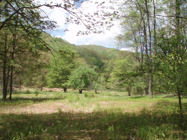
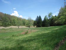
meadows seldom visited by hikers. Further adding to the
adventure is a 7 mile pack-less excursion of the
High Meadows which includes two previously un-described
meadows, the highest of which is the
largest and grandest one we've yet to encounter in this
venue. Add these to the ever beautiful "official" High Meadows
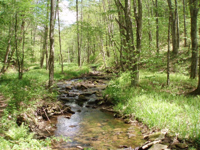
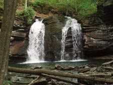
and the water works of the creek and you have one of the best
hikes in the area. Safety Note: There are approximately 7 creek crossings and a few crossings of North Prong. The latter are seldom an issue but during periods of high water the former can be pretty challenging. |
|
The hike begins at the Big Run-Allegheny Mountain Trailhead. ________________________________________ |
|
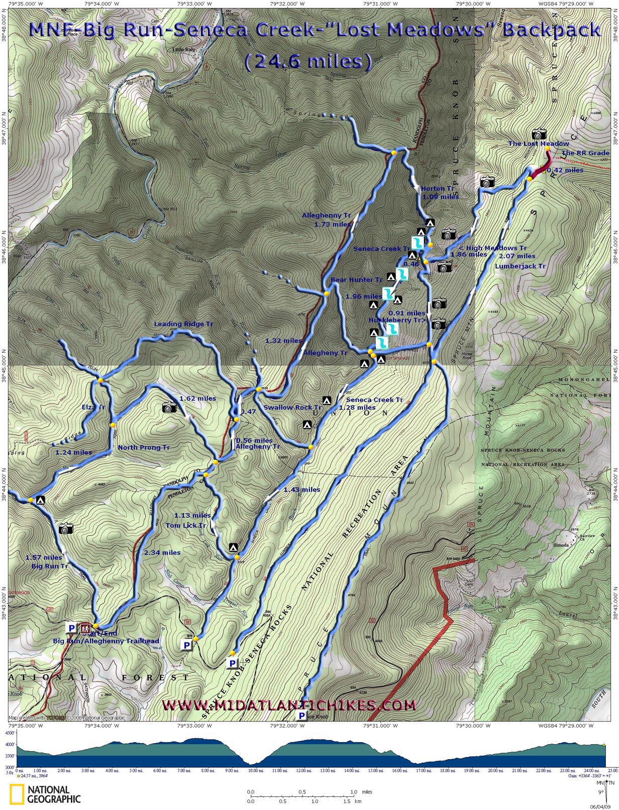
Printable/Downloadable Map (11X17) Zipped National Geographic TOPO! GPS and Universal GPS Files |
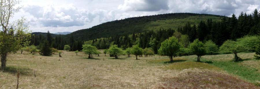
Trail Notes: All trails are blazed with blue diamonds except the one that goes to the "Lost Meadow". It is not blazed.
Day 1: As you look at the kiosk the Allegheny Mountain Trail is to the right behind a yellow forest gate. The Big Run Trail is just to the left of the kiosk. Follow it as you descend steeply, crossing two tributaries and then Big Run itself. After this last crossing the trail will at times be on an old railroad grade. Initially you'll be in deep woods but as the trail flattens out you'll skirt a couple of nice meadows. At 1.57 pass a small campsite in the spruce to the right, cross a stream and turn right onto the North Prong Trail. This is also an old railroad grade and crosses the stream about four times. In 1.24 miles pass an old bridge across the stream and the Elza Trail on the left. The trail then begins a gradual climb on a double track road as it skirts an upper meadow. This is the last chance to get water until camp. As you near the top of Allegheny Mountain you'll walk through two grassy hunter's plots. In 1.62 miles from the Elza Trail arrive at the Allegheny Mountain Trail. Turn left.
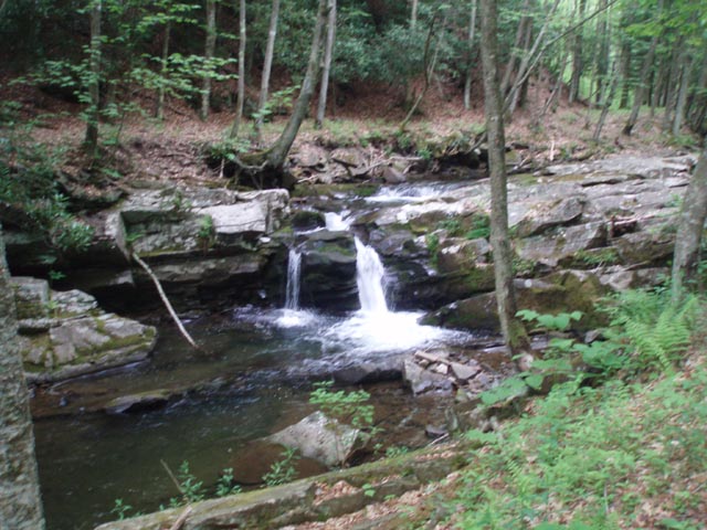
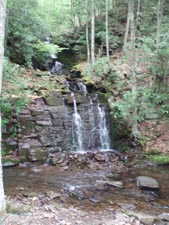
In 0.56 miles pass the Leading Ridge Trail on the left. In another 0.47 miles cross Swallow Rock Trail. In 1.32 miles cross the Bear Hunters Trail and in 1.73 miles pass Spring Ridge Trail on the left. Pass through a wildlife clearing and turn right onto the Horton Trail, a footpath that will quickly deposit you at the banks of Seneca Creek in 1.09 miles. There is a small campsite above the creek if you wish to call it a day but the best campsites are below Seneca Falls. Cross the creek and turn right on Seneca Creek Trail (another RR grade). Soon you'll notice a "siding" with three nice campsites. Of course, the most coveted one is that which is closest to the falls. If these are occupied there is another site above the falls but you'll have to ford the creek again. You've hiked a total of 9.8 miles at this point. If planning on doing the following day hike set up camp here. |
|
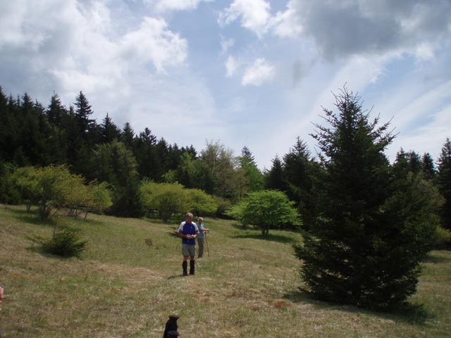
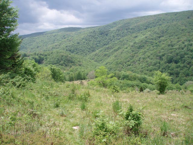
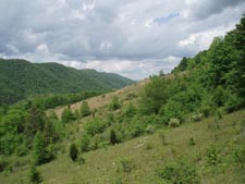
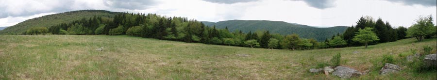
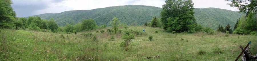
Day 2, 7.0 mile day hike: Assuming you camped below the falls grab your day pack and head upstream on the Seneca Creek Trail. Just before the ford above the falls turn left onto the Huckleberry trail. After a brief scamper up a footpath turn right onto another RR grade. Cross a stream and turn right (not left) onto yet another grade. In 0.46 miles pass the High Meadows Trail on the left (your return leg of the hike). Begin a gradual climb as the trail climbs Spruce Mountain at an angle. You'll visit a small meadow just before passing the Judy Springs Trail on the right at 0.91 miles from the High Meadows Trail and then a much larger meadow just before reaching the Lumberjack Trail. These meadows are full of Blackberries later in the summer.Turn left onto the Lumberjack Trail. You will still be gaining elevation but at such a slow rate it will barely be noticeable. Be prepared for some muddy going. This trail can be quite wet in places and never seems to dry out. In 2.07 miles the trail ends and the High Meadow Trail bears to the left. This is the only trail junction where there is no sign. If you wish to explore the "Lost Meadow" continue straight on the old RR grade. as of this writing it is blocked by a couple of fallen trees but it is easy enough to work your way around them. In a very short distance there will be a small meadow on the left. you can either follow the right edge of it or stay on the grade (becoming overgrown at this point) to a nice campsite. Pass through the campsite and enter a larger meadow partially lined with Red Spruce. Cross the meadow on a slight diagonal to the left and find the continuation of the RR grade through the evergreen forest. In a matter of a couple of hundred yards enter the "Lost Meadow" with grand views all around you. We strongly recommend you turn left at a cairn and walk up the hill to a large rock to get one of the best views of the trip.
After taking in the view retrace your steps to the junction of the Lumberjack and High Meadows Trail. Turn right and soon find yourself following an old barbed wire fence on the right. Over the next 1.86 miles the trail will alternate between open meadows and deep woods. Take your time enjoying the meadows (more blackberries). You'll cross a stream just before the junction with the Huckleberry Trail. Be careful! Every time we've crossed it someone has slipped on a big, flat rock. From here turn right onto the Huckleberry trail and return to camp.
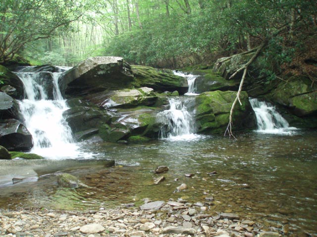
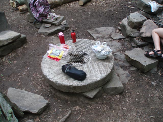
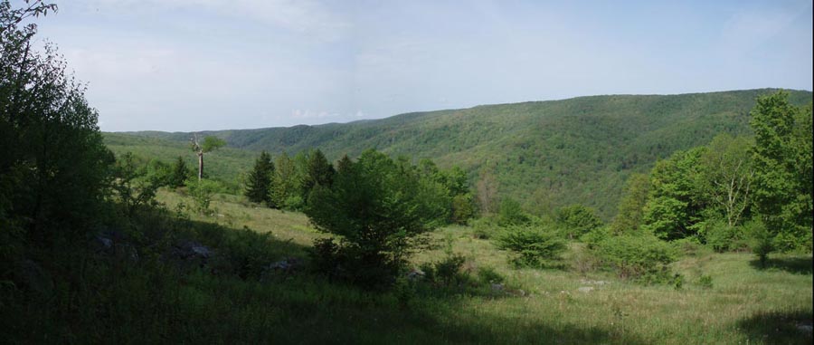
Day 3, 7.5 miles: Today is all about the waterworks of Seneca Creek. Although today's hike is pretty easy you'll want to linger at all of the falls and chutes along the way. Head upstream and cross the creek above the falls. Often this is the only ford were you might have to take off your boots. That is unless there has been a lot of rain. You'll ford the creek four or five more times and pass several attractive campsites before the hike is over. In 1.96 miles pass Bear Hunter Trail on the right. There is a very nice campsite on the left with an old grist stone as a table and a waterfall on a tributary across the creek. Shortly after this walk through the old Judy Spring Campground. The apples are small but very tasty if hiking here in September. A bridge crossing the creek here leads to more campsites and the Judy Spring Trail you passed yesterday. Do not turn here but continue up the creek. In another 1.28 miles pass the Swallow Rock Trail on the right. A lot of the next 1.43 miles will be through a tunnel of young Red Spruce trees. Turn right onto the Tom Lick Trail. Cross the creek on a small footbrige. The trail is a wide grassy woods road that climbs gently to the ridge of Allegheny Mountain. In 1.13 miles arrive at the trail by the same name. At this point it is a hunter's road. Turn left and in 2.34 miles arrive back at your vehicle.
______________________________________
______________________________________
Name:
Chris
Outing
Critique: Without this site, my backpacking exploration
would be limited to state parks and the ever popular well
known local trails in Pennsylvania so thank you for having
this site. ______________________________________ Name: Tom Hike: Big Run-Seneca Creek-Lost Meadows backpack Date(s): 4/30 to 05/02/2013 Rating: 4
Critique: Did this hike minus the Big Run entrance. Started at Seneca Creek trailhead instead. Warm days, chilly nights, beautiful water works. A small handful of other hikers. Was nice to hit High Meadows when it isn't overgrown. Also found the plane wreckage on Lumberjack since there was no vegetation. Had walked by it many times before and never saw it. Enjoyed the understory off-trail a bit too. Went past the Lost Meadow and found another trail to an even higher meadow on top the mountain. Looks like a 4-wheeler or hunter's trail that is easy to follow. Could be getting onto private property. Beyond the top of the mountain, I did not explore to the north, but you can look south along the entire spine of Spruce Mountain. Farther away you can see clear to Bald Knob on Back Allegheny Mountain over in Pocahontas County. One interesting feature is visible in the brush behind the fire ring near the south side of the the Lost Meadow. There are three nearly identical rock cairns spaced in a line about the same distance apart, each is 6-7 feet tall and remarkably well built. They have been there a while, as evidenced by the trees and brush growing in and around them. Maybe aliens built them, or maybe they are markers along an old trail. Anybody have a clue who built these and why?? Love this hike, and plan to go again, possibly this fall in the color season. ______________________________________
Name: Dave
L. Hike: Big Run-Seneca Creek-Lost Meadows Backpack ______________________________________ |
|
|