|
Spruce Knob/Seneca Creek Backpack
|
|
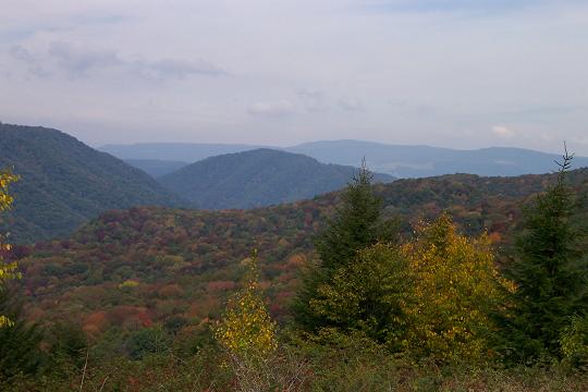
Description: This is a moderate
14.1 mile shuttle backpack in one of the premier venues of the
Potomac Ranger District of the MNF, WV. In reality this hike can be
completed in a day without packs if you get an early start. Since I
have to drive from
Day one has you
starting at the Spruce Knob Parking lot and hiking about 9 miles.
Your route is either all flat or downhill with the exception of a
steady, wet and gradual climb along the northern 2 mile section of
the Lumberjack Trail. You begin on Huckleberry trail and descend to
Lumberjack. After Lumberjack you�ll descend along a series of open
meadows and then follow the bottom segment of Huckleberry Trail to
|
|
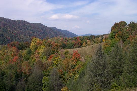
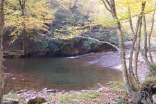
The next day is spent gradually ascending 5.0 miles out of Seneca Creek valley as you visit all of the waterworks the creek has to offer. Google Custom Directions to Seneca Creek Tr car drop-off Custom Google Directions from Seneca Creek Trailhead to Spruce Knob
The Huckleberry Trailhead is behind a
picnic shelter in the north corner of the parking lot (bus parking
area). ________________________________________ |
Zipped National Geographic. TOPO! GPS and Universal GPX Files |
Trail
Notes: From the parking lot
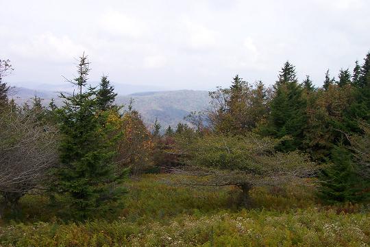
proceed down Huckleberry Trail (TR533). The first 2-2.5 miles is
spent weaving in and out of alternating Spruce groves and heath and
fern meadows on a relatively flat to slightly descending grade. It
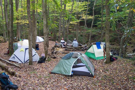
seems that every Spruce grove has at least one campsite although
they are all dry.
At about 3.1 miles
descend to a large campsite nestled in a very large grove. The trail
goes both left and right but follow the sign and turn right onto a
grassy woods road. In a 100 yards or so a blue diamond with a black
arrow will direct you to make a left turn onto a footpath which
leads to yet another woods road and a sign stating the mileage to
Seneca Creek (1.8
miles) and Lumberjack Trail (0.4 miles). The woods road goes in
either direction. Bear left at the sign. The woods road soon enters
dense woods. As it begins to disintegrate, look for another blue
diamond with a black arrow directing you to turn right onto a narrow
footpath. Descend, steeply at times, to the junction of Lumberjack
Trail (TR534).
Turn right onto
Lumberjack trail. This is an often times very wet railroad grade.
Climb gradually and at 2.i miles arrive at the junction of the High
Meadows Trail (TR564). This trail starts on an old Railroad grade or
woods road but soon turns sharply left, following a barbed wire
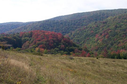
fence as it descends to the first meadow. Watch for blue diamonds on
the right that direct you through a rocky area just before the
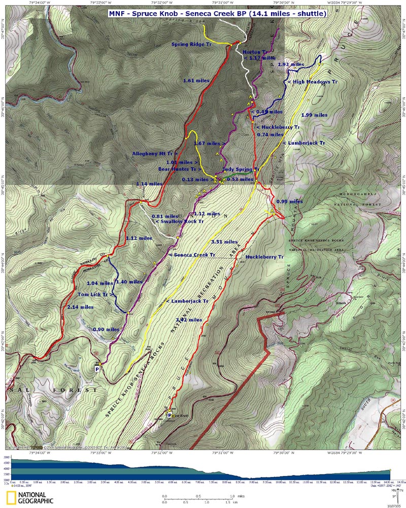
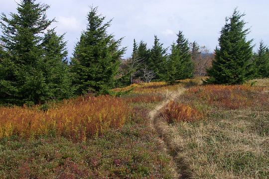
meadow. This is a great lunch spot as you take in the Seneca Creek
valley enclosed by the
Walk straight across
the clearing and pick up a narrow post with blue blaze that puts you
back on the trail. You�ll descend along the face of the hill and
re-enter the woods on another woods road. Just before the road
appears to enter a clearing look for blue blazes on the right
directing you on to a footpath that leads to a lower part of the
meadow. Watch for blazed stakes and
|
|
Turn right and follow
the trail down to Seneca Creek Trail (TR515) (0.6 miles). Turn right
onto Seneca Creek Trail. Soon pass
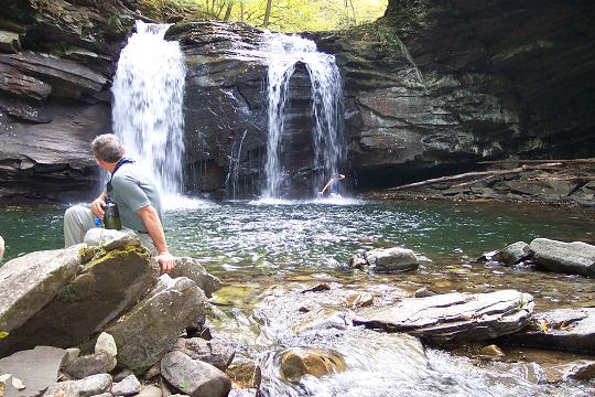
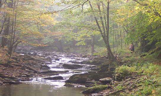
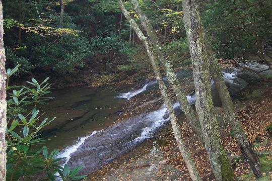
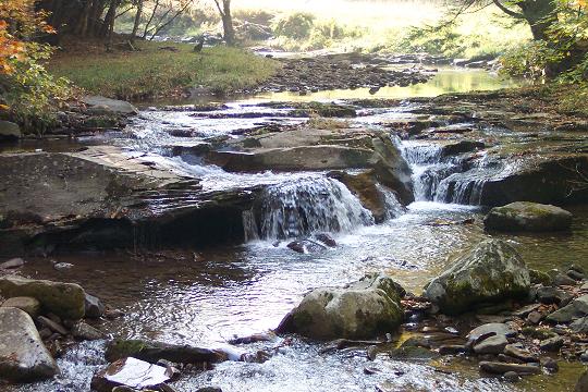
The rest of the outing is pretty obvious. Enjoy a nice 4.8 mile walk as you gradually climb out of the valley on Seneca Creek Trail. This entire trail is an old railroad grade except near the end where it becomes a woods road. The grade is barely noticeable especially in comparison to all of the downhill walking accomplished the day before. You will have to cross the creek about four times. The first one, just above the falls, is the most problematic. There is one place where you have to climb up, over and around some boulders to avoid a blow-out of the grade.
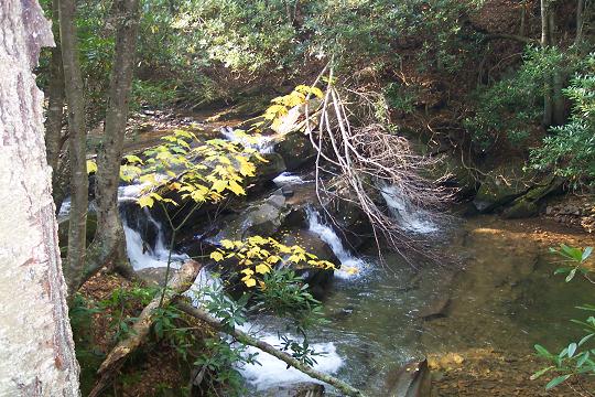
Try to allow time to
visit all of the water works along the way. Some may be hidden
behind a wall of Rhododendron so keep your ears alert for the sounds
of water falls. Also keep an eye out for an unmarked side trail on
the left. I believe this is an old railroad siding that once lead to
a mill. Follow it to see what makes be think this! The side trail
comes back to the main trail so you don�t have to retrace your
steps. I can�t recall it�s exact location. I know it�s just below
Judy Spring (See following description.) but can�t recall if it�s
above or below
Pass Swallow Rock
Trail (TR529) on the right at 1.18 miles from
Reference: Monongahela National Forest Hiking Guide, de Hart and Sundquist, 7th Edition Printable/Downloadable Directions and Trail Notes Read about a recent outing to Seneca Creek. ______________________________________
______________________________________ Name: Fmatt Outing Critique: Great hike with diverse scenery! The only strenuous part was the descent starting at High Meadows - it's the last leg of the first day and was difficult. The directions, as stated in other comments, are a bit off, though it's pretty straightforward.. Once you hit High Meadows Trail (which was our favorite part), you'll keep going through three large meadows. After the third meadow, you'll come to a creek crossing - it's a small waterfall with water running over smooth rocks and then falls down some small levels. Be careful crossing - it's an easy one to slip on and seriously hurt yourself. After this crossing, the trail winds for a half mile down hill, with campsites on your right as you defend. There's no clear signs, but once you get to the bottom and the creek is right in front of you, you have two options. Go left, you'll immediately come to a creek crossing that's at least 20 feet long. Go right, and you'll follow the creek and pass by the falls and a lot of camp sites. If you camp, you'll need to cross the stream (this is the start of the Seneca Creek trail). There's also a few campsites on this side of the stream. We came out on the Seneca creek trail as we didn't want to do all the uphill and re-hike the huckleberry (but also had a car parked there...you wouldn't be able to walk back to your car at Huckleberry trailhead from Seneca trailhead without a ride). There are at least 4 creek crossings on the full Seneca Trail which vary, but you should be ready to take off your boots at least once or twice. ______________________________________ Name: Christopher Robin Outing Critique: We did most of this hike last weekend, just did it a bit differently. We started out at Spruce Knob on Saturday morning in beautiful clear weather with temps in the 70's. Hiked down Huckleberry Trail and took Horton Trail after the 4-way with Lumberjack Trail. Huckleberry is a very nice trail, mostly in spruce, but with a few clearings that probably had great views 10-15 years ago. Took a quick left off Horton onto Judy Springs Trail, which opens up to some awesome meadow views. Soon you are back in the woods and cross the bridge at the intersection with Seneca Creek Trail. Seneca Creek is a very nice trail along the creek, with many great campsites. We found one we liked and spent our first night there. Sunday we headed to the falls and then up Horton to High Meadows trail. I would suggest watering up at the creek at the start of High Meadows, its the best on that trail and for the rest of the day the way we went. High Meadows is a nice trail through the meadows up to the top of the ridge, it does get steeper as you go though. We found Lost Meadows at the top of High Meadows, then took Lumberjack Trail back to Huckleberry Trail. Our last push was Huckleberry to the closest nice campsite near Spruce Knob. There we set up our camp, got water for dinner that we had stashed in the car and relaxed and watched the beautiful sunset. Since we had no walk out on Monday,we had time to visit Seneca Rocks! This is a great hike! ______________________________________ Name: Matt "Fever" Swenson
Hike: Spruce Knob-Seneca Creek (reverse) ______________________________________ Name:
WVwanderer Hike: Spruce Knob/Seneca Creek ______________________________________ |
|
|