|
Allegheny Mountain-Seneca Creek Loop |
|
More Sierra Club Photos |
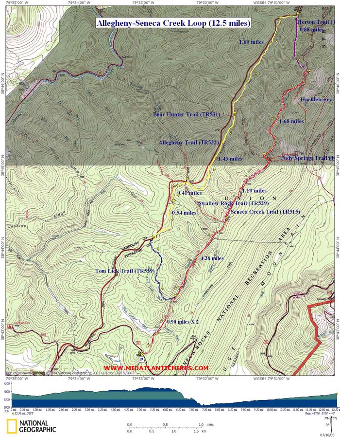
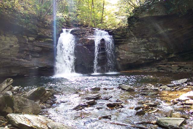
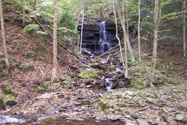
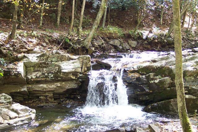
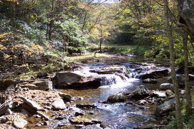
Description: This is a 12.7-mile moderate circuit hike through hardwood forest and along beautiful Seneca Creek. The length of the hike would lend one to rank this as a difficult outing but the minimal elevation gain (500 ft over 4 miles and then 900 ft over the last 5.5 miles) and excellent trail conditions make this a very moderate day hike. There are a couple of slick parts on the rapid 900 foot descent from the ridge to the creek at the mid-point. Approximately 6 wide stream crossings on the final 5 mile leg also add to the adventurous nature of this outing. Alternative footwear should be considered here. Make sure to stop and explore all of the waterfalls. Some are hidden behind Rhododendron thickets and require some bushwhacking to visit. Custom Google Directions |
|
______________________________________ |
|
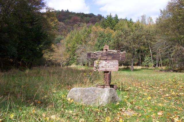
Trail Notes: All trails are
signed at trail junctions. All blazes are blue plastic or
metal diamonds. From the parking lot take the Seneca Creek
Trail (TR515), through a rapidly growing Red Spruce forest,
for 0.9 miles to the junction of Tom Lick Trail (TR559). Turn
left onto Tom Lick Trail. Cross a meadow and then the
headwaters of Seneca Creek on a
footbridge.
Gradually climb up to the crest of
the ridge on an old forest road. In about a mile, come to the
junction of Allegheny Mountain Trail (TR552). Turn
right. After 1.4 miles from the last junction, cross the intersection with Bear Hunter Trail (TR531). In about a mile arrive at a large clearing. The trail is a footpath at this point and may be hard to follow in summer months. The continuation of the trail is nearly straight ahead at about the furthest distance from where you entered the clearing. There will be a blue diamond blaze on a tree marking the trail. Shortly after re-entering the woods you will pass Spring Ridge Trail (TR561-not highlighted on the map) on the left and arrive at the Horton Trail (TR530). Turn right onto Horton Trail and quickly descend to the valley below, there are a couple of slippery rocks on the trail that need special attention. Otherwise the descent to the valley floor is easy. At the bottom you will meet the first of 5 or 6 stream crossings. Cross Seneca Creek and climb the opposite bank to reach an old abandoned railroad grade. This is Seneca Creek Trail (TR 515). |
|
Although it appears you could
go either way, the northern part of the trail (downstream) has
been closed due to storm damage and is not
maintained. Turn right (upstream) here and in about 0.5
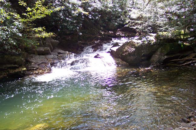
miles come to a great campsite and Seneca Falls, one of the
best lunch spots in the Mon. The trail back to the cars is rather
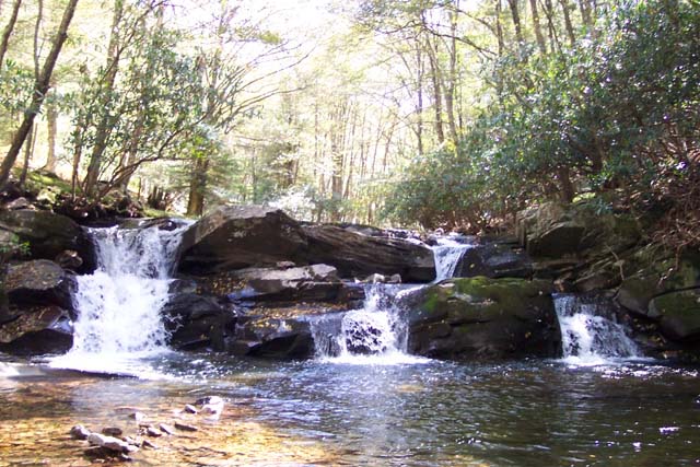
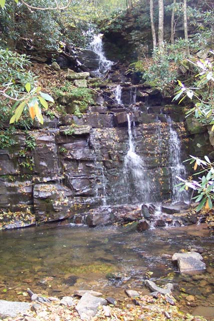
obvious from here. For 5.0 more miles gradually climb out of
the valley as you visit many falls, rapids, slides and wading
pools. You'll cross Seneca Creek five more times on the way
out. I tend to wear whatever is on my feet for the remainder
of the hike. You could lose an hour of travel time changing
boots at every stream crossing. After the falls, continue upstream
passing the junction with the Huckleberry Trail (TR533) on
your left. Soon arrive at your next stream crossing. Cross and
walk through another excellent camping area in a grassy
clearing. The exact locations of the remaining crossings elude
me but they are there. In about 1.6 miles from the last
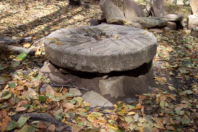
trail junction look for a little unmarked side trail to the
left that leads to another campsite across from a waterfall.
This one is unique because it has an old grist stone from a
mill long ago abandoned/destroyed as a functional
tabletop. Return to the trail, pass Bear Hunter Trail on your right, and soon arrive at the premier campsite in the valley, Judy Springs. It is not uncommon to find 10+ campers here at peak season. Above this clearing, Judy Springs Trail (TR512) crosses a footbridge on goes left. Dont cross the bridge but stay straight along the west bank of Seneca Creek. In about another mile pass Swallow
Rock Trail on your right and then in another 1.4 miles the
familiar Tom Lick Trail that you traveled at the beginning of
the trip, also on your right. In between take note of a large
marshy area on your right. This used to be a large beaver pond
but the dam ruptured a couple of years ago and the tenants
never rebuilt it. Retrace
your first 0.9 miles back to the
cars. Printable/Downloadable Directions and Trail Notes ______________________________________
______________________________________
Name: Kim
Hike: Allegheny Mountain-Seneca Creek Loop ______________________________________
Name: Mark & Dottie rust
Hike: Allegheny Mountain-Seneca Creek Loop ______________________________________
Name: Casual Hiker
Hike: Allegheny Mountain-Seneca Creek Loop ______________________________________
Name: Koyote Hike:
Allegheny Mt.-Seneca Creek loop ______________________________________ Name: Tony Van Vugt Hike: Allegheny Mountain-Seneca Creek Loop Date: 9/24/2005 Ranking: 5
Critique: Wow! One of the prettiest stream hikes in the mid-Atlantic. With campsites that are hard to beat. If you like to BP make sure you add this fantastic hike to your list. You'll be back again and again! ______________________________________ |
|
|