| Jug Bay Wetlands Sanctuary |
|
|
Description: The Jug Bay Wetlands Sanctuary, located on the eastern banks of the Patuxent River, is a 1500 acre preserve operated by the Anne Arundel County Dept. of Recreation and Parks. It is rich in estuarine flora and fauna not often seen in highland hikes. It supports 8 miles of groomed trails, boardwalks, blinds and piers that allow the visitor to get up close and personal with this unique environment. The recently acquired Glendening Preserve adds approximately four more miles of trails. The following rules apply to the main sanctuary only:
Described here is a 5.3 mile circuit taking you to most of the wetland viewing points and a nice walk in the woods. The hike starts on the brick walk outside the Visitor Center. Google Maps Custom Driving Directions |
|
________________________________________ |
|
Zipped National Geographic. TOPO! GPS and Universal GPX Files |
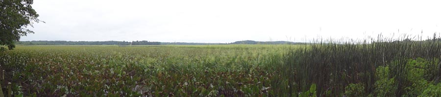
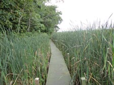
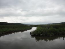
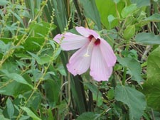
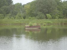
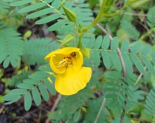
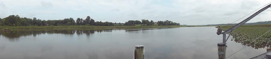
Trail Notes: After registering at the Visitor Center (Opens at 9:00.) take the brick walk towards the parking lot and turn left, following a path and a series of steps down to the boardwalk. Before you are wetlands as far as you can see. In the summer months it might be difficult, if not impossible, to see the river. The boardwalk is nearly 0.3 miles in length and gives ample time to observe Crimson Centered Rose Mallow, Water Hemlock (poisonous to humans in small amounts), Spatterdock and many other marsh flowers. At the end of the boardwalk climb another series of steps to the wide and sandy Otter Point Trail. There is no sign here but the trail is pretty obvious. Turn right and in 0.2 miles turn right onto the Railroad Bed Trail. This �straight� trail cuts across the wetlands, ending at a long pier and an old concrete pillar that used to support a turnstile bridge. Be sure to visit the �blind� boardwalk on the left about halfway and, in the summer, �the Scrub Shrub Boardwalk� a little further along. This narrow boardwalk has no view but allows you to study many different kinds of shrubs and marsh flowers.
After taking in all of the views return to the Otter Point Tr and turn right. In 0.3 miles you�ll arrive at the trail�s end and another view of the wetlands. You�ll pass yet another shelter just before arriving. Turn left onto the Two Run Trail. (There is no �One� Run Trail.) and climb slightly to a deck overlooking what appears to be more of a fresh water swamp, possibly created by a beaver. |
|
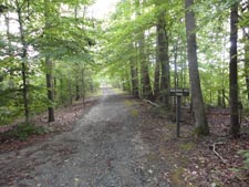
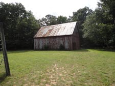
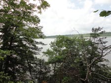
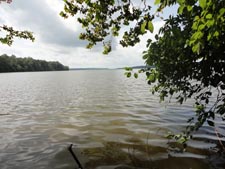
In 0.3 miles from leaving Otter Point, following the signs for the Upper Railroad Bed Trail, cross Two Run on bridges and boardwalks. Climb a short hill to get onto the RR grade and in a few steps turn right onto The Farm Trail, another wide and sandy lane. In 0.4 miles turn right onto a dirt road with the same name. Follow the right edge of the South County Community Garden to an old silver barn. Here pick up the Pindell Bluff Trail. The trail splits in 0.1 miles. Bear right, passing some window sized views of Jug Bay before descending for one last full view of the waterway. The trail then turns left and follows Pindell Branch, rejoining the �ridge� top trail in just 0.3 miles after leaving it. Turn right at the trail junction. Although this hike is mostly about the wetlands the surrounding forest is home to some pretty big trees. In 0.8 miles the Beech Trail comes in from the right. Continue straight and in 0.2 more miles cross Farm Road once again and join the Upper Railroad Bed Trail at its eastern terminus. In 0.5 miles return to the Two Run crossing you used earlier. Turn right onto Two Run Trail and then left onto a service/maintenance road. In 0.2 miles return to the Visitor Center.
________________________________________
_____________________________________ |
|
|