|
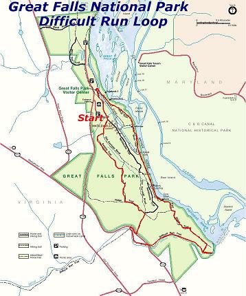
Difficult Run Loop |
|
Description: This is a relatively easy 5.2 mile
circuit around Pay $4.00/car entrance fee. Turn right immediately after passing the entrance gate and park in the lot closest to the Comfort Station. |
|
________________________________________ |
|
Trail Notes: From the comfort station begin walking down Matildaville Tr.
Soon turn right onto the
In another 0.5 miles the Swamp Trail ends at a wide horse trail. Turn right here and climb to the top of the hill.
At 0.3 miles from the last trail junction turn left onto Ridge Tr. A fenced in area will be to your left.
In another 0.2 miles come to the intersection of an old horse trail on the right The junction with the Old Carriage and Matildaville trail will be close by on the left. Turn right onto the horse trail and follow it to Georgetown Pike (0.2 miles from the last trail junction).
Cross Georgetown Pike. Take Care! This is a heavily traveled road. Climb over the guard rail an locate an un-named spur trail that leads down to Difficult Run.
Turn left onto Difficult Run Trail. Go under Georgetown Pike.
The footpath joins a wider woods road. You can stay on this all the
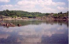
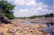
way down to� the Beach� on the
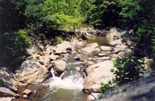
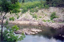
In about 0.8 miles after crossing Georgetown Pike pass the Ridge Trail on the left and descend to �The Beach�. This is a great lunch spot. |
|
After lunch retrace your steps and turn right onto the Ridge Tr. Reach the top of the Ridge in about 0.5 miles. The trail will turn left onto a wide path. Soon turn right onto a blue blazed footpath. In about 0.4 miles cross a stream on a wooden bridge and turn left. Cross an asphalt road and pick up the River Trail North. Turning right on the trail goes down to the river.
In another 0.3 miles, pass the entrance to the
Printable/Downloadable Directions and Trail Notes ________________________________________
________________________________________
Name: CJ
Hike: Difficult Run Loop
Date: 3.18.12 Rating: 4 Critique: I'm just starting to get into hiking, and this was my first time at Great Falls. I really enjoyed this trail. It was not very difficult but not boring either. We have had little to no rain lately, so the whole trail was in good shape with only a few wet spots and no really muddy sections. When you enter the actual Difficult Run Loop, there is a barricade and a sign saying the trail is closed. I think there are a few hundred yards of passable trail, and then a section where the trail might have been washed away. You would only be able to continue if you descended about 10' and then ascended approximately the same height to get through the washed out section. This might only require some careful walking along some narrow ledges. The views of the Potomac River are outstanding. There were some rock climbers descending from the rock face about 30 yds from the River Trail. It was an overcast day but it was still really nice to see the rushing river at the base of tall rock faces. We took our sweet time, sat to eat lunch, explored nooks and crannies slightly off the trails, and finished in 4hrs, 15mins. It likely would not be a fun hike following a rainstorm or big thaw. ________________________________________
Name: Cory Davis
Hike: Difficult Run Loop ________________________________________
Name: Tag-Alongs
Hike: Difficult Run Loop ________________________________________
Name: Cory
Hike: Difficult Run Loop ________________________________________
Name: Cory
Hike: Difficult Run Loop ________________________________________
Name: Mike Stinefelt
Hike:
Difficult Run Loop
Name:Tony Hike:
Difficult Run
Loop ________________________________________ |
|
|