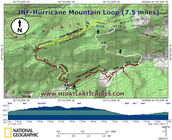
|
Hurricane Mountain Loop |
|
|
Description: This is our
fourth and final exploration of Iron Mountain in the Mount
Rogers N.R.A. See
Comers Creek Loop,
Rowlands
Creek Falls Loop
and
the Bear
Tree Gap Loop
for other Iron Mountain circuits. The 21 mile long yellow blazed
Iron Mountain Trail used to be part of the AT until a major
relocation several years ago. It is now maintained as a
multipurpose trail, allowing hiking, mountain biking and horse
riding. As with the other hikes the Iron Mountain Trail serves
as the backbone for the trek, with mostly gradual climbs and
descents. The climb to Flat Top is mostly gradual. The walk
along a gravel forest road in pretty pedestrian but short lived.
The rest of the hike is mostly flat or downhill. The AT portion
is probably the best since it is designated for foot traffic
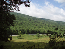
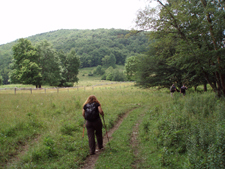
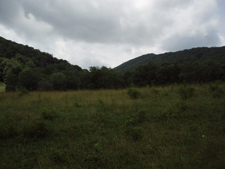
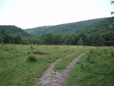
only. Hiking through the pastures on the Fairwood Valley Trail
provides views of the surrounding mountains. The hike starts at the kiosk in the parking area. |
|
________________________________________ |
|
Zipped National Geographic. TOPO! GPS and Universal GPX Files GPS Text File for Non-TOPO! Users
|
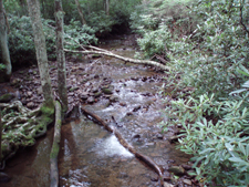
Trail Notes: Look for an unmarked but obvious trail to the right of the kiosk. Follow it, stepping over a few blowdowns, with an old fence to your left. In 0.1 miles join the Flattop Trail, turning left onto it. Although used by equestrians the clay and gravel makes a pretty durable surface resistant to the forces applied by our 4 legged friends. The forest and understory is lush in the summer. Turn right onto a service road in 0.6 miles. Pass a few false roads. Reach a bend in the road in 0.7 miles. There will be a yellow gate in front of you. Bear to the right, continuing up the road for another 0.2 miles. Turn right onto the yellow blazed Iron Mountain Trail. Parts of the trail might be muddy as the result of frequent equestrian use. The trail surface eventually stabilizes making it relatively good for walking. In 1.7 miles reach an area called Chestnut Flats and the intersection with the AT. Turn right and descend for 2.2 miles on a nice footpath. As the elevation drops more and more trailside Rhodos and Hemlock appear. Cross Fox Creek on a bridge. This is a great break spot. The water is perpetually cold and clear. Just before reaching Rt 603 turn right onto the Fairwood Valley Trail. It might be muddy at first but becomes a packed gravel base after a ford. Pass the Old Orchard trail on the left in 0.4 miles and then the Lewis Fork Trail also on the left in an equivalent distance. Pass through a pasture with wonderful views of Hurricane and Pine Mountains (home of Mt. Rogers). Make sure you close the gates. In 1.2 miles from the last trail junction arrive at a trail marked with a stake that leads you back to the parking lot.
|
|
________________________________________
________________________________________ |
|
|