| FMF-East Ridge Loop |
|
Description:
First I�d
like to thank Ed Stoebenau for sharing his map and knowledge of
the area.
For more information about the Frederick Municipal Forest see
the
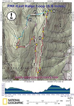
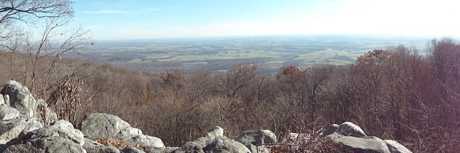
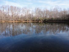
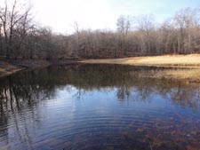
Clifford Hollow Loop hike. Described here is a fairly easy 6.8 mile loop, part of which follows the eastern-most ridge of Catoctin Mountain (hence the name). There is one steep section but it is only a few yards in duration. As with the other hikes in this venue only the Catoctin Trail is blazed and signed. All of the trails used here save one are old jeep roads and easy to follow. Carry this map and the Trail Notes to make sure you find one crucial turn ( I will give it extra emphasis later.) The highlights include a vista, an old stone quarry and two pretty ponds. |
|
The hike starts at a small pullover on gravel Gambrill Park Road where the blue blazed Catoctin Trail crosses it. It is on the right side if you approach it from Gambrill S.P. There are a few potholes but the road is generally OK for cars as long as you drive slowly. ________________________________________ |
|
Zipped National Geographic. TOPO! GPS and Universal GPX Files |
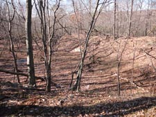
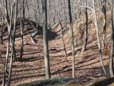
Trail Notes: Cross the road and follow the blue blazed Catoctin Trail for 0.1 miles to a 4X intersect. Continue straight for another 0.1 miles to the Piedmont Vista. After taking in the view retrace your steps to the 4X intersection and turn left. I call this old jeep road the East Ridge Trail because it is the eastern most ridge 0n Catoctin Mountain. The tread is mostly smooth, wide and easy to follow. In 0.2 miles a spur goes off to the right, returning to the road. Stay straight. In 0.5 more miles another trail splits off to the right. Again, continue straight. Arrive at an old stone quarry in 0.3 miles. The next 1.1 miles gradually descends along some short rocky sections. Be watchful here as the trail will leave the ridge to the left for a short distance to avoid a rocky knob. In 0.2 miles it curves back up to the ridge. Turn hard right at the next jeep road. Continue a gradual descent and in 0.8 miles arrive once again at Gambrill Park Road. Bear right onto it and in 0.3 miles bear left, walking around a yellow forest gate. Cross Little Fishing Creek. The old road turns right to follow the stream for a bit but then switchbacks to the left. At 0.5 miles from leaving the road the trail turns right and climbs steeply to the left of a large fallen log. Turn right on a trail that goes through a cut in the log. (This is the tricky part mentioned in the description.) It's not that obvious on the map but in a mere five steps or so the trail switchbacks sharply to the left and becomes a footpath cris-crossing an old sunken road for a while. It will gradually turn to the right and climb gently to a ridge top jeep road reaching it in 0.8 miles from the cut log. Turn right onto it. In 0.3 miles the Catoctin Trail will join from the left and continue straight ahead on the same jeep road. Follow it for 1.6 miles back to the car, passing two nice ponds along the way.
|
|
________________________________________
________________________________________
Name: Russ
Hike: FMF-East Ridge Loop ________________________________________ |
|
|