|
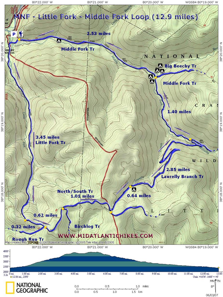
Little Fork - Middle Fork Loop |
|
Dottie's Photos Mollie's Photos |
Description: The Cranberry Wilderness is a wonderful place to hike. Don�t go there if you are seeking vistas (You will see them as you drive to it!). If, however, mature forests with towering Red Spruce, Hemlocks, moss covered boulders, wildflowers and tranquil streams teeming with falls, rapids and pools are what you are searching for this is the place. The following hike is described as day hike but can also be done as a quick overnighter or tied in with other hikes on this site such as the Big Beechy � Middle Fork Loop. If you wish to do that check out that link first. Google Custom Directions Special Note: The Google directions might want you to turn onto Public Road 76 from Scenic Highway 150. This cannot be done. That road was closed about 40 years ago. It and Public Road 108 which might also be mentioned are now part of the Wilderness Trail System. Use a real map to get there. The remaining remnant of Public Road 108 open to traffic is on Forest Road 86 about 11.7 miles west of its junction with Scenic Highway 150. |
|
________________________________________ |
|
Zipped National Geographic. TOPO! GPS and Universal GPX Files |
Trail Notes: Trails that are totally within the Wilderness boundaries are not blazed. All trail junctions are signed with two exception (the lower terminus of Laurelly Branch Trail with the Middle Fork Trail and the Big Beechy Trail at North Fork Trail). Trails that extend beyond the Wilderness are blazed.
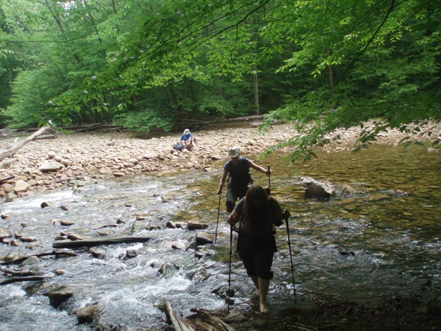
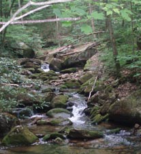
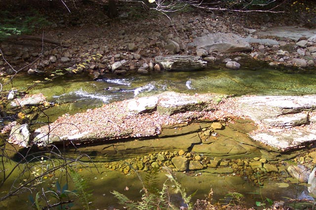
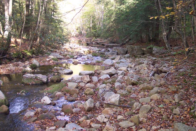
From the end of the gravel road cross a small stream and soon arrive at a kiosk in a weedy area. Turn right following the sign for the Little Fork Trail. After passing through the weedy area you will pick up an obvious trail blazed with blue diamonds. (Except for the fact that this area is too close too the road it would make an excellent camping area.) Ford the Middle Fork of the Williams River and regain the trail on the other side. For the most part the trail is rather obvious. After the first crossing of Little Fork you�ll pick up a railroad grade. You�ll cross the fork 3 or 4 more times before reaching the top. All crossings are usually rock hops except during periods of high water. Keep an alert eye. Just as the grade starts to climb the trail will leave it to the right and almost immediately connect with another RR grade that continues to follow the fork. Look for the old rock buttress for what was once a bridge going over the fork. The next mile or so is particularly pretty as the trail stays in close proximity to the fork and its cascades. The grade will start climbing steeper and leave the fork below it.
Descend from the grade and cross the fork for the last time. At this point it is a mere stream. After climbing steeply up the other side turn left on yet another grade. In 3.45 miles from the kiosk arrive at the junction of the North � South Trail. Note that there is no water or campsites along the next segment.
Turn left onto the North � South Trail. In 0.32 miles pass Rough Run Trail on the right and in another 0.62 miles also pass Birchlog Trail. Continue for another 1.01 miles to the pretty obvious junction with the Laurelly Branch Trail. If you are doing this as an overnighter the first really nice campsite is 0.64 miles down the trail in a Hemlock Grove to the right. There is enough room for about 4 small tents. This is also the last time The Laurelly Branch Tr gets close to water until it reaches the valley. |
|
There is one feeder stream further along but it is seasonal. After the campsite cross the stream and soon reach a railroad grade that switchbacks down the mountain. Generally speaking you should make good time on this segment. There are some pretty expansive seeps and Stinging Nettle patches but if you stay to the outside edge of the grade in most of these areas you�ll avoid the worst of it.
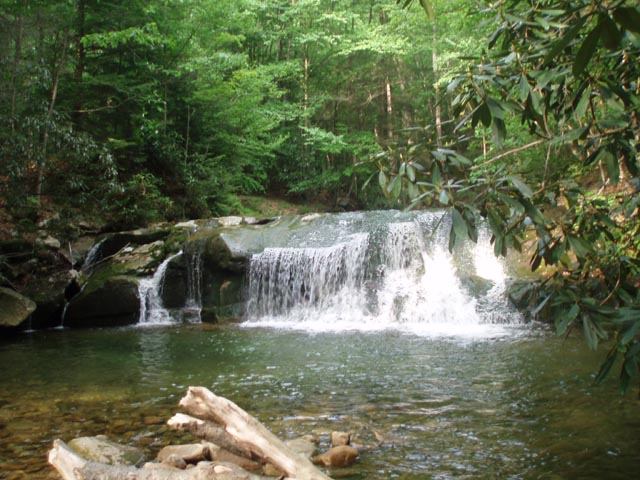
In 2.85 miles from the campsite ford the Middle Fork of the Williams River and merge to the left onto the Middle Fork Trail. There was no sign as of this righting but its an obvious junction. In another 1.4 miles reach Big Beechy Run. Big Beechy Trail comes in from the right. To the left is a small secluded campsite and the falls and swimming hole. Cross the Run. There is yet another small campsite on the left and the mother of all campsites on the right. This must have been a staging area for the logging industry. Now it is absolutely beautiful with towering trees, giant boulders and at least 3 fire rings. You could fit an army in there.
From this point it is an easy 2.53 mile walk down the river to your cars. Take time to check out the many views the River offers as you go.
_______________________________________
_______________________________________ Outing Critiques Name: Joy Hike: Little Fork-Middle Fork Loop Date: 5/25/13 Rating: 4
Critique: We took our time, camped at Big Beechy campsite night one after just 2.5 miles in. The next day, hiked down to the Laurelly campsite and enjoyed the solitude of the beautiful forest.The third day, we hiked (the North-South Tr to the Little Fork Tr) which is a pretty trail, lacking any campsites. We ended up hiking to where the car was parked, grabbed some leftover refreshments in the cooler and hiked appx .25 miles to a campsite that was on Middle Fork, where we began our loop. The campsite needed some attention after an obvious storm had made a little mess, but left us a lot of great firewood for the resurrected fire ring. A great, relaxing 3 nights out. The only problem was finding the trailhead. Google directions didn't help with the last 4 directions. Make sure to double check your directions. This trailhead was located at the campsites for the Three Forks. there is parking at the end of the gravel road. _______________________________________ |
|
|