| AT-Old Horse-Shoe Trail Loop |
|
|
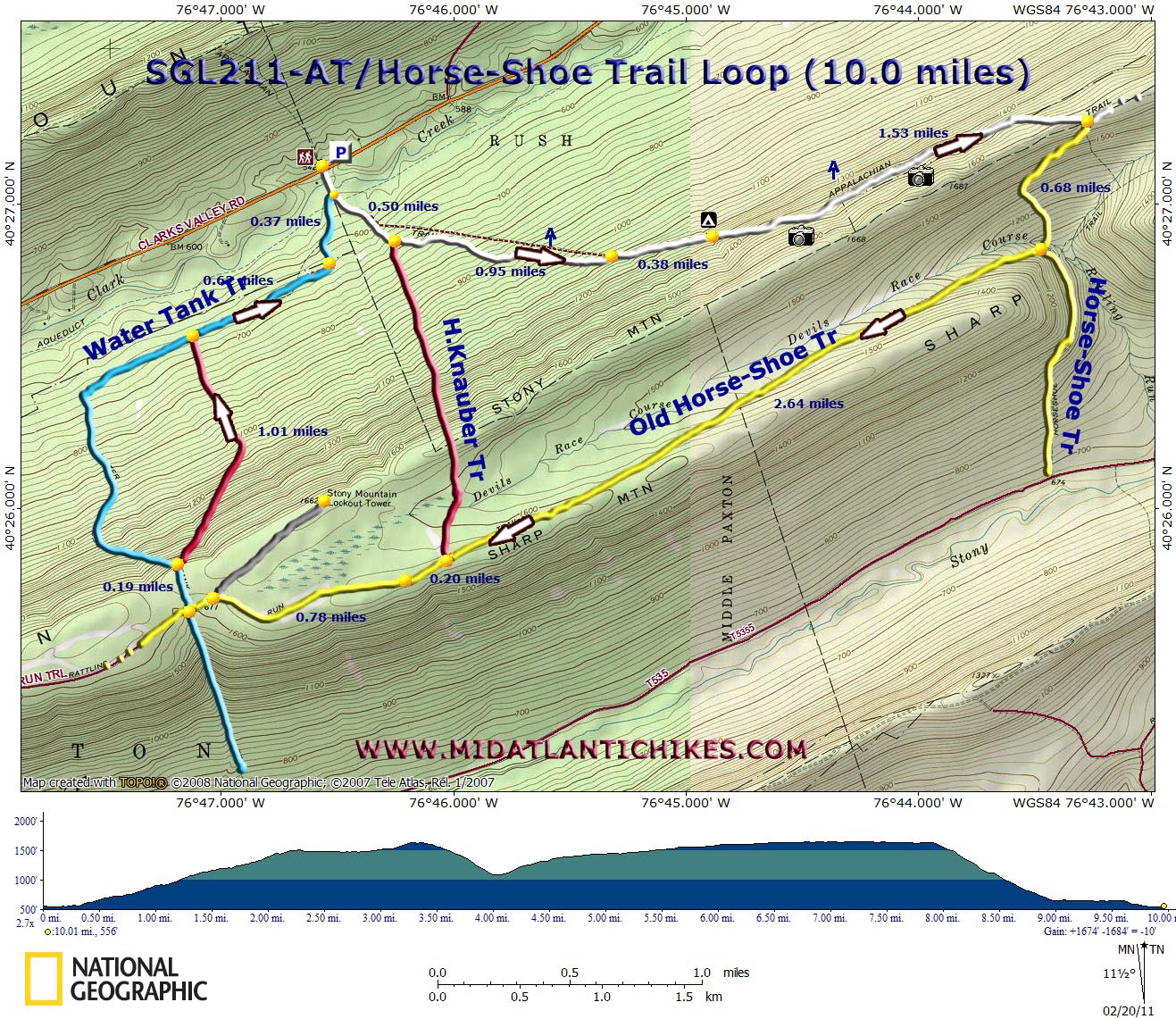
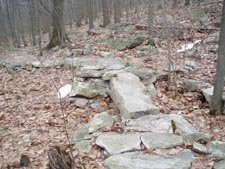
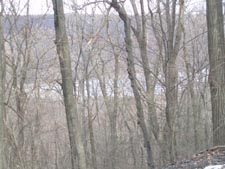
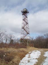
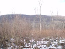
Description: For more background information on Saint Anthony�s Wilderness and SGL211 see the Rausch Gap Loop. Described here is a moderate 10.0 mile circuit (Add 1.0 mile if you do the out-and-back to the Stony Mountain Fire Tower.) with 1674 feet of elevation gain. The main draws of this hike have to be the broken views of De Hart Reservoir, the gap in Sharp Mountain and of Peters Mountain on the final leg as well as a taste of industrial history. Special thanks goes out to the Susquehanna Appalachian Trail Club who�s volunteers relocated part of the AT off of a badly eroded woods road. What is so amazing about the task is all of the stone work (large steps and bridges) through a veritable continuous scree field that they performed to make the traveler�s journey relatively comfortable. Google Maps Custom Driving Directions The hike starts at the large parking lot where the AT crosses Rt 325. |
|
________________________________________ |
Zipped National Geographic TOPO! GPS and Universal GPX Files |
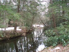
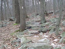
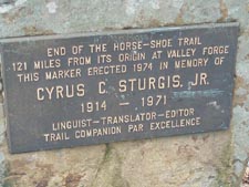
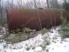
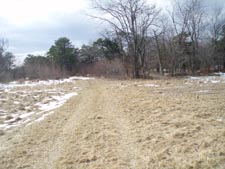
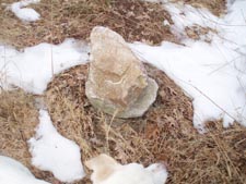
Trail Notes: From the parking lot cross Clark Creek on a concrete bridge. Almost immediately bear left onto the AT, an old road at this point. The trail leaves the road to the right on a footpath and arrives at the red blazed Henry Knauber Trail on the right in 0.50 miles. Continue on the AT as you climb obliquely up the northern slope of Stony Mountain. Rejoin the haul road in 0.95 miles. A sharp eye can spot old overgrown grades on either side. Pass a strangely out of place flat area along the grade with a fire ring in 0.38 miles. Since this is outside of the SGL it might be the only legal campsite in the area. For the next 1.53 miles enjoy broken views of the reservoir before arriving at the Northern Terminus of the 121 mile long Horse-Shoe Trail (H-ST). Turn right and follow the yellow blazes down into a gap in Sharp Mountain. On a clear day in winter you might be able to pick out one of the Hershey Chocolate plants in the distance. Arrive at an old haul road in 0.68 miles. Recently the H-ST was relocated, turning left here and following the road down to the S&S railroad grade. You want to ignore the blazes and turn right to follow the old route of the H-ST. The climb is very gradual as you gain the ridge of Sharp Mountain. Pass a large rusty water tank on the left and reach the southern terminus of the Henry Knauber Trail in 2.64 miles from leaving the �new� H-ST. In another 0.20 miles walk through a large grass field (perhaps a wildlife clearing?). Arrive at the junction with the Stony Mountain Fire Tower Road on the right in 0.78 miles. The Water Tank Trail will be on your right in about 0.10 miles. It might be hard to spot. When we did this hike it was marked with a 2 rock cairn. There are no trees to support blazes close to the road but you will see one back in the woods. Turn here and follow the trail for 0.19 miles. To avoid some excessive road walking turn right onto an un-named red blazed trail (previously pink). |
|
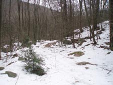
The descent is steep and rocky at first but lessens considerably as it passes through an area overgrown with low growing Striped Maple and Black Cherry trees. Here you will get views of Peters Mountain. In 1.01 miles from leaving the Water Tank Trail turn right onto a service road, the continuation of the Water Tank Trail. In 0.62 miles the service road curves to the left and re-enters a more mature forest. In another 0.37 miles arrive back at your vehicle.
________________________________________
________________________________________ Outing Critiques Name: lwtrekpa Hike: AT-Old Horse-shoe Trail Loop Date: 12/24/14 Rating: 4.5
Critique: The
is long hike, but not a majorly difficult one. Please plan time
wise for this hike. I would venture to say at least 5 hrs if
your going to take in glimpses of DeHart's Reservoir along AT,
sign register at northern terminus on Horshoe, stop at Devil's
Race Course, Water Tank, Stony Mtn Fire tower, lunch and water
breaks and any other small venture you may encounter along
way(i.e. Snakes, Deer, grouse, frogs, etc). I've done this hike
the way described, backwards, used both the blue and H. Knauber
trail to ascend and descend. Note, if you want more of a
vigorous challenge, do this hike in reverse or use the
H.Knauber to ascend up to Old Horshoe Trail. Either pink
connector or H Kauber are real good climbs up Stony Mtn. If one
wants to shorten this hike slightly and still see all the sights
but the actual water tank, I have an alternate route. When
ascending Old Horshoe Trail and you see the start of the red
blazed H.Knauber trail..turn right onto it and take it. this
takes you thru a bit of a marshy area depending on time of year
but climbs to the crest of Stony Mtn. Once there you will see a
rock cairn where you can turn right onto red blazed H. Knauber
and continue down Mtn or go straight onto a blue blazed trail.
Follow blue hashes along a trail that takes you along ridge of
Stony Mtn and winds up at Stony Mtn Fire tower. After spending
time at tower continue on regular road that takes you back to
Old Horshoe trail(people also refer to this as Ellendale road).
I absolutely love this trail for the variety and time away from
"it all"! During hunting seasons please wear at least some
orange. ________________________________________
Name: Justin
Hike: AT-Old Horse-shoe Trail Loop ________________________________________
Name: Matt Hike: AT-Horseshoe Trail ________________________________________
Name: Hard Corey
Hike: AT-Old Horse-Shoe Trail Loop ________________________________________
Name: chris rockwell Hike: Horse shoe Trail Loop
Date: 02/10/2012
Rating: 4 ________________________________________
Name: Joe
Hike: AT-Old Horse-Shoe Trail Loop ________________________________________ |
|
|