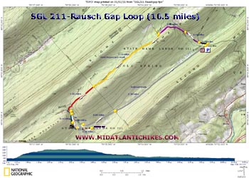
| Rausch Gap Loop |
|
|
Description: Peter Fleszar, the contact of St. Anthony�s Wilderness, a section maintainer and currently the webmaster for the Susquehanna Appalachian Trail Club (SATC): http://www.satc-hike.org, says �St. Anthony's Wilderness� name comes from a 255 year old map, it is not officially designated nor is it managed as a capital W Wilderness as in the National Forests. As such the name is romantically unofficial, you won't find it on signs. The closest it has come to official sanction is an article about it in the PA Game Commission's official magazine a few years ago. With that said everyone who's heard the name will likely assign it to the part of SGL 211 southeast of PA 325, northeast of the Ellendale Forge parking area on Stony Creek, and west of Gold Mine Road - or to the entirety of SGL 211. I personally prefer to apply the name to the contiguous complex of undeveloped and publicly owned lands in three counties, including not only SGL 211, but also SGL 210, the Haldeman Tract of Weiser State Forest, Ibberson Conservation Area, National Park Service A.T. lands on Peters and Stony mountains, and adjacent Harrisburg, Halifax, Elizabethville, Lykens, and Lebanon watershed lands. This more expansive definition would cross the paved roads, Gold Mine, 325, 225 at the overpass, and the back road from Lykens to Halifax, stretching from the Second Mountain overlook south of Dauphin behind Fort Hunter Conservancy, up to Williams Valley Elementary School at the edge of Tower City. That's about what the 1755 map name covers.� |
|
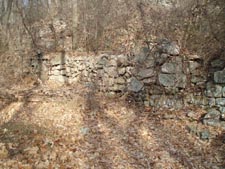
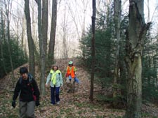
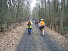
This area was heavily industrialized from the mid-1800s to the early 1900s. Primary activities were logging, coal mining and quarrying. When the resources were spent the Schuylkill and Susquehanna Railroad (S&SRR) left and so did the people that lived and worked here. All that is left are a few industrial artifacts, coal mining pits, bony piles, graveyards, foundations of ghost towns and a network of old roads and railroad grades. Described here is the first of several loop hikes found in the SGL 211section. The 10.5 mile distance earns this one a moderate rating although the quality of most of the tread and the lack of severe elevation gain (only 730 feet all at the beginning) almost wants me to call it easy. Seriously consider bringing your favorite walking shoes for the last four miles on the railroad grade. The hike starts at the large SGL 211parking lot on Gold Mine Road. Google Maps Custom Driving Directions ________________________________________ |
Zipped National Geographic TOPO! GPS and Universal GPX Files |
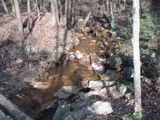
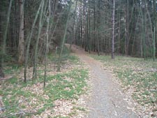
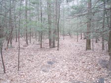
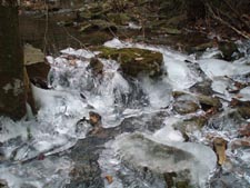
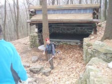
Trail Notes: From the parking lot walk back out to Gold Mine Road and turn left. In 0.32 miles bear left onto a gated woods road and begin a gradual but steady climb up to a gap in Sharp Mountain. In 0.44 miles pass the old eastern terminus of the S&SRR grade to the left and a higher road supported by extensive rock cribbing to the right. Cross the acid polluted Gold Mine Run and bear left through a huge pine plantation. Watch for the bony piles in the woods. These are piles of acid soil removed during coal mining. In 0.66 miles from the old RR grade turn left onto another road. This is commonly known as the Old Stagecoach Road although you will see no sign noting it as such. You will pass a few old orange blazes at the beginning but the road is very obvious without them. The road climbs a short distance before turning right and paralleling the ridge. In 2.10 miles cross a gas line right of way. Although the trail is narrower and wilder here it appears to be the same grade that you�ve been walking on. Young Hemlocks are now encroaching on the road. It is marked with red blazes. At around 1.0 mile from the gas line the trail splits. Follow the red blazes to the right and cross the East Branch of Rausch Creek and a large boulder field (lots of blazes here) before crossing the main branch. Here the trail turns left to follow the creek bank for a few steps before arriving at the white blazed AT. Turn left onto it. Soon arrive at a blue blazed spur on the right that leads to a shelter in 0.28 miles. It�s a pretty nice place for a break. Continue to follow the AT for 0.36 miles to the S&SRR grade and turn left onto it. |
|
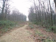
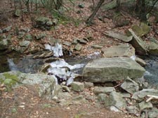
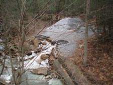
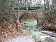
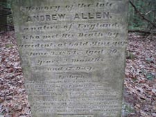
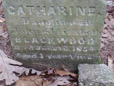
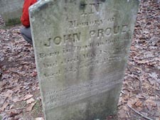
In 0.14 miles cross Rausch Creek on a new span built over the original stone bridge, checking out the liming station as you cross. To visit the Rausch Gap Cemetery turn right to stay on the AT and hike 0.42 miles to the sign. It looks like folks didn�t live long up here. Return to the RR grade and turn right onto it. This is where some good walking shoes would come in handy. The grade is wide, flat, smooth �. and hard. In 0.85 miles pass over the same gas line you crossed earlier. You�ll walk through a near continuous tunnel of Hemlocks for the next 2.78 miles before reaching your cars. ________________________________________
________________________________________
Name: Bryan
Smith
Hike: Rausch Gap Loop ________________________________________
Name: John Hike: Rausch Gap Loop ________________________________________ |
|
|