|
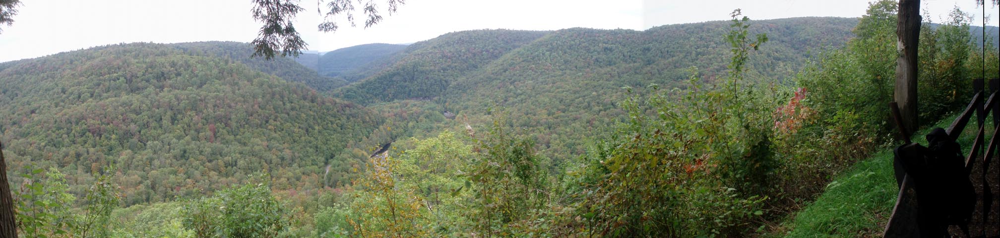
World's End State Park Figure 8 |
|
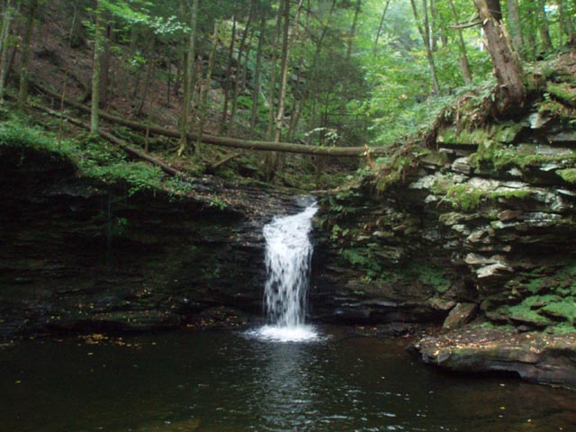
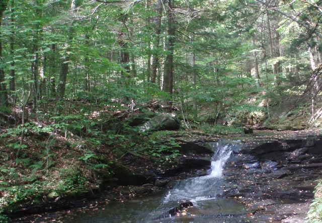
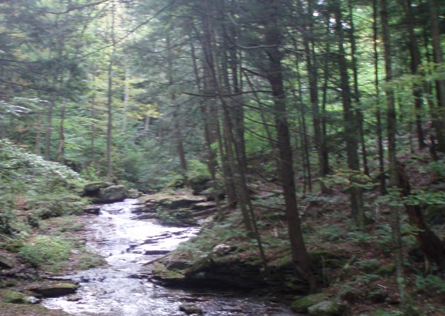
Description: World�s End State Park, surrounded by the Loyalsock forest and divided by the creek of the same name, hosts some of the best hiking trails in north-central PA. Usually, when thinking about state park hiking trails, one conjures up visions of near flat trails over easy terrain and a pleasant walk in the woods. Not so here. The trail system offers steep, rocky ascents and descents, interesting rock formations, vistas and the beautiful water works of Double Run and Loyalsock Creek itself.
Described here is a nearly figure 8 circumnavigation of the part of the park that lies on the south bank of the creek. If you complete the entire circuit you will cover 7.5 miles and climb 1600 feet. If time or physical condition does not allow you to attempt the entire trek it can easily be broken down into the two lobes of the figure 8 and completed separately. Google Maps Custom Driving Directions The hike starts at the Visitor Center parking lot. |
|
________________________________________ |
Zipped National Geographic TOPO! GPS and Universal GPX Files |
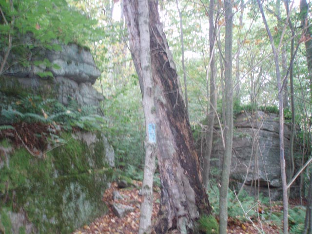
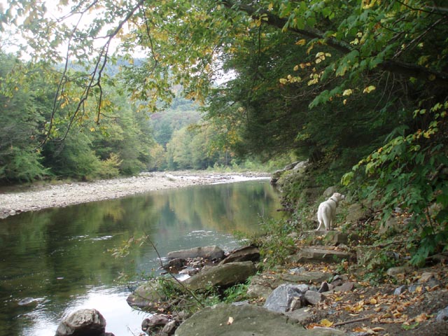
Trail Notes: As you leave the Visitor Center parking lot turn right onto the cabin access road. Just before the bridge (0.09 miles from Visitor Center) turn right onto the Link Trail (Red X on a yellow metal disk). Cross a back water of the creek and follow its rocky edge to a Hemlock grove. In 0.36 miles turn left onto Rt. 154, cross Double Run then turn right into the Double Run Trailhead parking lot. Pick up the white and green blazed Double Run Trail and in 0.23 miles come to a junction with the Loyalsock Trail (LT) and Link Trail (X). This is the apex of the figure 8. Turn left and quickly climb up to a grade and then turn left onto the LT. In 0.19 miles the LT crosses Mineral Spring Road and begins a steep rocky climb. At 0.28 miles from Mineral Spring Road turn left onto blue blazed Canyon Vista Trail. In another 0.35 miles arrive at a gravel campground road. (Mineral Springs Road is just to the left.) Turn right and walk 0.33 miles along the campground road, passing one intersection, and turn right onto a footpath at the parking area for campsite 61. The trail goes between four walk-in campsites before starting to climb along a sidehill that parallels Rt. 154. Eventually it turns away from the road and becomes much steeper before leveling out at the entrance to a rock city. After hiking through this the trail will alternate between flat and easy to steep and rocky. Cross the LT at 1.49 miles from leaving the campground. In another 0.39 miles the Link trail will join in from the left. Shortly after that arrive at the Canyon Vista (Yes, you can drive there.) and take in the fabulous views. There are outhouses at the parking lot. Continue on the combined Link/Canyon Vista Trail as it descends to a low spot 0.37 miles from vista). Here the Canyon Vista Trail makes a sharp right. Continue straight here staying on the Link Trail. |
|
Resume your descent as you work your way through a rock outcrop before reaching Mineral Springs Road once again (0.13 miles from the last junction). Cross it on a left diagonal to regain the trail and switchback down to Double Run. Initially the trail is pretty rugged as it weaves its way around boulders and blowdowns but soon takes on more of the features of a real trail. Eventually the trail joins a grade. In 0.48 miles from the last Mineral Springs Road crossing turn left and once again reach the apex of the figure 8.
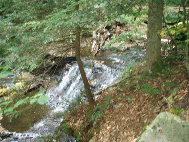
Turn left here than right and cross both branches of Double Run. Turn left, staying on the green Double Run Trail. Pass Water Beech Pool (0.11) and Cottonwood Falls (0.24 miles more) before arriving at a bridge on the left at another 0.09 (Crossing it and following the trail would take you back to the apex. Don�t cross the bridge but continue the climb out of the gorge reaching World�s End Road in 0.36 Miles. Cross the road and join the Pioneer Road. The rest of the hike is either flat or downhill. In 0.23 miles the LT comes in obliquely from the right to join the road. As the trail turns to the left enter a mature pine forest. At 0.58 miles from the last LT junction turn right and descend on the joint LT/World�s End Trail for 0.30 miles to Rt. 154. Cross it and return to your vehicles at the Visitor Center.
________________________________________
________________________________________ |
|
|