|
Wild Oak National Recreation Tr/North River Gorge Loop |
|
|
Description: The Wild Oak National Recreation Trail (WONRT) is a popular 27 mile backpacking loop. When studying modern maps there are no apparent cross connectors (except forest roads) with itself or other trails allowing for shorter loops. Leonard Adkins in his �Fifty Hikes in Northern VA� describes the main loop and a separate shuttle hike along the North River Gorge Tr. This trail comes very close to the WONRT in two places. In 2005 Janet and I drove out to the area and found what some old USGS maps suggested. First, there is an extension of the North River Gorge Tr that connects the two trails along the river at the northern end. Secondly, The Bear Draft Tr that seemingly ends at the WONRT on most maps actually continues north-westward across the WONRT as an unmaintained 0.5 mile jeep road/trail that eventually connects to a service road that is about 0.9 miles from the southern terminus of the North River Gorge Tr. It is not signed but can be spotted by the observant eye if hiking from either direction. These �finds� allowed us to close the loop on a pretty nice moderate 9.9 mile circuit with views, Blue Berries in season and a pretty stream to follow for about 4 miles. |
|
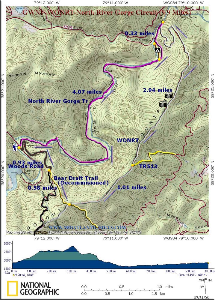
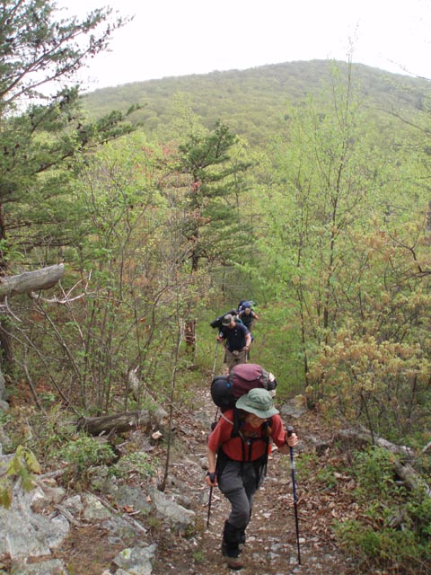
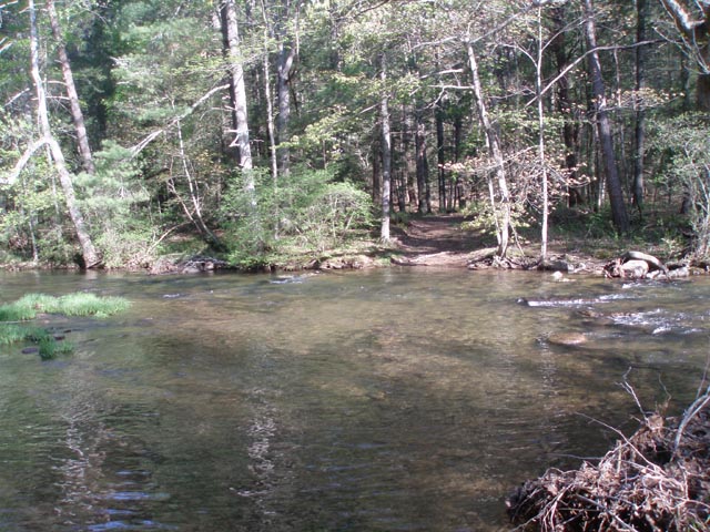
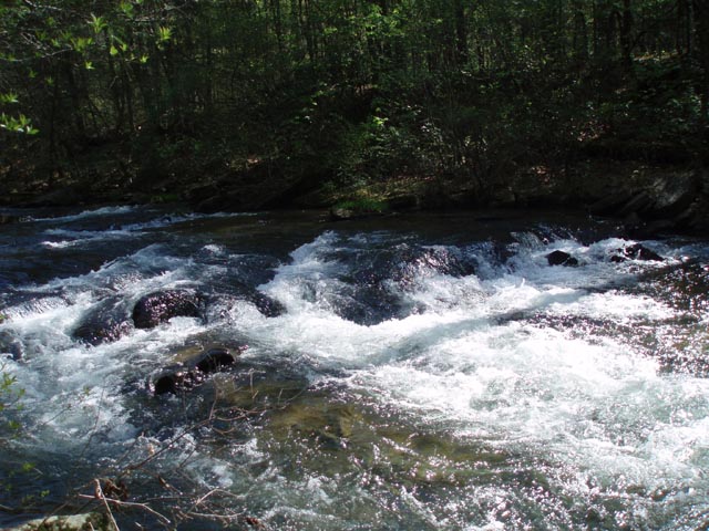
There is a 1000 foot elevation gain over the first 3 miles, a couple of steep descents and 8 stream crossings. These can vary from rock hoops to tricky knee high fords depending on the season. Note: Google Maps calls FR95 Leading Ridge Road. Directions from US250 (West) and VA Rt42 (Scenic Route - recommended but longer) :
________________________________________ |
|
Zipped National Geographic. TOPO! GPS and Universal GPX Files GPS Text File for Non-TOPO! Users
|
Trail Notes: From the gate proceed up the gravel service road. Soon it will curve to the right. There will be a grassy jeep road on the left. This ends at the North River. Continue up the grade. You will pass a couple of grassy clearings on the left suggesting possible trailheads. They�re not! Continue up the road. The road has several bends in it. At 0.93 miles from the start it will curve to the right for a short distance. Just before it starts turning to the left again look for a faint foot trail on the left. (If you use GPS refer to waypoint #4 in the GPS files to confirm your location.) This is what I refer to as the �Decommissioned� segment of the Bear Draft Tr. It is not signed or blazed but becomes quite obvious once you take a few steps uphill. The trail is about 0.58 miles in length. The first half of this has about 20 minor blowdowns across the trail. Every one is a �Step Over� obstruction. The remainder of the trail is a wide open grassy jeep road all the way to the ridge of Lookout Mountain. At 0.58 miles from leaving the service road arrive at the junction with the �Official� Bear Draft Trail (yellow, straight ahead) and the WONRT (gray, left and right). Turn left onto the WONRT. The next mile is an easy jaunt along a flat grassy jeep road. As you start to climb toward the highest point of the trek pass yellow blazed TR513 on the right. You may get partial views as you crest the knob but the best views are as you climb up the saddle toward the next knob even though it is much lower. Be sure to turn around and look behind you. The trail will descend, steeply at times, and make an abrupt switchback to the left as it leaves the ridgeline. It will zig-zag through the woods as it gradually descends. In 2.94 miles from the TR513 junction arrive at the junction of the North River Gorge Trail. To check out the WONRT swinging bridge that spans the river turn right for a very short distance. To continue turn left (upstream) onto a nice wide trail. The official blaze color for this segment is purple but you won�t see any for a while and when you do see them they will be far apart. The trail is obvious nonetheless. |
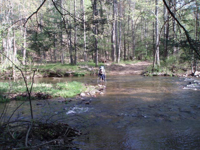
|
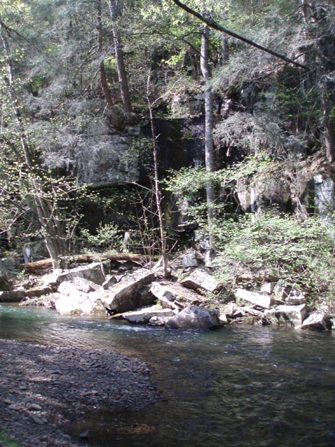
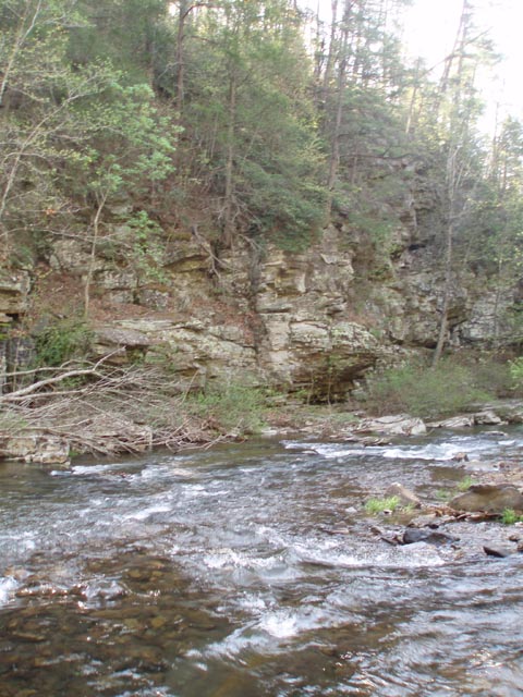
In about 0.25 miles pass a ford on the right. This crossing leads to the northern terminus of the North River Gorge Tr and is blazed yellow (not shown on the map.). In 0.33 miles the trail seems to split. Follow the orange blazes to the right to explore a huge campsite in a pine grove. There are 2 short spur trails that lead to the river. The upper one is the best. At its end is a 3 foot deep pool which is ideal for cooling off in. (It�s also full of fish!) The orange trail shortly rejoins the main trail. In about 0.7 miles make the first of 8 crossings of the river. Some hikers prefer to wear hiking sandals from this point on and just slog across. If you do I would advise wearing socks with them. The trail is mostly flat, wide and easy with less than a 200 foot elevation gain over 4 miles. The first five crossings are pretty close together then you will walk about 1.5 miles before the next set of 3. The last 2 are perhaps the prettiest as you really pass through a rocky gorge here! After the last crossing it�s an easy 0.6 miles or so back to the car. Printable/Downloadable Directions and Trail Notes ________________________________________
________________________________________
Name: Natasha
Hike: WORNT-North River Gorge ________________________________________ |
|
|