|
Wild Oak National Recreation Trail - North |
|
|
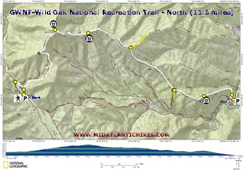
Description: The Wild Oak National Recreation Trail (WONRT), located in west-central VA, is a 27 mile backpacking circuit. Leonard Adkins and others have aptly described it as a rugged trail not often traveled. While the degree of difficulty has not changed over the years the quality of the trail has. Recently the Shenandoah Valley Bicycle Coalition (S.V.B.C.) has adopted the entire trail system. Through government grants and the support of the forest service they not only rehabilitated the entire trail, cutting back understory from the path, repairing eroded sections and adding fresh white paint to the often hard to follow gray blazes, they added a very nice high water by-pass trail above the western ford of North River, thereby making that sometime treacherous point mute, and installed more erosion resistant switchbacks approaching the bridge at the eastern crossing. You can read about their work here. Consider donating to their cause. |
|
Initially our plans were to backpack the entire loop but due to severe weather and flooding of the trail before the bridge we were only able to complete what I�ll call the northern segment. During the ride home I realized that this hike could stand alone as a strenuous 11.3 mile shuttle day hike with nearly 2700 feet of elevation gain and several nice vistas to make it worth the effort. If you live close by or are camping at Todd Lake give this one a try.
Google Maps Custom Driving Directions to the Eastern Trailhead Directions for Shuttle to Camp Todd
The hike starts at the Camp Todd parking area on dirt FR95 (Be alert for potholes in the road!) and ends at the main trailhead and kiosk on paved FR95. ________________________________________ |
|
Zipped National Geographic. TOPO! GPS and Universal GPX Files |
Trail Notes: From the Camp Todd parking area walk north on FR95 and cross the river on a bridge in 0.3 miles. Turn right onto a trail marked at the road with a dark green diamond. (This trail is so new it doesn�t have a name yet and vegetation has yet to start growing on the tread. I think the trail was cut-in during the winter of �10.) The trail switchbacks a bit before descending into Horse Trough Hollow and crosses an un-named tributary. (Note the excellent trail work where a diligent crew laid in cobble stones on either side of the crossing to prevent erosion of the trail. In 0.4 miles the by-pass trail ends at the WONRT. Turn left onto it. I recommend taking your time on this stretch as this is the hardest part of the hike. The sometimes rocky trail climbs 2000 feet over the next 3.2 miles. You�ll reach Bald Mountain Road at the top. Turn left for a few steps to enjoy some nice views. Return to the last trail junction and continue to follow the WONRT as it slowly descends on Chestnut Ridge. In 1.2 miles pass another vista to the right. Pass the yellow Grooms Ridge trail on the left in 1.5 miles. While the rest of the hike is generally downhill from here there will be enough �ups� to add nearly 1000 feet more of elevation before you reach the end. At 2.0 miles the trail crosses Little Skidmore Trail, jogs to the left just a couple of steps on the old road before turning right back onto a footpath. Summit Grindstone Mountain (the last of your climbing) and perhaps catch a glimpse of North River to your right in 1.1 miles. |
|
In another 1.1 miles the trail passes an earthen bearm to the left (blocking the original trail) and crosses a stream on a bridge. The trail splits here. Straight ahead is the continuation of the trail should you want to visit the river. Turning left returns you quickly to your plant vehicle. By now you probably have worked up an appetite. Visit T-Bone Tooter in Churchville for a quick hunger fix.
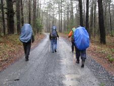
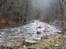
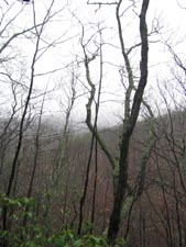
________________________________________ Photos by Andrea Lenaris
________________________________________ |
|
|