|
Turk Mountain Circuit |
|
|
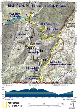
Description: This is a strenuous 10.6 mile circuit hike with 2400 feet in elevation gain. It can be made shorter and easier by by-passing the out-and-back to the Turk Mountain summit. You will also lose about 500 feet of the E.G. If you elect to do the shorter version you will miss one of the best views in the southern part of the park. Parts of the hike include hiking along Turk Branch and Moormans River (both small streams). Turk Branch in particular can be very scenic during periods of high water. Google Custom DirectionsNote: Google Maps often makes use of Park Fire Roads in its directions. These are closed to the public. Confirm your route with other maps! The trailhead is at the Jarman Gap parking area on the east side of Skyline Drive near Mile Post 97. |
|
________________________________________ |
|
Zipped National Geographic. TOPO! GPS and Universal GPX Files GPS Text File for Non-TOPO! Users
|
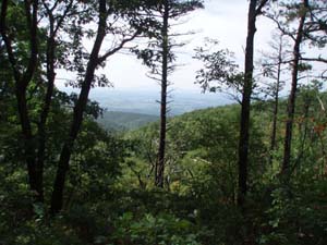
Trail Notes: All trails are signed and blazed. There are two cabled roads at this parking area. You want to follow the one between the front of the parking lot and the Drive. This is yellow blazed Moormans River Fire Road. Follow it for 0.24 miles to the white blazed AT. Turn left onto it and begin a long gradual climb. At 0.66 miles pass through a gas line swath that offers a nice north-easterly view. Continue climbing for another 1.09 miles passing yet another view, this one to the west, before arriving at Skyline Drive. Sawmill Run Overlook is to the left. Cross the Drive at the Sawmill Ridge Overlook and climb for 0.24 miles to two small, dry campsites. One is straight ahead and the other is to the left. The trail makes a right hand turn here.
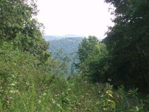
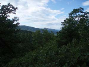
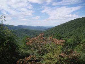
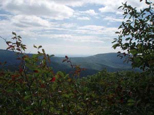
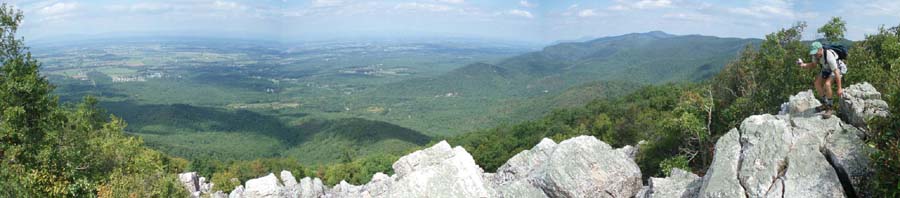
In 1.26 miles arrive at the junction of the Turk Mountain Trail. To do the full loop turn left here. You will descend into a saddle before climbing to the summit. Parts of this trail are very rocky. In 0.95 miles from the AT junction arrive at a concrete summit marker. Here you can take in a small southerly view. To take in a 180 degree view overlooking the Shenandoah valley continue to rock scramble out to the main vista.
After taking in the views retrace your steps back to the AT. Turn left onto it and in about 0.3 miles cross Skyline Drive. Enter the Turk Gap Parking area and turn right onto yellow blazed Turk Branch Trail. Initially this old woods road parallels the Drive but it soon makes a sharp left turn and descends to Moormans River. You�ll hike through sections that appear to be recovering from some sort of blight or fire, deciduous forest and groves of pine trees. Near the bottom the trail passes two old bridge abutments. Look up the side stream to the left for a potentially nice waterfall/slide. In 2.61 miles arrive at Moormans River Fire Road. It is also yellow blazed. Turn right onto it and cross both Turk Branch and Moormans River in short order. From hear the route is a gradual climb. In 2.00 miles pass the AT on the left and right. In another 0.24 miles arrive back at Jarman Gap.
|
|
________________________________________
________________________________________ Outing Critiques
Name: Jamie G
Hike: Turk Mountain Circuit
Name:
blueridgetreks
Hike: Turk Mountain ________________________________________ |
|
|