| Tuscarora-Standing Stone loop |
|
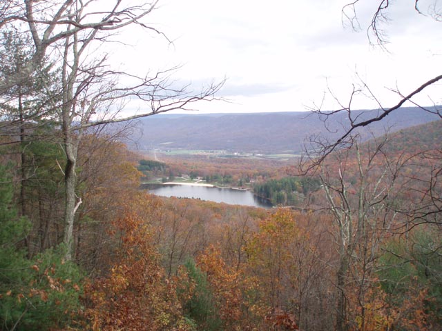
Description: The 250 mile Tuscarora Trail (TT) was originally constructed to replace a section of the AT between Shenandoah National Park in VA and Blue Mountain in Deans Gap, PA. The PA section is 110 miles long. The original path of the AT has since been secured leaving the Tuscarora to stand on its own. The Standing Stone Trail (SST, formerly the Link Trail) is a 70+ mile long connector between the Tuscarora Trail and the Mid-State trail. It previously extended south from Greenwood Furnace State Park to the Tuscarora Trail 3 to 4 miles north of Cowans Gap State Park. In the summer of 2010 the SST club and volunteers extended the trail along the ridge of Cove Mountain to join the TT at the park�s dam. The section of trail that was bypassed was re-blazed and named Todds Trail. Together these three trails form a nice 10.4 mile loop with 1500 feet of elevation gain. Unlike the majority of the Tuscarora Trail this section is not rocky but uses, for the most part, an old woods road. |
|
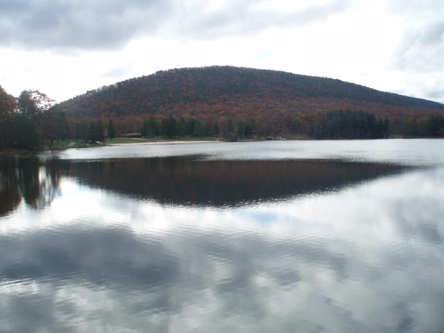
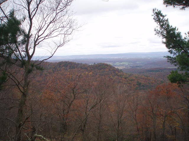
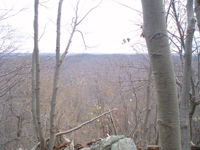
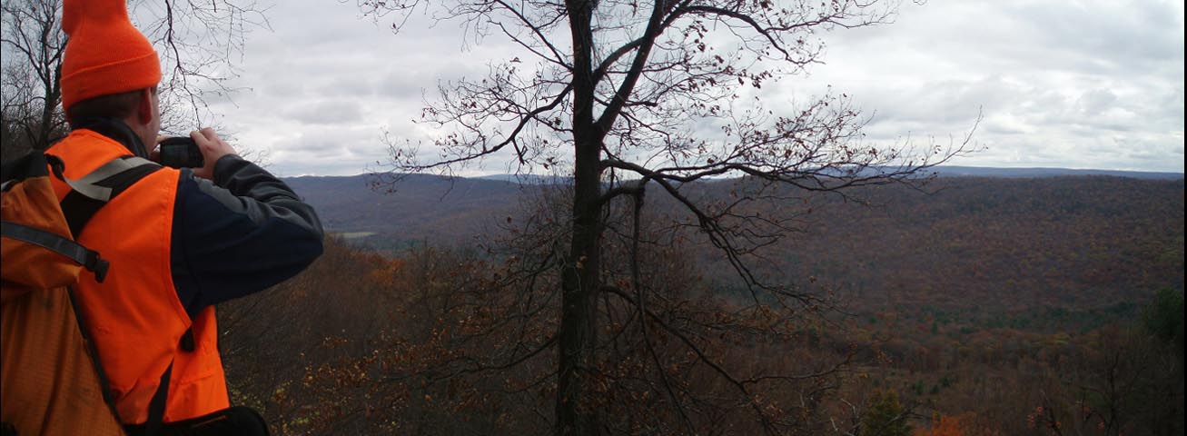
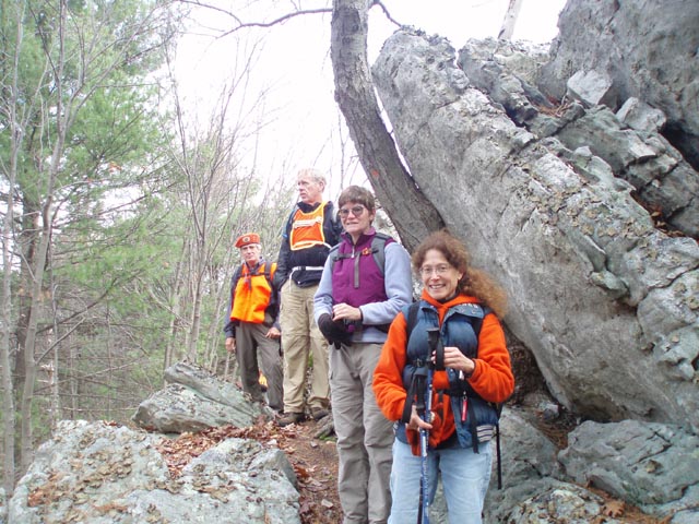
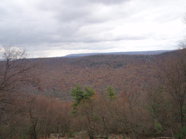
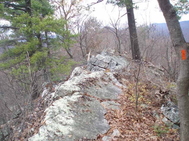
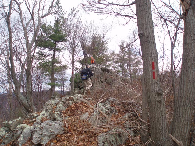
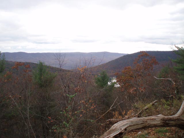
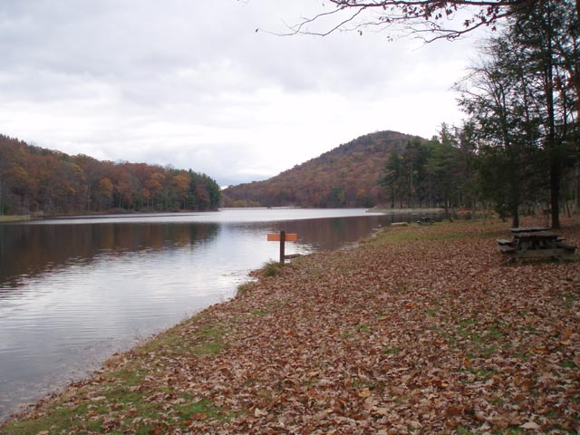
The climb up Todd Trail is steep but aided near the top by a series of well constructed switchbacks (an anomaly on most PA trails). The hike along Cove Mountain is extremely rocky but the traveler is rewarded with several panoramic views and some smaller ones along the way. The last 1.3 miles is a gradual descent on the Knobsville Road and Lakeside Trails back to the parking lot. A 0.4 optional out-and-back on the SST to two more vistas is also described. Standing Stone Trail Club Note: �The SST section on the ridge top between Fox and Sharpe trails is closed Nov 1-Jan 15 including Sundays � this affects a tiny but strategically located sliver of private land, owned by an organization that has been very helpful in creating the new SST in this area. Please respect the landowner�s wishes and do not use the ridge top trail on the private land section during this time. Use Todd and Tuscarora trails as an alternate, or if hiking the loop from Cowans Gap, cut over Fox Trail. Map 4 (See �private Property� on the Midatlantichikes map.) has been updated on the SST web site with the new route and the closure dates.� The hike starts at the parking lot behind the bathhouses. Google Maps Custom Driving Directions The Standing Stone and Tuscarora Trails are part of the Great Eastern Trail (GET). ________________________________________ |
Zipped National Geographic TOPO! GPS and Universal GPX Files |
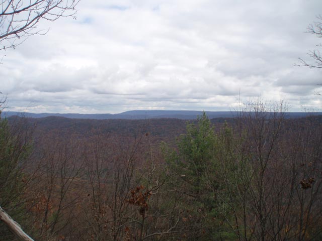
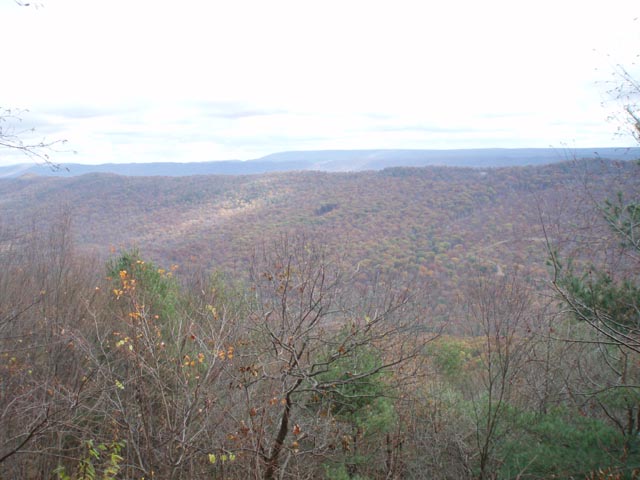
Trail Notes: Follow the paved/gravel path along the beach and across the dam to the new SST terminus sign. Turn right onto a blue blazed footpath to stay on the TT. It soon becomes an eroded woods road. In 0.21 miles pass the junction of the signed Horseshoe Trail. In another 0.98 miles pass the Wagner Trail and in another 0.35 miles the Fox Trail. The condition of the road steadily improves as it first climbs a bit and then descends again. In 0.0.90 miles from the last trail junction the trail approaches Aughwick Road and bears left to pass several hunters� cottages. The trail goes around a forest gate and passes the junction with the Sharp Trail in another 0.13 miles from Aughwick Road . At 0.77 miles from the Sharpe Trail the TT goes off to the right. Continue straight on the woods road, now the orange and red Todds Trail. Keep an eye out for in 0.30 more miles you will turn left off of the road and ascend to the crest of Cove Mountain in another 0.66 miles. If time, weather and energy permits we recommend turning right and following the SST for 0.19 miles to a nice view to the east. Immediately after that will be a short yellow blazed trail that ends at a rocky vista to the west. Retrace your steps to the Todd Trail and SST junction and continue south along the ridge. The trail is generally well marked but watch the blazes carefully as the trail is constantly switching from one side of the ridge to the other. You�ll obviously pass trail junctions with the previously mention connector trails you passed along the TT: first the Sharp Trail in 0.99 miles from the last junction and then the Fox, Wagner and Horseshoe Trails. They will be approximately the same distances apart as when they were passed in the valley. The private property discussed in the description is between the Sharpe and Fox trails. It is signed and blazed with white paint. There are many vistas along the ridge. The camera icons on the map mark the best ones. |
|
Between the Wagner and Horseshoe Trail will be a yellow blazed trail on the right. If for whatever reason you feel the need to vacate the ridge walk take this route for an early connection to the Knobsville Road Trail. Otherwise continue along the ridge until the SST meets the descending end of the road. In 1.37 miles descend to the park road, passing the Lake Vista along the way. Continue straight ahead to a bridge over the creek. The SST turns left before the creek on the dual blazed (orange and yellow) Lakeside Trail. The shortest walk back to your vehicle is across the bridge where you will turn left onto the remainder of the Lakeside Trail (yellow). Follow it through the picnic area back to your vehicle. ________________________________________
________________________________________
Name: Emily Hike: Tuscarora-Standing Stone Loop Date(s): 09/27-28/14 Rating: 5
Critique: We
started this hike in the early afternoon, clockwise from Cowans
Gap State Park, intending to camp in the Narrows, as mentioned
by Ben in a review above from January 2012. Departing the State
Park around the southern side of the lake, we found the Standing
Stone Trail and began our ascent to a rocky ridge top trail that
gave way to vista after vista. After 4-5 miles we came to the
end of the ridge and followed the Standing Stone Trail west down
a switch back to the Narrows (as seen on the map) instead of
heading east to the Tuscarora Trail as the hike notes suggest.
Name: Ben
Hike: Tuscarora - Standing Stone Loop ________________________________________
Name: Tom
O'Donnell
Hike: Tuscarora-Standing Stone Loop ________________________________________
Name: RoyalT
Hike: Tuscarora Standing Stone Loop ________________________________________ |
|
|