|
Saint Mary's Wilderness |
|
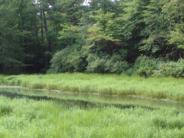
Description: At nearly 10,000 acres this is the largest wilderness area in VA. Until 1950 the area was heavily mined for iron ore and manganese. Artifacts and ruins from those days are still visible as the forest tries to recapture what was once wild. It was given the wilderness designation in 1984. Even with the mining scars the area is, for the most part, a joy to hike in. There is about 17 miles of trails and an old service road that connects some of them, making this a great place for a nice day hike or overnight backpacking trip. The tread varies from rocky footpaths, old work roads and trails almost totally engulfed by Mountain Laurel and Rhododendron. Although we spent 3 days exploring this area, here we describe an overnight trip with a pack-less out-and-back to the St. Mary�s Falls. As with most wild areas there are places that become over-used or abused and this special place is no exception. The primary route into the wilderness off of FR41 was severely damaged by Hurricane Isabel in 2003. It has not yet been repaired. |
|
The Forest Service and Tidewater Appalachian Trail Club (The trail overseers for the wilderness) recommend using Mine Bank Creek Tr from the Blue Ridge Parkway as a means of access to the area. Still many folks (Calling them riff-raff would be kind in my opinion.) still manage to haul huge tents, cases of beer, assorted trash, etc along the lower part of the St. Mary�s River Tr and the Falls trail and illegally camp right on the trail. (NO CAMPING IS ALLOWED IN THIS AREA!!!) On our scouting trip a small group had literally taken the Falls area over as if it was thier own campground. The same often occurs at the legal primitive campsites along FR162. If you witness such abuse don�t confront the individuals but report it to the Pedlar Ranger district as soon as possible: PH# - 540-291-2188.
There is an unsigned gravel road on the west side of the Parkway with a kiosk marking the trailhead. It is not signed at the road. ________________________________________ |
|
Zipped National Geographic. TOPO! GPS and Universal GPX Files |
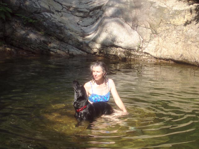
Trail Notes: Being a wilderness area, there are no blazes. Most trail junctions are signed. For the most part, trails are pretty obvious except in areas along the river that have been damaged by flooding. Day 1: There is an old woods road that cuts across the parking area. Ignore this. The Mine Bank Creek Tr is the footpath that starts to the left of the kiosk. Follow it, passing the junction with the Bald Mountain Tr on the right. (This is your return route if doing the 10 mile loop.) As you descend you will cross Mine Bank Creek 5 times. The first is usually dry while the others are typically rock hops. The gorge is pretty scenic with many little chutes and falls, many with their own little swimming hole at its base. In 1.88 miles reach the junction with St. Mary�s River Tr. Turn right. Cross Mine Bank Creek for the 6th time and in 0.31 miles from the trail junction cross another stream. Immediately pass some old concrete foundations from the old mining operation on the left. Enter a large, shady and grassy area. This is a great camping spot. A better one is along a footpath on the left right next to the river. Set up camp here. To visit the other mines, falls and swimming holes retrace your steps to the Mine Bank Creek Trail junction. Follow the St. Mary�s River Tr downstream. The trail will gradually leave the river and climb a bit. It will then snake through a stream fed cove where you might find a small campsite and some unexplored mine areas on a spur trail to the left. |
|
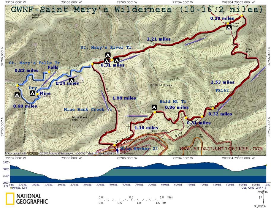
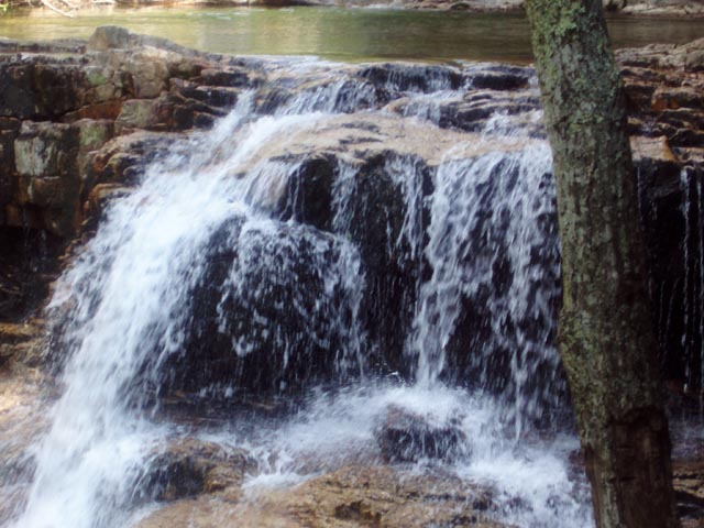
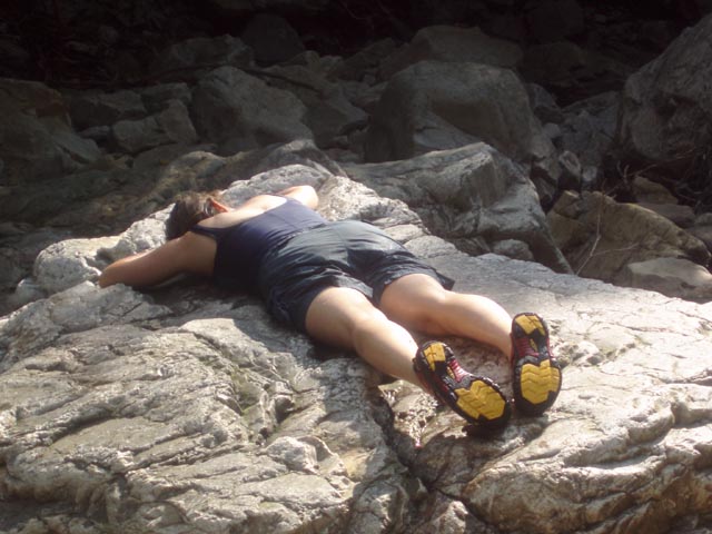
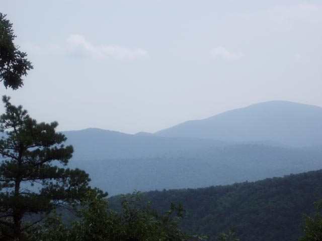
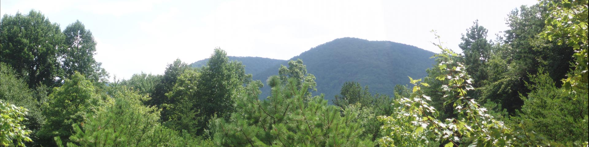
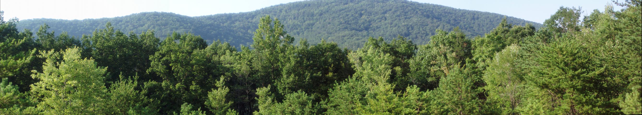
Continue on the main trail and cross the stream. In 1.24 miles from the last trail junction there will be a side trail to the right that climbs a high bank. From here you can see the surrounding mountains and the vestiges of a mining operation below you in a bowl-shaped area. Take time to explore it, either now or on the way back from visiting the falls. The place is honeycombed with trails but the main route will always be on the other side of the man-made bank. On the other side of �The Bowl� the trail will descend steeply from the bank and enter a beautiful hollow formed by Sugartree Branch. If you are running out of time or energy and still would like a nice refreshing soak before returning to camp you�ll be sure to find an acceptable pool here. In 0.68 miles from �The Bowl� arrive at the junction with the St. Mary�s Fall Trail and turn right onto it. Almost immediately ford the river. From here to the trail�s end you will pass numerous swimming holes. In about 0.3 miles the wide, flat trail reaches a blow-out. It continues as a narrow footpath to the left around the blow-out to rejoin the old trail on the other side for a short distance. The trail then seems to end at a set of 10 ft high cliffs. Either scramble down the cliffs or backup a bit and slither down between the rocks to the riverbank. Ford the river for the last time. In a few yards reach the 20 foot tall St. Mary�s Falls. As you return to camp take time to visit the many swimming holes and mine ruins if you haven�t yet done so. Day 2: If your main goal for the trip was to visit the mines, falls and swimming holes you can break camp and retrace your steps back to the car. The climb back up Mine Bank Creek is pretty steep in places so take your time. Use the cool pools to refresh yourself along the way. To complete the Backpacking loop described here return to the grassy area. There will be a well-worn trail going up a steep hill (away from the river) and one going around the hill. Both trails connect on the other side. The one going steeply up the hill passes through a 1-tent campsite w/fire ring. I prefer taking the easier grade around the hill to the right. From here the trail gradually climbs away from the river before paralleling it but at a much higher elevation. As before, at times the trail will be almost totally engulfed by Mountain Laurel and Rhododendron. As Tina at the RD would tell me �The Mountain Laurel is so thick down there you couldn�t throw a cat through it!� You�ll cross Chimney Branch and then the main river (a mere stream at this point and the last �good� water for about 5 miles.) before beginning a steep climb. You�ll ascend approximately 900 feet in less than a mile. Joining a rocky old jeep road and a couple of short switchbacks do little to add any comfort. As you near the top look behind you for a nice view of Bald Mt. You�ll be walking in its shadow latter on. In 2.21 miles from camp the trail flattens in an area called the �Big Levels�. The name conjures up visions of expansive views of the surrounding mountains � but there are none. Instead you are surrounded by Mountain Laurel and forest. Still it is a pretty nice walk along a flat, sandy trail. Soon reach a kiosk and clearing. The remnants of FR162 cross in front of it but I believe it was relocated to its current location to protect the fragile microenvironment of the unique Green Pond area. (There is camping here but I am not sure of the quality of the water but the name �Green� worries me!) After visiting the pond and the Sphagnum Peat bog that surrounds it follow the main trail for another 0.3 miles to its terminus at FR162. There is no sign here but the battered dirt road is quite obvious. It is open to those with vehicles that can handle the conditions. Turn right and soon pass the terminus for the Kennedy Ridge Tr on the left. There may not be a visible sign here. (Often the Forest Service places signs about 20 feet or so down the trail to discourage removal by mischievous sorts!). You�ll follow this road for approximately 3 miles with a couple of modest uphill grades. At 2.53 miles you�ll come to a campsite on the left frequented by car campers. If not occupied it offers nice views to the southeast and east. As you look out there will be a footpath to the left. This is the terminus of Mill Creek Tr that runs through the valley below, an area we hope to visit soon. Proceed up the road for another 0.32 miles where the road forks. The left fork goes to a lookout tower. I do not know its condition/availability or if it offers views. You want to take the right fork. In 0.31 miles keep an eye out for an obvious footpath on the right. There is a signpost but no sign. Turn onto it and in about 20 feet pass a sign for the Bald Mountain Trail. As you descend toward Bear Run you�ll pass through an area of dense blowdowns that have been cut through or worked around by volunteer trail crews. These were the result of the severe Gypsy Moth infestation of the 80s. Although the trees died over 20 years ago they are still falling down! After you pass through this area you�ll cross the stream and pass a small campsite on the right (0.86 miles from leaving FR162). This is the last campsite and reliable water source until you reach the end of the trip. In another 0.9 miles or so the trail forks. To the left is an old grassy road. Recent cuttings suggests that it is maintained. This could be the woods road that crosses the parking area but we didn�t check it out. If you don�t feel up to the adventure bear right, staying on the footpath. In another 0.3 miles arrive at the junction with Mine Bank Creek Tr. Turn left and soon arrive back at your car. ________________________________________
________________________________________ Name: Andrew Hike: St. Mary's Wilderness Date: 08/23-25/13 Rating: 4
Critique: Parked at the BRP and hiked Mine Bank to the junction of the River trail. This trail is clear of blowdowns and seemed very recently cut back. Other trails are mildly overgrown but still passable.) We turned right and hiked 0.3 miles to the group camp described above. Easily room for 3 or 4 boy scout jamborees here. Saturday we did an out and back to the Falls. The best swimming hole, in my opinion, is just upstream of the lower falls - 10 ft. deep, clear water, complete with rope to haul yourself out with and plenty of rock ledges for canonball jumping.
________________________________________
Name: Scott_R
Hike: St. Mary's Wilderness ________________________________________
Name:
2dawghikers
Hike: St. Mary's Wilderness ________________________________________
Name: Dave
Eccleston
Hike: Saint Mary's Wilderness ________________________________________
Name: Dwight
Maskew
Hike: Saint Mary's Wilderness ________________________________________
Name: Mike from
Richmond
Hike: St. Mary's Wilderness ________________________________________
Name: Steve
Weber
Hike: St. Mary's Wilderness ________________________________________ |
|
|