| Jeff Mitchell's Waterfall Wonderland |
|
Description: This will probably be the prettiest, most serene 8 mile PA day hike you will ever undertake. It will probably also be the most dangerous .. dangerous enough that I need you to read the Terms of Use of this website now, if you haven�t read them yet, before trying to take this one on. Before I go any further I have to admit that I cannot take any credit for this hike. I wish I could but this one belongs to Jeff alone. I�m just here to tell you about it in the broadest of brush strokes possible. |
|
The hiker needs to understand some things before venturing out on this one:
If you are OK with all of that then be prepared for one amazing hiking day! Google Maps Custom Driving Directions The hike starts at the second parking area on the left side of Sullivan/Jamison City Road after entering State Game Lands 13. Note: The road in from PA Rt487 near Ricketts Glen SP is closed as of this writing due to heavy flood damage. ________________________________________ |
Zipped National Geographic TOPO! GPS and Universal GPX Files |
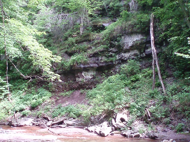
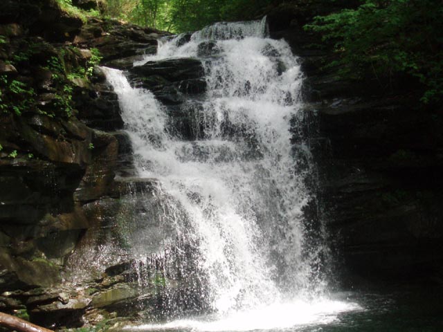
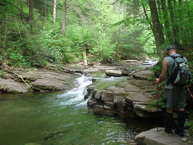
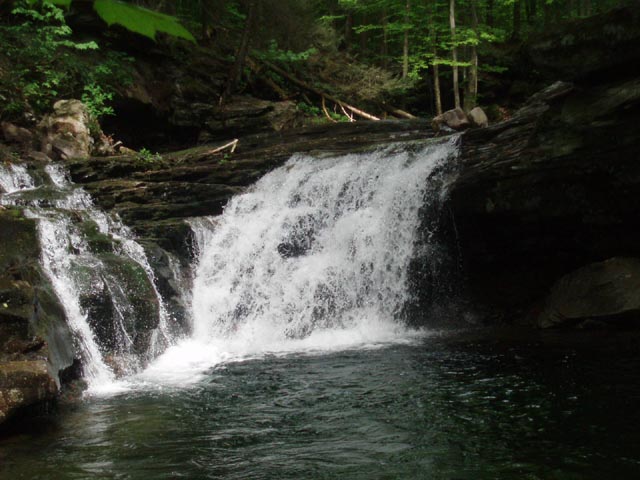
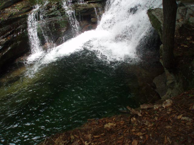
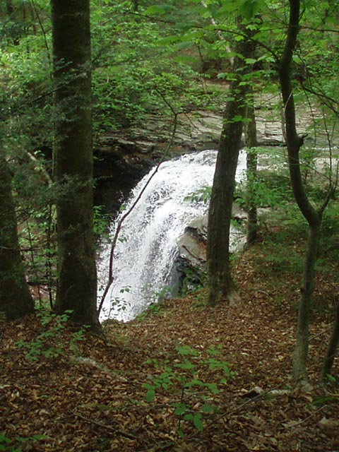
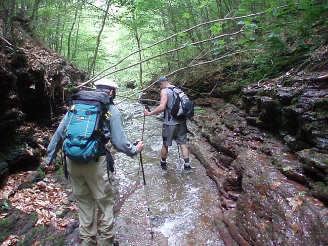
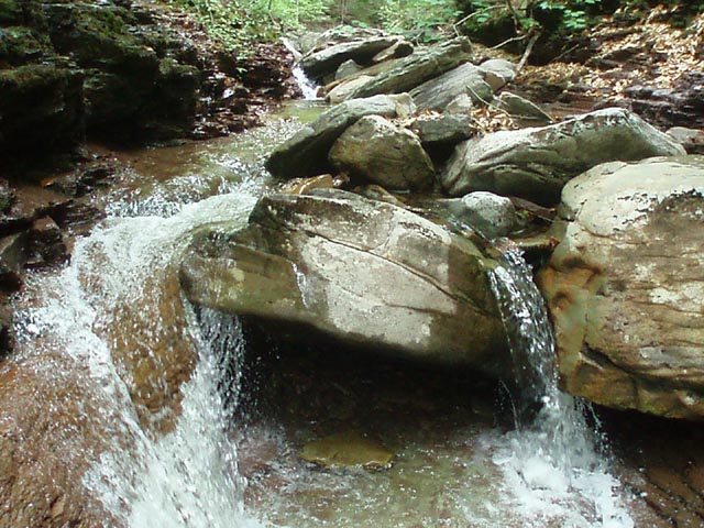
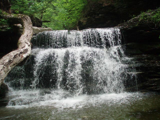
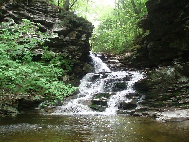
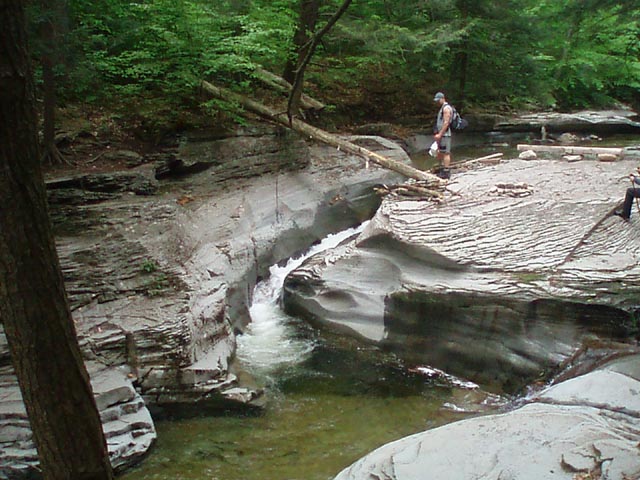
Trail Notes: As mentioned in the description most of this hike is without trail � and this starts at the parking lot. Bushwhack through the woods toward the sound of flowing water. Ford the East Branch of Fishing Creek just below the confluence of Sullivan Branch and Heberly Run. Turn right and follow Heberly Run upstream. This entire section up to leaving the stream at an old haul road is 1.96 miles. Note that the ground is soft here, a sign of frequent flooding. It�s hard to tell you when you should be in the woods and when you should be in the stream and where the stream should be crossed because a change of just a couple of inches in the stream depth can effect your course greatly. This is why the hiking is so slow. Eventually you will be compelled to walk in the stream. Look for rock hops or the shallowest places to walk. Remember, wider crossings usually have less forceful, shallower flowing water and is safer than a deep, narrow crossing. You will arrive at Big Falls first. After taking it in retrace your steps a bit and begin a diagonal climb up the left bank (as you look at the falls). You will see the cliffs above you. Follow the diagonal until you are well past them then switchback and climb above them. This is the steepest and trickiest climb on this leg of the hike. You will visit approximately five more falls before leaving the run. By-pass them much the same way as the first falls but on the opposite bank as previously described. (This strategy is subject to changes in water levels and weather conditions.)
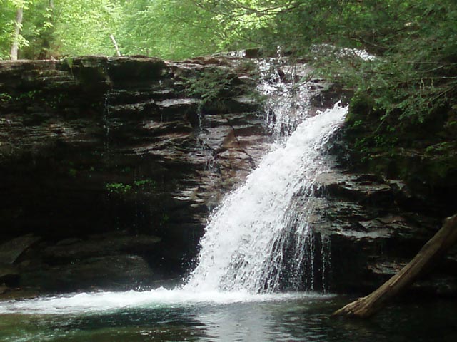
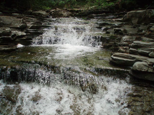
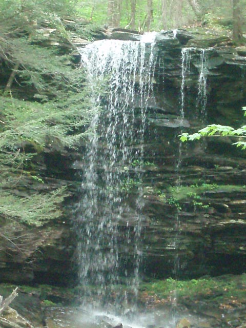
Shortly after visiting the last falls (Lewis) on the run leave it to the right on an obvious old haul road. This climbs gradually to the top of the plateau. In 0.54 miles look for a small cairn on the left side of the road. If you bushwhack down from here on a slight upstream diagonal you should soon see/hear moving water. This the confluence of Quinn and Shanty Runs, one of the most beautiful lunch spots in the Mid-Atlantic and each with their own waterfall.
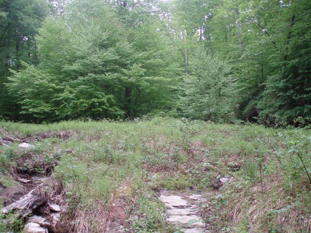
After listening to moving water in stereo for a while scamper back up to the haul road as best you can and complete the climb to the top. Here the trail degrades into a serpentine footpath. For the most part it is easy to follow but keep your head on a swivel as you approach the second of three clearings (1.09 miles from the lunch spot above.). The trail will make an abrupt left to avoid an area of dense blowdowns. |
|
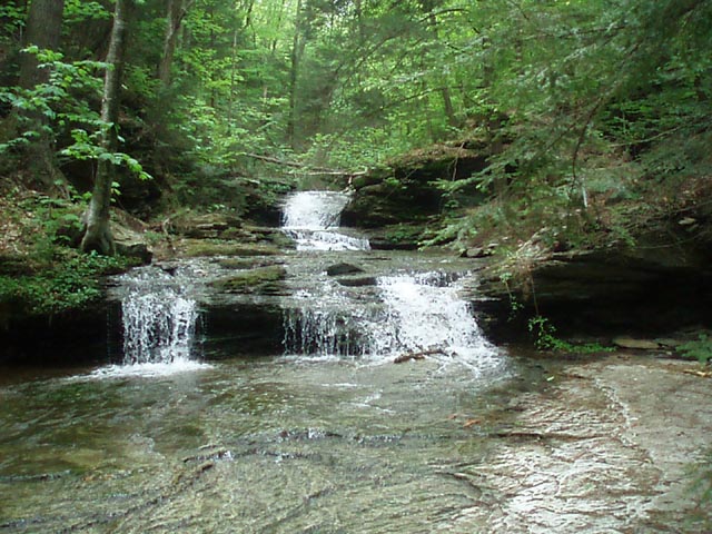
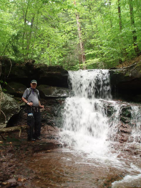
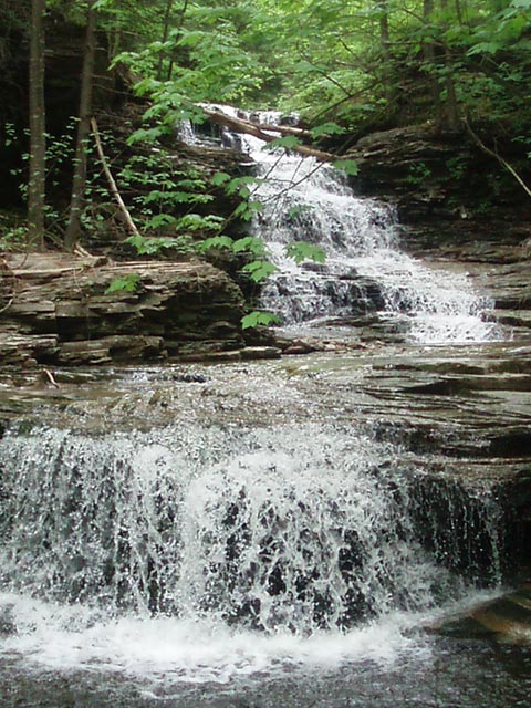
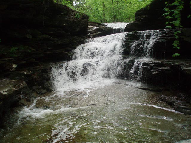
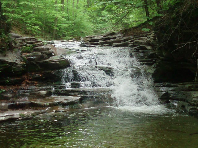
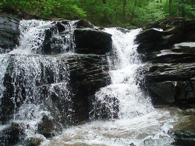
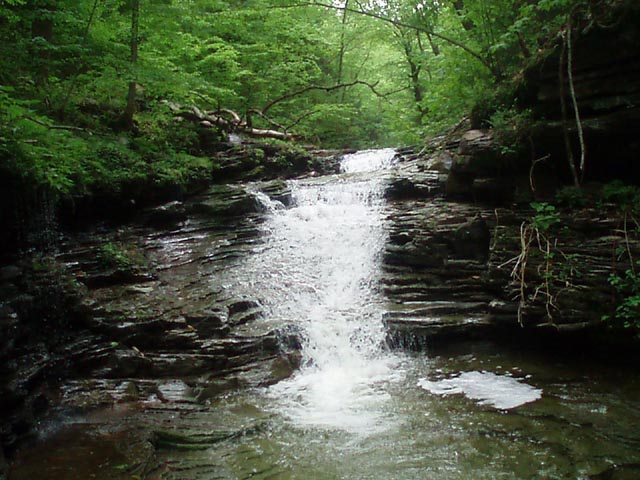
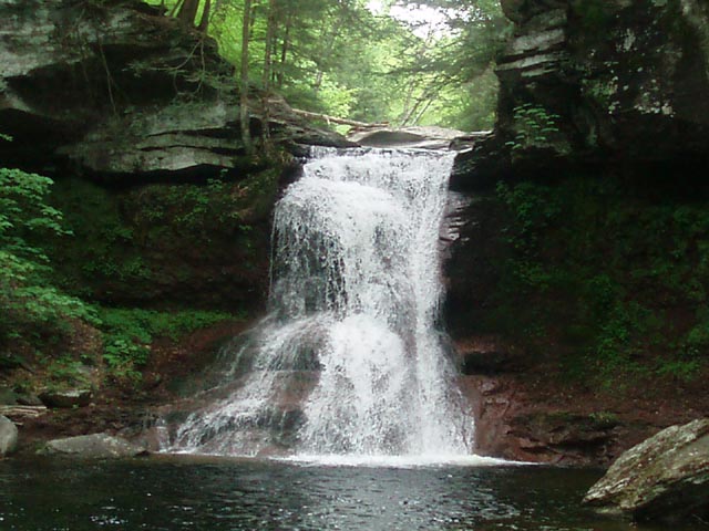
The trail will cross a small feeder stream and immediately make a 90 degree turn in another 0.95 miles, once again becoming a haul road. Keep an eye to the left for a hidden waterfall you can bushwhack partly to for a better look. As you drop to the same level as Sullivan Branch you�ll have to step into the stream to work around some large blowdowns. Shortly after that cross the stream to rejoin the continuation of the haul road on the other side. The haul road crosses Ore Run in 0.64 miles from leaving the plateau. (Remember this as it serves as probably the only easy bailout route of the hike. You will join it again near the end.) Leave the road here and waterwhack down the run to it�s confluence with Sullivan Branch. Turn left down the Branch and soon reach a nice 10 foot waterfall. A cool walk down a mini-chasm follows shortly after. If your feet weren�t wet before they will be now. After the chasm walk reach a fern field on the right. Just below this is probably the hardest falls to negotiate on the hike. Begin by walking down the right side of it on nature�s own stone steps until they run out or go under water. This is where you will turn to face all of that power. There is a nice flat stone shelf under the frothing water that possesses amazingly good traction and reaches the other side. Carefully side step across, paying attention not to pick your feet up too high. Once on the other side use the natural rock steps and ladders to get to the bottom. Treat the remaining falls with the same approach. After negotiating about seven waterfalls look to the left bank for a relatively flat area of the bank. This marks the confluence of Pigeon Run and a nice side waterfall worth visiting. The waterwhacking continues for another a little further beyond Pigeon Run. Currently there is a yellow rope marking its end but I wouldn�t rely on it always being there (and it kind of detracts from the whole �being out in the middle of nowhere by yourself� thing.) What one needs to do is look for the return of that old haul road you were walking along earlier to the left (or the GPS waypoint). Once it comes into view bushwhack up to it and turn right. In another 0.28 miles you�ll find yourself Back on Sullivan Road. Although the adventure part of the hike is over the waterfalls part is not. Turn right onto the road and in a handful of steps arrive at a parking area. Switchback down a real trail to the ever impressive Sullivan Falls, making sure to visit the top of the falls and the dramatic chute above it. When finished return to the road and walk 0.79 miles back to your vehicle.
________________________________________
________________________________________ Outing Critiques
Name: Boondoggle Hike: Jeff Mitchell's Waterfall Wonderland Date: 08/02/14 Rating: 4.75
Critique: A Great hike, very slippery, very demanding. The faster you try to go the more you get hurt... so just take your time. The bridge that had washed away has been replaced so it's much easier to get to. This is the 2nd time I've done the hike. The first time we got caught in a thunderstorm and had to take the haul road for the 2nd half of the hike all the way down. This last trip we were able to complete the entire trip. It took 7 hours total, but we did stop to look for a few geo caches and took 2 other breaks for eating and a 10 minute "let the feet dry out a little bit" break. The bugs were somewhat bad, and the plateau walk had some incredible mud pits, one which consumed my leg up to my knee...
________________________________________
Name: Dan Hike: Waterfall Wonderland Date: 2009/2010/2013 Rating: 5+
Critique: First, I have to admit that I've done sections of this hike on different occasions - never the full hike at once. I've done all of Sullivan Run. It worked from the top, but not the bottom for me, but I know of someone who went in from the bottom and made it (he was very much in shape and trail-professional). Perhaps, I was just nervous to get a wet camera... I've done most of Heberly Run. I didn't hit Big Falls, but I've done the rest. I found what I saw to be rather beautiful, but the Sullivan Run section is much better than anything out there that I've ever done (and I pride myself on taking in as many waterfalls as I can (though Ricketts has "more" it also has drawbacks - see below)). I also was lucky enough to be escorted back to Quinn Run, which isn't in the Scott Brown guide (his stuff is fantastic, by the way AND NO, I'm not him). It's a great place to get lost and get trained. I liked this a whole lot, too. I agree with the reviews of how wonderful and difficult the hike is. There's definitely a sense of accomplishment, but there's also a sense of take your time and THINK but don't get too in your head out there. It's definitely a place that you will have for yourself, and that's what I like about it. The litter and hordes at Ricketts Glen have really detracted from an otherwise beautiful place in recent years. I heartily recommend Sullivan and the other places if you want to go off the grid since there is no trail or crowds. If you want a taster of Sullivan, I recommend hiking up to Quinn Run and testing your feet on the smaller waterfalls for ascent and descent purposes. Some of the hike in is a little steep, but it's not a lot of vertical - just a drop on the sides.
My photo gallery.
________________________________________
Name: The Mad Hatter Hike: Jeff Mitchell's Waterfall Wonderland Date: 07/16/11 Rating: 5
Critique: Certainly one of the best, prettiest and most challenging hike I've ever done, and that with only one serious trailess climb. Will probably never do this again but still very memorable. ________________________________________
Name: Mitch
Hike: Waterfall Wonderland
________________________________________
Name: Ed Duguid
Hike: Jeff Mitchell's Waterfall Wonderland ________________________________________
Name: Jeff
Hike: Waterfall Wonderland
________________________________________
Name: robert
Hike: Jeff Mitchell's Waterfall Wonderland ________________________________________ |
|
|