|
Reddish Knob Summit |
|
|
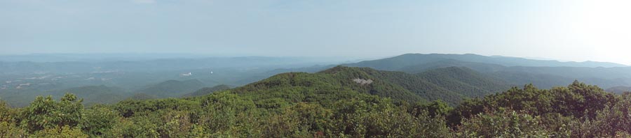
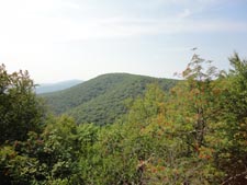
Description: At 4,397 feet, Reddish Knob (Yes Bobby, you can drive to it!) is the highest point in Northern Virginia. There are no taller peaks between it and the Adirondacks to the north save Spruce Knob (4863 feet) and Mount Portre Crayon (4770 feet) to its west in WV. You never hear much about hiking to this wonderful high point with a near 330 degree view, perhaps because you can drive there, but it makes for a very nice 2 or 3 night foray into the back country. Generally speaking this can be considered a moderate hike but it is rated as strenuous here because 1) there is a pretty challenging climb near the beginning as you climb 2500 feet in about 3 miles and 2) particularly in the summer, the streams, springs and wild life ponds for which you will need to depend on can dry up forcing the hiker to carry extra water and perhaps cache even more at the mid-point of the trek. (See Google Maps driving directions below.) |
|
Google Maps Custom Driving Directions to Hearthstone Lake Directions to Upper Timber Ridge Trailhead for Water Drop Off Allow approximately 30 minutes for caching water. ________________________________________ |
|
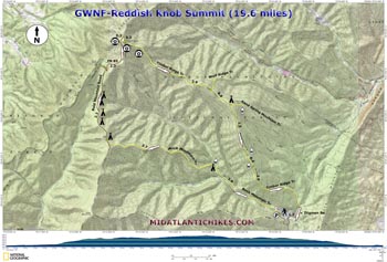
Printable/Downloadable Map (11X17 Best) Zipped National Geographic. TOPO! GPS and Universal GPX Files |
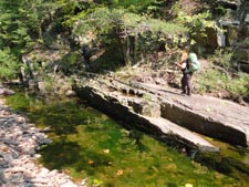
Trail Notes: All trails are blazed yellow. Forest roads are not signed. From the parking area walk back up the road until you reach the hikers stake for Buck Mountain Trail (434). This section of the trail goes through a damp spot so expect it to be weedy in the summer. The trail crosses Little River and then seems to disappear at a washout and tangle of fallen trees. It continues on the other side. It�s best if you work your way to the right of the tangle and then back into the woods. You should soon regain the trail and a yellow blaze. The trail zig-zags across the flood plain with the base of Hearthstone Ridge to the right (north) and the river to the left (south). Watch out for stinging nettles. At one point the trail nearly joins the river. At 2.6 miles from the parking lot cross the river again. (It might be dry in the summer.) Here you will find a suitable spot for a tent or two. Begin a steep climb, first along the north flank of Buck Mountain and then straight up its back. This is the hardest part of the hike. In 3.7 miles the trail becomes an old haul rode as it crosses a clearing and merges with dirt Bald Knob Road. Here is a large flat grassy area suitable for camping. In the back you�ll find an overgrown trail. If you can navigate it you will find a seasonal spring and the headwater of a feeder that flows into North River. If you decide to push on there are several other wildlife clearings to camp at. |
|
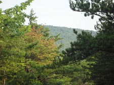
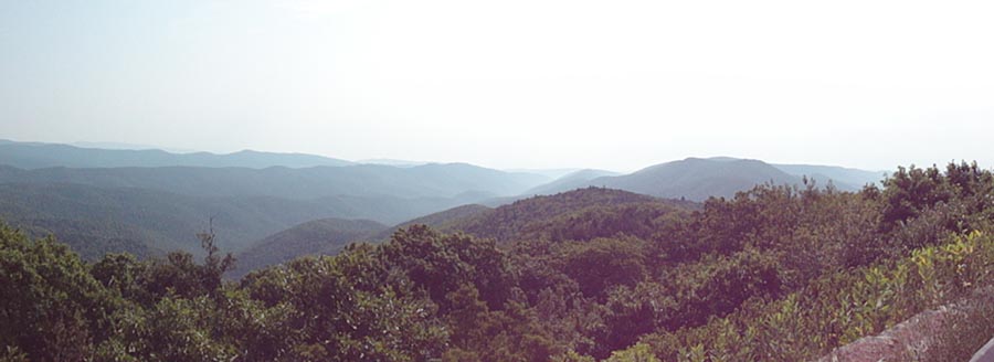
In 2.2 miles reach the intersection with dirt FR 85. Turn right and switchback up the backside of the ridge that Reddish Knob sits on. In 1.3 miles pass a vista and primitive car camping site on the left and in another 0.2 miles arrive at the paved portion of FR 85. Turn right and climb about 0.3 miles to the parking area (Please block out the graffiti on the asphalt.) and enjoy the views. To the west is Sugar Grove Naval Base (I still don�t know how they get the ships there. Actually it�s a Comm facility.), Shennandoah Mountain and other mountains of WV, to the north and east are Massanutten Mountain and the Blue Ridge, and to the south are Little and Big Bald Knob, Trimble Mountain and other assorted peaks of the GWNF.
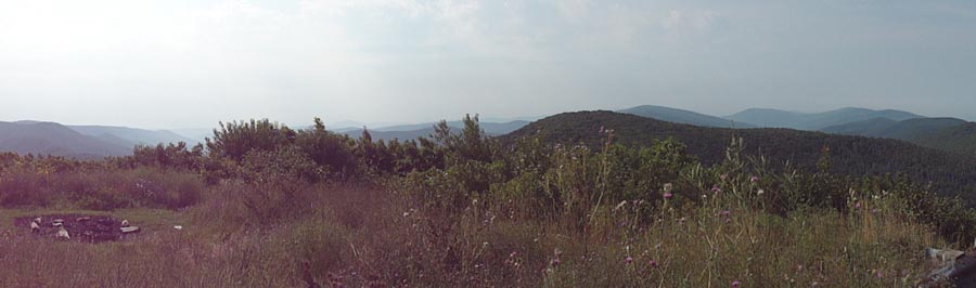
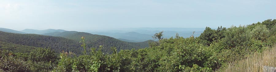
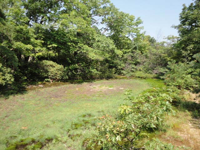
After taking in the views retreat to Timber Ridge Trail (431) and collect your water cache if that was in your plans. The rest of the trek is generally downhill with a few sneaky hills that might make you stop to catch your breath. Traverse a narrow talus slope which offers a splendid view of Little Bald Knob. In 2.9 miles pass Wolf Ridge Trail (378) on the left and in another 0.8 miles arrive at the junction with Sand Spring Mountain Trail (423). Straight ahead is a clearing with a fire ring. A little further down this trail is a wildlife pond. This is the only good spot to camp on the ridge if you planned your trip over two nights.
Bear right to stay on the Timber Ridge Trail and descend along the crest of Hearthstone Ridge. Pass two more wildlife ponds; one on the left in 1.5 miles and the other on the right in another 0.4 miles. You�ll also be passing through a large swath of oak forest which has been defoliated by Gypsy Moths. The open canopy seems eerily odd. You know you are approaching the end of the trail when you pass through a dense Hemlock grove with its soft needle tread. Arrive at gravel Tilghman (Tillman) Road that you drove in on in 2.0 miles from the last pond. Turn right and hike 1.3 miles back to your vehicle. It�s a shame but swimming is not allowed in the lake and about now you are probably ready for a refreshing dip.
________________________________________
________________________________________
Name: Ed Outing Critique: The Reddish Knob Summit is a really remote hike that all the animal life. We saw eagles, signs of bear, 7' rattlesnake, and much more. The bear markings where intense around the mile 5-8 and also one the way down. There was a den of bears somewhere at mile 6-7 in the rocks. The trees were marked by claw marks at 6' up. Trees were pushed over, and the brush was thick you were walking through. If you were doing this alone without making noise this is not a good idea. The camp sites were remote and the only one that looked like you could somewhat pitch tent was the car camp site off the dirt road near the top. (See trail notes) The trail is marked yellow until you hit jeep road, dirt roads, and follow the trail notes with map. About two miles going down the mountain the trail is nearly impossible to go through. We were wearing gaters to our knees and hiking boots. Our arms and knees had some major scratches. The trail is so thick you think you lost it, and then you see yellow. You will go 15 minutes to 30 minutes until you see another yellow marking. The trail notes refer to open field for camping the grass is about 2-3 feet tall. Rattlesnakes we saw were in it. We saw a 7' rattlesnake, that would not leave us alone when we stopped for lunch. We moved one. He was too friendly. You will need to drop water at the top. The best idea ever from the trail notes and website. Oh have fun driving up the mountain road to the top. You will learn to pray very quickly. Amazing views, and they are so worth it when you hike to the top. We hiked the whole loop in one day 12 hours with 40 lbs in the backpack. We were planning on camping on the mountain. We did not find any camp sites that we want to camp at, and the bear activity made us rethink it. I enjoyed the hike, my wife did not like the bear activity and rattlesnake. ________________________________________
Name: Bob H
Hike: Reddish Knob Summit ________________________________________
Name: Linsey
Hike: Reddish Knob Summit _______________________________________ |
|
|