| Quehanna Trail-West Backpack |
|
|
Description:
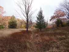
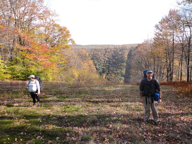
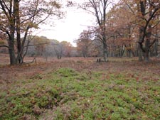
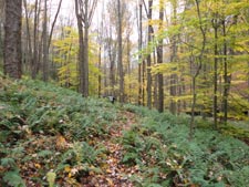
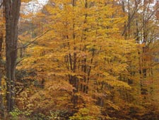
The Quehanna Wild Area is located in the Moshannon State Forest.
The terrain is a pleasant mixture of a nearly flat plateau and
deep ravines. The trails meander through large open heath
meadows full of Blue Berries, lush forests with a thick
understory of ferns and Rhododendron tunnels along the many
streams. The 70 mile long Quehanna Trail circumnavigates this
area. It is bisected by several connector and Ski Trails, making
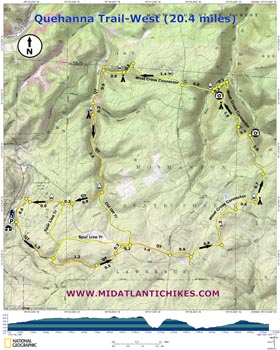
smaller 2 and 3 day loops � even day hikes � possible. The western most trailhead is in Parker Dam State Park. By using the Western Cross Connector a moderate 20.5 mile loop can be formed with plenty of water sources and nice campsites. |
|
The Trailhead is located at the northern end of the overflow parking lot on Fairview Road. Be sure to register at the park office before proceeding to the parking area. ________________________________________ |
Zipped National Geographic TOPO! GPS and Universal GPX Files |
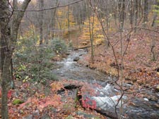
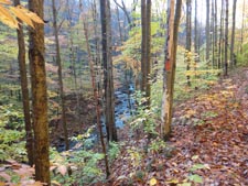
Trail Notes: From the kiosk follow the orange blazed Quehanna Trail/Log Slide Trail as it follows Little Laurel Run from high above. You�ll pass a park trail on the right, Stumpfield Trail, that leads to the campground. It is not shown on this map. Cross a tributary of Little Laurel Run in 1.3 miles. Here the QT turns right onto an old road while the Spurline trail goes to the left to join the QT near the end of the hike. Continue to follow the QT. It will soon turn left and closely follow the bank of the stream. In 1.2 miles the trail crosses Laurel Run Road and joins the old Goodyear Logging Railroad grade. The grade will re-cross the road in 0.5 miles and then cross Tyler Road in another 0.2 miles. In 0.2 miles pass the junction with the Cut-off Trail on the left. This trail also rejoins the QT near the end of the hike. Continue on the QT for 1.0 miles and arrive at the intersection of McGeorge and Wilson Mine Roads. The trail parallels Wilson Mine Trail for 0.6 miles, through a nice Red Spruce grove, before depositing you on the road again. The QT continues straight ahead but you want to turn left onto the road, now a part of the yellow blazed (formerly blue) Western Cross Connector. In 0.8 miles turn left back into the woods and cross Caledonia Pike in another 1.2 miles. The trail gradually bears to the right, skirting a highland bog and descending to Trout Run. Just after the ford you will find a very nice campsite on the right of the trail nestled in a Hemlock grove.
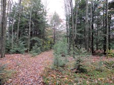
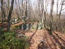
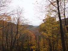
The tread continues to follow the run for 0.7 miles until crossing Shagger�s Inn Road where the cross connector joins and old gas well road. Parts of the road�s edge have been planted with white pine and American Larch (a conifer that loses its needles in the winter). In 1.0 miles cross the old pipeline which offers a nice view. In 0.5 miles the road ends at the abandoned well while the trail continues as a rocky footpath through a miniature rock city. The trail passes a small, dry campsite with a bit of a view just before it begins to fall off the side of the mountain. The rapid descent is eased somewhat by a series of switchbacks which end at an old grade that parallels Little Medix Road before eventually merging with it. Veer left onto the road and follow it for 0.2 miles. |
|
Just after crossing the run on a newly constructed road bridge turn right onto another old gas well road. Be watchful as the trail will soon turn sharply to the right and cross a tributary of the run. Here it turns left and climbs steeply through moss covered rocks with near constant views of the small but pretty stream. Cross Caledonia Pike again in 0.8 miles and then a pipeline. The trail follows the edge of a ridge for 1.4 miles before making a sharp left hand turn and descending to an un-named tributary of Laurel Run. The trail crosses the stream and turns right onto an old logging grade, soon passing a small streamside campsite. In 0.5 miles from crossing the stream arrive at Saunders Road and the continuation of the QT. Turn left and enjoy a casual road walk for 0.9 miles. At a bend in the road continue straight up a hunter�s cabin driveway and pick up an old RR grade. In 0.2 miles you will find a very large campsite to the right along the banks of Saunders Run. At this point you are less than 5 miles from your vehicle. If you elect to continue on the next good place to camp is almost back at the parking lot.
The trail offers easy hiking for the next 100 yards or so where it leaves the grade and crosses the run on a stout footbridge. For the next 1.5 miles the trail is rocky and narrow and oscillates up and down in an attempt to avoid falling into the stream. The tread eventually joins another RR grade which it follows to its junction with the Cut-off trail that you passed on the first day. Here the stream cascades over huge boulders making for a pleasant sight and refreshing break spot. Turn right to stay on the QT and make the final climb to the last plateau. Cross Tyler Road in 0.8 miles from leaving the stream. The Spurline Trail, which you also passed on the first day, will join from the left in another 0.2 miles near a pipeline crossing. Shortly after this the trail joins an old haul road that passes through a bog, a Hemlock grove and then some more deciduous woods. Here again pay attention as the trail will make a 90 degree turn onto a footpath and soon deposit you onto Fairview Trail/Road. Turn left and follow the dirt, then gravel and finally paved road for 0.6 miles back to your vehicle.
________________________________________
________________________________________ Outing Critiques
Name: Adam
Hike: Quehanna Trail-West Cross Connector ________________________________________ |
|
|