|
Quehanna Trail - SE |
|
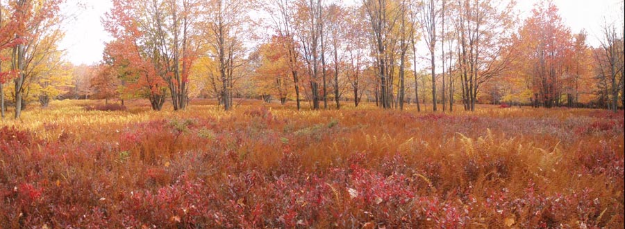
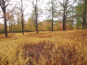
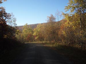
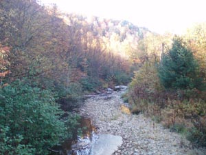
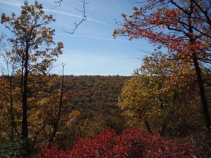
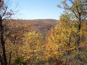
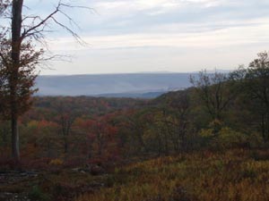
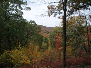
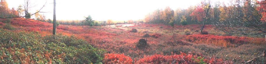
Description: The Quehanna Wild Area is located in the Moshannon State Forest. The terrain is a pleasant mixture of a nearly flat plateau and deep ravines. The trails meander through large open heath meadows full of blue Berries, lush forests with a thick understory of ferns and Rhododendron tunnels along the many streams. While the 70 mile long The Quehanna Trail circumnavigates this area it is bisected by several connector and Ski Trails, making smaller 2 and 3 day loops � even day hikes � possible. The 30 mile moderate loop described here is the sister hike to the Quehanna Trail � NE Circuit. Like that hike, this one has some steep descents and ascents, most without the aid of switchbacks, with long stretches of plateau and ridge walking in between. Total elevation gain is about 2300 feet. While water is hardly ever an issue in the Quehanna Wild Area good campsites are at a premium. The well- established sites are shown on the map. While it may be possible to hike more than described here on any given day finding a campsite may be an issue. |
|
Safety Note: The trails in most of the deep hollows become overgrown with stinging nettles in the summer. Wear appropriate clothing. Google Maps Custom Driving Directions This hike starts at the parking area at the Sinnemahoning Trailhead marked by a steel forest gate off of gravel Three Run Road. ________________________________________ |
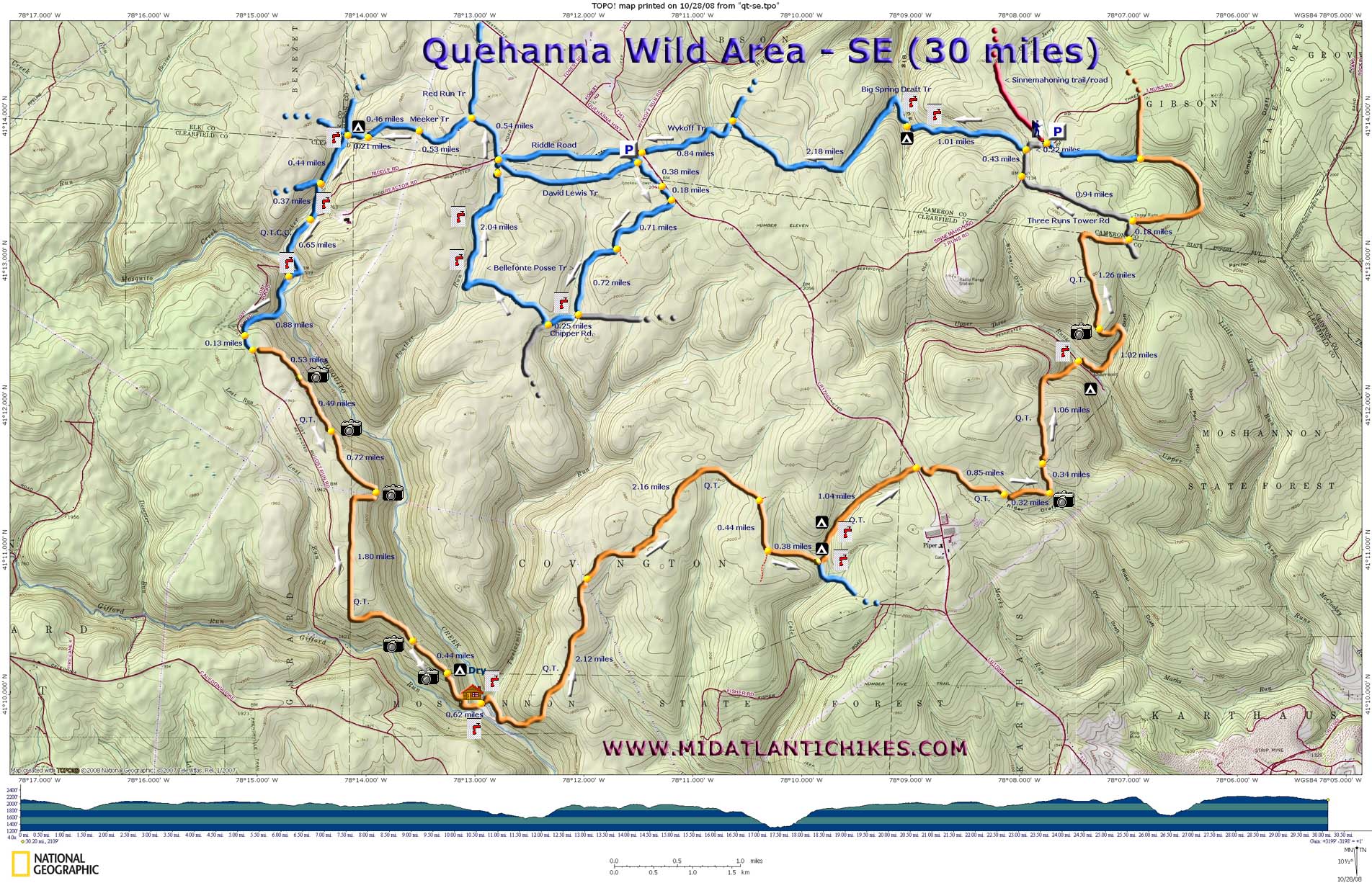
Printable/Downloadable Map (11X17) |
Trail Notes: All connector trails are blazed blue. The Quehanna Tr is blazed orange. From the parking area walk back out to Three Run Road. Turn right. In 0.22 turn right into the woods at a wooden Cross Country Ski Sign. This is Big Spring Draft Tr. Almost right away the trail splits. Bear right and pass a small spring house. Follow the blue blazes. In 1.01 miles pass a nice campsite on the other side of the stream. Shortly after that the trail crosses the stream on a bridge and makes a hard left to climb out of the drainage. In 2.18 miles from the camp arrive at the intersection with the Wykoff Tr (also blue blazed). Turn left onto it and in 0.84 miles cross the Quehanna Highway. Enter the Wykoff Wild Area Parking lot. Turn left at the kiosk. You have three options here. You can turn right onto dirt Riddle Rd, stay on it or, in a short distance, bear left onto the David Lewis Trail or you can follow The Bellefonte Posse Tr South-east out of the parking lot. The latter is described here. It is about 2.5 miles longer than the other two options. Initially the trail closely parallels the highway as it skims a large open area and Elk viewing station. In 0.38 miles it will join a short gravel service road. In another 0.18 miles bear right onto an old haul road. There are a couple of side roads that are not shown on this map. Follow the sparse blue blazes for 0.71 miles to a sign post. The trail makes an abrupt right turn here and gradually descends to a fork of Twelve Mile Run. |
|
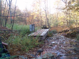
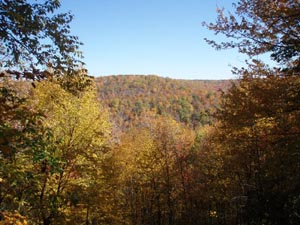
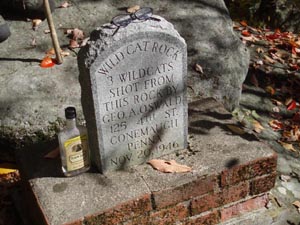
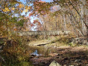
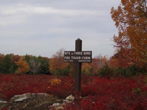
In 0.72 miles from the last turn arrive at gravel Chipper Road. The signs on stakes might be confusing here. Turn right onto the road and in 0.25 miles turn right off of the road and descend to Panther Run. In 2.04 miles from Chipper Road pass through a dense spruce grove and arrive at a parking area on gravel Reactor Road. As you look around you will notice that the David Lewis Tr and dirt Riddle Road mentioned earlier are to your right. Nearly directly across the road is another trail with a sign pointing to the Quehanna East Cross Connector (Q.T.E.C.C.) and the Red Run Trail. Although not signed as such this is the blue blazed Meeker Tr. Follow the Meeker Tr. In 0.53 miles pass Red Run Tr on the right and in another 0.53 miles cross a power line swath. (Watch out for seeps on the east side of the swath.) In another 0.46 miles join an old woods road that passes through a nice Hemlock grove. In 0.21 miles arrive at a large camping area on the left. You�ve hiked about 10 miles. This is your home for the night. There is a fire ring a few yards down the trail and Meeker Run is but a few more yards further. On day 2 break camp and cross Meeker Run. Turn hard left onto blue blazed Q.T.E.C.C. in a few steps you will see a sign for the trail imbedded in the bark of a tree. It looks like its been there a while. Follow an old RR grade for 0.44 miles. At one point it might be wise to bear to the right, off trail, and weave through some large boulders to avoid a large, perpetual seep. You will also pass a new trail sign/trail for the Crawford Vista Extension. In 0.44 miles from the Meeker Run crossing the trail bears left off of the RR grade onto a footpath and descends to another easy crossing of the run. There is an old pump station here that was used to provide cooling water to the nuclear reactor up on Reactor Road. Cross the run and gradually climb to gravel Mosquito Creek/Lost Run Road. Turn right onto the road. In 0.65 miles cross Mosquito Creek on a one lane bridge. Shortly after that turn left onto the continuation of the Cross Connector. This last segment used to be difficult to follow but trail crew spent a day in 11/2008 putting it back into good shape and re-blazing it. In 0.88 miles climb to the top of a ridge and rejoin the gravel road you had just left. Turn left on the road but in 0.13 miles arrive at the junction of the orange blazed Quehanna Tr. As of this writing the next 3.5 miles is a flat walk along easy tread. (There are plans to relocate the trail off of the ridge in the Wildcat Rocks area to avoid a hunter�s cabin described later. Watch out for this change and let us know when it happens.) You will pass three eastward vistas along the flat stretch and a couple of southward views during the 1.06 mile descent. This section is very steep and rocky, some quite loose. The second vista has a nice but dry campsite. At the end of this descent the trail parallels Gifford Run for a bit and crosses the back yard of the aforementioned Hunter's cabin. There is a rickety old cable and wood bridge that crosses the run to the right. Ignore it. The Q.T. continues across the yard. Follow it to a pretty spiffy new bridge built by the State Forest, Q.T. Club, a Chinook helicopter from the National Guard and other volunteers. After crossing Mosquito Creek on the new bridge the trail makes a hard right and follows the creek to the Corporation Dam area, crossing Twelve Mile Run on a small bridge. The trail then turns left and follows a tributary up a hollow before leaving it and climbing steeply to the top of a plateau. Here the trail flattens out. In 2.12 miles from the cabin cross a power line swath. On the other side the trail joins a well graded road. You can make good time from here to the next campsite but keep an eye out for a right turn onto a grassy road in another 2.16 miles. (If you miss this turn you will end up on the Quehanna Highway.) In another 0.44 miles you will turn left off of the grassy road onto something that will soon more resemble a footpath. In 0.38 miles pass a sign post with an un-named trail going off to the right. Turn left, continuing on the Q.T., and descend into a shallow valley. This is the Fisher Rocks area. There is a good campsite to the left just before the first stream crossing. If this is taken or not suitable to you continue on the Q.T. for a few more hundred yards. As you begin to parallel the right fork of the stream a short hill dividing the two forks will appear on the left. There is no obvious trail here but if you climb up the hill you will find a large campsite with a fire ring sheltered by large trees. This is the end of day 2. You�ve hiked 12 miles. The final day starts with a pretty easy one mile hike out to the Quehanna Highway. There is a slight climb just before you reach it. The trail continues on the other side through a new growth area. In 0.85 miles cross an old boundary road for the natural area. Climb a bit and in 0.32 miles arrive at an area nearly devoid of trees. I don�t know what happened here but it offers a nice view. The trail is hard to follow through this area but there are just enough blazes to keep you on trail. In another 0.34 miles re-cross the same boundary road you crossed earlier and in another 1.06 miles descend to gravel Reservoir road. (There are supposed to be campsites off of the road if you turn right here.) Cross the road then Upper Three Runs on a wooden bridge. The trail turns downstream here and follows the run until the reservoir comes into sight. The trail then turns left and follows a secondary drainage for a bit before turning left again to climb steeply to the top of a plateau and a small but nice vista. This is about 1.02 miles from the Reservoir Road. In 1.26 miles of easy walking arrive at an un-named sandy road. Turn left and in a few yards arrive at Three Runs Tower Road (also sandy). You can extend the hike and take in a couple of more vistas by staying on the Q.T. a bit longer and taking the blue blazed # Fifteen Trail back to Three Runs Road to a spot just east of your car. This hike ends by turning left onto the tower road and following it for 0.94 miles to Three Runs Road. Turn right onto Three Run Road and walk 0.65 miles back to your vehicle. _______________________________________
_______________________________________ |
|
|