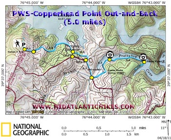
| Prettyboy Reservoir Copperhead Point Out-and-Back |
|
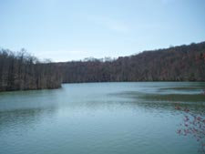
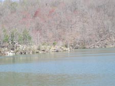
Description: The Prettyboy Trail is a ten mile long collection of lakeside footpaths and cross-country fire roads. I don�t know how long it has existed (the oldest reference that I could find being in a 1970 publication that was republished in 1983) but it has long since fallen into a state of un-use. That was, at least, until two local hikers, Mary Corddry and Ted Hellen, rediscovered it and began giving it the TLC so badly needed to keep a trail alive. The trail is blazed with blue painted bottle caps and for the most part easy to follow. Any hills are usually gentle. Described here is a 5 mile out-and-back introductory hike to a prominent rocky point, Copperhead Point (shown as Piney Point on the map) where one can soak up the sun and scenery as they watch the Canadian Geese, Double-crested Cormorants and other water birds. The trail continues eastward to Prettyboy Dam Road and north-westward to Beckleysville Road if you care to explore even further. There are also several other side trails and fire roads to add to the adventure. |
|
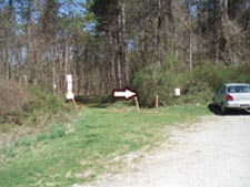
Google Maps Custom Driving Directions The hike starts at the parking area for gates 1 and 2 on Traceys Store Road. ________________________________________ |
|
Zipped National Geographic. TOPO! GPS and Universal GPX Files |
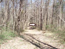
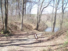
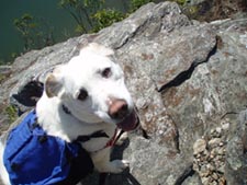
Trail Notes: From the parking area bear right onto a fire road. In 0.2 miles the road will turn left and descend to the lake. Continue straight, following the blazes. The trail descends and follows the shoreline of Prettyboy cove for a while before climbing to cross the Gate 3 Fire Road (Note: there is no parking at its end on the main road.) at 0.8 miles from leaving the first fire road. The trail passes through a nice pine plantation for 0.3 miles where it turns right and exits the woods at Gate 4. Turn right and walk on the grassy shoulder for 0.3 miles crossing Prettyboy Branch. Turn left onto a footpath near the end of the guardrail. The trail follows the stream for just a bit before climbing slightly and passing through another pine plantation. Here you may find two blazed routes. Either will work as they come together just before another fire road that stops at the lake at 0.5 miles from the main road. The trail turns right onto the fire road for just a few steps before turning left to follow the rocky bank for 0.6 miles through Mountain Laurel and then Hemlock trees. The trail turns hard right here to follow the shoreline. Stop here and work your way through the evergreens to reach Copperhead Point. After relaxing, watching the wildlife (You�ve probably already seen proof that the reservoir is teeming with beavers.) and basking in the sun retrace your steps to your vehicle �.. or explore a little further if you wish. Prettyboy Dam Road is about another mile further east.
|
|
________________________________________
________________________________________ Outing Critiques Name: Bob Hike: Copperhead Point Date: 05/26/13 Rating: 3
Critique: Thanks for getting this on the map. The fire road, especially past the first left fork down to the reservoir, on May 26 2013 was overgrown with thigh-deep grass, and I wasn't prepared with DEET, so I took the left turn down to the reservoir instead to avoid collecting ticks, after a short exploratory walk down the fire road. To be fair, I have not yet found any ticks on my body or clothes after my shorter foray in 24 hours, but if you are preparing for this hike, prepare for ticks. I may revisit this hike again next winter when the grasses may be somewhat shorter. _______________________________________
Name: Paul
Schwartz
Hike: Copperhead point _______________________________________
Name: Kingston
Bowen
Hike: Pretty Boy Reservoir _______________________________________ |
|
|