| Pinchot Trail |
|
|
Description: First, I would like to thank Jeff Mitchell for his campsite suggestions and the rock warning. The Pinchot Trail is located in the heart of the 27,345 acre Lakawana State Forest. It is named after Gifford Pinchot (Pronounced Pin`-cho. French, for whatever reason, do not use the consonants at the end of names.). He was the first Chief of the United States Forest Service and the 28th governor of PA. He coined the phrase �conservation ethic� as it applies to man�s use of natural resources.
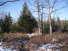
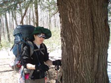
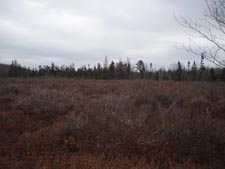
The trail is a collection of 15 named trail, one un-named trail and parts of Tannery Road. The main route described here is blazed orange with connectors blazed yellow. At times the trail follows perfectly straight routes as it follows (sometimes old) forest boundaries and then meanders a bit mostly to avoid swamps. The hiker will experience Blueberry bogs, swamps and areas of forest that had been �thin cut� as well as a more healthy hardwood forest with thick understory of Mountain Laurel and Rhododendron. |
|
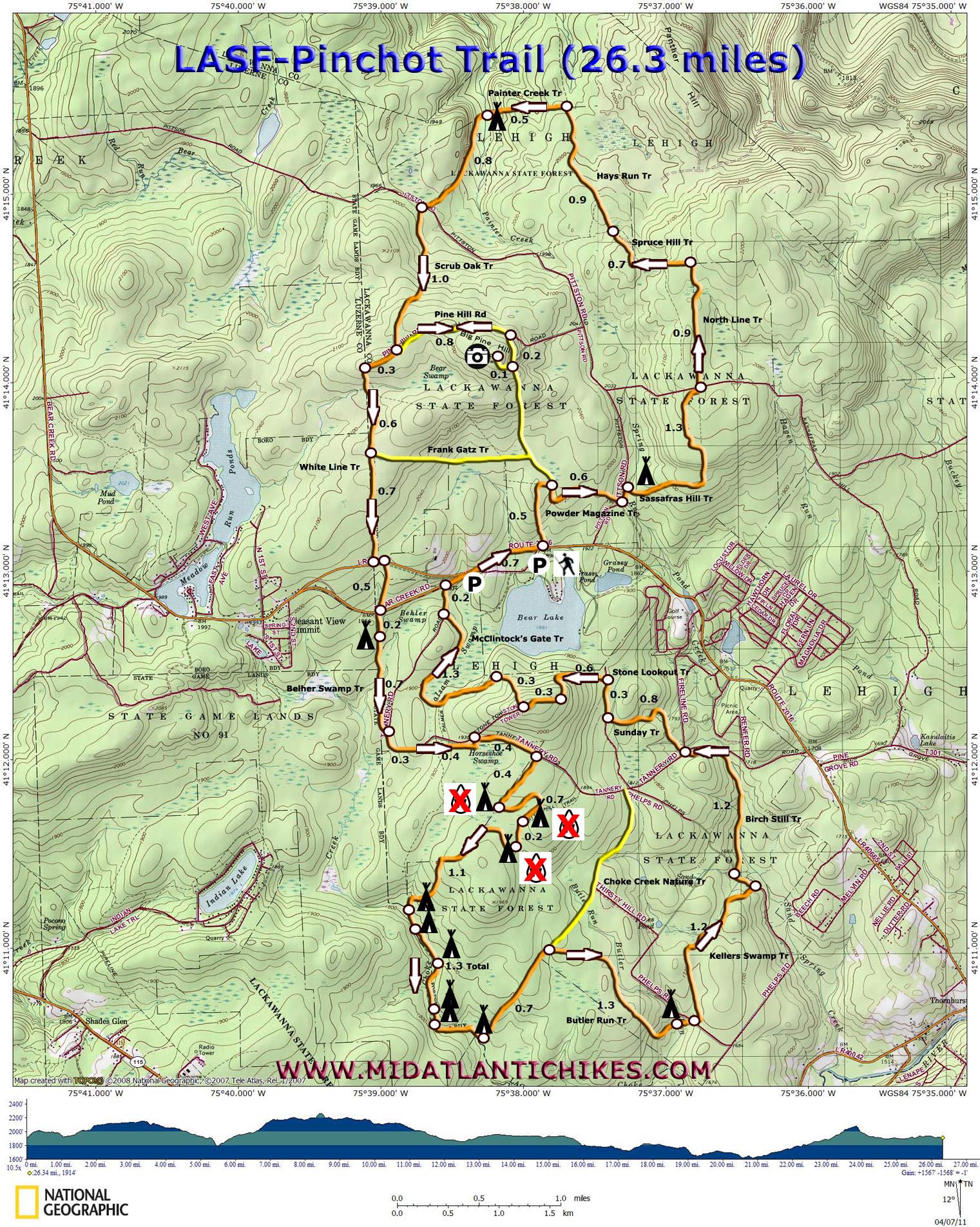
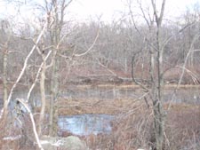
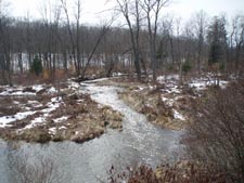
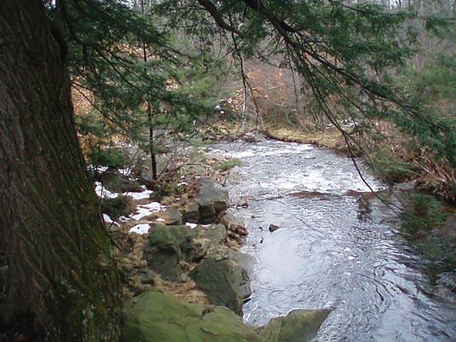
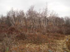
Red Spruce, Hemlock and white and silver Birch provide an interesting contrast to the surroundings. Choke Creek at the southern end of the circuit is this hiker�s favorite section. The valley widens out at some points and nearly becomes a gorge at other points. Elevation changes are very slight but the trail can be extremely rocky and/or wet in spots. Good boots are a must! The entire circuit is described here but the hike can be shortened as needed. Many prefer to do a North and South loop on different days. Google Maps Custom Driving Directions ________________________________________ |
Printable/Downloadable Map (11X17 best) Zipped National Geographic TOPO! GPS and Universal GPX Files |
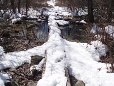
Trail Notes: From the kiosk pick up the orange blazed Powder Magazine trail. In 0.5 miles the yellow blazed Pine Hill Trail comes in from the left. Continue straight and in 0.6 miles turn left on dirt Pittston Road. In a few steps turn right onto the Salamander Hill Trail and cross the rocky headwaters of Spring Run, passing a small campsite on the right as you climb. In another 1.3 miles cross Sassafras Hill Road and join the very straight North Line Trail, initially a wide grassy woods road lined with pine trees. In 0.9 miles the trail makes a left turn onto Spruce Hill Trail and descends steeply through a rock scree for 0.7 miles to eventually join another grassy woods road. Take care not to get to comfortable on this new tread as you will soon turn right onto the Hays Run Trail, a footpath. In 0.9 miles turn left onto Painters Creek Trail and finish your descent into the hollow. Arrive at the Hemlock encased creek in 0.5 miles. To the left, uphill before the crossing, is an old road that has been converted into a campsite. This is a good place to spend the night.
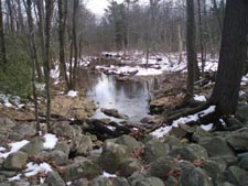
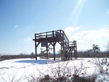
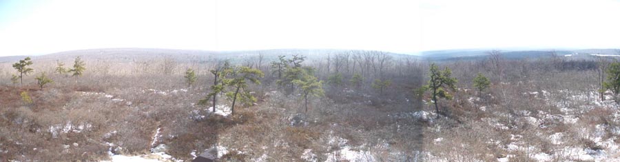
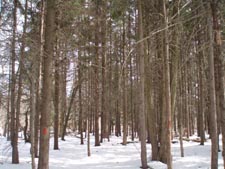
The trail crosses the stream and turns left, gradually climbing out of the hollow on a very oblique angle. Cross Pittston Road again in another 0.8 miles and join the Scrub Oak Trail. In 1.0 miles reach Yellow blazed Pine Hill Road/Trail. To visit the vista turn left onto it and walk for 0.8 miles to a yellow forest gate. Turn right here onto a footpath. Re-join the road in 0.2 miles, turning right to reach the viewing platform with a 360 degree view. After taking in the sights retrace your steps, passing the previously hiked Scrub Oak Trail on the right and turn left onto the White Line Trail. It is as straight as the North Line Trail you hiked earlier but considerably more rocky. A series of narrow boardwalks gets you through a section of Bear Swamp. In 0.6 miles pass the Frank Gatz Trail on the left. (This is a good bailout back to the parking area should it be needed.) In another 0.7 miles turn left onto a power line swath, cross a snowmobile trail and in a few steps turn right, following the orange blazes. In 0.5 miles cross Bear Creek Road (another bailout point) and jog to the right just a bit to pick up the Belher Swamp Trail. Pass a nice campsite under a huge Hemlock tree in 0.2 miles. Water is close by on the other side of the trail. The trail follows the western boundary of the forest for 0.7 more miles where it bears left and passes through a Red Spruce grove before reaching Tannery Road. |
|
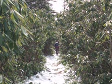
Turn right. The trail follows the road for 0.3 miles but continues straight through the woods on an old road as Tannery curves to the left. Exit out onto Tannery Road in another 0.4 miles across from the gated Stone Tower Road (another shortcut). Turn right on Tannery Road. In 0.4 miles turn right onto a footpath at an orange blazed but not signed post. This section of trail takes you through a winding Rhododendron and Mountain Laurel Tunnel mixed with Red Spruce. It passes small dry campsites at 0.4, 0.7 and 0.2 miles, respectively. In 1.1 miles after the last dry campsite the trail descends to Choke Creek and the first of 6 campsites along its bank. Parts of the trail have been badly eroded by recent rain events but the blazes are still easy to follow. The final (and best) campsite is arrived at in 1.3 miles from first reaching the creek. It is under a grand old Hemlock, perched above the creek on a low cliff. Further investigation will find small �rooms� further back in the woods.
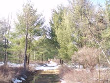
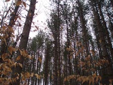
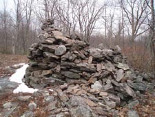
From this point the trail turns left, away from the creek, and follows old boundary signs for 0.7 miles. Turn right onto Butler Run trail and descend to a large grassy opening in 1.3 miles, a good place to camp a large group. Cross Butler Run and pass a small campsite on the right. Cross dirt Phelps Road and join the Kellers Swamp Trail. In 1.2 miles the trail passes through a stand of tall pine and turns left on another section of Phelps Road (I believe it forms some kind of a loop.). In a few yards turn right onto Birch Still Trail. This trail, for the most part, follows pretty Sand Spring Creek. We were amazed to find, despite several �benches� on both sides of the creek, a lack of campsites along this stretch. We encountered a few areas where recent flooding had eroded the trail but that will probably be remedied soon. The trail briefly exits the woods at the three-way intersection of Tannery and Fireline Roads. Cross here and pick up the Sunday Trail. Initially the trail is very rocky as it passes through the headwaters of Sand Spring Creek and under some large Red Spruce. After crossing an earthen bearm the trail turns left onto an old woods road, following the northern edge of the Spruce Swamp Natural Area. In 0.8 miles from leaving Tannery Road turn right onto a wide grassy woods road, the Stone Lookout Trail. The trail turns left onto another road in 0.3 miles and climbs gradually for 0.6 miles before turning right onto a rocky footpath. In 0.3 miles reach an open area with a large pile of rocks. (I am not sure if this is the old tower or if someone simply piled the rocks up after its destruction.) The trail passes through another open area with a fire ring and Stone Tower Road on the left. Broken views of Bear Lake can be had when the leaves are off. Bear right onto a footpath and negotiate a short, steep and rocky descent. In 0.3 miles from �the stone tower� arrive at the junction with the McClintock�s Gate Trail straight ahead. In about ten steps find yourself on what appears to be an old grassy road. The trail circles and then passes through Balsam Swamp with its dense Blueberry bogs, beautiful stands of white Birch and backdrop of Red Spruce. The berry feasting in July and August must be primo and the contrasting yellow leaves and white bark of the Birch with a flaming red carpet under them must be a photographer�s delight. Once across the swamp the trail follows its northern border through another endless Rhododendron tunnel until it ends at Tannery Road, 1.3 miles from leaving the Stone Lookout Trail. Turn right and follow the road for 0.2 miles to Bear Creek Road. Turn right, using the left shoulder, and in 0.8 miles find yourself back at your vehicle. ________________________________________
________________________________________
Name: Troop
115, Schoeneck PA
Outing Critique:
We brought our youngest group of Boy Scouts for a one-night
introduction to backpacking. Properly fitting packs are
difficult to find for 60-70 pound 11-12 year olds! I know good
ones in youth sizes are out there, but it is difficult to
justify the expense for a pack that could be 6 months and a good
growth spurt away from being too small. Nevertheless, the
trails are easy and ideal for youth. ________________________________________
Name: Adam
Outing
Critique: Hiked the trail counter-clockwise beginning with the
southern loop. We found the hiking to be easy and we were able
to complete the entire 26 miles in two nights at a leisurely
pace. It's not challenging and has no great views, but this
trail makes for a nice weekend backpacking excursion. ________________________________________
Name: Kurt Pinchot Trail-South Date9s): 05/09-10/15 Rating: 4
Critique: Friend and I did the south loop counter-clockwise, 5 miles on Saturday (3hr) and about 9 on Sunday (5hr). Very well-marked and easy on day 1, camped near the second-to-last of the 6 watered sites -- there's an unmarked adjacent site, very well-established, on a small island right next to the marked one. Requires hopping across a small stream, but has much much better tent spots, a row of stone chairs(!!!), and a nice firepit (which we sadly didn't get to use because of seasonal burn bans). Look just upstream from #5 out of 6 and you'll see it. #4 looked nice as well but was occupied. Day 2 was MUCH rockier but very peaceful, no people in sight the entire time, very varied surroundings that passes through lots of different areas. The trail was quite overgrown and blocked by deadfall in many places. We went up and down Stone Lookout at high noon, there was no shade and it was pretty brutal! Make sure you stock up on water for the last stretch, we didn't see any at all past the end of Birch Still Tr. and it's easily the toughest part. Excellent trail guide overall, much better than the printed DCNR one!
________________________________________
Name: Reese Salen Hike: Pinchot trail Date(s): 07/30-31/14 Rating: 3
Critique: Trail notes very helpful for the most part. It may be good to note that the trail does not follow alongside Sand Spring Creek, it parallels it but never descends to it. Water in Choke Creek and Butler Run in late July was slow moving and I didn't trust it enough to drink from the looks of the water. The footpath as you turn off Tannery Road toward Choke Creek is now signed with "Choke Creek Nature Trail" ________________________________________
Name: Dave Nguyen Hike: Pinchot Trail Date(s): 13-15/14 Rating: 4
Critique: This was my first time solo BP trail, that from what I was reading was a good beginners course. Rained most of the time for the first day I was there (pants and socks were soaked). Overall trail guide was pretty accurate found all campsites w/o issues, trails were clearly marked, and elevation was no as severe as I thought. As previous hikers have commented it does get pretty rocky, especially the Northern Loop. I did the northern loop on day one, and finished the southern loop saturday into late Sunday. Overall a great trail once the sun came out. Pretty sights all around. ________________________________________
Name: Patrick Mulholland Hike: Pinchot Trail-South Date: 06/06-09/14 Rating: 4
Critique: This trail is great for either a rigorous 3 day hike of the full loop, or easily separated into a more leisurely hike of either the north or south loops. As indicated on the map the south loop has a number of established camping locations, though many are perhaps too close to the trail for comfort. There are also some neat little creeks on both loops to dip your feet or refill water bottles for cleaning purposes. A few open fields provide very pretty scenes, and the elevation changes are never too severe. As others have warned the trail does get very rocky in places so bring a nice stick.
________________________________________
Name: Ed D. Hike: Pinchot Trail Date: 06/08/13 Rating: 1
Critique: We started this hiking on 6/8. The rain from the night before made the thick trail a water wonderland for your hiking boots and pants. Even with gaiters my shoes, socks and pants were socking wet. The sights were not impressive. We also just hiked "World End Park" the day before this hike. We had planned on backpacking for two to three days on this trail. We had ran into some other hikers that were not impressed by the views or trail. On some of the other hikes we have encountered we have different scenery and the vegetation changes as with trees. These trails all seem to have the same views. We had a few camp sights that we were going to stop at for lunch, but nothing was impressive. The viewing platform was nice, when we stopped for lunch. The trails were marked well. The beginning of the trail was so thick you could not see the trail path. We were planning on stopping to camp at the camp sight at Behler Swamp, but the dead dog carcass mostly decayed scared my wife. She started running back down the trail for the highway. I have never seen her run that fast with her full backpack. I wanted to look at the bright side and tell of the good thing of this trail, there was a babbling brook under the rocks. I guess maybe the south trail might be better. There is some many more hiking trails within an hour from this that are so much better. The trail was marked well, and had nice trailhead parking. Trail notes were right on target and help us find the viewing platform. The other funny thing was in the trail notes it mentioned twice about half way through if you want to bailout take this trail. Thank you for the trail notes, and we have much appreciate for the people that mark and maintain the trails. It is hard with miles of trails. I am sure we just hit the trail at a bad time. ________________________________________
Name: Sam Hike: Pinchot Trail Date: 05/11-13/13 Rating: 5
Critique: Ted E. Bear, Wooly Bully and Shortstack did this BP (26.8 mi) in three days, with mileage being 5.6, 12.4, and 8.8 respectively. The terrain is indeed moderate, but very diverse. We enjoyed the Balsam Swamp, hemlocks, rhododendron tunnels, lots of orange salamanders and frogs, plenty of pretty streams and a great 360-view from the tower. Wooly Bully downloaded the waypoints from the website on his GPS and we all had M.R. Hyker maps. All campsites indicated were easy to locate, mostly flat and water was no issue. The trails were well maintained with only a few blow-downs that we had to walk around. Beware, there is new construction near the pipeline intersection along the White Trail. We followed what may have been a snowmobile trail / new road construction which took us to Bear Creek Rd., east of where we should have been to connect to the White Trail. (For GPS users, we went off track shortly after waypoint #23). It was not too long of a road walk to get back to the connecting White Trail, but future hikers should beware of this area. There were orange diamond markers, then the new gravel/mud road which had yellow posts with orange on them, but we were not sure if they were for the trail, snowmobile trail or road construction. Other than that, trails are well marked and sections are indeed rocky, so good boots are a must. ________________________________________ |
|
|