|
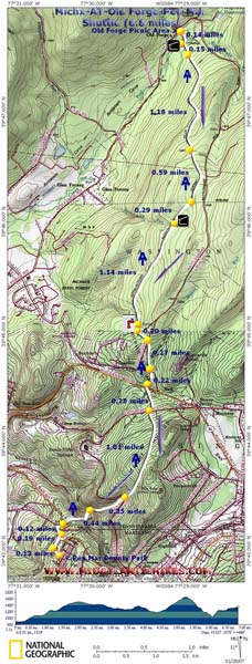
Old Forge - Pen Mar AT Shuttle |
|
|
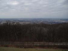
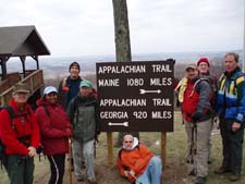
Description: This is a moderately strenuous 6.8 mile linear hike in the southern most section of Michaux State Forest. The last 1.5 miles or so is outside the forest and the last few yards are actually in Maryland. The only real vista is at the end in Pen Mar County Park. In the winter you can catch glimpses of the surrounding ridges though the leafless trees. With about 2200 feet of elevation change this trek will provide a pretty good workout.
Google Custom Directions to the Car Drop-off at Pen-Mar Park Google Custom Directions to Old Forge Picnic Area
If the picnic area is closed proceed north on Old Forge Rd a few more yards and turn right onto Rattlesnake Run Road. Soon pull into a parking area on the left where the AT crosses the road. This will add a few tenths of a mile onto your hike. From the picnic area the hike starts behind the pump house. |
|
________________________________________ |
|
Zipped National Geographic. TOPO! GPS and Universal GPX Files |
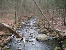
Trail Notes: The AT is blazed white throughout its entire length. This segment is well blazed, signed at all road crossings and well maintained. All streams and creeks are bridged.
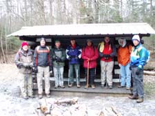
From the pump house turn right (southbound) onto the AT. In 0.14 miles pass the Antietam Creek shelter and cross the east branch of Antietam Creek. In another 0.15 miles cross a horse trail and a begin a long gradual climb to the ridge. In 1.18 miles cross an old service road. Shortly after that the trail will flatten out a lot. In another 0.59 miles cross a pipeline swath. In 0.29 miles reach Deer Lick Shelters. This is a good break spot.
After your break continue southbound. You�ll gradually descend for the next 1.14 miles and pass a signed spring house on the right. Switchback out of the slight hollow and cross a gravel road. In about 0.3 miles you will cross gravel Rattlesnake Run Rd and in another 0.27 miles cross Mentzer Gap Rd. Cross PA Rt16 in another 0.22 miles. This is a very busy road so please be careful.
After crossing Rt16, cross a small stream on a double log bridge and traverse a large rock scree before climbing up and over Mount Dunlop. You�ll cross old Rt16 in another 0.28 miles. In 1.01 miles after crossing old Rt16 cross Buena Vista Road. Turn left and walk up the road a short distance before turning right onto the continuation of the AT. Descend on a rocky grade toward Red Run Falls Creek where you will switchback down to the stream and cross it on a sturdy bridge. Climb out of the hollow for about 0.44 miles and follow a grassy service road that parallels the rear of some homes and arrive at Rt550. Cross the road and follow the blazes across the railroad tracks. Turn right and follow the trail to the Pen Mar Vista pavilion where, after taking in the view, you will turn left and follow the park drive out to the parking lot.
|
|
________________________________________
________________________________________ |
|
|