|
Mount Rogers Backpack |
|
|
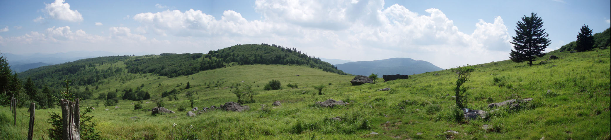
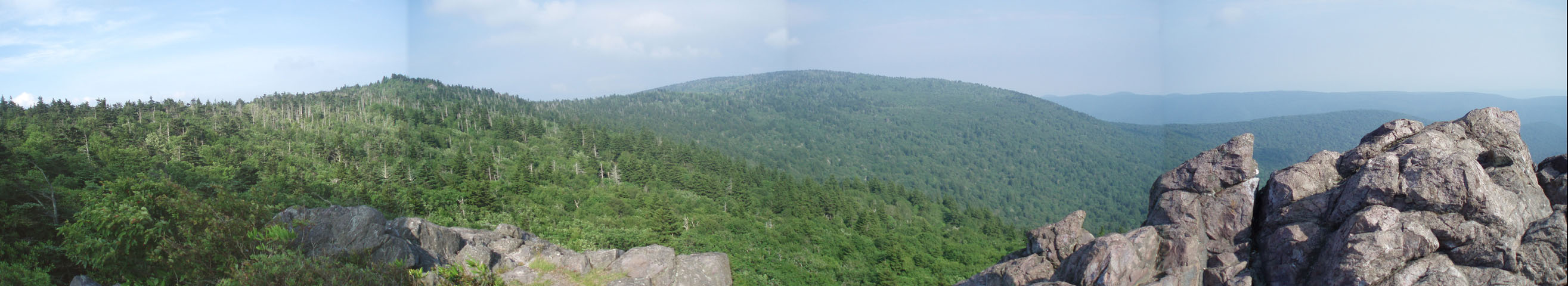
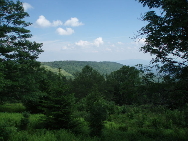
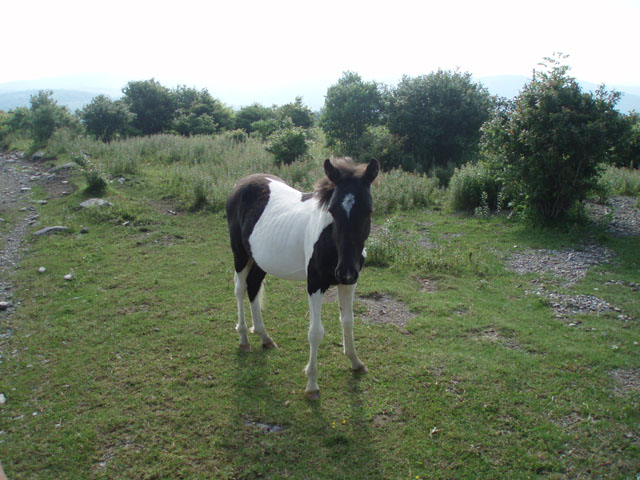
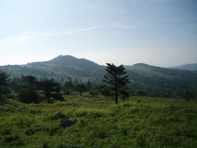
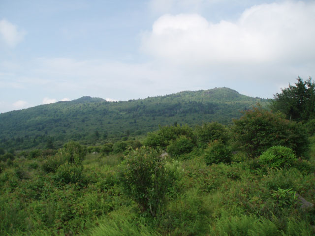
Description: The combined Grayson Highlands and Mt. Rogers National Recreation Area has to be the biggest crown jewel in the VA hiking crown. I can only say that no other hike in VA comes close to what this venue has to offer you. Combine the exposed balds of the Highlands, volcanic looking rock formations to play on, the constant changes in landscape, fields and tunnels of Catawba Rhododendrons blooming in mid-June, clusters of Mountain Laurel and Flame Azaleas at the lower elevations in May and June, Rhododendron maximum (white Rhodos) in bloom along the streams in July, vista after amazing vista .... then throw in the wild ponies like a cherry on top of a giant Banana Split and you have the Highlands!
This is the third of three hikes exploring the beautiful and ever popular Mt. Rogers N.R.A. and Grayson Highlands. (See Grayson Highlands SP and Grayson Highlands-2 hikes.) It is described as a three day, 21 mile, moderate loop with approximately 3300 feet of elevation gain although it can easily be done in two days if you arrive early enough and don�t have a long drive home. An intermediate campsite will be described if you wish to try this option.
|
|
Trailhead Security: This hike can either be started at the Mt. Rogers Trailhead or AT parking lot, both located on Rt. 603, however, due to a continuing incidence of car break-ins and thefts at these locations that have been going on for over ten years we recommend that you park at the Grindstone Campground and pay $3.00/night. It�s worth the added security. I had it happen to me. Google Custom Driving Directions ________________________________________ |
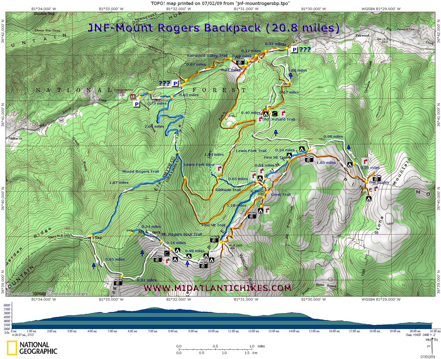
Printable/Downloadable Map (11X17) Zipped National Geographic. TOPO! GPS and Universal GPX Files GPS Text File for Non-TOPO! Users
|
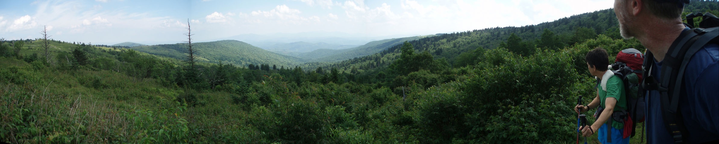
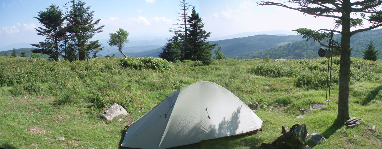
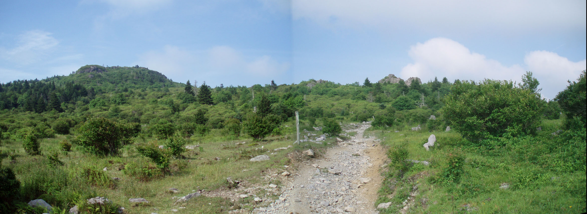
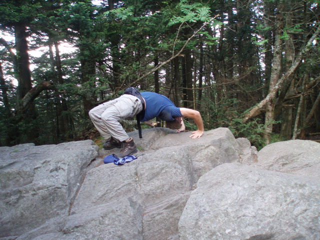
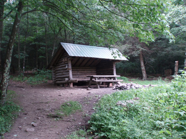
Trail Notes: Day 1 (7.8 miles): From the parking area walk down the main campground road towards the entrance. Turn right onto the signed Mt. Rogers Spur. In 0.73 miles from the parking lot turn right onto the blue blazed Mt. Rogers trail. Switchback gradually to a flat area. In 2.06 miles from the last trail junction pass the blue blazed Lewis Fork Spur Trail on the left. In another 1.87 miles bear left onto the AT as the Mt. Rogers Trail ends. In 0.95 miles arrive at the first of many vistas looking out over the Highlands. Continue on the AT and in 0.91 more miles arrive at the Mt. Rogers Summit Trail. Turn left onto it and climb gradually for 0.54 miles to a large boulder with a USGS marker on it. Most people think this is the summit. It is not. Continue on the trail for about 10 more steps to a smaller boulder that also has a marker. According to the altimeter in my GPS the top of this rock is five feet higher than the previous one. This is the highest point in VA at 5,720 feet. Return to the AT and travel 0.16 miles to the Thomas Knob Shelter. There are nice campsites on either side of it and a spring in the corral behind it. This is you home for the night if doing this hike over three days. Enjoy the views and the ponies as you settle in for the night.
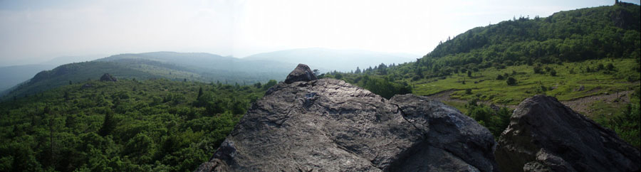
Day 2 (8.1 miles): Continue northbound on the AT. You�ll pass several other �dry� campsites as you go. At 0.98 miles arrive at the west terminus of the Pine Mountain Trail. Just before this, on the left is a giant rock outcrop that is easy to climb and provides a 360 degree view of the area. The Pine Mountain Trail was the original route of the AT before it was re-routed to share the Highlands with the through hikers. |
|
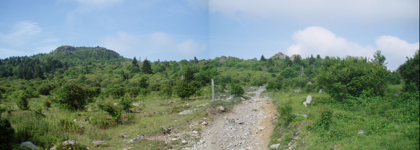
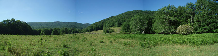
Shortly after passing Pine Mountain Trail turn left onto the Crest trail. This is an unblazed but obvious multipurpose trail. At first the going is over lose rock but soon becomes more bearable. If hiking this in mid-June you�ll be surrounded by blooming Catawba Rhododendrons. In 1.18 miles pass a side trail on the right with a water sign. If you are doing this trek over two days turn right here and find a nice grassy campsite with a view and cool spring water.
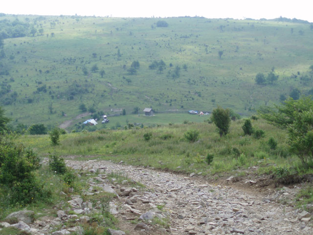
Continuing on, pass a couple of horse campsites and arrive at the junction of the Lewis Fork Trail in about 0.10 miles from the �water� trail. Continue on the Crest trail and descend to the Scales in another 1.85 miles. This is where cattle were herded prior to market in days long gone. Find piped spring water and latrines inside the corral. Immediately turn left onto the AT and climb for 0.98 miles to the east terminus of the Pine Mountain Trail (not signed here but blazed blue.). You�ll pass another nice campsite next to a spring prior to this junction. If you stay on the AT it will be a quick 2 mile downhill hike to the Old Orchard Shelter, your home for the night. To extend the hike turn left onto the Pine Mountain Trail. Pass two dry campsites, one on the right almost immediately after turning onto the trail and the next on the left, 0.34 miles from the AT junction. Cross an exposed spring before arriving at the junction of the Lewis Fork Trail in 0.54 more miles from the last campsite. Turn right and soon pass another campsite. Almost immediately turn right onto the Cliffside Trail. Cross a spring that makes the last campsite a very viable option and descend steeply for 0.65 miles to another junction with the Lewis Fork Trail. There is no sign here but it is quite obvious. Turn right here. In 1.04 miles the Lewis Fork Trail makes a hairpin left turn but the road/trail ahead of you continues as the Old Orchard Trail. Stay straight, cross a stream and pass some very nice gassy camp sites under the trees on the right. In 0.4 miles from the Lewis Fork junction turn right onto the AT and in a hundred yards or so arrive at the Old Orchard Shelter and your home for the night. There is another nice campsite just before it.
Day 3 (4.5 miles): Today is pretty easy. Retrace your steps to the Old Orchard Trail junction. Cross it and jog slightly to the left to stay on the AT. Descend into the valley. Cross Rt. 603 in 1.45 miles from camp and immediately turn left onto the Fairwood Valley Horse Trail. Despite being a horse trail I found this to be a pretty good connector trail as you pass in and out of deep woods with Rhododendron thickets and open meadows with the sky and the mountains you�ve been exploring as a backdrop. You�ll pass the northern terminus of the Cliffside trail on the left in 0.32 miles and then a high water route shortly after that. Cross a stream (I think it is the Lewis Fork) and in 0.10 miles pass the terminus of the trail of the same name on the left. In 0.87 more miles bear left onto a footpath that leads to the Mount Rogers Trailhead parking lot. Turn right onto Rt. 603 for a few steps and then left onto the boardwalk that marks the beginning of the Mount Rogers Trail. In 0.63 miles arrive at the Grindstone Campground Spur. Turn right and retrace your initial steps of the trip back to your vehicle.
________________________________________
________________________________________
Name: Johnny
Outing Critique: Just completed
this hike a few days ago, I also did it in 2 days/1 night,
although when I set out I had planned on 3 days / 2 nights - but
decided to push harder with some nasty weather moving in.
Grindstone Campground was closed so I parked in the small lot
right across from the Mt Rogers Trail Head. My vehicle was fine
when I came back, but this parking area is very close to the
road so be wary. Most of the elevation gain is experienced in
the first few miles, and the views after about 4 or 5 miles are
well worth it. I would classify this as an easy to moderate
hike. The ponies were very cool, and it was very windy. ________________________________________
Name: Robert
McPeak
Outing
Critique: Excellent hike! Here's what I'd like to share: ________________________________________
Name: Ryan Hike: Mount Rogers Backpack Date: 06/06-08/14 Rating: 4
Critique:
I am
including
a 2000 word blog post I wrote detailing this trip and 25+
photos. Definitely feel free to take a
look at that to get the entire details of my trip. We had a
fantastic time and I definitely encourage anyone to do this
route. ________________________________________
Name: J. Pierce
Hike: Mt. Rogers Backpack
________________________________________
Name: Greg
Romano
Hike: Mount Rodgers / Grayson Highlands 2 ________________________________________
Name: Bob
Hike: Mt. Rogers Backpack ________________________________________
Name: Chad Fike
Hike: Mt. Rogers Backpack (Modified) ________________________________________
Name: James Leo Hike: Mount Rogers Backpack Date: 02/26-28/11 Rating: 6
James when through a lot of effort to make a table of trail notes with his comments. It's too large to post here but you can read the PDF file here. You can see his awesome photos here. ________________________________________
Name: Matt
Swenson
Hike: Mount Rogers Backpack ________________________________________ |
|
|