|
Mid State Trail-Little Pine SP circuit |
|
Description:
Don't let the casual stroll along the lake or the
0.75 mile road walk fool you. This little 6.3 mile hike is quite
the workout! The initial climb itself will cause you to check
your vital signs. The total elevation gain is over 1800 feet.
Add to this a very steep descent over loose rock along Wildcat
Run and you can easily give this one a strenuous rating. The
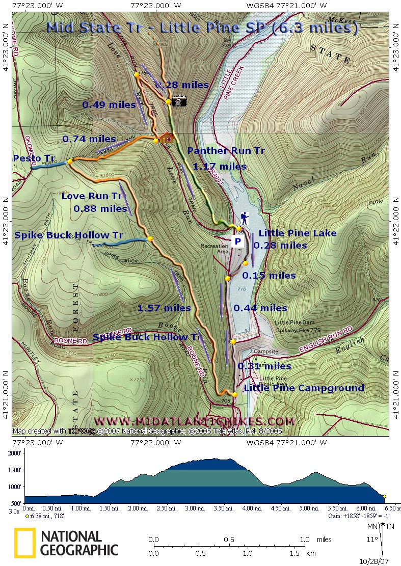
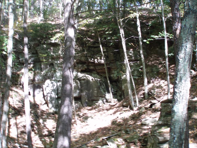
rewards are some old quarry sites, dense woods, interesting
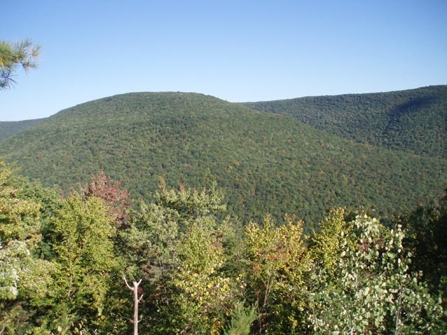
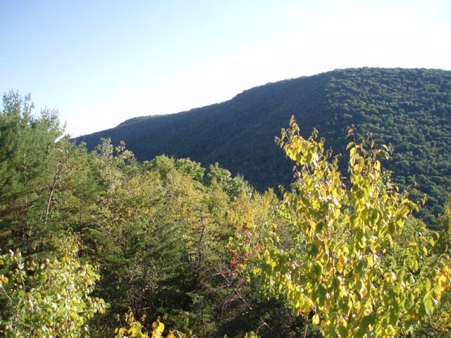
sandstone wind sculptures, a nice vista and an attractive view
of Little Pine Lake and its surrounding ridges. The loop makes use of a small part of the Mid-State Tr, Panther Run Trail and SR4001 (Little Pine Road). Safety Note: Whenever possible walk on the shoulder of the road facing traffic. The Mid State Trail is part of the Great Eastern Trail (GET). Google Maps Custom Directions |
|
The hike starts at the day use area along Little Pine Lake on the east side of SR4001 - Little Pine Road. ______________________________________ |
Zipped National Geographic. TOPO! GPS and Universal GPX Files |
Trail Notes: You have two options to start the hike. You can either begin straight off hiking down SR4001 toward the campground or follow the lake shore for a bit. I recommend the latter since you can get nice views of the valley from that vantage point. When the lake side road ends follow the edge of the lawn out to the road. Turn left onto the road. In 0.44 miles turn left onto a service road that crosses the breast of the dam. Here you get a really nice view of the lake and valley. Continue down SR4001 for another 0.32 miles to the entrance to Little Pine Campground. Turn right, crossing the road and immediately start climbing up the orange blazed Mid-State/Spike Buck Hollow Trail. There will be switchbacks but these serve more to help the hiker navigate around rock crops and old quarries than to lessen the steepness of the grade. After the initial climb the grade will moderate significantly. Here you will find the first example of sandstone wind sculpture.
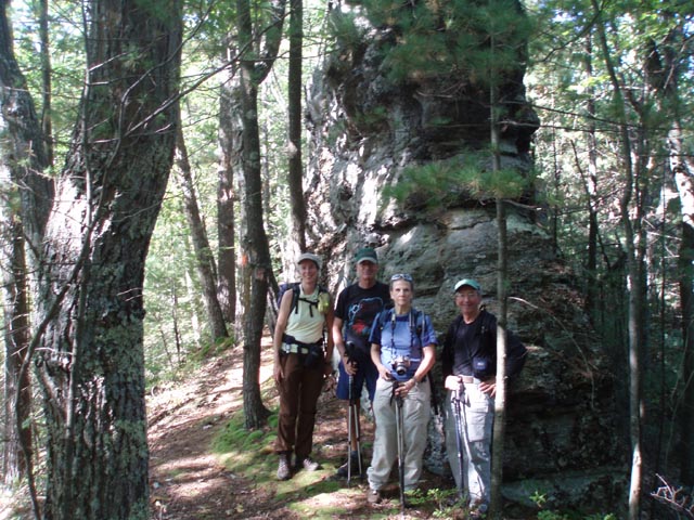
In 1.57 miles from leaving SR4001 the Spike Buck Hollow Tr will leave to the left. Continue straight ahead, now on the orange blazed Mid-State/Love Run Tr. In another 0.88 miles the Pesto Tr comes in from the left. Turn right here and descend steeply on the Love Run segment of the trail. Take care here as the tread is very lose. In 0.74 miles cross a small foot bridge over Love Run and arrive at the back of a hunter's cottage. Turn left onto a grassy woods road (Love Run Road) and continue to follow the blazes. Keep a keen eye out for another woods road that comes in very sharply from the right at 0.49 miles from the cottage. Love Run "Road" continues straight ahead but you want to make this turn to stay on the Mid-State/Love Run "Trail". This will be the last significant climb. It's a lot more gradual and shorter than the first one!
Near the crest of the ridge, at about 0.28 miles from leaving Love Run Road, this road continues straight but the blazed trail veers to the left for a few yards to arrive at a 3X trail junction. The State Park Map calls both the left and right trails the Panther Run Trail. The sign, however, might say that the Love Run Trail is to the right. Regardless of what the sign says turn right and in a few yards reach a nice vista atop a rock outcrop. The trail is poorly blazed with unsymmetrical blotches of yellow and/or dark green paint. This is actually the site of an old quarry. You can get nice views of the surrounding ridges but the forest has grown back too much to let you see the lake and valley. |
|
There appears to be two ways to continue the hike from here. It looks like some folks just shush on their butts down the front of the rock outcrop. Careful investigation will reveal a narrow trail hugging the left side of the outcrop as you look out. Choose one and make it down to the front of the rocks. Poking around in the weeds and trees will reveal the resumption of the trail. Upon your initial descent you will pass through/around a few more sandstone sculptures/ There will be one slight rise before the last short descent back to SR4001. Cross the road and return to your car.
______________________________________
______________________________________
Name: Peter Fleszar
Hike: Mid State Trail-Little Pine State Par
Date: 02/01/14
Rating: 4
Critique: I hiked part of this loop after completing my quest
to hike the entire Tiadaghton Trail. When referring this hike to
someone in a Facebook group I noticed a couple of things. First
and perhaps most important, Happy Acres Restaurant has been
tested and found excellent several times since I submitted the
2011 critique. Second, Spike Buck Hollow Tr south of MST does
NOT continue straight west of MST, instead it quickly turns
left/south heading down the drainage almost parallel to the
narrow ridge, turning again at the bottom of the intermittent
stream hollow to follow along left bank of Boone Run for a bit.
The trail comes out on Boone Rd at an I-beam bridge over Boone
Run, about at the 820' contour.
______________________________________
Name: Peter
Fleszar
Hike: Mid State Trail-Little Pine SP Circuit ______________________________________ |
|
|