|
PVSP-McKeldin Area |
|
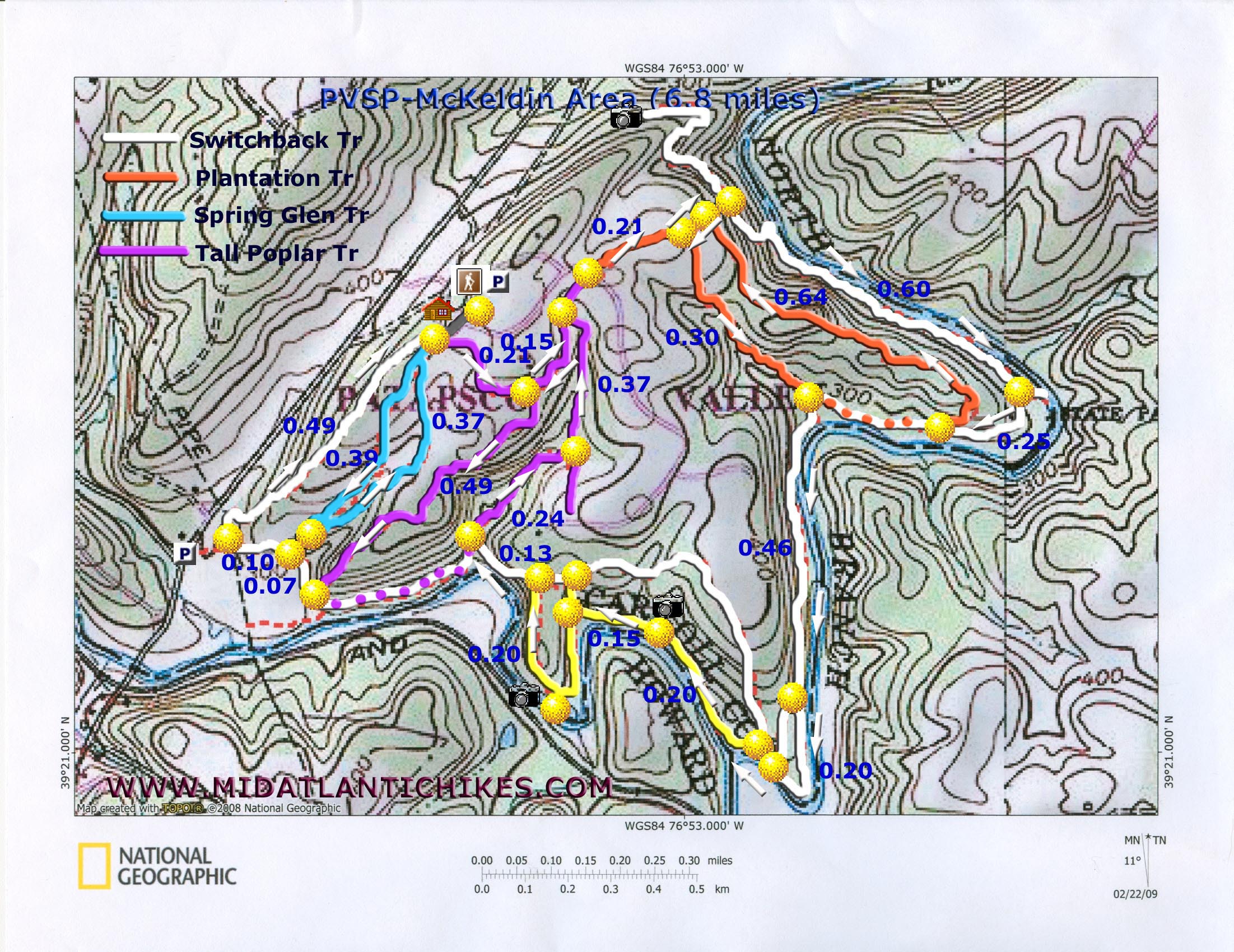
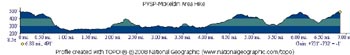
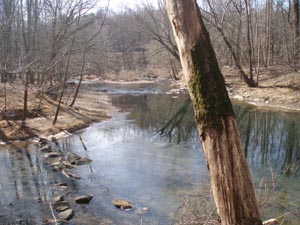
Description: The McKeldin Area of Patapsco Valley State Park consists of 1403 acres on the Howard and Carroll County border. It has 8 miles of well maintained trails, most of which are multi-use. The focal point for hikers has to be the Switchback and McKeldin Rapids Trails as they follow the banks of the north and south branches of the Patapsco River. Dogs are allowed on the trails of the park but you cannot take them beyond the first parking lot past the entrance. (The trailheads are just before the entrance.) Parking costs $2.00 for MD residents and $3.00 for non-residents. Pay by the honor system. This 6.8 mile easy to moderate hike included most of the trails except for a couple of short segments of the Switchback Trail and the Medicine Tree Trail. Feel free to change the route to your liking. It is very difficult to get lost. Google Maps Custom Driving Directions The hike starts at the multiple trailheads just outside the contact station. |
|
________________________________________ |
|
Zipped National Gepgraphic TOPO! and Universal GPX GPS Files |
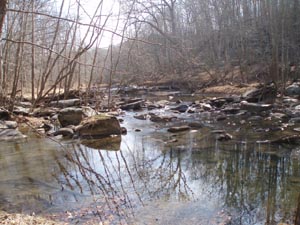
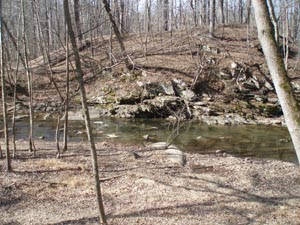
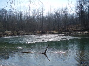
Trail Notes: All trails are well signed and blazed, each with their own color. From the grassy area outside the contact station turn left onto the purple blazed Tall Poplar Trail. In 0.21 miles the trail forks. Take the left fork as you hike behind the park headquarters buildings. In another 0.15 miles arrive at another split with a kiosk. A shelter is to the right. (You will hike this last short section in the opposite direction later on.) Bear left and follow the trail out to a park road. Cross the road and pick up the orange blazed Plantation Trail. At this point it is a dirt/gravel road. In 0.21 miles the trail forks. Bear left and soon come to another fork. Bear left again. Shortly arrive at the white blazed Switchback Trail. (A 0.6 mile round trip out-and-back to the left will take you to a partial view of Liberty Reservoir Dam.) If you opt to not visit the vista turn right and descend quickly to the river. The first 50 yards or so of this riverside trail is pretty rocky but you will soon find yourself on a well-groomed flat trail. In 0.60 miles the trail splits. The trail to the left goes down to the river at a shallow bend. This could be a good break spot. Continue to follow the white blazes and in 0.25 miles once again arrive at the orange blazed Plantation Trail. Turn right onto it and climb gradually back to the top of the plateau in another 0.64 miles. Turn left onto a previously traveled small section of the trail then turn left at the next fork. In 0.30 miles arrive back at the white blazed Switchback Trail. Turn right onto it. In 0.46 miles the trail splits. The right trail is a 0.1 mile short cut. The left fork continues to follow the river and is a much nicer walk. In 0.20 miles the short cut will come in from the right again just before arriving at a kiosk. |
|
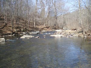
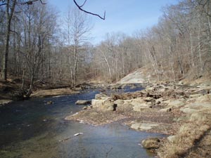
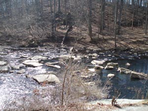
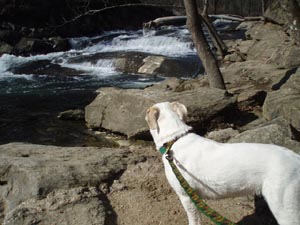
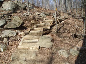
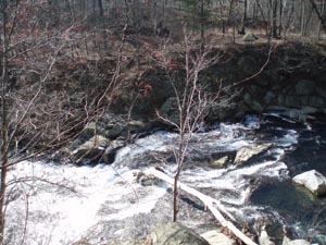
Bear left onto the yellow blazed McKeldin Rapids Trail. In 0.20 miles the trail will climb to the top of a huge rock with some mini-rapids below it. (This is not McKeldin Rapids.) There are two options here. You can either walk down the face of the rock to a trail along the river or stay high and follow a trail that descends more gradually. They both come together just before a bypass trail climbs to the right. Follow the yellow blazes to the left. In another 0.15 miles arrive at the Mckeldin Rapids. There is a deep pool below them that could be tempting during the hot summer months. Swimming is not allowed, however, due to strong undercurrents. From the rapids take the log steps up to a picnic area. Follow the paved road past the rest rooms and turn left onto the continuation of the white blazed Switchback Trail. In 0.13 miles come to the junction with the purple blazed Tall Poplar Trail. Turn right here. In 0.24 miles pass a spur on the right that goes to a shelter. In another 0.37 miles arrive back at an earlier trail junction. Turn left and in another 0.15 miles turn left again. Descend for 0.37 miles back to the river and the white blazed Switchback Trail. Turn right onto it. In 0.07 miles pass a signed unmaintained spur trail on the right. This connects with the Spring Glen Trail that you will be hiking later. In another 0.10 miles arrive at a trail junction. There is a kiosk to the left. This trail goes out to Marriotsville Road. Turn right and climb for 0.49 miles back to the initial staging area. If you elect to end the hike now you will have hiked about 6 miles. To complete the hike as described turn right onto the blue blazed Spring Glen Trail. The trail will gradually descend to a mostly dry drainage. In 0.39 miles the trail will abruptly turn around and follow the drainage for 0.37 miles, crossing it at one point, back to the top. From here take the park road back to your vehicle. Printable/Downloadable Trail Notes ________________________________________
More Photos
________________________________________
Outing Critiques
Name: Geoff Hike: McKeldin Area Date: 05/15/13 Rating: 5
Critique: I want to share the route I take when I go running on the trails in McKeldin. Start out at the parking lot just above the dam, not the one closest to the dam, the one at the top of the hill. Follow the rapids trail down to the beach, then when the trail forks go straight, don't keep following the rapids trail, those rocks aren't fun to run on. Follow Switchback across bridge, gain elevation, then you want to fork right take the trail that goes back down to the rapids trail. Follow the trail along the river ALL THE WAY, following the river until you past the first entrance to the plantation trail on the left. Don't take that one, well, you can, but the better hike is further up. Follow the switchback trail until you see the next entrance to the plantation trail. This one is much steeper. Follow the plantation up up AND UP to the highest point in the park, you'll know you're close after a very steep incline, you'll notice a fork to the right and if you follow it you'll come to a high summit with a pole with a white flag. Anyway, keep going on the plantation, this is my favorite part of the park. keep going until you come to the meadow. Keep going through the meadow, across the road, onto the tall poplar, go left at fork. Follow the tall poplar all the way back to your car, fork to to the left to get back to parking lot where you started. Love this park, so beautiful, and running on it is great. I think this circuit totals to a little over 3 miles, but I could be wrong. Watch your footing, hope to see some of you out there!
________________________________________
Name: Adventure
Runner
Hike: McKeldin Area ________________________________________
Name: Kim
Hike: PVSP-McKeldin Area ________________________________________ |
|
|