|
______________________________________
______________________________________
Name: Peter F.
Hike: Martin Hill Wild Area-Central Loop
Date: Various
Rating: 4
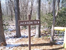
Critique: The
upper part of Jackson Trail (from the summit circle down to the
"green trail" junction) has been cleared and is now red blazed.
______________________________________
Name:
MountainStreamFlood Hike: Martin Hill Wild Area-Central Loop
Date: 9/23/12
Rating: 4.5
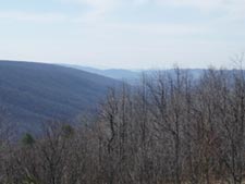
Critique: Overall a great hike. Fall colors were in full
brilliance this past weekend, especially the plentiful blueberry
bushes which have turned a fiery red. The foliage is nicely set
against numerous views of the surrounding ridges and coves.
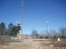
A few notes. First the MST has been rerouted and no longer
follows the power line cut at mile 1.35. Instead it crosses
underneath the line and then bears left and parallels it on a
newly constructed footpath in the woods. The trail passes back
under the line just below Tower Road at the view of the Sideling
Hill Cut, before ascending to a junction with the road (this
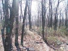
adds ~0.3mi to the trip). Second, both the un-blazed Jackson and
red-blazed Fetters Trails are extremely overgrown for much of
their length. For the most part, as noted, they are still easy
to discern, with the exception of the very beginning of the
Fetters trail, where there is no visible footpath and the old
and fading red blazes are few and far between.
Still a wonderful hike, that I would highly recommend, great
scenery and seclusion!
________________________________________ |