Lost Pond Circuit


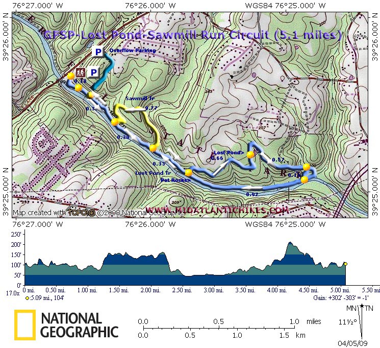
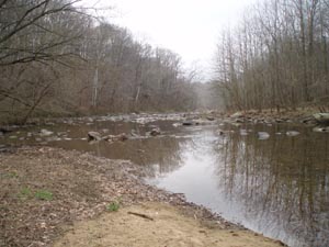
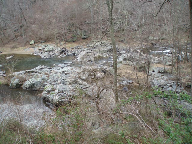
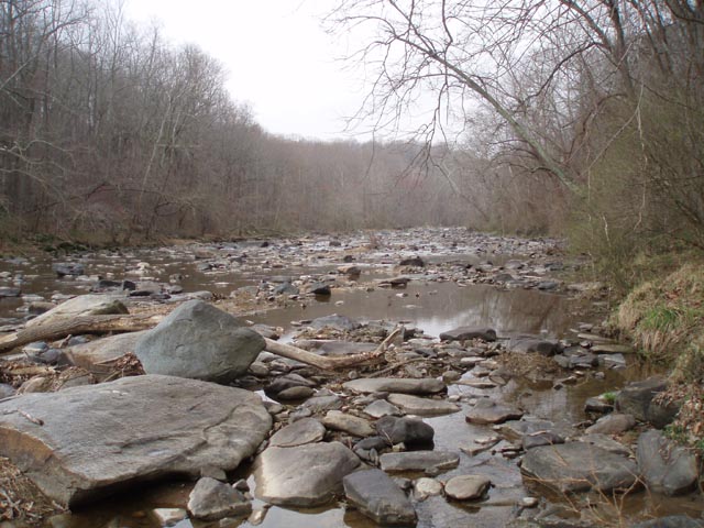
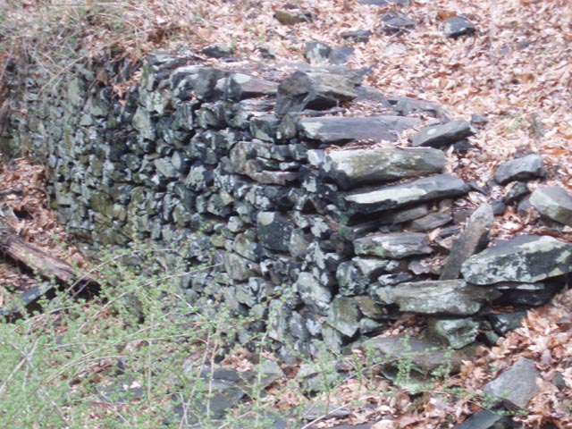
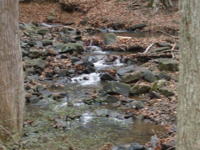
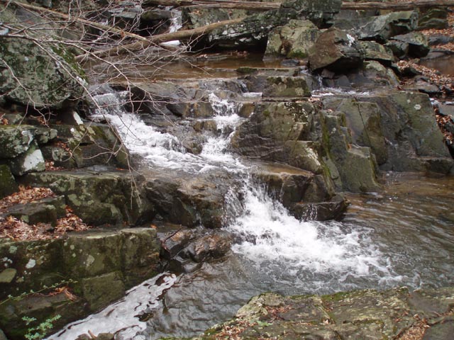
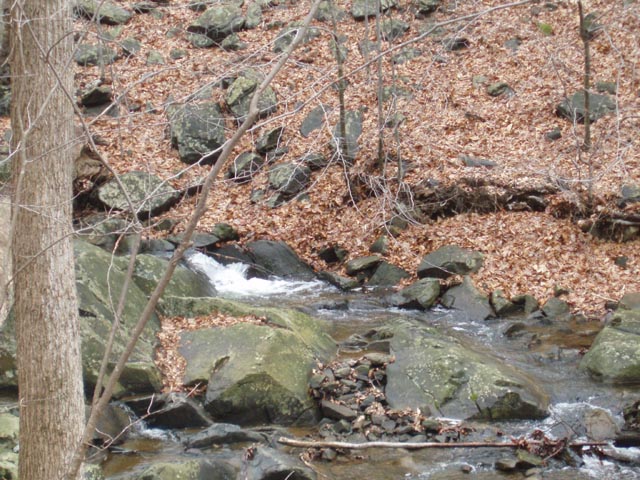
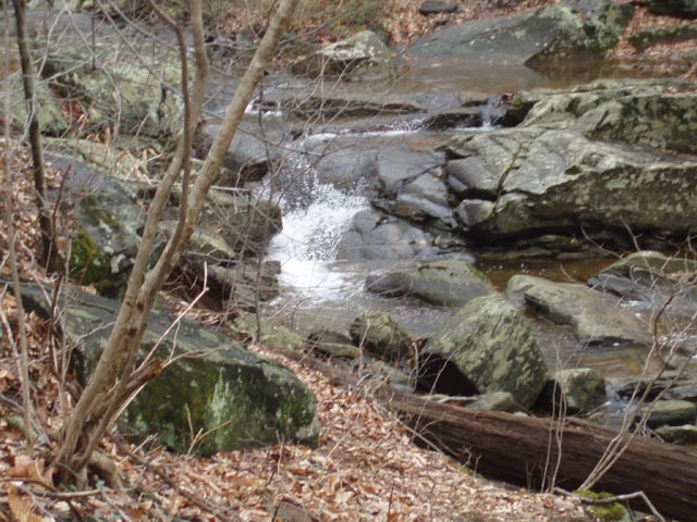
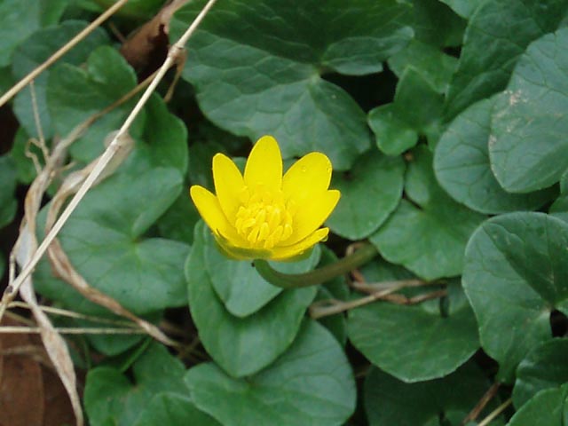
Description: The Belair Road area of Gunpowder Falls State Park is a very popular hiking venue. There are two parking lots at the main entrance and an overflow lot about 0.10 miles further north on Belair Road with a footpath that leads back down to the river. If you visit the park in the winter or during the week you might find some degree of solitude. 

This easy 5.1 mile circuit features the always pleasant Gunpowder River, the remains of an old sawmill, the beautiful stream that used to supply the power for the mill, an area in the river known as Pot Rocks (You�ll understand why when you visit it.) and the Lost Pond which is now just a grassy meadow with a stream flowing through it. Spring flowers include, but are not limited to, large clusters of Marsh Marigolds, Periwinkle, Bloodroot and Virginia Blue Bells.  

If this hike is a bit lacking in length consider adding the 5.0 Sweathouse Branch-Wildlands Loop also found on this site.

Google Maps Custom Driving Directions

________________________________________


Printable/Downloadable Map

View 3-D Map

Zipped National Geographic and Universal GPX Files

GPS Text File for Non-TOPO! Users


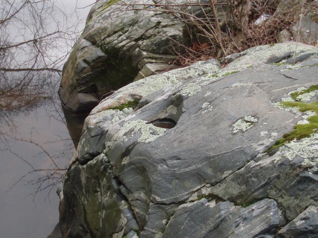
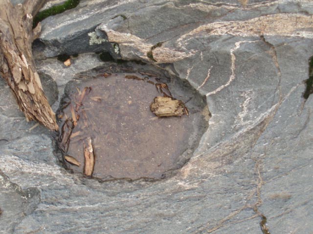
Trail Notes: From the back parking lot look toward the river. In the right corner will be a break in the railing. Descend on dirt and wooden steps to the blue blazed Lost Pond Trail. Turn left. The trail splits and rejoins itself several times to either get better views of the river or to avoid wet spots. In 0.18 miles a blue spur trail coming from the overflow lot will come in on the left. In 0.31 more miles pass the junction with the yellow blazed Sawmill Tr on the left. (You will be coming back this way at the end.) In another 0.30 miles pass the other end of the Sawmill Tr and ford a wide stream

In another 0.33 miles the trail splits. Take the left fork and climb to a vista overlooking Pot Rocks. For the next 1.66 miles you will be skirting large open fields until you arrive at Lost Pond. Circle the pond and in 0.57 miles, shortly after crossing a stream, keep a keen eye out for a sharp right turn off of the wide trail onto a narrower footpath. There is no sign here but once you step over a fallen log (there as of 04/02/2025) you�ll see fresh blue blazes. I believe this is a recent relocation of the trail. If you miss this turn you will descend and cross a stream to end up back on the river a little further down stream. Either way turn right and hike up river for 0.97 miles to Pot Rocks. You can usually find a way to rock hop out onto the large boulders to examine the deep holes bored into them by the combination of spinning smaller, harder cobbles and the hydrostatic force created under a sheet of ice as the river flowed over the rocks during the ice age.

Continue on, passing the trail split that leads to the vista and Lost Pond. Continue up the river for 0.33 more miles, re-ford the wide stream you crossed earlier but this time turn right onto the yellow blazed Sawmill Tr. This is a particularly beautiful stream with mini-falls throughout its length. You�ll see the ruins of the sawmill and mill race near the beginning of the trail. In 0.77 more miles descend back to blue Lost Pond Tr. Turn right and retrace your earlier steps back to your vehicle.

Printable/Downloadable Trail Notes

Critique This Outing

________________________________________

________________________________________

Outing Critiques

Name:   Sarah
Date(s) of Hike: 04/17/16
Hike Name: Lost Pond Circuit
Ranking: 5

Outing Critique: The primary reason for this critique is to report that the blazing around the lost pond is now complete and easy to follow, as is the "sharp right turn" the previous reviewer missed, as long as you understand traditional trail markings (two blazes, one above the other, with the upper one on the right means "turn right").  I don't doubt this is a recent addition; I did this hike not too long ago and had the exact same problem. Yay for trail maintenance!

Overall, a very lovely hike on a gorgeous day.  At this time in spring, the bluebells are out in full force and are a sight to behold.  The river is lovely, and I definitely recommend adding on the sawmill branch loop to spot a couple *small* but very pretty falls.

I was able to do both this hike and the sweathouse branch loop on the other side of Bel Air Road in one outing, and I highly recommend combining them if you are up for the distance.  It took me just over four hours total and I stopped several times to enjoy views, eat lunch, etc.

I also agree with the previous reviewer that the trail up to Pot Rocks is much more heavily trafficked than the route up to lost pond.
Worth doing!  I've also done this hike in fall and the colors along the river were really pretty.

________________________________________

Name:    Tyler
Date(s) of Hike: 10/23/15
Hike Name:  Lost Pond Circuit
Ranking:  4

Outing Critique:    What a great hike and trail run!  I went on a late October early Friday afternoon and there were very few people.  Until today, I had never gone beyond pot rocks.  This hike has two personalities:

1.  The parking lot to pot rocks section is heavily-trafficked, decently wide, and well marked.  The trail was dry and I needed no routing detours for mud.  Some of it is rocky (particularly after you cross Broad Run) but most prior to that is sandy, loose soil associated with a floodplain.

2.  After pot rocks, the trail becomes more robust and is not well-marked.  The trail moves out onto very large shoreline rock right after the pots.  Once off of that, the trail is a single lane deal- shoulder width or less in breadth due to the dense near-shoreline vegetation.  Not many blue blazes anymore and I was off trail a couple of times due to lack of blazes, but was close enough to figure it out.  This is a wilderness-style section.  After reaching No Name Stream, you'll curl up to the left away from Gunpowder Falls on the trail to the uplands- not very difficult climbing if you're fit.  The trail is well marked and now that you're in the woods, a bit wider too.  Shortly, you'll be at the clearing that marks the "ghost pond"- it is interesting for a naturalist or a historian of the area.

Some more hiking over hills and almost one dale gets you to the pot rocks overlook rocks- nice view.  A few meters after this puts you back on the main blur trail with pot rocks just behind you.  Continue on to return to Broad Run and definitely turn up the yellow, Sawmill Trail for some hill work, great views of the stream and gorge, and the historical remnants of the Carroll sawmill. This loop drops you to the main blue trail closer to the parking lot.  Just a little more to go...

I plan on combining this circuit (5.1mi.) with the Sweathouse loop (5 mi.) on the west side of Rt.1 for a really nice and invigorating time out.

________________________________________

Name:   DanB
Date(s) of Hike: 06/29/15
Hike Name:  Lost Pond Circuit
Ranking: 4

Outing Critique: Overall a nice, not too strenuous hike.  I did this one earlier today, according to the map on this web site.

Starting from the parking lot, the trail is well-defined and pretty heavily trafficked on the route to Pot Rocks.  Passed by several groups of folks over this first half-mile.  However, once I reached the fork and took the left to head up towards the Overlook/Lost Pond, I was on my own.  This section of trail is still fairly well marked and open up to Lost Pond.  Once you get around Lost Pond, the blazing is a little more sparse, but the trail is still fairly well-defined as you decline back towards the Gunpowder.

Pay close attention at this point.  I missed the "sharp right turn" described in the description above and apparently ended up off the trail or on an older version of the trail.  I ended up walking a quarter mile or so upstream of a stream that isn't really described on this site, but apparently is "No Name Stream" according to the map on the DNR website:


http://dnr.maryland.gov/publiclands/pdfs/GFSP_big1.pdf

Realized I was headed off trail and turned back around following "No Name Stream" to where it outlet into the Gunpowder.

This next mile was a little rough, the trail is not well defined or blazed as it runs along the water.  Maybe I was still off the trail, it was pretty overgrown...  At one point there was a crossing where I'm assuming there used to be a trail bridge or something, as the water is several feet deep and the bank is very steep where the trail takes you.  Headed a little upstream to find a place to cross and still had a tough time getting up the opposite bank.  From there on it as you follow along the Gunpowder, the trail is quite overgrown, lots of spider webs to run face first into :)

As you continue, you eventually reach Pot Rocks from the North, and back to 'civilization'.  The trail is again well-defined and you are backtracking the way you came.  The Sawmill Trail was a worthwhile diversion, getting a little bit of elevation and some more forest trail.

Personally I enjoyed the Lost Pond Circuit, but bear in mind the trail from the parking lot to Pot Rocks is one thing, but the Lost Pond Circuit is a couple degrees of additional challenge.  Still worth it to reach the mouth of "No Name Stream".

________________________________________


Laura T.                                                                                                                        Hike: Lost Pond Circuit

Date: 11/09/13                                                                                                         Rating: 3


Critique: Nice views and a pleasant hike - enough hills to get the heart rate up without being killer. Nice for an afternoon after work. At 3pm on a chilly Friday, I only saw a handful of other people. But the rocks, oh the rocks... The rocks rolled under my feet. The rocks caught my trekking poles. The rocks slowed my pace to a crawl, especially going down hills... I stubbed my toes several times on rocks hidden beneath layers of leaves. I'm sure it's a very different hike in the spring and summer.


________________________________________


Name: Kingston Bowen                                                                                            Hike: Lost Pond Circuit
Date: 8/12/11                                                                                                           Rating: 2.5

Critique: Nice hike. Fairly moderate but has a couple good climbs in it. I think it will be a much different hike later in fall or just before wintry weather. Once you hike away from the water, the forest takes over on the way to the Lost Pond. Lost Pond was taken over by brush and growth. I look forward to going back later in the year.

________________________________________

Name: Kim                                                                                                                   Hike: Lost Pond Circuit
Date: 4/4/10                                                                                                              Rating: 4

Critique: This is a nice short hike. I went with my 12 year old on Easter Sunday morning. There were only a few cars in the parking lot when we got there around 8:30 but both lots were full when we were finished around 11:00. The trails weren't crowded though...I don't think many people were hiking past pot rocks. Trail notes are very good and the trails are well blazed.

________________________________________

VA Hikes MD Hikes WV Hikes PA Hikes Contact Us Home