
| Laurel Highlands Trail-South |
|
|
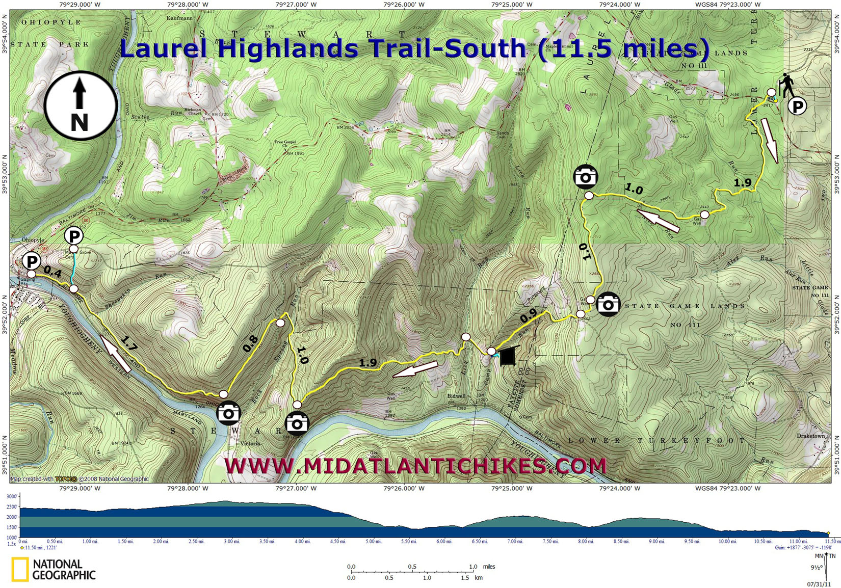
Description: The Laurel Highlands Trail is a 70 mile trail stretching from Seward to the north to Ohiopyle in the south. It passes through State Forests, Parks and Game Lands as well as private property. If you wish to backpack all or portions of the trail preregistration is required. Call the park office at 724-455-3744. No fee is required to do a day hike. I�ve been told by several hikers that the nicest but also the most challenging part of the trail is the southern section so that is where I placed my initial focus. Described here is a strenuous 11.5 mile hike with 1800 feet of elevation gain. The hike starts on Maple Summit Road and ends at Ohiopyle, next to the Youghiogheny River. |
|
________________________________________ |
Zipped National Geographic TOPO! GPS and Universal GPX Files |
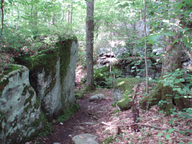
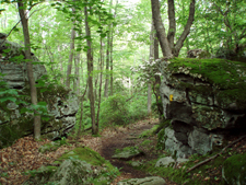
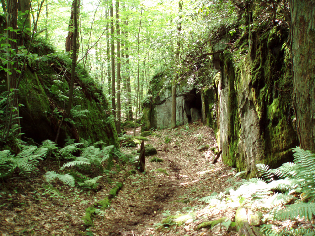
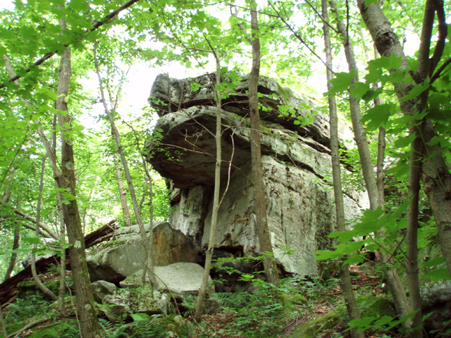
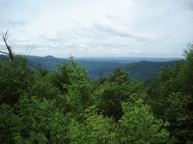
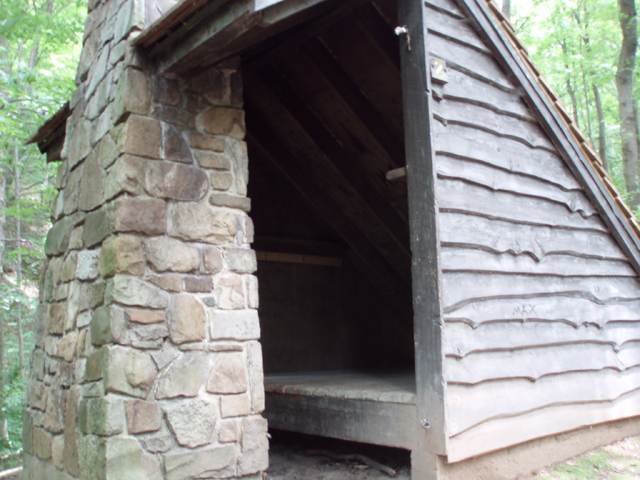
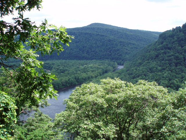
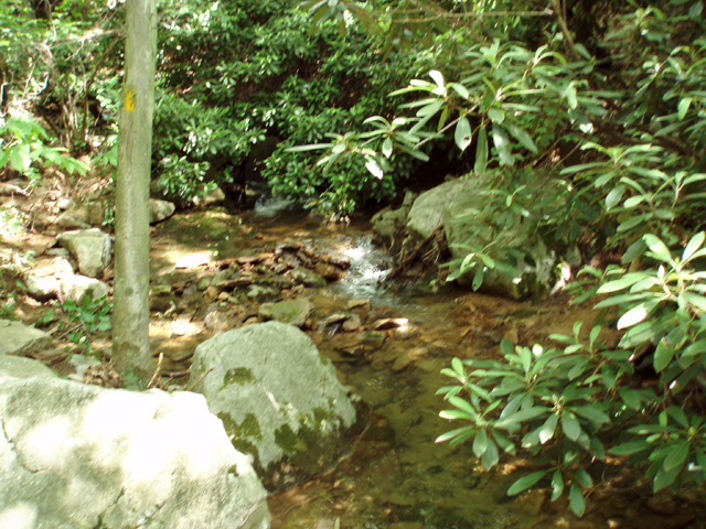
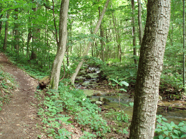
Trail Notes: Take the blue blazed spur trail next to the kiosk. Turn left onto the yellow blazed Laurel Highland Trail, crossing the road. The trail passes through hemlocks and rock cities before crossing pretty Little Glade Run. In 1.9 miles from the start cross a gas well road. The trail climbs gradually for a mile to a west/north facing vista with Mill Run Reservoir in the distance. The trail then swings south and arrives at another view point in another 1.0 mile before descending to and crossing another gas well road. The trail climbs slightly before making a rapid descent for 0.9 miles to the Ohiopyle shelters on the left. Look for window sized views along the way, especially during leaf off periods. The trail continues to descend for 0.5 miles where it crosses Lick Run and a road. Another climb ensues, reaching another vista in 1.9 miles. From here you can see the river below. The trail repeats itself as it once again descends, this time to pretty Rock Spring Run. Take a break here because although the next climb is shorter than the previous ones it is much steeper. The climb out of the hollow is aided by some switchbacks but I think they just serve a psychological purpose. Shortly after crossing a road the climb ends for the most part and joins an old grade for the remainder of the hike. Reach side by side vistas in 0.8 miles from the last road crossing. This is, by far, the best view of the hike. From here the trail descends and crosses Sheepskin Run before arriving at a parking lot spur (for backpackers) in 1.7 miles. Continue straight for 0.4 miles, descending on an eroded set of natural steps to follow the last grade to your cars. |
|
________________________________________
________________________________________
Name: Brian S.
Outing Critique: I went out on a solo overnight hike
on the LHHT and planned to make it from mile 0 to mile
11.5 and turn around and camp at the Ohiopyle (mile 6.5)
shelters. It was warm for late April, with high temps
near 80. The leaves were just starting to come in so the
sun was very hot too! ________________________________________
Name:
Jeremy K
Hike: Laurel Highlands Trail-South ________________________________________ |
|
|