| Laurel Highlands Trail-North Backpack |
|
|
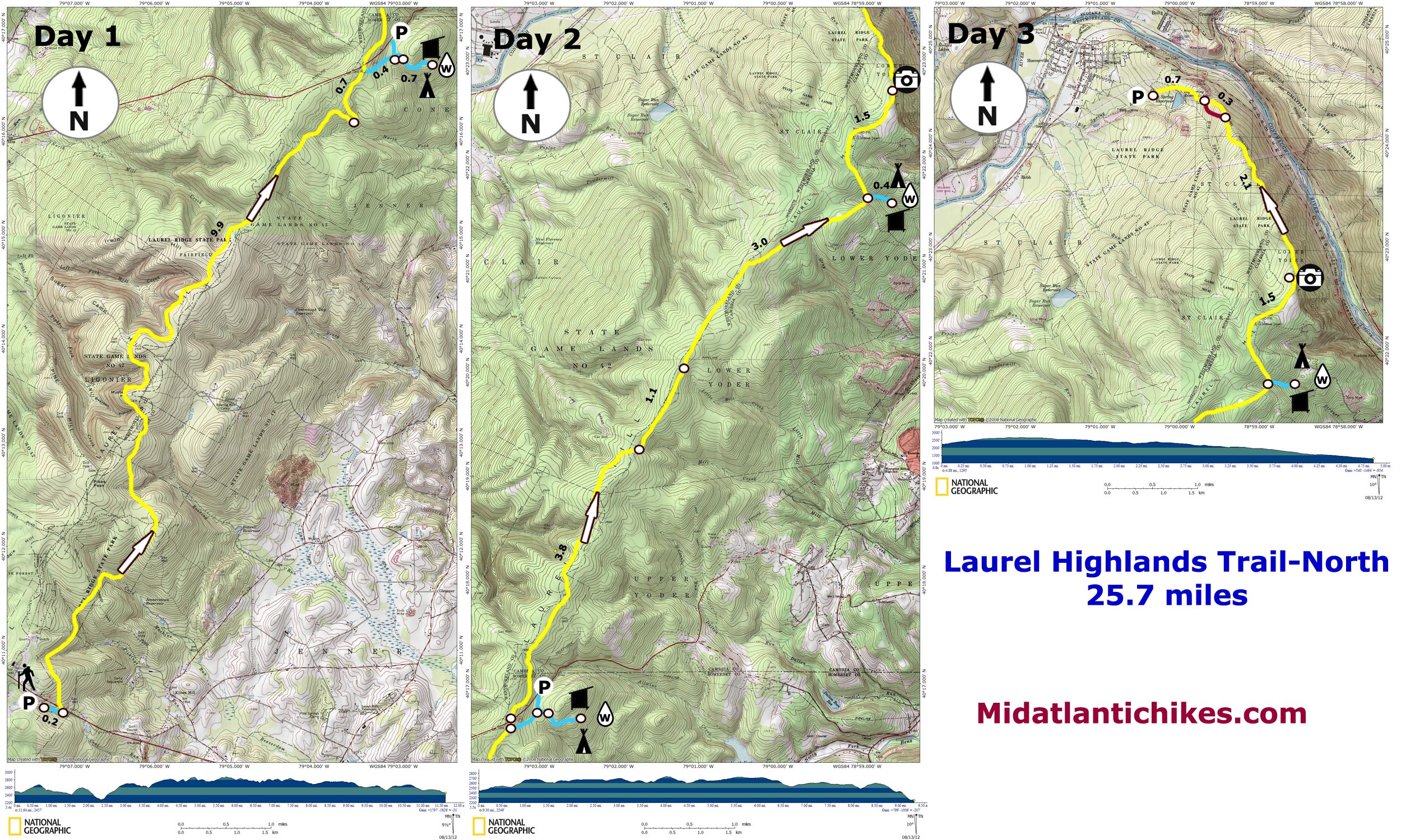
Description: The Laurel Highlands Trail is a 70 mile trail stretching from Seward to the north to Ohiopyle in the south. It passes through State Forests, Parks and Game Lands as well as private property. If you wish to backpack all or portions of the trail preregistration is required. Call the park office at 724-455-3744. There is a $5.00/person/night fee and you must camp at the well maintained shelter areas. Described here is a 25.7 mile shuttle backpack beginning at U.S. 30 and ending at the trail�s northern terminus on PA Rt 56. There is approximately 3200 feet of elevation gain, most of which happens early on the first of three days (If you use the two shelter areas provided.). If you arrive early on the first day and are in good shape it is possible to do this hike over two long days. Google Maps Custom Driving Directions to North (RT 56) Trailhead Google Maps Shuttle Directions to U.S. 30 (South) Trailhead |
|
________________________________________ |
|
Printable/Downloadable Map (11X17) Zipped National Geographic TOPO! GPS and Universal GPX Files |
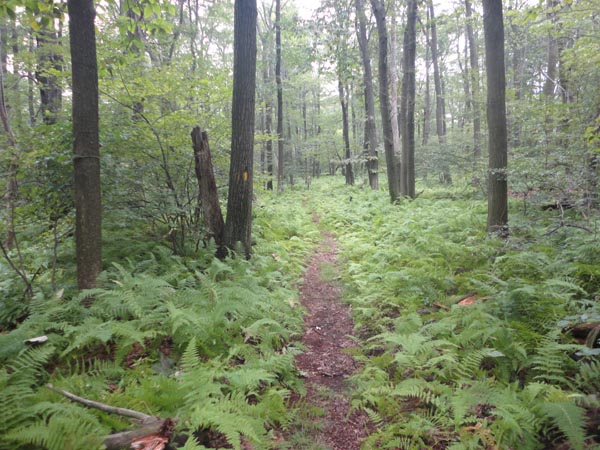
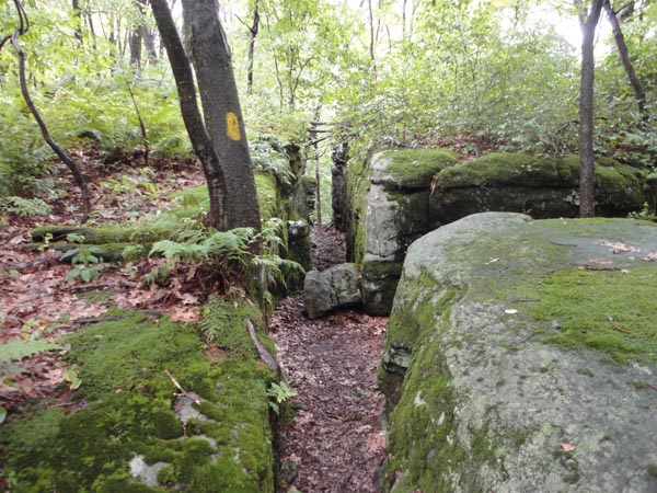
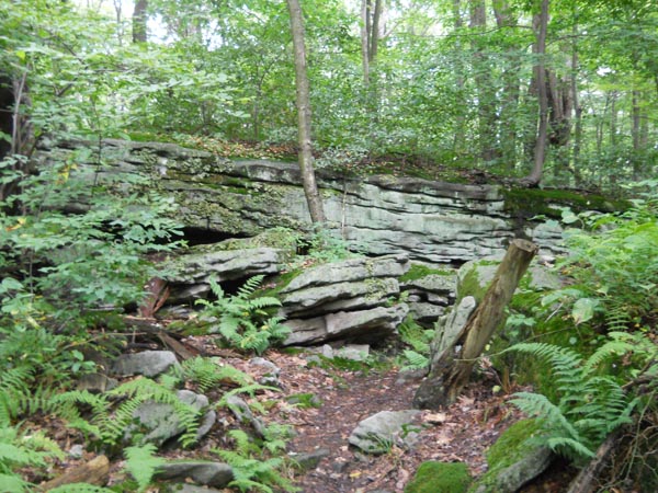
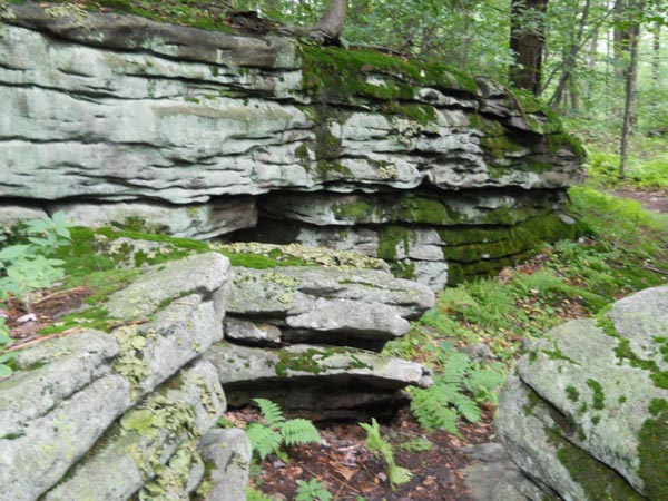
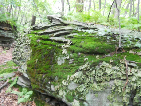
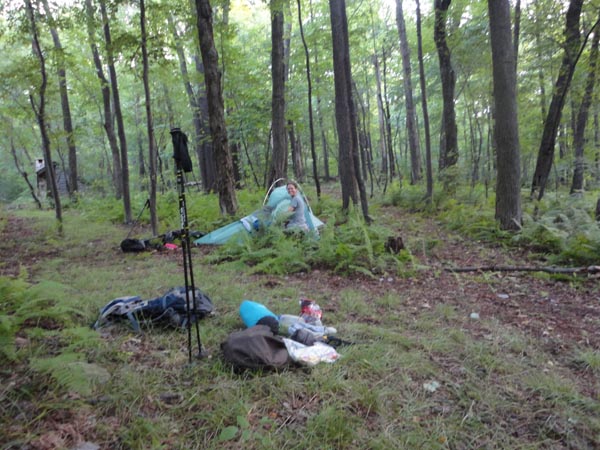
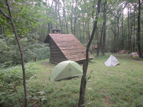
Trail Notes: Day 1) 12.0 miles, 1800 ft E.G.: From the parking area on U.S. 30 find the kiosk/signs introducing you to the trail. Follow the blue spur trail to the yellow Laurel Highlands Trail and turn left onto it, soon crossing the highway. The LHT is much like the AT but in miniature. It is almost impossible to get off trail except possibly in one place that will be described when we get there. There are way too many forest road crossings to make mention of here. Immediately the trail begins a series of ascents and descents crossing small streams on log bridges. After about 2/3rds of the elevation gain for the day is achieved you�ll settle into a relatively easy ridge walk over rolling terrain. At one point you�ll pass through a pretty cool crevice unaware that in comparison to what you will witness later in the day this is but a teaser. At 9.9 miles into the hike the trail turns sharply to the right and quickly descends to a labyrinth of rock corridors, complete with steps ever so precisely put in place by the trail builders. At the end of it you�ll climb back up to the ridge and in 0.7 miles from the end of the labyrinth reach the blue blazed spur to the shelter area and Rt 271 parking area on the right. Follow it for 0.4 miles, making another right that soon leads to the gravel shelter area service road. Turn right yet again and in 0.7 miles reach your home for the night: several shelters, ample tenting area and really nice multi-stalled privies with stainless steel fixtures, TP and hand sanitizer. There is a stream flowing through it and stacks of fire wood. No two shelters� openings face each other and each is equipped with a fireplace for winter hikers. |
|
Day 2) 9.5 miles, 800 ft E.G.: Retrace yesterday�s steps back to the LHT and turn right. After a long gradual climb you�ll once again reach the ridge and some views to the west. I didn�t make note of their exact location on my GPS but they are there. In 3.8 miles the trail makes a left turn onto a gravel road which in 1.1 makes a 90 degree left turn but you want to continue straight into the woods next to a gas compression facility. The next 3.0 miles are pretty easy with one short climb before descending to the next blue spur leading to the next shelter area. Turn right and in 0.4 miles arrive at the shelters. The facilities are identical to the ones used on the previous night. Day 3) 5.0 miles, 500 ft E.G.: Although the climb back to the main trail is shorter today it is much steeper. Once back on the trail you will have yet another brief climb to reach the ridge. Once there the rest of the day will literally all be downhill. In 1.5 miles the trail will swing to the east for a bit, turning north again at the only legitimate full vista that I can remember on this section of trail. For the next 2.1 miles the trail will hug the steep east flank of the mountain, descending gradually. At this point you have to be careful. You�ll find yourself facing a very eroded woods road full of loose ankle biting rocks just waiting to twist your ankle. While the trail will eventually cross it I wouldn�t consider it to be the primary route. Stop and look over your right shoulder to find a yellow blaze and the continuation of the real trail � a much nicer option. In 0.3 miles cross the same road. Here the trail flattens out as you pass Big Spring Reservoir, visible through the trees to the left. In 0.7 miles from crossing the eroded road arrive at the Rt 56 parking area and your plant vehicle. ________________________________________
________________________________________ Outing Critiques
Name:
Jukebox
Hike: Laurel Highlands Trail Thru Hike
________________________________________ |
|
|