|
Ketchum Run-Scar Run Circuit |
|
Many Thanks to Jeff Mitchell, author of �Backpacking Pennsylvania�, �Hiking the Endless Mountains� and �Hiking The Allegheny National Forest: Exploring The Wilderness Of Northwestern Pennsylvania� for sharing this hike with us. Description: The Loyalsock Trail is a 59.3 mile linear trail. The use of blazed connectors, ski trails and old logging roads and grades make smaller loops possible (especially in the eastern portion of the trail). Throw in a bushwhack or two and the possibilities open up even further. Described here is a moderate 8.0 to 9.8 mile circuit exploring the many water works of ever popular Ketchum Run (short version) and the less visited Scar Run (long version). The bushwhack for the Ketchum Run portion is only about 0.3 miles while the Scar Run portion requires substantially more off trail work both in distance and difficulty of the bushwhack. |
Google Custom Driving Directions Note: Google Maps calls the road on the west side of World's End Road (SR3009) Shanersburg Road. It has been renamed High Knob Road. The hike starts near the Cross-country Ski warm-up shack. ________________________________________ |
Zipped National Geographic TOPO! GPS and Universal GPX Files |
Trail Notes: All official trails are blazed. Bushwhacks and unofficial trails (grades and haul roads) are not but are shown as purple on the map.
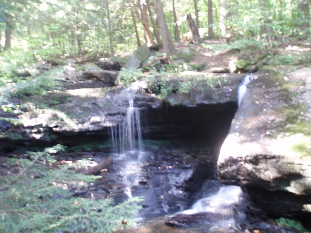
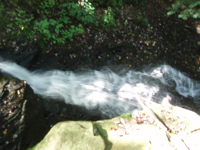
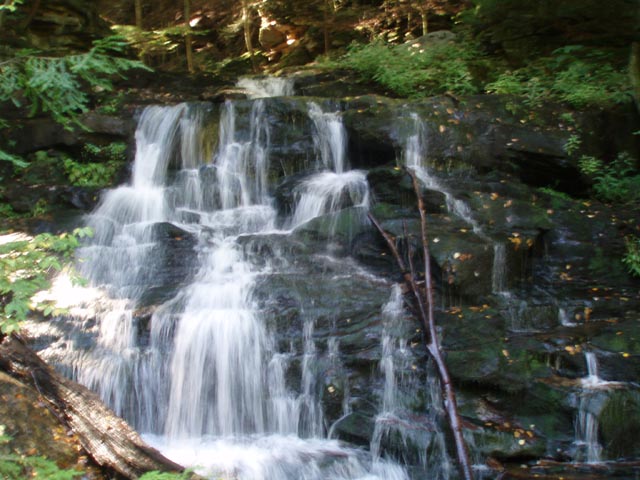
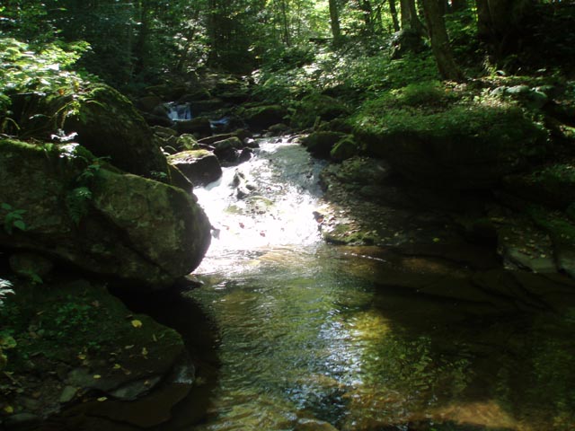
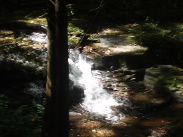
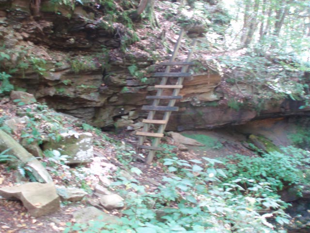
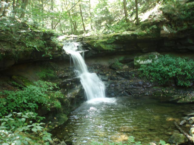
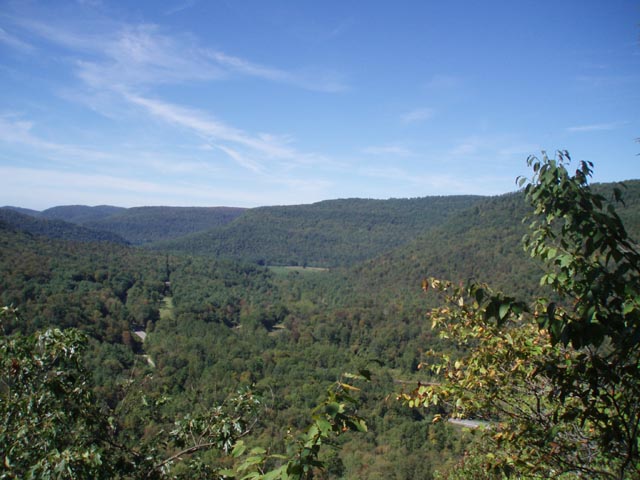
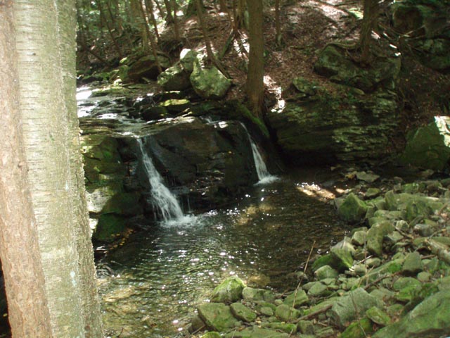
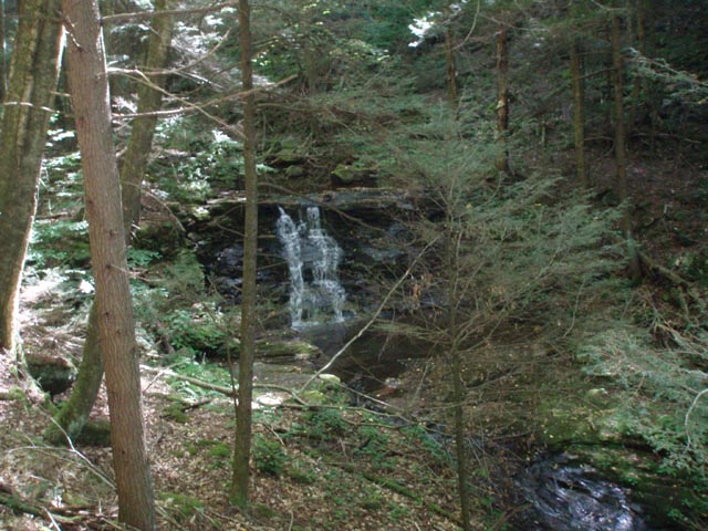
From the warm-up hut follow the Fern Rock Nature Trail (orange painted disk with blue FR) to its right for 1.05 miles. Turn right onto a yellow and blue blazed ski trail. In 0.14 miles turn left at a �T� junction onto another ski trail (Bark Shed Trail?). This trail will eventually tie in with the Loyalsock Trail (LT) but to see some of the less frequently visited water works of Ketchum Run you want to just take a few steps and turn right along the stream without crossing it. This �open woods bushwhack� is now almost a trail in its own right. After 0.29 miles full of nice mini-falls and chutes the LT comes in from the left. Over the next 0.24 miles pass a very large campsite nestled in a Hemlock Grove to the left and a smaller site right on the trail near a registration box. After hiking around the remains of an old splash dam (shallow, weedy hill) the LT will make a sharp right turn and climb to avoid the rocky banks of the creek. To see the most beautiful water works stay straight on the RX-4 trail and descend to the base of Lee�s Falls. Over the next 0.52 miles the trail will cross the run twice and the LT will come in from the right. In 0.21 miles the RX-5 trail will climb to the right. (If you have a dog, take this route and backtrack on the LT to visit Rode Falls.) Stay on the LT and climb down a rather robust ladder to the base of Rode Falls. This is a great break spot. The horseshoe shape of the surrounding rock face holds in the coolness it produces. There is a small campsite here as well. In another 0.12 miles the RX-5 trail comes back in on the right. Climb via old grades for 0.50 miles to the Lower Alpine View.
To complete the short version of the hike skip the following description, stay on the LT and pick up directions at its intersection with the World�s End Trail.
[Scar Run segment: From the Lower Alpine View continue on the LT for a short distance. Look for some logs on the left near where the LT makes a sharp turn. These are blocking an old, somewhat overgrown but useable railroad grade. |
|
JStep over the logs and follow the grade for 0.40 miles. ust before arriving at a power line swath turn left and descend steeply on an oblique angle towards the swath but remain above it. In about 0.10 miles arrive at a wide smooth grade that follows the edge of the swath on the right and a pine forest on the left. Although the trail has no name it is blazed red (bridal trail). In 0.44 miles, just before exiting the forest, turn right, walk through the woods and cross Scar Run. Turn right here and begin the bushwhack. Most of the time you will be on the left (north) side of the run, occasionally making use of an old eroded grade. At times you will have to make your own sidehill route but never leave site of the run. Near the top you will have to cross the stream twice, following the old grade until it finally gives up the ghost on the left (north) bank. Keep a sharp eye out on the right (south) bank for a branch of the run coming in. just above this is a part time falls/chute. Climb above this feature and cross to the south bank for the last time (1.00 miles from starting the bushwhack). A little bit of probing the understory should find a wide, smooth and clear haul road. Follow it with the south branch of Scar Run on your right, passing a deer exclosure on the left, before reaching a gravel road in 0.68 miles. Turn right for a few steps and then right again onto the yellow blazed World�s End Trail. Pass through a pine plantation with a great campsite near the headwaters of the south branch of Scar Run. In 0.15 miles cross Coal Mine Road on a diagonal, continuing on the World�s End Trail for 0.45 miles, arriving at the junction of the LT. Turn left.]
Continuation of hike: From the junction of the LT and World�s End Trail continue east on the LT (Left if doing the long version). In 1.66 miles arrive at World�s End Road. The LT crosses it here. Bid fair well to it as you turn sharply to the right, without crossing the road, to pick up a red blazed bridle trail. Initially it passes through a weedy area without blazes but the woods and blazes will soon become apparent. In 0.34 miles arrive at the southern intersection of Coal Mine Road and World�s End Road. Turn right onto it and follow the red and blue blazes about 0.10 miles and turn left onto a power line swath. Follow the blazes as the trail leaves and enters the swath twice. In 0.44 miles from leaving Coal Mine Road the trail will enter and leave the swath for the last time. The last 0.39 miles is on a wide haul road. Find yourself on World�s End Road just a few steps from your vehicle.
________________________________________
_______________________________________
Galiwalker Date of Hike: 08/24/2015 Rating: 3.5
I found the old logging road for the longer part of the hike - i.e. the Scar Run takeoff point - and followed it for about a hundred yards or so. It was non-obvious, overgrown, covered with light dead-fall and did not seem to see much traffic, if at all. I would have enjoyed tackling it, but did not do so due to time constraints. The Ketchum Run part was worth it, even though the return leg along the Loyalsock Trail suffered by comparison. _______________________________________
Name: Allen
Keeney
Hike: Ketchum Run _______________________________________
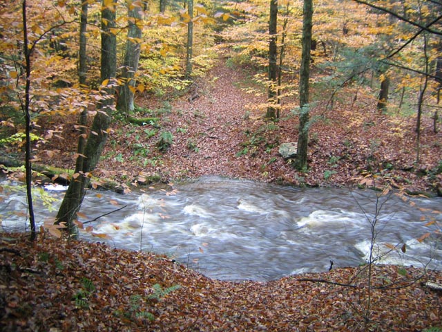
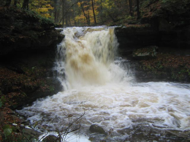
Chris H. Hike: Ketchum Run-Scar Run Circuit 10/24/2009 Rating: 4
My buddy and I
just did the Ketchum Run hike this weekend right after the rain
had stopped. Those smaller streams turned into raging rivers.
Compare the pictures that I send to you with the ones on your
website. It was soggy and very awesome to see those raging
rivers. Ketchum Run was unreal. The stream crossing after you
make a left from the yellow-blue ski trail was basically
impassable. We did the bushwhack there instead and eventually
met up with the Loyalsock trail where it comes in from the left.
Check out this movie file of Lees Falls gone wild. _______________________________________ |
|
|