|
John P. Saylor
Trail Backpack 08/24/11 |
|
|
Description:
John P. Saylor served PA in the House of Representatives and
was a staunch conservationist and supporter of the Wilderness
Act of 1964. This trail located in Gallitzin SF was named in his
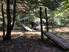
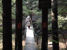
honor. The entire trail is 18 miles long - two loops joined
together by a suspension bridge across Clear Creek. Described
here is a relatively easy 20.5 mile overnight backpack. There is
less than 2000 feet of elevation gain during the entire trek, most of
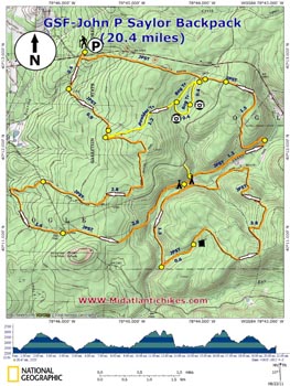
which is quite gradual. Besides the vandalized Wolf Rocks there
is nothing really fantastic about this hike yet, for some
indescribable reason I'd have to count this in my top 10
favorite PA day hike. Google Maps Custom Driving Directions Turn right into the Lost Turkey Trailhead parking lot to begin the hike if traveling west on RT 56. |
|
________________________________________ |
Zipped National Geographic TOPO! GPS and Universal GPX Files |
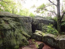
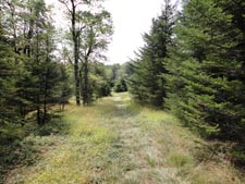
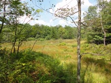
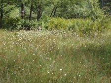
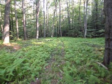
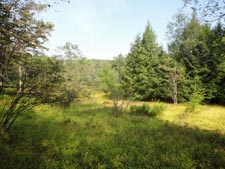
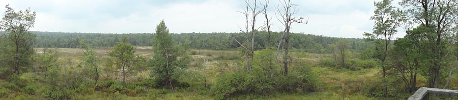
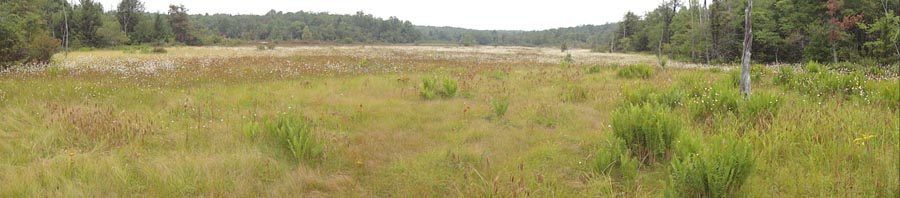
Trail Notes: From the parking area follow a paved road back to Rt 56. Cross it and turn left at the kiosk to join the orange blazed John P. Saylor Trail. the picnic area drive to the Kiosk and join the orange blazed trail. In 0.47 miles cross a road and begin to follow a stream for 0.9 miles. The trail will become very rocky as you approach Wolf Rocks. There used to be a view from atop them but the trees have now obscured them totally. The trail remains quite rocky until shortly after passing the yellow blazed Boulder and Bog Trail on the left below the rocks. The trail is easy to follow for the next 1.58 miles. As you pass through some young spruce trees and a clearing (the remains of camp 51) cross a small stream and immediately turn right at a sign post. (Continuing straight will take you out to Clear Shade Road. ) In another 1.2 miles cross another gravel road and join an old haul road. In 0.5 miles the road will disintegrate, Turn left onto a footpath and pick up a railroad grade. The grade becomes more apparent as you cross a stream where there must have once been a culvert or trestle. The trail immediately bears left and follows the stream in a straight line up a hollow to a gas well road (1.0 miles from joining the grade). There has been a lot of logging activity to the right of the trail. Once at the gas well road turn left and follow it for a handful of steps to the intersection with a gravel road. Cross it to pick up the continuation of the trail. This is the only really wet area that we encountered. Once you near the crest of the hill you'll discover why. A boardwalk follows the southern edge of a small but pretty highland bog. In 1.9 miles watch for an orange "T" blaze in a dense Hemlock forest along Clear Shade Creek. This is where a suspension bridge joins the northern and southern loops and also makes for a great lunch/camping spot.
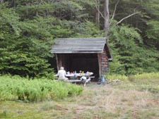
Cross the bridge and turn right at the orange blazes for the southern loop. Follow an old railroad grade for 1.3 miles and turn sharply to the left onto yet another grade. In 0.6 miles cross a stream (your water source for the night) and enter a clearing with an old shelter on the right. If you prefer not to sleep on the dirt floor of the shelter try out one of several flat Sphagnum Peat pads or search for small clearings along the edges of woods for something firmer. |
______________________________________
________________________________________ |
|
|