|
Jenkins Gap/Hickerson Hollow Circuit |
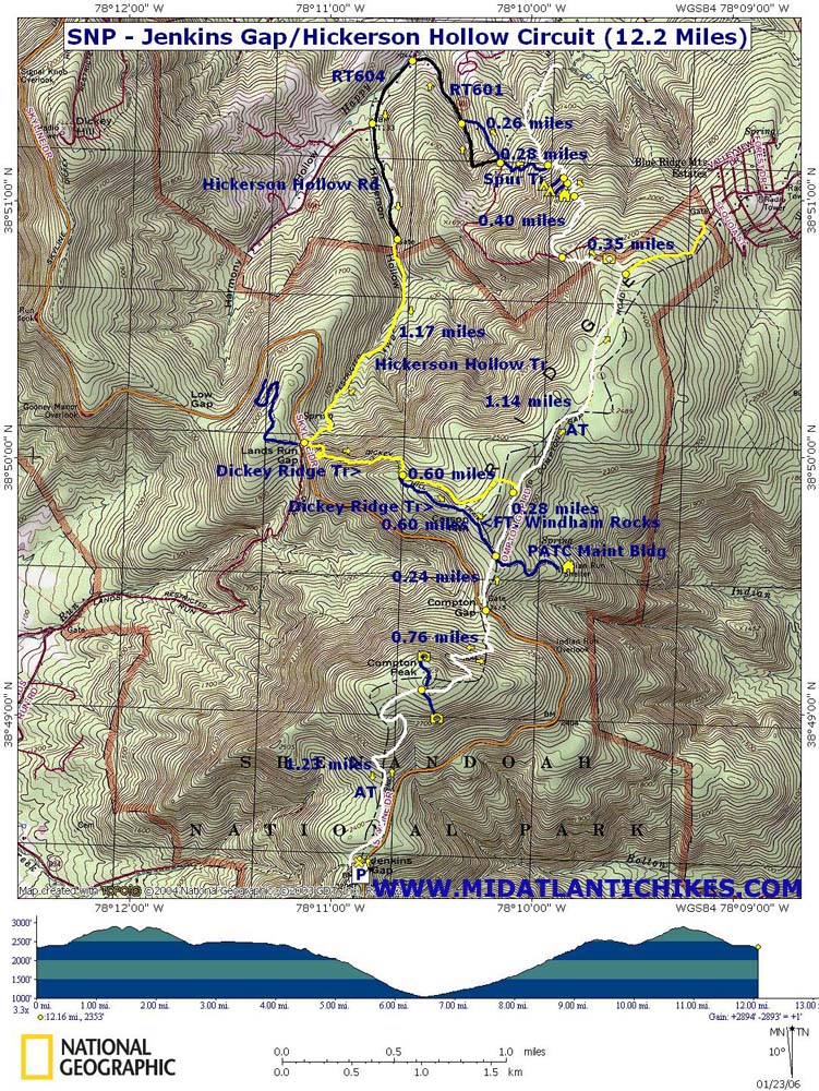
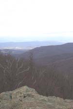
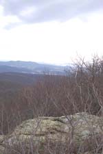
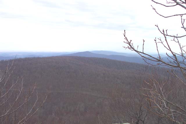
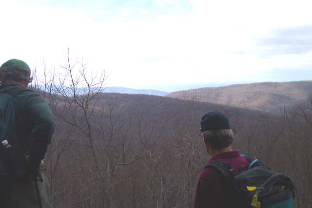
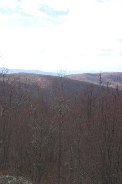
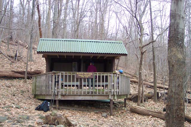
Description: This is a pretty arduous but rewarding hike in the northern section of SNP. It can be done either as a moderate 7.5 mile loop w/ a 1500 foot gain in elevation or a strenuous 12.2 mile �lollipop� circuit with over 2000 feet of elevation gain. There are views both east and west from Compton peak although the west view is by far the best. There is another vista as you leave the park on the AT and a nice lunch spot at the Tom Floyd�s Wayside. A one mile road walk will bring you back into the park on the Hickerson Hollow Tr along a picturesque stream of the same name. If you opt to do the shorter loop but still want to take in the views on Compton Peak add a 2mile out-and-back at the beginning or end of the trek for a total distance of around 9.5 miles. If doing the shorter loop follow Skyline Drive to about Mile Marker 10.2 and park at the Compton Gap Parking Lot on the left. If doing the entire trek continue past mile marker 12 and park at the Jenkins Gap parking lot on the west side of the drive. |
|
________________________________________ |
Zipped National Geographic. TOPO! GPS and Universal GPX Files |
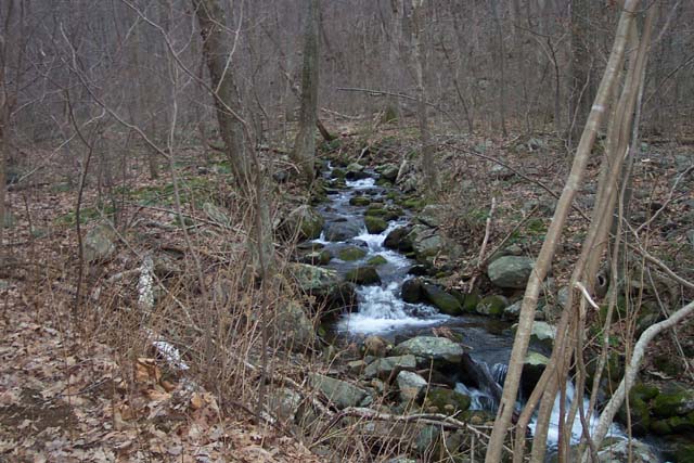
Trail Notes: For the long version start at the Jenkins Gap Parking Area. Follow a spur trail a short distance to the junction with the white blazed AT. Turn right on the AT and follow it for 1.2 miles to a concrete post marking a 4X intersection. Take in the views and then continue to follow the AT as it switchbacks down to Skyline Drive in 0.76 miles. Cross the drive into the Compton gap Parking area. This is the start of the shorter hike. The continuation of the AT is a fire road blocked by a park gate at the back of the lot. Follow it north. In about 0.24 miles, cross the junction of blue blazed Dickey Ridge trail. (This is part of the return leg.) In another 0.28 miles pass yellow blazed Springhouse Road on the left. For the next 1.14 miles the AT will carry dual blazes, yellow and white. (Yellow is the designation for hiking and equestrian trails in SNP. I think this is the only section of the AT in the park where horses are allowed.) At the end of this section the AT will turn left onto a footpath and leave the park. Shortly after passing a through hiker registration kiosk arrive at Possum Rest Overlook. The road in the distance is Rt522. Descend steeply down from the overlook and soon cross an old woods road. In 0.4 miles after crossing the woods road arrive at the Tom Floyd�s Wayside. After lunch at the wayside continue to descend on the AT through a series of switchbacks. There will be two blue blazed spur trails to the left that lead to campsites and a spring and eventually back to the wayside. Turn left onto a third blue blazed spur trail. There is currently a sign propped up on the base of a tree noting the way to Rt601. Follow the spur trail out to the road. It breaks out through an old stone wall behind a house. (According to the PATC map the trail is supposed to go back into the woods around a pond to the right. We found the pond but not the trail. |
|
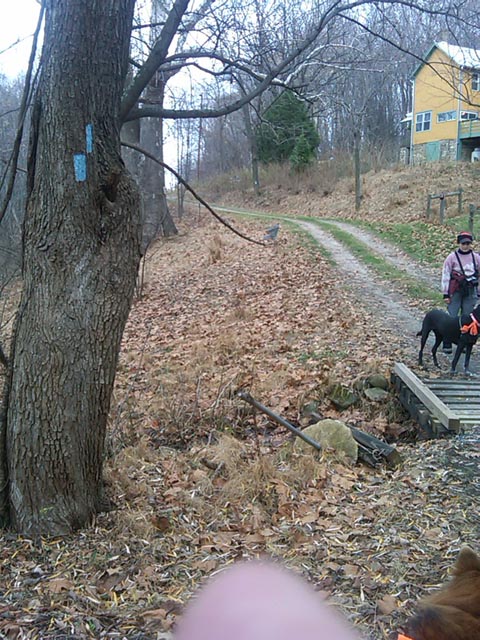
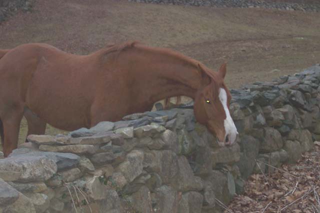
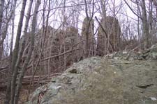
If anyone finds it please send us a description and/or photos. They will be included here with proper attribution.) If you cannot find where the trail reenters the woods simply follow Rt601 down past the 2 vehicle parking area and final terminus of the spur trail to Rt604.Turn left onto Rt604 and then make another left onto Hickerson Hollow Rd. This will become yellow blazed Hickerson Hollow Tr as it enters the park. Say " Hi!" to a rather friendly horse at the Promised Land as you walk up the road. The trail initially follows the run. Shortly after it fragments into many smaller streamlets the trail veers away from the hollow and climbs up to Skyline Drive reaching it at 1.17 miles after reentering the park from below. Turn left onto the shoulder of the drive. Take about 3 steps and immediately turn left onto yellow blazed Dickey Ridge trail. Climb steadily for about 0.6 miles to the junction of Springhouse Rd on the left. The yellow blazes will follow it while you and blue blazes will continue to the right on the remainder of Dicky Ridge Tr. Gradually descend another 0.6 miles to the AT on what now seems to be a woods road, passing Fort Windham Rocks (Geologically interesting) on the way. Turn right on the AT and retrace your earlier steps back to your cars regardless of your starting point.
Printable/Downloadable Directions and Trail Notes
______________________________________
______________________________________
Name: Bryan
Hike: Jenkins Gap/Hickerson Hollow ______________________________________
Name: The Tick
Hike: Jenkins Gap/Hickerson Hollow Circuit ______________________________________
Name: Ryan Shaw
Hike: Jenkins Gap/Hickerson Hollow Circuit ______________________________________
Name: Michael Eckert
Hike: Jenkins
Gap/Hickerson Hollow Circuit ______________________________________ |
|
|