| Iron Stone Loop |
|
|
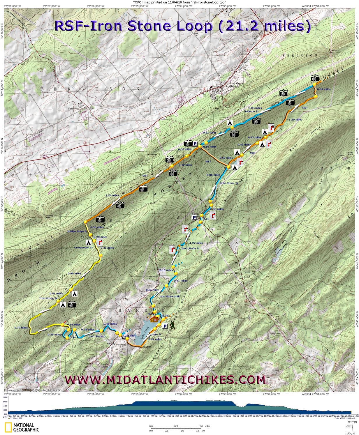
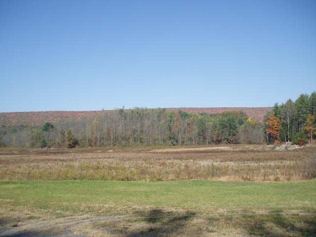
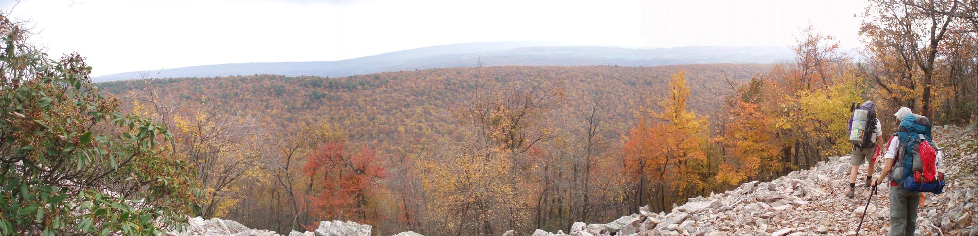
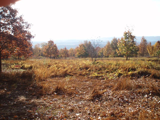
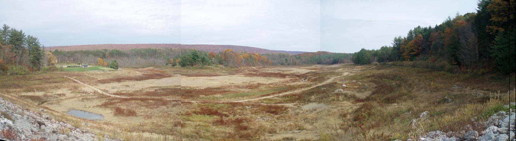
Description: The Mid-State Trail (MST) is a 313 mile trail that when complete (325 miles) will extend from the New York state border to Maryland at Green Ridge State Forest. Described here is a 21.2 mile moderate loop utilizing about six miles of the MST, the 3 mile Jackson Trail (formerly part of the MST), the Iron Stone Trail in the Stone Valley Recreation Area and assorted connector trails. Overall 2400 feet of elevation will be lost and gained. The steep sections are �VERY STEEP� and extremely rocky but thankfully short in their duration. The Jackson Trail/MST ridge walk is also very rocky but the numerous panoramic views (the camera icons on the map are an under-estimation.) in all directions make it more than worth all of the effort and pain you will endure. Google Maps Custom Driving Directions The hike starts at the parking lot by the boat mooring area of currently dry Lake Perez. Make sure you inform the Stone Valley Recreation Area of your intentions in advance. You can also park in two places on PA Rt26 but the RA parking area is the most secure. The Standing Stone Trail is part of the Great Eastern Trail (GET). |
|
________________________________________ |
Zipped National Geographic TOPO! GPS and Universal GPX Files |
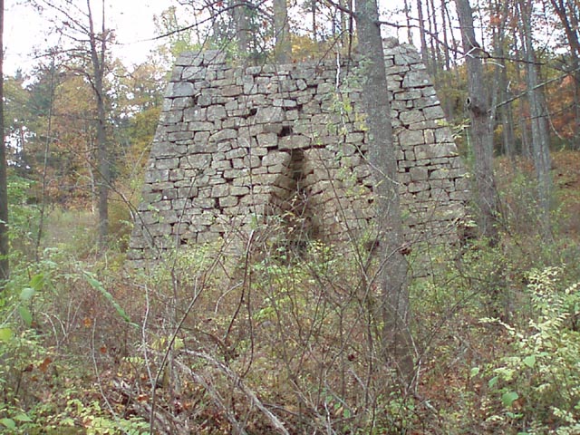
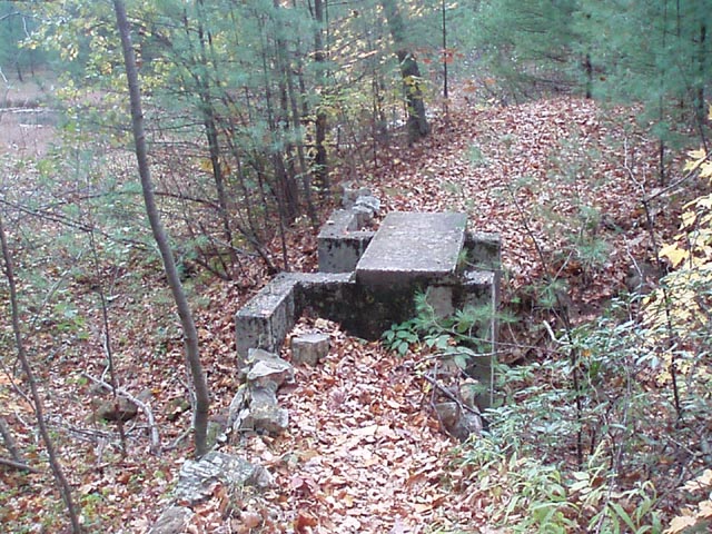
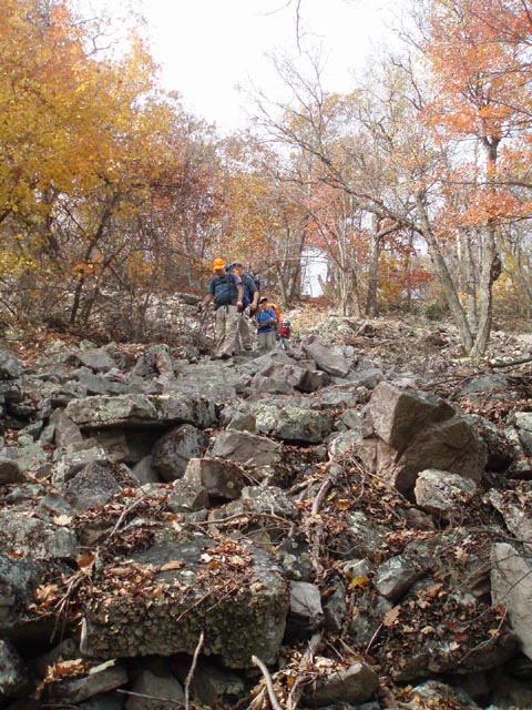
Trail Notes: All trails are blazed as shown on the map and generally well signed with one exception to be described later. The S.V.R.A. maintains over 20 miles of trails. We only show those used on this hike. A free map can be downloaded from the above site (recommended). From the parking area travel north-east a short distance. Cross a small bridge and pick up the orange blazed Lake Trail. Follow the yellow arrows to the Shaver Creek Nature Center. Turn left and cross the headwaters of the lake on a boardwalk. Follow a blue blazed gravel trail for 0.38 miles as it winds its way up to the nature center�s parking lot. They sell maps of the S.V.R.A. for $0.50. Cross the parking area and pass through a walk-through kiosk. The trail continues at the end of a retaining wall to your right. Turn left onto the trail and descend to the intersection with the Lake (orange) and Iron Stone (blue) Trails. Turn right onto the Iron Stone Trail. Soon pass an old shelter on the right and the Bluebird Trail on the left. In 0.65 miles cross Red Rose Road. In 0.41 more miles the orange Woodcock Trail begins to share the treadway. Be careful. In another 0.16 miles a double dark blue blaze suggests that you turn right at a sign. This is the Homestead Trail but is not signed as such. Continue straight on the dual blazed Woodcock/Iron Stone Trail along pretty Shaver Creek encapsulated in Hemlocks. Cross Rt26 in another 1.22 miles. Pass the ruins of the Monroe Iron Furnace on the left. Follow a railroad grade for 0.35 miles. Bear left off of the grade, around a yellow forest gate onto a gravel road. Turn right onto it but in a few steps turn left onto a cabin driveway. The trail continues on the right as a footpath. The trail climbs up to join an old logging road as you skirt a recently logged area to your left. Tussey Mountain, your objective for tomorrow, is clearly in sight. In 0.86 miles from the driveway the Iron Stone Trail ends. The orange blazed MST continues to the left and straight ahead. Continue straight. |
|
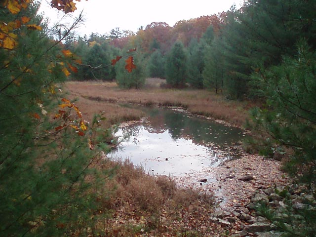
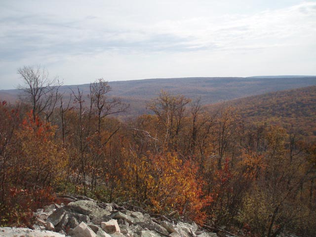
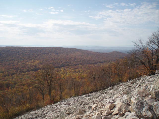
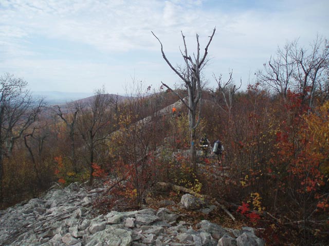
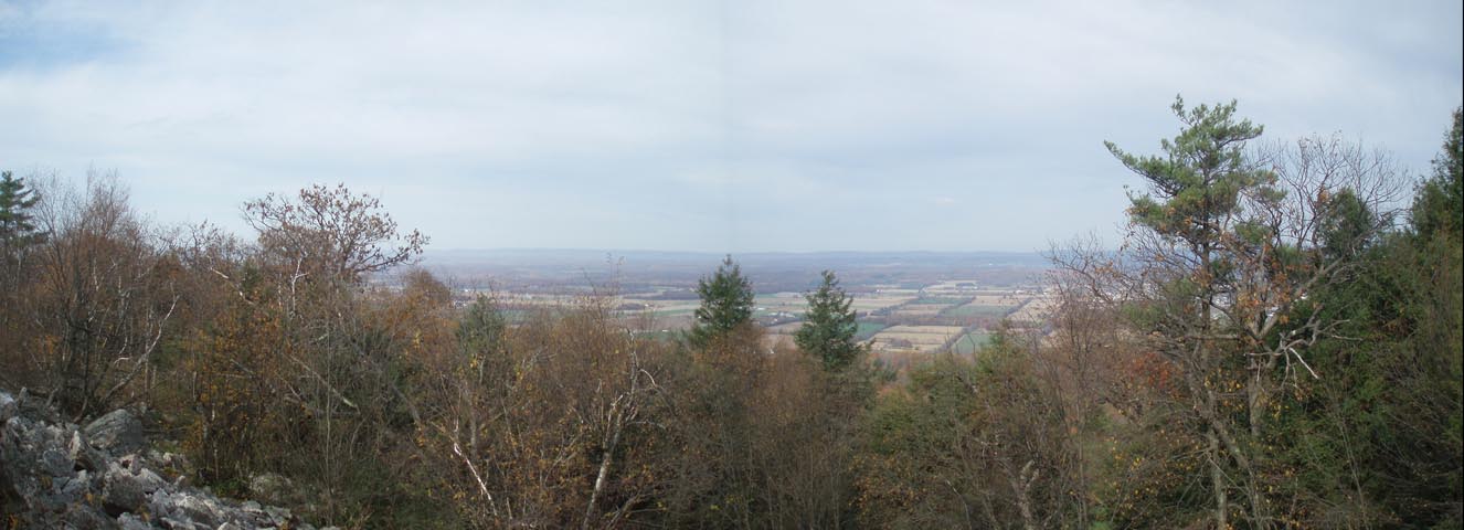
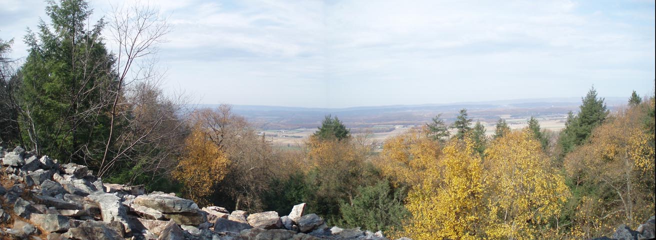
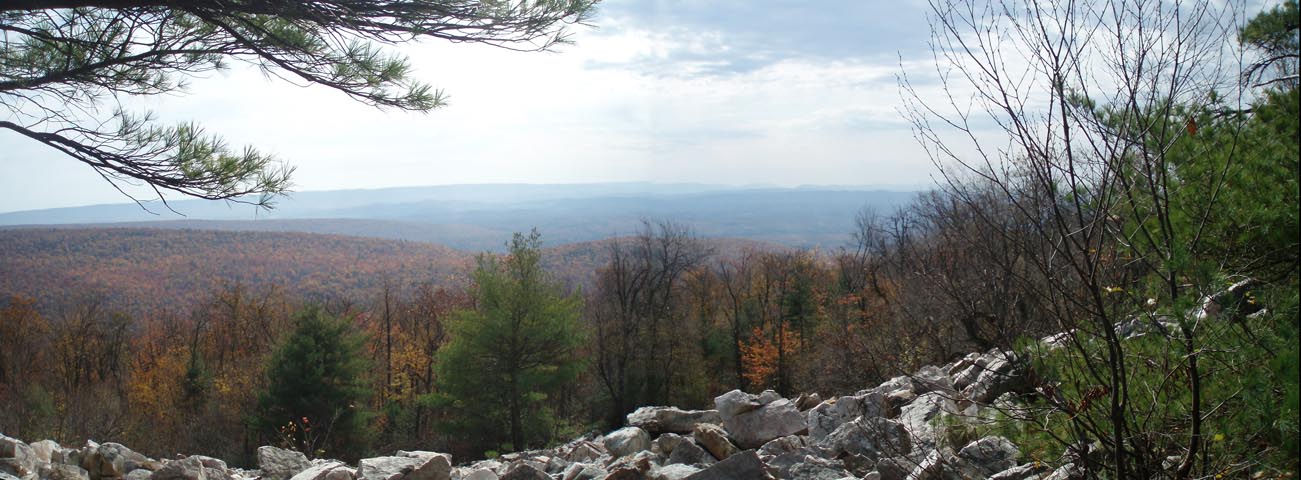
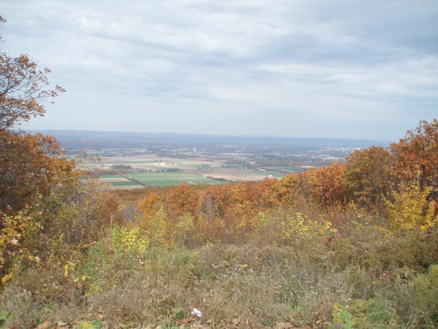
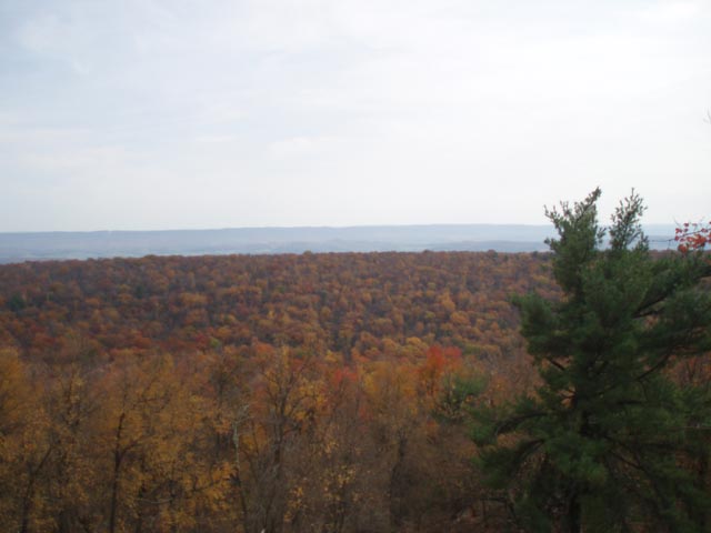
There is a great two level campsite above the Beaver Pond (actually an old mill pond) immediately to the right. We recommend stopping here for the night. If you wish to push on a little further or if that spot is taken potential campsites close to the creek are to the right as shown on the map. They are flat, large and open but they may not have fire rings. The MST continues up the valley for 1.59 miles after the last campsite, passing the front of a hunter�s cottage at one point. It then makes an abrupt left hand turn and climbs steeply up a rocky talus slope to the ridge of Tussey Mountain. Turn left onto the blue blazed Jackson Trail. Although the next 6 miles are virtually flat they are extremely rocky. The views, however, are among some of the best in PA. Some offer views both to the left and right of the trail. There are a lot more vistas than what is shown on the map. Take your time and enjoy them. Watch your footing! In 2.03 miles reach one of those double views. This one has a hidden, dry campsite nestled deep in the hemlocks. This would be a good place to watch the sun set and rise without changing your location. The trail improves into a jeep road shortly after this. In 0.61 miles from the campsite it becomes a comm. tower service road. In another 0.16 miles arrive at Rt26 and Jo Hay�s Vista. After taking in the view continue on the MST using the comm. tower service road. (A spur trail from the vista will lead you back to it.) The going is easy until you pass the last tower in another 0.37 miles but then the rocks return. In 0.40 miles cross a power line swath with a double view. The next 2.24 miles is similar to the Jackson Trail but perhaps not quite as bad. Enjoy several more views at every talus slope or rocky knob you cross. Turn left onto the yellow blazed Indian Steps Trail. You�ll drop about 500 feet over 0.35 miles. Cross Harrys Valley Road, joining the Crownover Trail. In another 0.28 miles there is a large, flat campsite on the left about 30 yards from the stream. It is the last campsite on water for the rest of the trek. Continuing on, cross Harrys Run and climb steeply up the north flank of Leading Ridge on the Crownover trail (still yellow). In 0.45 miles reach the crest of the ridge. The trail will make a 90 degree right turn and eventually turn into a nice jeep road. In 0.96 miles pass a small, dry trailside campsite. The best ridge top camping comes in another 0.41 miles. Turn left through the trees into an open meadow with a nice south-easterly view. The sunrise must be exceptionally nice from this vantage point. Somewhere along this ridge walk the road becomes the Iron Stone trail. The debarkation point is not signed and the blazes do not change to blue until you near the forest boundary with the S.V.R.A. The road eventually descends down the south flank of the ridge, bearing right at a fork in 1.72 miles from the last campsite. In another 0.19 miles exit the forest. Arrive at a gravel road in 0.28 more miles. Turn left onto it. In 0.34 miles, as you pass a stream gauge building on the left, turn right onto an old woods road in a forest of spruce, pine and larch. The pine needles will feel like a thick carpet on your feet after yesterday�s hike! In 0.78 miles cross the same gravel road you walked on earlier. Climb through a clear area that has recently been planted with pine. In 0.46 miles turn right onto a gravel turn around area and cross Charter Oak Road. Continue up the south entrance drive of the S.V.R.A. for 0.23 miles. Turn right onto a road blocked by a gate (the orange blazed Lake trail). Cross the dam and spillway and bear left, following a gravel/ asphalt trail through the cabin area (restrooms and hot showers for $1.00!!!) to your vehicles. ________________________________________
________________________________________
Name: Michelle Outing Critique: My husband and I hiked this as a 1-night backpack. We started out from the parking area at Lake Perez going the direction described in the trail notes. The trails within the S.V.R.A. were blazed with different symbols than described (I think it was yellow stick people instead of yellow arrows, or some thing like that) but were extremely easy to follow regardless. We decided to dry camp on the ridge of Tussey Mountain, at the site marked 2.03 miles into Jackson trail, to even out the mileage for each day. We planned to fill up on water from the stream before the climb, but it was either dry or farther from the trail than we thought. Luckily we came across a trickle, although our water pump broke and we had to carry dirty water to camp and boil it instead. The climb up to the ridge was very steep but not too long, and the ridge was extremely rocky, as advertised. I'm pretty sure we stayed at the camp site described as hidden in the hemlocks, but we also may have missed that particular site, because the one we found was definitely not hidden. There were 3 fire rings and multiple spots you could put a tent, but it looks like it is a popular teen/college hangout based on the trash, broken glass, and obvious cutting of standing trees for firewood--we were pretty close to Rte 26 so I think a lot of people just walk in from the road. There were a few potential spots we could have stopped prior to this, but not many due to the rocks. Even so, the camp location was amazing and we were able to see the sunset, stars, moon, and sunrise all from the pair of overlooks. There was a burn ban, so we brought our stove to the overlooks for dinner and breakfast with a view instead of cooking on the fire. On day 2 we completed the loop. The descent and ascent were, again, very steep but having rock and log steps helped. Overall, we had a fantastic trip--highly recommend this one! _______________________________________
Name: Ted E. Bear, Shortstack, Wooly Bully, ,com Hike: Iron Stone Loop Date(s): 10/11-13/14 Rating: 4.5
Critique: After watching the weather reports all week, it looked as if Accuweather was giving us a window of opportunity for this Columbus Day weekend hike to happen. Leaving from two locations in fairly heavy rain (Frederick and Timonium) at 8 AM we arrived at the "Day Use" parking area about within 5 minutes of each other at 11:15 to clearing skies. Finding our way around the lake without too much difficulty we arrived at the environmental center to screaming children having fun at a early Halloween party and were befuddled as to which way to go. After a ranger/employee pointed out the obvious retaining wall, we were on our way again only to miss the hard unmarked right before a residence and road. Back tracking and making an early turn, we had to backtrack some more before we found the missed unmarked start of the trail. (There were blue/yellow marks once you made the turn but not before.) All in all we lost about a half hour. The rest of day one was an uneventful nice walk in the woods with the exception of Ted E. Bear's realization that he left his much talked about (on the way up) Turkey sandwich in the car! Making do with an energy bar and knowing it was only 5 miles to the campsite no one perished that afternoon. As the 1st site mentioned was occupied by 6 college age folks we decided to go on and stayed at a somewhat abandoned campsite just off trail and across the stream from the hunters cabin about 3 PM. After setting up tents, and filtering water, the gathering of loose wood from around the site and rebuilding of the fire ring really spiffyed up the site. Other than the rocks the site was flat and soft. A blazing campfire and s'mores with good company made a cold night warm. Day two started by breaking camp at 8:45. Despite the cold and "sleeping in" til about 7 we all moved pretty fast after breakfast. The warm up mile and a half or so before the "big climb" of the day was appreciated. Up until then, the "PA rocks" weren't too bad. Steep as it was we all made it up without the use of ropes and after getting to the top and taking a needed break we took the hard left to the rocky and view filled Jackson trail. (Note: the color coding of the map to the trail color changes was helpful.) Several great vistas and two small rattlesnakes occupying our path (One rudely removed by Ted E.) later we came upon the crowds of Jo Hay's vista at Rt. 26. We were still one week prime of autumn foliage. (Note: none of us felt the trail was a "jeep road" prior to the obvious communication tower access road on both sides of 26.) We didn't count but there were over a half dozen of the ugly sky scratchers. The trail did get slightly less rocky (as advertised) as it turned back into the MST. As we got to Indian Steps and took a break before the long decent there was a group of about 20 just starting to come to the top from a hiking club out of Altoona. They were doing some kind of loop or shuttle thing which didn't seem well planned based on the conversation with the individual we talked to, but he was not the one in charge. The one in charged seemed to be wanting to "hurry" the folks up the hill. (Ha Ha) After breaking for over 20 minutes we decided to pass the rest of this group "on the fly" as we descended the bugger. Everyone had aches in either toes, calves, or thighs or some combination, but no one fell! We chose the 2nd campsite on the left after the decent and road just before our nicely flowing stream water source. Another nice evening with fire and the last of the s'mores and not quite as cold. Day 3 started overcast with low lying clouds making it dark, but for the second morning no dew as well surprisingly. We were on our way by 8:45 again and refreshed by the night's sleep and good breakfasts we all made it up the steep hill in 10 minutes! The rest of the morning was pleasant with clouds getting darker but this seemed to bring out the fall colors more especially on this "jeep road" section. All trail intersections were obvious or clearly marked and color coded. We arrived at our cars before noon, cleaned up or took advantage of the $1.00 shower and headed to a ranger recommended BQ place not far from the park. Unfortunately we found it was closed on Mondays. Splitting back into the East and West group, the West group found a good lunch at Boxer's Cafe in Huntingdon, PA and the East group found lunch at a local grocery store/sandwhich shop with indoor seating about 5 minutes from the BQ on 26. (Sorry we forgot the name.) Leaving our lunch spots the rain started which bookended our near perfect trip. All had a great time. ________________________________________ |
|
|