|
Iron Horse Trail |
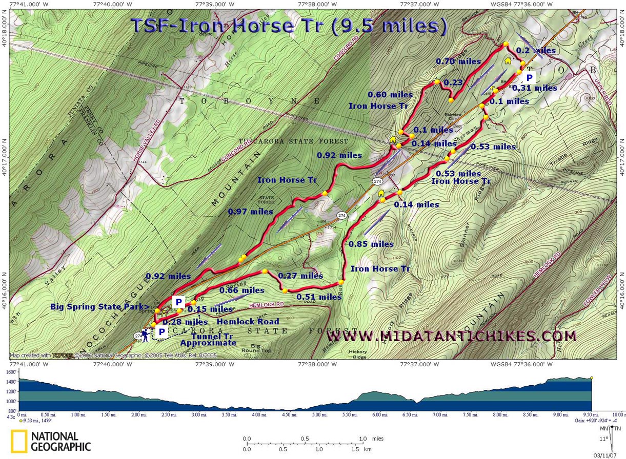
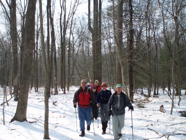
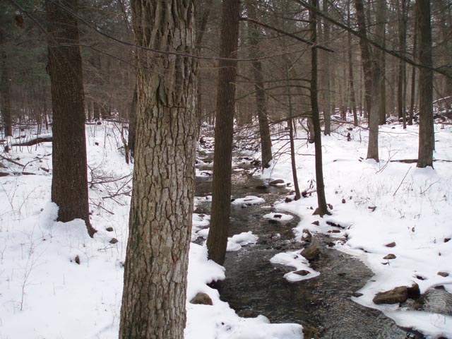
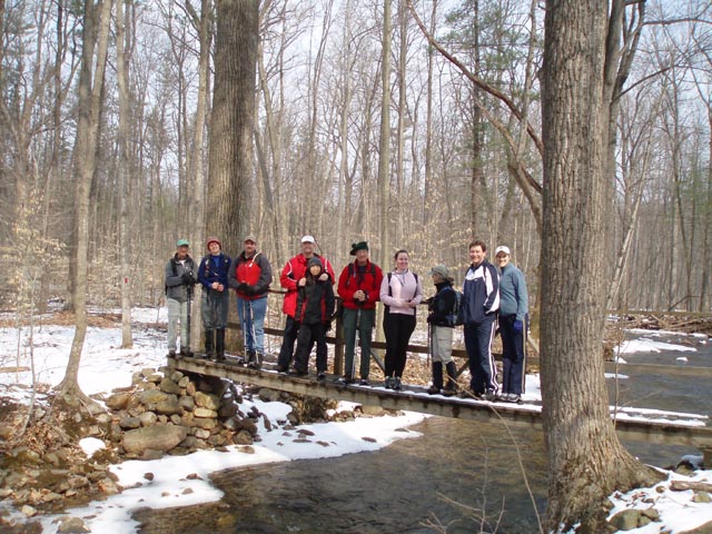
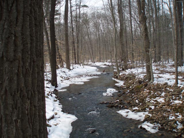
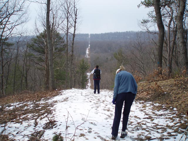
| Description: This is a moderate 9.5 mile circuit beginning at Big Spring SP/Picnic Area. The main treadway is composed old railroad grades. On the east side of PA Rt 274 is the Perry Lumber Railroad. On the west side of the road is the Path Valley Railroad. The grades themselves decrease and increase in elevation quite gradually. At times however, you are forced to surrender the grade to avoid some eroded conditions or private in-holdings. Some steep but short climbs are involved to accomplish this. A fair portion of the Perry Lumber RR grade still has the ballast and, as such, is a bit rocky. You cross and parallel several streams and Sherman Creek along this segment of the hike. All stream crossings are bridged. Most of the ballast had been removed from the Path Valley grade after it was closed. Short sections of the trail closely parallel the road on either side. One such section between the Epy's cemetery and the turn around point is overgrown with thorns. There are also 2 small clear cut areas you have to hike by. Despite these detractions this is still a pretty nice walk in the woods. |
|
There is a short 1
mile loop to a failed tunnel should you want to lengthen
your trip.
Almost immediately after turning onto Hemlock Road turn left into the signed trailhead for the Iron Horse and Tunnel trails. If Hemlock Rd is snow covered continue a few yards north on PA Rt 274 and turn right into the Big Spring SP Picnic Area. ______________________________________ |
|
Zipped National Geographic. TOPO! GPS and Universal GPX Files |
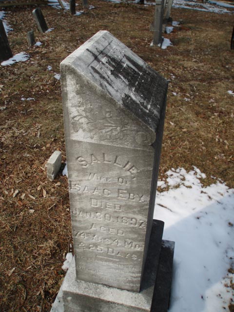
Trail Notes: From the kiosk head north-east on the dual blazed Tunnel/Iron Horse Tr (red and blue). It is lined in stones. In a short distance the red return leg of the Iron Horse Trail comes in from the left. Continue to the right. In 0.28 miles the trail goes around a large picnic pavilion and then passes an old water fountain. In another 0.15 miles the blue blazed tunnel trail leaves to the right. Continue straight on the red blazed Iron Horse Tr and cross Big Spring Run. In 0.66 miles cross Big Spring Run again and leave the RR grade on a footpath to the right. Climb gradually and in another 0.27 miles cross an old woods road. In another 0.51 miles descend and cross Hemlock Run. Follow Hemlock Run and rejoin the RR grade at its confluence with Big Spring Run to form Sherman Creek. There's a few spots where the trail leaves the RR grade because of erosion so keep an eye out for logs blocking the grade and detours marked with red blazes. At 0.85 miles from crossing Hemlock Run pass a hunters cabin on the right. Please stay on the trail. In another 0.14 miles cross a gravel road. In another 0.53 miles cross over 2 pipeline swaths and in another 0.53 miles turn left onto a gravel/dirt road, following it almost to PA Rt 274. Just before reaching the road the trail turns right onto a footpath. In 0.1 miles cross the road and visit the Epy cemetery. The trail continues to the right of the grave yard. The first couple hundred yards are quite thorny but soon clears up when you reach a pine grove. |
|
Turn left onto a gravel road. soon pass a clear cut on the right and a very large hunter's cabin on the left. In 0.2 miles from turning onto the road turn left onto a footpath (the Path Valley RR grade). This is just before a left hand bend in the gravel road. In 0.7 miles turn right off of the RR grade and climb steeply to the top of a ridge. Note the Private Property postings and white blazes marking the boundary to the left of the trail. At the top (0.23 miles from leaving the RR grade) turn left onto a gravel road and climb gradually to the high point of the ridge. Here you will pass to the right of a second clear cut area. In 0.6 miles from where you turned onto the gravel road reach a pipeline swath. Turn left onto it but in less than 0.1 miles turn right to regain the RR grade. In 0.14 miles cross a small stream and a driveway to a cabin on your right. Climb again to regain the RR grade. There is an unmarked trail that goes off to the right once you reach the top but I don't know where it leads. The next 2 miles are almost entirely on the RR grade. You'll cross a snowmobile/woods road near the halfway point (0.92 miles). In another 0.97 miles you'll join an old woods road but only for a few yards before turning left and picking up the grade again. For the next 0.92 miles the trail closely parallels the road. The last 200 yards of the trail are so close to the road that I recommend crossing the road And walking through the picnic area. The last few yards of the trail are lined with rocks as it passes through a pavilion area.
Printable/Downloadable Directions and Trail Notes ______________________________________
______________________________________
Name: Karen
Hike: Iron Horse Trail, PA ______________________________________
Name: Alia
Hike: Ironhorse Trail 2 comments from hiking the trail anti-clockwise: 2 main areas need better trail markings: where the trail continues after Epy's cemetery as well as as the section of the trail that goes on the dirt road where it seemed part of the old trail has become private property. It looked like the trail has been maintained as we did not have problem with overgrown bushes. ______________________________________
Name: Barry
Wolfe
Hike: Iron Horse Trail ______________________________________
Name: Terri G.
Hike: Iron Horse Trail ______________________________________
Name: Matt
Culbertson
Hike: Iron Horse Trail ______________________________________
Name: PP
Hike: Iron Horse Trail ______________________________________ |
|
|