|
Piney Ridge - Piney Branch Loop
|
|
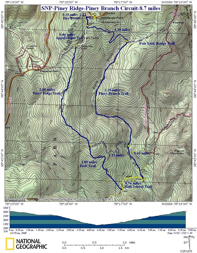
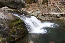
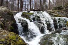
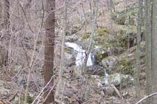
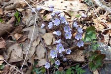
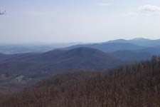
Description: This is an 8.7 mile moderate circuit hike having a little of everything the Shenandoah has to offer: ridge lines, a view, rock outcrops and lots of waterfalls and rapids. The first 4 miles is a brisk walk down Piney Ridge followed by an equivalent amount of walking along Piney Branch. At first, Piney Branch Trail zig-zags through a flat rocky area only occasionally following the stream. After climbing up a series of switchbacks the scenery suddenly changes. The valley narrows and for nearly 2 miles you pass waterfall after waterfall, some at eye level, others 50+ feet below you. Most require some degree of bushwhacking in order to explore them close-up. Except for one short section of trail the climb out of valley is relatively gradual. There are 4 stream crossings in all. The lower two may pose some degree of difficulty during periods of high water.
The hike starts at the Piney Branch Trail kiosk near a maintenance building. The driveway is not marked but obvious.
|
| _______________________________________ |
|
Trail
Notes: From the parking area find
the bulletin board and trail post for Piney Branch Trail between the
parking area and
Follow the AT to the
For the next 3.7 miles the walk is all downhill. At 2.0 miles from the last trail junction pass the Dwyer graveyard on the right marked by a cairn and then the junction with the blue-blazed Fork Trail. Piney Ridge Trail goes to the left. To shorten the hike by 1.1 miles and miss the lower 2 stream crossings turn left here and pick up the directions later. Otherwise continue straight onto Fork Trail.
Continuing on Fork Trail
for 1.09 miles, come to the junction of yellow-blazed Hull School
Trail. Turn left, following it down to Piney Run where you'll make
your first crossing. Turn left, walking upstream. For a short
distance
Re-cross Piney Branch and
in 0.67 miles from the last trail intersection pass blue-blazed
Piney Ridge Trail on the left.
In about a half of a mile the valley will narrow and you'll have to negotiate a series of switchbacks taking you high above the stream. Soon after this the views begin as stream climbs swiftly to meet you. |
|
None of
the falls or rapids are right on the trail but a few are easy enough
to bushwhack to. Others are harder to reach.
Dip down and cross Piney
Branch for the last time. A couple of nice long switchbacks will
help you almost to the top of the ridge. The last 0.5 miles will be
a straight climb, crossing what appears to be a trail, but is
actually the route of some survey posts, and the AT before reaching
the parking lot and your vehicle.
Critique this outing! _______________________________________
_______________________________________
Name: Tom Hike: Piney Ridge-Piney Branch Loop Date: 08/30/13 Rating: 5
Critique: I made a two day hike out of this. Started on Skyline Drive; hiked down Piney Ridge Trail, taking a left on the trail at the intersection with Fork Trail, and continued on Pine Ridge to the Hull School Trail, where I crossed the stream and camped for the night. The next morning I continued west on Hull School Trail, right on the Fork Trail, and hiked back to Skyline Drive on Piney Ridge. The 1.11 stretch of Piney Ridge to Piney Branch is very steep, with a lot of switchbacks. Suggest going downhill on this stretch, not uphill. Saw a black bear in this area. There is a good camping spot at the intersection of Hull School Trail and Piney Branch, just on the west side of the stream, far enough away from trail to be hidden. Only ran into two groups the entire hike. Overall, it is one of the lesser used routes in the northern section of SNP.
_______________________________________
Name:
Dave
Hike: Piney Ridge - Piney Branch Loop
_______________________________________
Name: XXXX Hike: Piney Ridge - Piney Branch Loop Date:
02/04/2012
Rating: 4 _______________________________________ Name: Chris Uttenweiler
Hike: Piney Ridge - Piney Branch Loop _______________________________________ Name: Michael Eckert
Hike: Piney Ridge-Piney Branch Loop _______________________________________ Name: Charlie
Hike: Piney Ridge - Piney Branch Loop _______________________________________ Name: Liz Hester
Hike: Piney Ridge/Branch Loop _______________________________________ name: Tony
Hike Date: 3/29/2003 Ranking:
3 _______________________________________ |
|
|