|
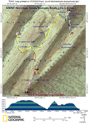
Strickler Knob-Duncan Knob Loop
|
|
|
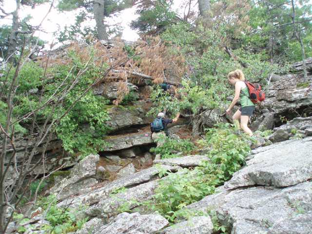
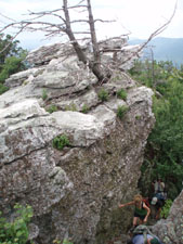
Description: This is a pretty strenuous 10.1 mile circuit including two of the best vistas on Massanutten Mountain. For the longest time the hike out to Strickler knob was considered a bushwhack around, over and through the rocky ridge of Middle Mountain. Recently a crew has gone in and blazed a trail to the end of the knob. It can still be considered a bushwhack. It�s just harder to get lost now. On the other hand, Duncan Knob is a steep 200 foot high pile of rocks with some small trees on the top. You can attempt both or one or the other. Whatever you do bring sturdy hiking boots. Google Custom Driving Directions Note: The last turn off of U.S. 211 is signed Crismon Hollow Road. This road is often closed in the winter. |
|
________________________________________ |
|
Zipped National Geographic. TOPO! GPS and Universal GPX Files |
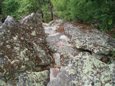
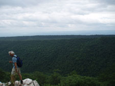
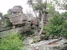
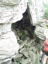
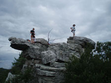
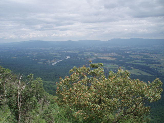
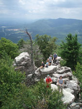
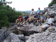
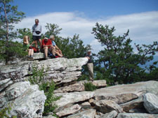
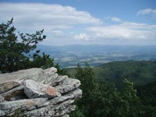
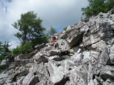
Trail Notes: From the parking area walk down the gravel road, cross a stream and walk around a forest gate. Climb the yellow blazed Scothorn Gap Trail, steeply at times, for 1.39 miles to the junction with the orange blazed Massanutten Trail (straight ahead and to the right. Scothorn trail continues to the left.). Continue straight on the Massanutten Trail for 0.67 more miles to the junction of the pink blazed (no sign) Strickler Knob Trail. (There is a view of the Shenandoah valley and National Park to the left on top of a small rock outcrop.) Turn right onto the Strickler Knob Trail and weave in and out of the rocks for 0.75 miles. A little hand over hand work will be required to reach the highest point.
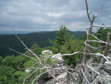
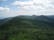
After taking in the view retrace your steps to the Massanutten Trail. Turn right and descend for 2.09 miles, passing through an area devastated by the Cardinal Forest Fire in 2007, to the junction with blue blazed Gap Run Trail on the left (No sign but blazed. If you turn right here and cross the stream you�ll find a nice campsite immediately on the left.) Turn left on the blue trail and climb steeply to the Peach Orchard in 0.72 more miles. There is a nice but dry campsite on the left. Turn right on the white blazed Duncan Knob Trail. In 0.2 miles arrive at the base of the knob. Climb to the top for unrestricted views of the area.
Return to the Gap Run Trail and turn right. Descend for 0.26 miles and turn left on the yellow blazed Scothorn Gap Trail (No sign but blazed). The trail climbs very gradually for 1.57 miles to the first junction with the orange Maasanutten Trail you hiked to at the beginning of your hike. Turn right to stay on the Scothorn Gap Trail and descend 1.39 miles back to your vehicle.
|
|
________________________________________
________________________________________ Outing Critiques
Name: The Tick
Hike: Duncan Knob/ Strickler Knob ________________________________________
Name: Robyn Hike: Duncan Knob Circuit Hike ________________________________________ Name: Cham Green Hike: Duncan Knob
Date: 11/11-12 Rating: 4 ________________________________________ |
|
|