|
Canaan Mountain Backpack
|
|
Description: This is a moderate 23 mile backpack trip using
many of the primary Park and
Some notes here: 1) The
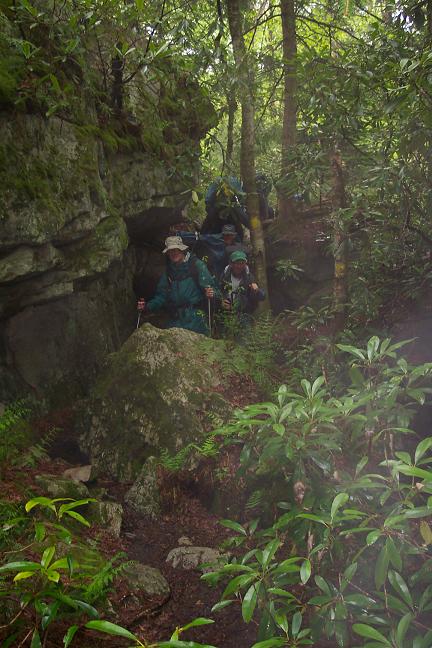
North section of Lindy Run Trail used in this hike has been
officially abandoned by the
o |
|
Follow signs to the Blackwater Falls Lodge. The park requests that you leave the names of the participants, vehicle descriptions and tag numbers and emergency contact numbers with the receptionist before starting the hike. ________________________________________ |
View 3-D Map of the entire hike Zipped National Geographic. TOPO! GPS and Universal GPX Files |
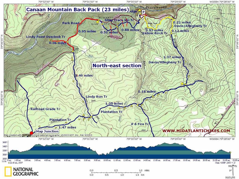
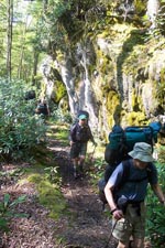
Trail Notes: From the lodge parking lot walk out to the sign at its main entrance. Across the road find a sign for Yellow Birch Trail (yellow blazes). Follow it for 0.93 miles to its intersection with the stable drive. The official route of the Allegheny Trail is up the drive, through the stable gate and left on a wide trail. A route more agreeable to one�s olfactory nerves is to cross the drive, remaining on Yellow Birch Trail. At this point you are actually also on Allegheny Trail-southbound. Cross Engine Run on a wooden bridge and soon arrive at a wide, unsigned or blazed trail. (This used to be a section of the Davis Trail. Its official trailhead has been moved further south at the park/MNF border on the Allegheny Trail.) Turn right here and merge onto the official Allegheny trail. There will be peat bogs to your left.
In 0.3 miles leave the park and enter MNF. Stay straight on the Allegheny Trail. This is the official trailhead of the Davis Trail. Both it and the Allegheny Trail share the same tread through the Canaan Mt area.
Soon cross Engine Run on a foot bridge. The trail turns left and follows the drainage for a while. Over the last 0.3 miles or so the trail veers away to the right of the stream and ascends through a series of steep but quick climbs. At 1.37 miles from leaving the park boundary arrive at a wide, flat rocky area with a shelter on your right. In 70 yards reach the intersection with blue blazed Plantation Trail.
Turn right on the Plantation
Trail and cross the west fork of Engine Run. In 1.18 miles from the
last trail junction pass
Cross two forks of Lindy Run and climb a short hill. On the right is a meadow filled with Hay Scented Fern suitable for several tents. There is a fire ring in the middle. This is where I camp on night two of the trip. There are several spots along this segment of Plantation Trail under the bows of giant Hemlocks that would make great campsites but they are dry. If you intend to use them �water up� at the last Lindy Run crossing.
At about 1.47 miles from leaving Lindy Run reach the
difficult-to-recognize juncture with unsigned Railroad Grade Trail.
Stop here and study the trails. For about 30 yards both trails share
the same tread. The Railroad Grade Trail bears slightly to the left
through a trough and has a blue diamond blaze in eye sight while the
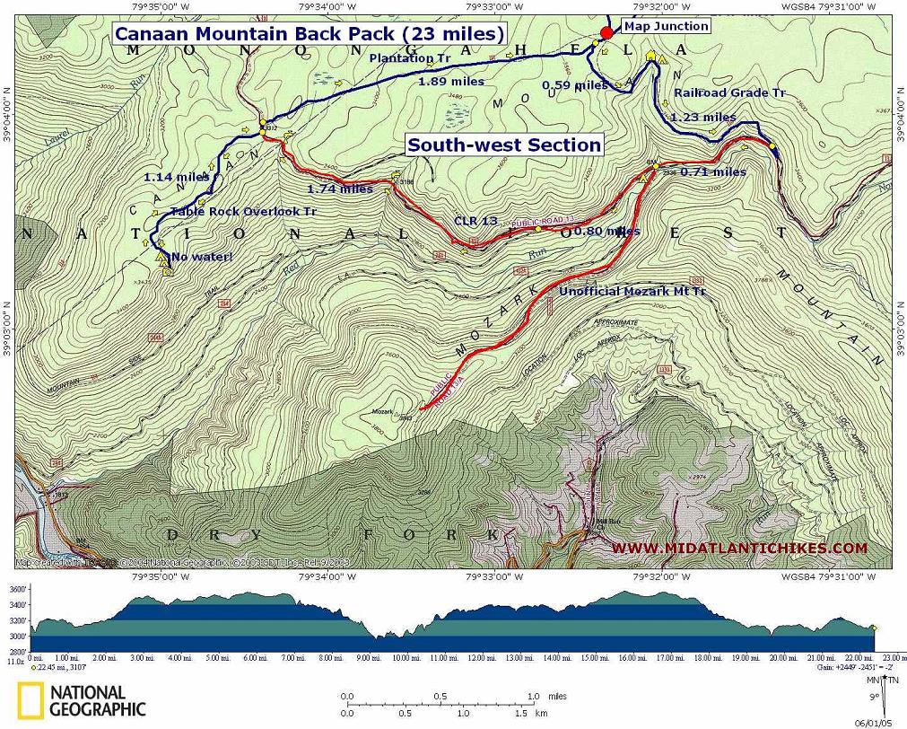
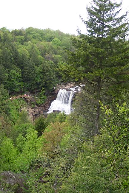
The Railroad Grade Trail first goes directly up the trough and then follows the right berm for a bit before crossing over to the left berm. Eventually the grade rises to follow the valley wall along a trail softened by Hemlock and Spruce needles. In 0.59 miles from the last trail intersection cross a stream and arrive at a large shelter. There are campsites on the hill behind it. This is a great spot for the first night�s camp.
|
|
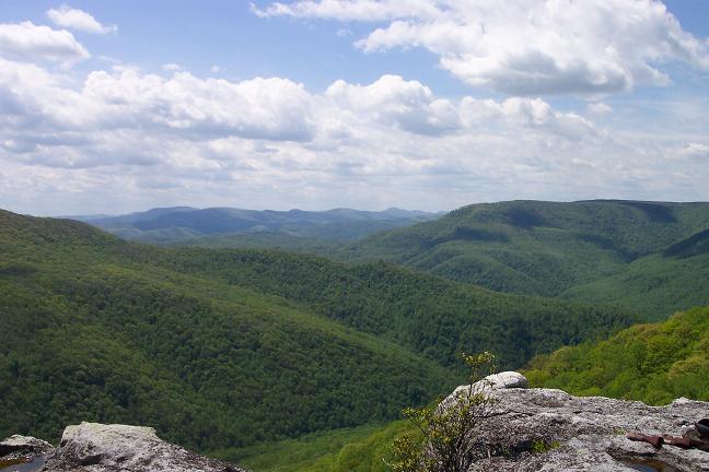
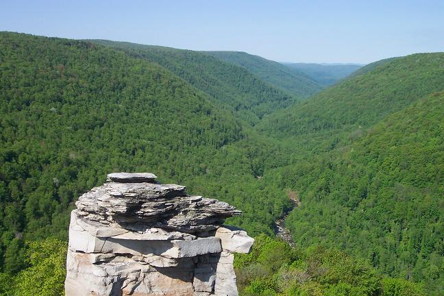
From there it is a pleasant 1.23 mile jaunt out to
Turn left onto Table Rock Trail. Near the top of the slope the pace becomes slower as you negotiate a series of seeps. As you reach the end, the trail splits. A lesser view is to the left. Bear right, passing through a nice but dry campsite, to see the real views. This is a great place to spend a night if you lug up some extra water!
Retrace your steps to
From the campsite re-cross
the 2 forks of Lindy Run and continue to the intersection with Lindy
Run Tr. The sign here states that
Turn right onto
Return to
Cross the intersection of
Once again cross Red
Spruce Trail and then orange blazed Balanced Rock Trail (shown red
on the map). In 0.88 miles from the cabin road arrive at the west
entrance to the Lodge and your vehicle. Printable/Downloadable Directions and Trail Notes ________________________________________
________________________________________
Name: Richard Hike: Canaan Mountain Loop Date: 07/04/14 Rating: 3
Critique: 4 stars for solitude minus a star for trail conditions and less interesting stretches on the road. In mid summer the seeps and mud holes might be fun for the mountain bikers but can lead to blistered feet. Many overgrown spots on these trails, but overall not hard to follow despite minimal markings. One clarification - the campsite near the fork of Lindy Run on Plantation trail is only about 80-100 yards from the stream still at the base of the hill. The directions to climb up a short hill confused us and we passed the site multiple times. The ferns had grown over most of the meadow and obscured the fire ring and rock furniture so it was hardly recognizable as a camp site. Very nice site once there. Would be interested to see if conditions are more favorable in fall and winter. ________________________________________
Name: Rexpit
Hike: Canaan valley loop/24 mile ________________________________________ |
|
|