|
Pinnacle Picnic Area to Beahms Gap Shuttle |
|
|
Google Custom Directions to Beahms Gap Overlook Car Drop-off Google Custom Directions to the Pinnacle Picnic Area Start Point |
______________________________________ |
Zipped National Geographic. TOPO! GPS and Universal GPX Files |
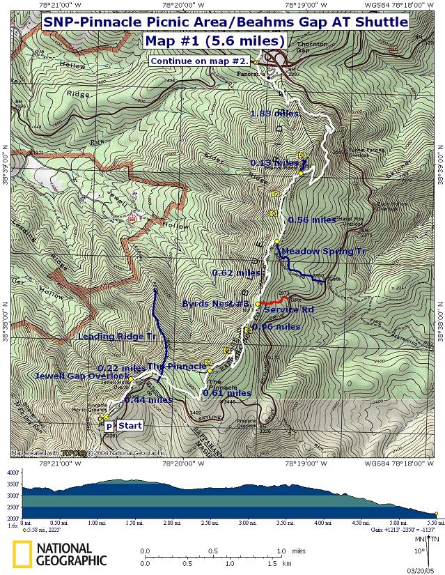
Trail Notes (Map #1): From the main bathrooms locate the white blazes on the trees to their right. Follow the AT as it parallels the driveway. At one point the trail comes out onto the lawn at a sign with distances indicated for the Pinnacle, etc. From there the trail bears left into the woods for a bit. Shortly come to a sketchy spur trail to the right that leads to Jewell Gap Overlook. Turn left staying on the AT.
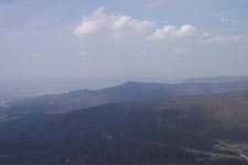
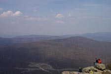
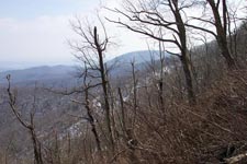
The AT will switchback and continue north under the overlook (0.43 miles from the start). Begin to climb passing the junction of blue blazed Leading Ridge Tr in another 0.22 miles. The trail will be straight and gradual for a while. As you near the top it will become steeper and weave in and out of rock formations. At 0.59 miles from the last trail junction arrive at a fantastic overlook with views to the south, west and north.
Descend down to a sag in the ridge via a series of
switchbacks. The first couple are short and steep. The last two are
quite long and gradual. 0.98 miles from the overlook finds you at
Byrds Nest #3, a day use only shelter. This is a good break spot.
Partial views east of the
Continue north soon coming to a concrete post marking a
spring (and a service road that leads to
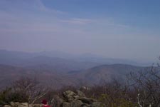
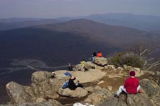
Start to climb here and in another 0.62 miles arrive at the junction of the blue blazed spur trail to the left that leads to Mary�s Rock. You�ll actually walk behind Mary�s Rock just before the concrete post. Turn left and in 0.1 miles arrive at the summit of Mary�s Rock. After enjoying the view retrace your steps back to the last trail post and take the left fork onto the AT. Descend to Thornton Gap, arriving at U.S. 211 at 1.83 miles from the last trail junction.
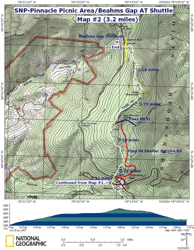
Trail Notes (Map#2): Cross U.S. 211 and
continue on the AT. In about 0.1 miles cross Skyline drive on a
cross walk. Pass a yellow forest gate, walk a few yards up the
Continue north. In another 0.39 miles you will temporarily join up with the service road but only for a few steps. Turn left onto a grassy footpath. In 0.79 miles come to the junction with blue blazed Pass Mt Trail. Stay straight on the AT. You�ll walk through a nice White Pine plantation along this stretch.
In 0.73 miles reach the summit of
From there descend quickly for 1.18 miles
to
|
|
________________________________________
________________________________________ |
|
|