|
Hazel Mountain Loop |
Description: This is a strenuous 10.4 mile loop
through the heart of what is known as Hazel Mountain Country. It was
the last heavily settled area before it became part of the
This all comes at some costs. There is a total elevation gain
of over 2100 feet for the entire circuit. At one point you�ll climb
over 500 feet in less than 0.5 miles only to find three more false
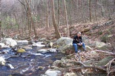
summits before you. There are 5 crossings of
|
|
Finally, if one can find ample parking on Rt600 at the southeastern end of the hike, where Sam�s Ridge Tr and the Hazel River Trail come together you can knock 3.2 miles off of the loop. I would still do the loop in a counter-clockwise fashion. The climb up Sam�s Ridge is quite steep from that end.
_______________________________________________
|
Zipped National Geographic. TOPO! GPS and Universal GPX Files |
Trail Notes: All trails are blazed yellow or
blue. Every trail junction is clearly marked with a SNP concrete
post. The
Descend from the lot and immediately pass the junction of
blue blazed Buck Hollow Trail on the left.
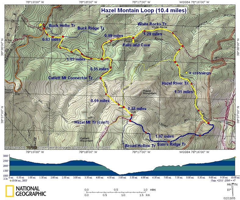
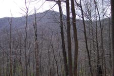
For about 0.69 miles you will climb steadily and pass yellow blazed Hazel River Trail on the left. In another 0.18 miles Hazel Mt Rd/Tr bears right (The red trail laid in by National Geographic is incorrectly located). Bear left onto blue blazed Sam�s Ridge Trail here. Soon pass blue blazed Broad Hollow Trail on the right. Along this portion of the hike you should get some nice views north and east.
At 1.97 miles from leaving Hazel Mt Rd/Tr you�ll descend steeply to the yellow blazed Hazel River Trail. This junction is almost exactly at the mid-point of this trek and makes a great lunch spot.
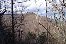
After lunch, head upstream along the Hazel River Trail for 1.31 miles. You will cross it five times. Immediately after the fourth crossing the Hazel River Trail will bear left at a concrete post and climb a hill.
|
|
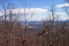
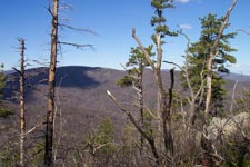
Stay straight, now on yellow blazed White rocks trail and cross a small tributary and the main river for the fifth and final time. From here climb steeply for about 0.5 miles gaining 500 feet in elevation. The trail will make a hard left turn and climb over a series of false summits. Keep an eye out for a
faint, unmarked spur trail to the left at the top of one of these
summits. This supposedly takes you to White Rocks and a view of the
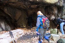
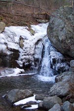
At 1.29 miles from leaving the river arrive at a concrete post marking the spur trail to the falls and cave on the left. It�s 0.2 miles to the falls and cave, most of which is straight down. At the bottom make a sharp right and follow the rock outcrops back to the cave and falls.
Return to the ridge and turn left to continue on White
Rocks Trail. In about a mile reach the original junction with Hazel
Mountain Rd/Tr. Turn right here and retrace the first 1.6 miles of
the trek back to the parking lot. Printable/Downloadable directions and Trail Notes
_______________________________________________
________________________________________
Name: Randi
Hike: Hazel Mountain Loop
________________________________________
Name: Ronald Gross
Hike:
Hazel Mtn. Loop
________________________________________ name: Tony Hike date: 02/12/2024Ranking: 3 comment: Hard long hike that starts from Skyline Drive and descends to the valley floor before looping back for a very steep ascent. The waterfall at the top of Hazel Mountain is the main highlight.
________________________________________
name: Lori Hike date: 02/12/2024 comment: Great hike! Lots of great views, stream crossings, some tough patches (steep) but all worth the effort. The waterfall and cave towards the end were really the icing on the cake. ________________________________________ |
|
|