
|
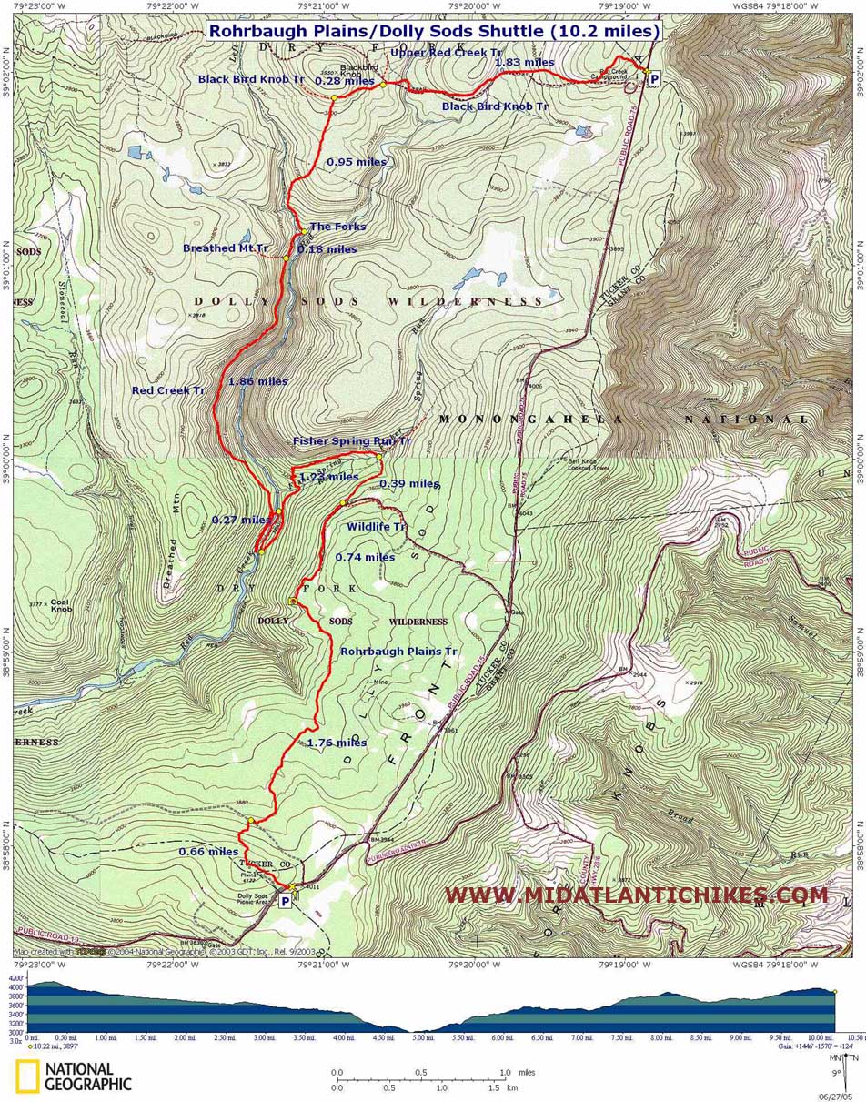
Rohrbaugh Plains/Dolly Sods Shuttle
|
|
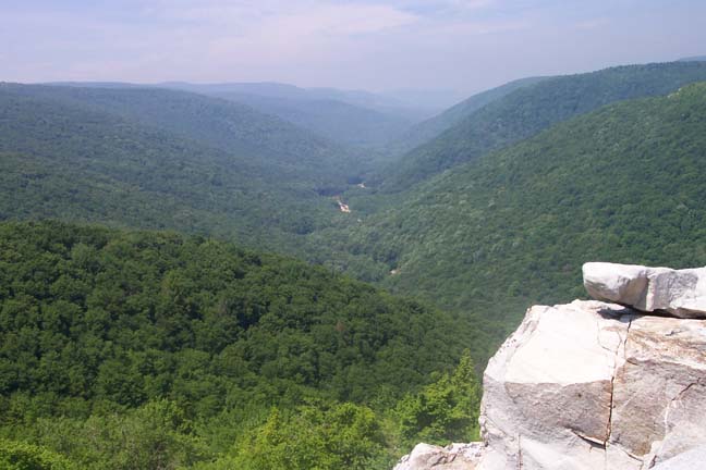
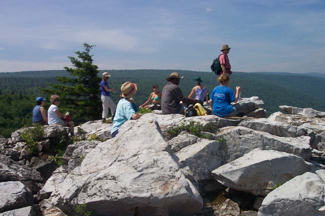
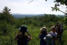
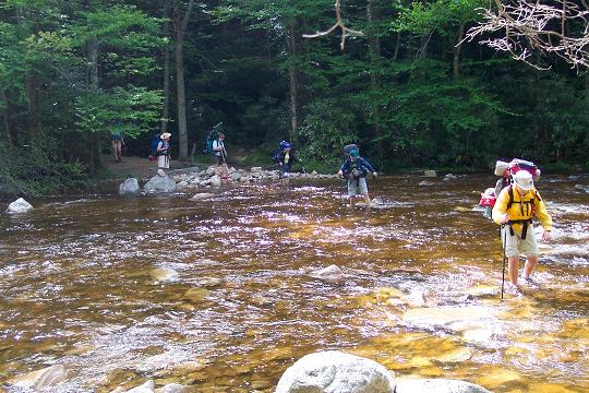
Description: This is a 10 mile moderate shuttle hike through some of the best that Dolly Sods has to offer: a mixture of deciduous and evergreen forests, a breathtaking view of Red Creek Valley, open meadows and heath bogs, thickets of wild flowers, swimming holes, Rhododendron and ferns and waterfalls. There are 5 water crossings. One Red Creek crossing is quite wide and can be deep at times. Here's a photo. Water levels can be at the boot tops to butt high depending on the season and the latest heavy precipitation.Since this is probably the widest part of Red Creek the overall velocity of the water is greatly reduced and will be lower than at other narrower parts of the creek.
The hike starts across FR19 from the Dolly Sods Picnic Area.
Google Custom Directions |
|
________________________________________ |
Zipped National Geographic. TOPO! GPS and Universal GPX Files |
Trail
Notes: Because of it�s wilderness designation all trail signs had
been removed but in recent years the forest service realized that
less damage was done to this fragile area when the trail
intersections were posted. The signs have returned. Still take care
as signs are often destroyed by bears, hunters and deer in rut. Some
intersections are also marked by
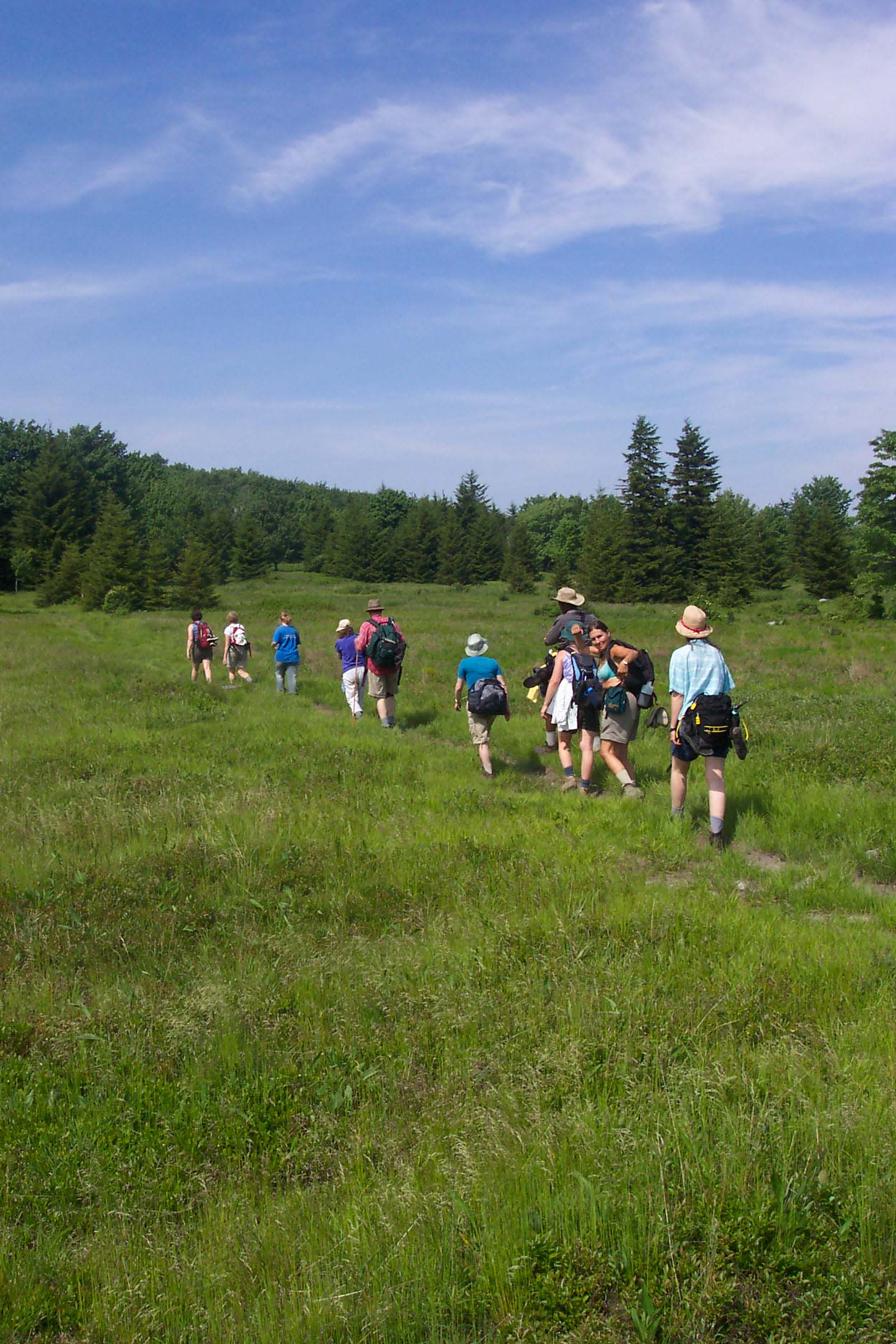
Starting at the parking area cross the forest road and look for a narrow footpath in the trees. A few yard into the woods you�ll see a forest kiosk. This is the Rohrbaugh Plains trailhead. First climb and then descend a small hill. Cross an old woods road at 0.49 miles. You�ll cross a couple of small part-time streams and pass through a beautiful fern meadow. Little side trails will go off in every direction but the main trail should be pretty obvious.
Come
to �The Un-named
The
footpath will turn into an old woods road as it enters a hardwood
forest. At 0.75 miles from the overlook watch for
Fisher Spring Run Trail will descend a bit and then switchback sharply, crossing Fisher Spring Run and ending at Red Creek Trail in 0.93 miles from the last trail junction. (Just before coming to Red Creek Tr there is an unmarked trail on the right that descends to a railroad grade that follows Red creek with several good camping spots. Explore it if you wish. Going upstream on the grade takes you to Fisher Spring Run�s |
|
confluence with Red Creek. A nice water fall further upstream can be seen from here. Going down stream takes you past the lunch spot waterfall and more good camp sites, finally arriving at the Red Creek ford you�ll use after lunch.) If you did not partake in the above adventure turn right onto Red Creek Trail at that junction and descend to the creek.
Turn up stream on one of a couple of unmarked paths and find your way to the railroad grade that follows the creek. In less than 0.25 miles arrive at the lunch spot waterfalls. This falls can range in ferocity from a mere trickle to a rapid on a #1 kayak run. (See photos linked to other Dolly Sods hikes described on this site.)
After
lunch and a refreshing dip/soak return to the ford (at a 3 foot tall
narrow stump and usually marked with
The
next part is probably the hardest. After the ford turn right onto
the continuation of Red Creek Trail. Climb up the side of
In
1.49 miles from the Rocky Point Trail pass Breathed Mountain Trail
on the left and soon arrive at the Forks of Red Creek. I�m sure the
falls, swimming hole and scenery will be quite compelling. Take a
break and explore this wonderful area. Once you�re ready to travel
again, cross the left fork of Red Creek. The trail will follow the
north bank a few yards upstream before turning right and climbing up
to an open meadow and the scenery that Dolly Sods has become famous
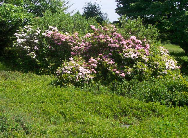
for: open grassy meadows, dispersed clumps of Red Spruce taking back
the land, Blue Berry and Huckleberry bogs and
Near
the crest of the hill re-enter the woods and in 0.93 miles from �the
Forks� arrive at the junction of Black Bird Knob Trail. Turn right
here and in about 0.42 miles pass newly signed Upper Red Creek Trail
on the left. Descend to and cross Red Creek at the island. You�ll
cross another stream and weave in and out of Red Spruce forest and
open tundra-like plains with azalea, berry bushes, wild flowers and
exposed rock; scenery more common in the Canada Shield. Take note
that parts of the trail along this last stretch can be quite muddy
and nearly impossible to avoid. Attempts to fill in the wet areas
with rocks and logs have proved fruitless. The mud is so relentless.
We refer to it as Dolly Sods Peas Soup! Thankfully this mess soon
gives way to a boardwalk that soon delivers you to your awaiting
vehicles! Printable/Downloadable Directions and Trail Notes ________________________________________
________________________________________
Name: Tristan (Adirondackiteer)
Hike: Dolly Sods Wilderness Via Rohrbaugh _______________________________________
Name: Mark
Hike: Rohrbaugh Plains/Dolly Sods Shuttle _______________________________________
Name: crazyone
Hike:
Rohrbaugh Plains/Dolly Sods Shuttle ________________________________________ |
|
|