|
Long Mountain/Tibbet Knob Shuttle |
|
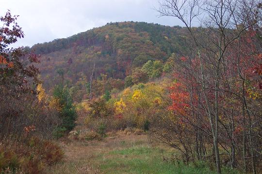
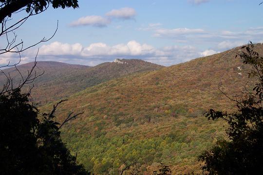
Description: This is a 13.3 mile strenuous shuttle hike in the George Washington National Forest. If you�ve hiked up to either Big Schloss or Halfmoon Lookout you�ve seen Long Mountain and Tibbet Knob. After hiking this one you�ll have viewed Trout Run Valley and the surrounding mountains from every possible vantage point.
The trek is a mixture
of everything a hiker can expect to find on the trail: a small but
technically challenging stream crossing at the beginning, a steep
climb,(I believe the �overall� elevation gain is around 2400 feet
through the course of the hike), a 350 yard rock field crossing and
a fantastic view from the focal point of the hike, Tibbet Knob. This
is topped off with a 200 foot four wheel drive descent from the knob
before returning to a more conventional tread. Most of the hike is a
pleasant mixture of old woods roads and narrow footpaths except for
the above mentioned rock field and the rocky access to Tibbet
Knob. |
|
Although
I classify this one as strenuous my friends and I accomplished it in
6.5 hours including breaks. Google Custom Directions to the Wolf Gap Campground car drop-off Google Custom Directions from Wolf Gap to North Terminus of Long Mountain Tr
There will be orange blazes on trees going up the forest road and
yellow blazes on trees on the left side of
The Tibbet Knob Trail is part of the Great Eastern Trail (GET). ________________________________________
________________________________________ |
|
|
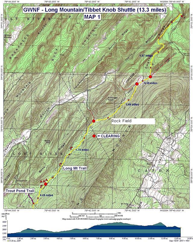
Trail Notes: Both Long Mountain Trail and Tibbet Knob Trail are blazed with yellow paint. Follow Long Mt Trail north for a few hundred yards and then turn sharply left (south) onto an old woods road. The trail will leave the road and pass through a grassy area near a campsite. Cross Trout Run on a newly constructed bridge. This is the only significant stream crossing in the hike. Climb steeply up a footpath. The trail eventually becomes a woods road and switchbacks up Cherry Ridge. At about 1.87 miles from the trailhead pass a grassy clearing on the right and an old woods road on the left (the old Crack Whip Furnace trail, I believe) before arriving at yet another large grassy clearing. The continuation of the trail is a grassy woods road on the right side of the clearing.
Turn right here and in about 0.3 miles arrive at another clearing and the junction of 4-5 woods roads. Long Mt Trail is the one on the left and is marked with a yellow blaze. In about another 1.2 miles the fun begins as you reach the rock field discussed in the description. There is no trail but the trees are blazed rather frequently. Take your time! Once across you�ll return to a relatively smooth footpath. In about another 0.3 miles come to yet another grassy clearing. A woods road goes right and downhill. You want to turn left and follow the blazes.
In another 1.78 miles there will be another grassy opening to the right of the trail. This is a great campsite under the shadow of Ben�s Ridge complete with a fire ring. There is a small spring in the woods behind the clearing (walking towards the ridge) that some one has damned up. A better water source is a stream that crosses the trail less than 100 yards south of the campsite. This stream is not shown on any maps I�ve found but it does exist.
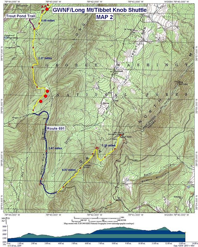
As
you travel south from the campsite you will pass one more woods road
on the right and begin to ascend Devil�s
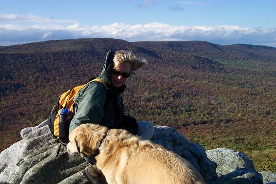
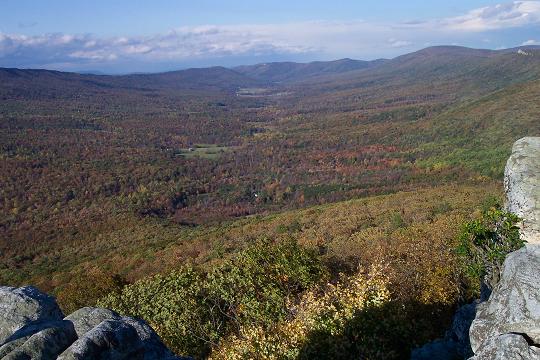
Turn left on FR 691 and walk 2.47 miles to a parking area on the left with a campsite and fire ring. Look for yellow blazes marking the beginning of Tibbet Knob Trail. Follow the blazes (some will be on rocks) along the spine of the ridge until you reach the overlook. Long Mt will be to your left, Halfmoon Lookout straight ahead and Mill Mt with Big Schloss on your right.
Follow the yellow blazes and scramble/slide/sush your
way down the steep face of the knob. In a hundred yards or so you
will regain a more normal trail that descends to the Wolf Gap
Campground and your awaiting vehicles (1.50 miles from the top). On
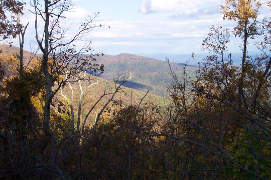
the way down you will cross over a small summit which affords nice
views of Big Schloss and Little Sluice. Printable/Downloadable Directions and Trail Notes Read about a recent trip to Long Mt.
|
|
________________________________________
Name: John
Hike: Long Mountain/Tibbet Knob Shuttle ________________________________________ |
|
|