|
Dolly Sods North Circuit Hike
NOTICE: As
of Oct 1, 2024 the Forest Service has officially assigned names and
numbers to the trails in Dolly Sods North. These names do not
coincide with that found on other maps previously posted here or on
other web sites. Also beware that as of Oct 9, 2024 all of the
signage has not yet been put in place further adding to the
confusion. Go to
Dolly Sods North Master
Map for a full trail inventory and an updated color-coded
map of the area. The following information is based on the latest
data obtained from the USFS. |
|
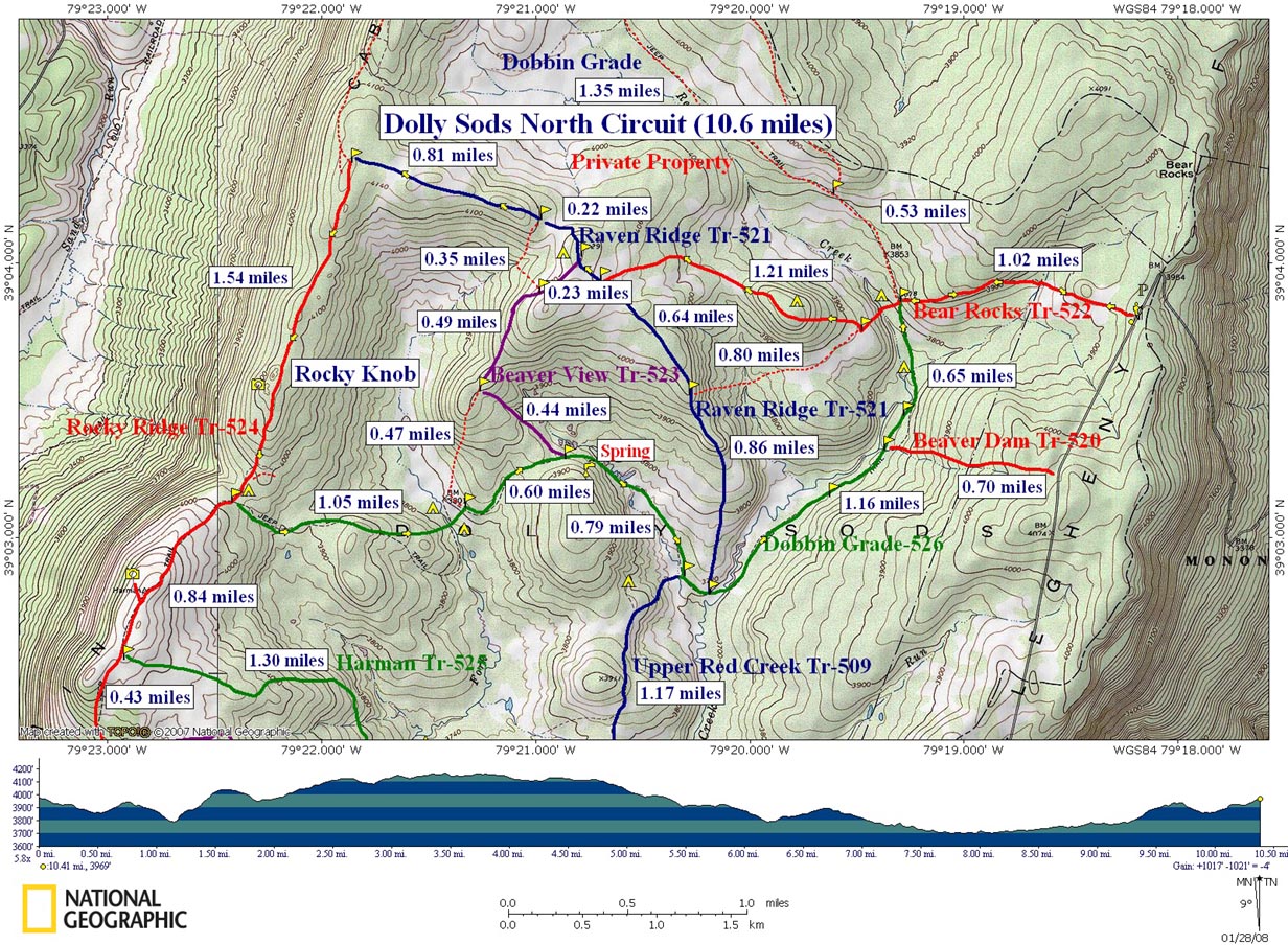
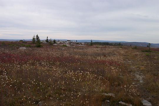
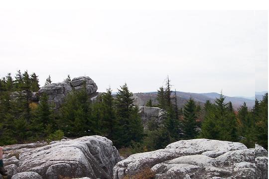
Description: This is a moderate 10.8 mile circuit through the scenic Dolly Sods North. You�ll walk through areas of breath-taking beauty. The entire trek is one big photo op. There are some deciduous forest along the way but you�ll spend most of your time walking through heath bogs on Dobbin Grade, grassy plains sprinkled with Spruce groves along Raven Ridge and the rocky, tundra-like ridge of Cabin Mountain. There will be views in every direction throughout the course of the day. There are some wet spots, especially along Dobbin Grade so have some dry footwear waiting for you back at the car. Also remember that mountain top weather can change with a wink of an eye and in many instances you might be totally exposed to the elements so pack accordingly. Google Custom Directions FR |
|
FR75 is a gravel road with some nice bumps but passable for most cars. The parking area is at the top of the Allegheny Front right were the road makes a sharp left turn. It is unmistakable. ________________________________________ |
|
A "MUST READ" before entering Dolly Sods North!!!
Trail Notes : First I need to thank Trudy and John Phillips and Jonathan Jessup for sharing their maps with me. Their insight has made my exploration of the North Sods quite enjoyable. To get more info visit Trudy and John's site. I�ve hiked most of these trails 3 times now and carried my
From the cars walk south on FR75 for about 100 yards and turn right onto an old jeep trail named Bear Rocks Trail (Tr522) and blocked by boulders. You will gradually descend to Dobbin Grade, passing a seriously eroded section of the jeep trail (A footpath to the left gets you around this.) and a mini-bog sheltered in a hollow. You�ll climb out of the hollow and descend to Dobbin Grade (TR526) at 1.02 miles from the start. The jeep trail is also badly eroded here. There are optional trails on either side.
Cross Dobbin
Grade and descend further through a grassy area to Red Creek. There
are a few good campsites here. Cross the creek. Climb to the first
rise. You�ll end up on an old ATV trail. Do not take the ATV trail
but turn right onto a footpath at the
|
|
another trail that goes uphill. Turn right. Soon you�ll arrive at the grassy slopes of Raven Ridge although, at this point, you are still on Bear Rocks Trail. Follow the Trail stakes for another 0.4 miles until you arrive at the junction of Raven Ridge Trail (Tr521). Turn Right here.
It may be possible at certain spots to climb to the northern edge of the ridge for views of Dobbin Slashing and distant ridges. At about 0.2 miles from the last trail junction pass Beaver View Trail (Tr523) on the left. Soon reach a large grove of mature Red Spruce to your left (South). As you look at it there is a lone deciduous tree to its left, possibly a fruit tree. This approximates an opening in the grove and the front door of a fantastic campsite protected from the elements.
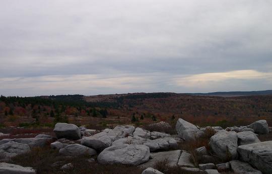
Continue west passing an unsigned trail on the left that eventually connects with Beaver View Trail that you passed earlier. At 0.86 miles from the Spruce Grove turn left onto a footpath cut through some small Red Spruce. In another 0.44 miles arrive at Rocky Ridge Trail (Tr524). Turn left here. From this ridge you can get sweeping views of Dolly Sods and much of what you just hiked.
Continue south
on Rocky Ridge Trail. At about 1 mile the trail veers slightly
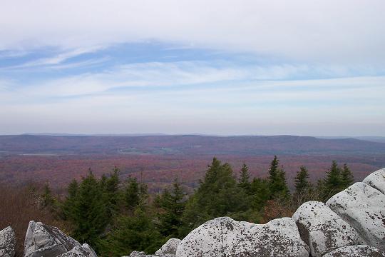
to the right and crosses Rocky Knob. Weather permitting this is
a great lunch spot with views of
In about 0.3
miles from Rocky Knob you�ll pass a trail intersection in a wet
area with a large boulder. The trail to the left is marked with
Continue on Dobbin Grade Trail. At first it hugs the side of a hill and then descends to a huge open bog. It turns south here following the drainage for a tributary of Red Creek. In places I think the stream and the trail are one and the same. As the grade begins to turn left (East and then North-east) pass Upper Red Creek Trail (Tr509) to your right (south) and, in a few more yards, Raven Ridge Trail (Tr521) to your left (North).
As Dobbin Grade makes it�s gradual turn to the left (North-east) cross Red Creek. For a great view of the bog and points west climb up a grassy slope to an exposed campsite and turn around.
Return to Red Creek and turn right. If you did not climb up to the view turn left immediately after crossing the creek. At about 1.16 miles from the crossing arrive at Beaver Dam Trail (Tr520) on the right. This trail takes you out to FR75. In another 0.65 miles reach the junction with the Bear Rocks Trail. Turn right here and retrace your initial steps back to the cars. Printable/Downloadable Directions and Trail Notes Read about our scouting trip to DSN. Read about our scheduled outing. ________________________________________
________________________________________
Name: Ed. S
Hike: Dolly Sods North Circuit Hike ________________________________________
Name: Mark Skidmore
Hike: Dolly Sods North Circuit Hike ________________________________________
Name: Chitra
Sundaram
Hike: North circuit Tr 522-524 and back ________________________________________
Name: TG & BZ
Hike: Dolly Sods North ________________________________________
Name: Marshall
McCoy
Hike: Dolly Sods North Circuit ________________________________________
Name: Dave
Hike: Dolly Sods North ________________________________________ |
|
|