|
Mason - Dixon Shuttle |
|
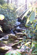
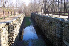
Description: This is a 5 mile
moderate shuttle hike featuring scenic streams, views and fragments
of history. This is just a small segment of the Mason Dixon Trail
but perhaps the most beautiful. You�ll hike pass the remains of
historic Lock 12 of the Susquehanna Canal and the ruins of an old
saw mill before visiting two scenic streams, Mill Run and Oakland
Run, with views of Lake Aldred in between.
The hike can be accomplished in either direction but I always prefer to hike upstream. This converts a relatively easy hike with only one climb of note to something providing a little more exertion as you have to make 3 400 foot climbs each over about a 0.5 to 0.6 mile distance.
Google Custom Directions (Posey Rd Car Drop-off) Google Custom Directions to Lock 12 Trailhead |
|
Directions from
I-95 around 1. From I-95 take MD RT 543 North (Exit 80).________________________________________ |
|
Trail
Notes: The Mason-Dixon
Trail is blazed blue. From the parking area walk toward the river
and cross Lock 12 on a bridge. Turn left and walk upstream, picking
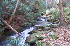
up the blue blazes as you reach the footpath. As you walk up stream
you might catch glimpses of the old canal wall as you go by. In 0.59
miles reach the ruins of an old saw mill. The trail follows the
outer walls up to
Mill Run will fork.
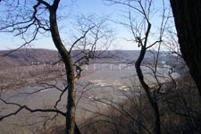
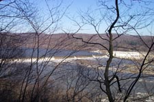
Turn to follow the right fork but quickly turn uphill following the
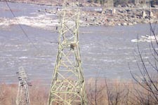
blazes to 2 nice overlooks. From here you can see the Susquehanna,
the
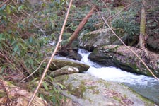
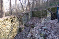
At 0.66 miles from
leaving River Rd. reach the high voltage lines and quickly descend
back down to River Rd. Here you will find the remains of a carriage
house used by a hotel many generations ago. Behind it lies remnants
of other foundations. Across the road is the spillway for the
dam.
Turn left up the road.
In about 0.25 miles the road will turn to the left and head up hill.
Continue straight, following the blazes first along an old road that
passes some cottages and then a footpath that follows the banks of
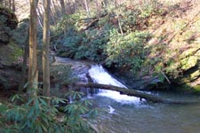
At the confluence of
From here continue
upstream and watch carefully as the trail suddenly turns left and
quickly climbs past some huge rocks to the top of a hill. For a
while the stream will be out of sight although you might be able to
here it down below you. |
|
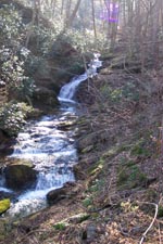
At about 0.75 miles
after leaving Lake Aldred, or 0.25 miles after leaving Oakland Run,
you will descend, crossing a small
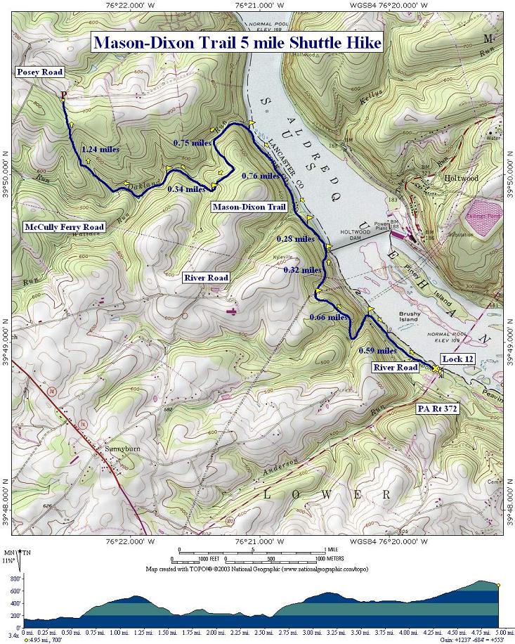
tributary, and again pick up the run. Continue upstream. In about
0.34 miles you�ll make the only significant stream crossing of the
hike. It is usually a rock hop or log crossing but one should always
be prepared for high water. After the crossing the footpath will
eventually become an old woods road as it passes through Hemlocks,
Rhododendron and Bamboo thickets. The road becomes grassy as the
grade increases and the evergreens give way to a hardwood forest. In
1.24 miles from the stream crossing return at the vehicles near
Posey Rd. Printable/Downloadable Directions and Trail Notes Critique this outing! ________________________________________
________________________________________
Outing Critiques
Name: Neil
Hike: mason-Dixon shuttle
________________________________________
Name: Joel
Hike: Mason-Dixon Shuttle
________________________________________
Name: Thomas
Hike: Mason - Dixon Shuttle ________________________________________
Name: Sal
Hike: Mason-Dixon Shuttle trail ________________________________________
Name: Kathryn
Hike: Mason-Dixon Shuttle ________________________________________
Name: Vern
Hike: Mason - Dixon Shuttle ________________________________________ |
|
|