|
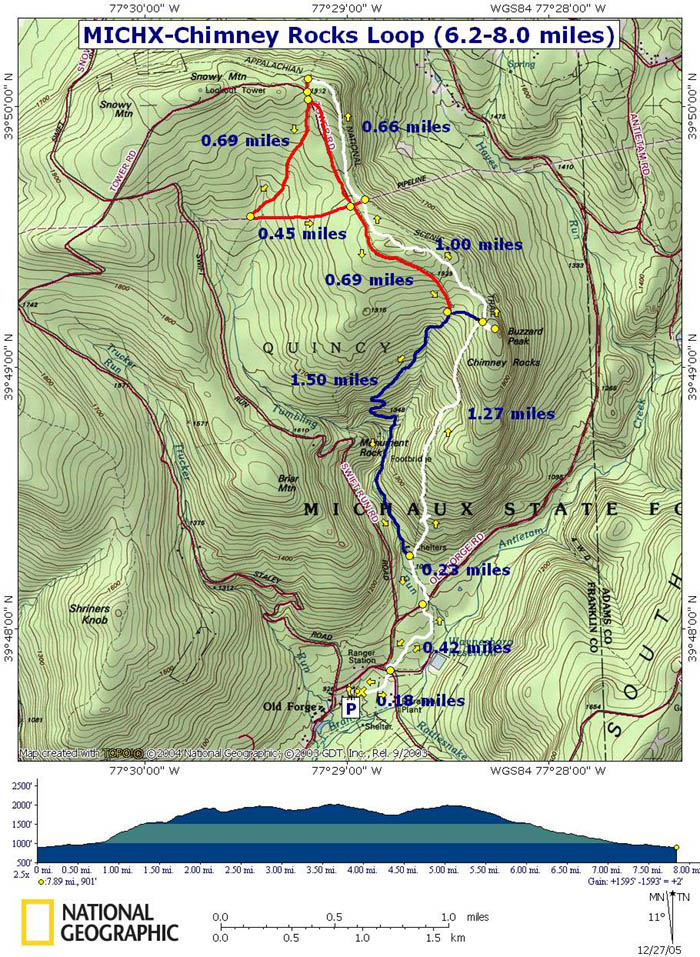
Chimney Rocks (Michaux State Forest) Loop |
|
Description: This
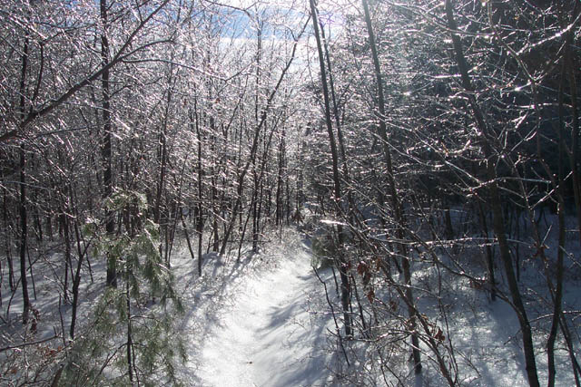
The hike starts behind the baseball diamond in Old Forge Picnic Area. |
|
________________________________________ |
Zipped National Geographic. TOPO! GPS and Universal GPX Files |
Trail Notes: Begin at the well house behind the backstop. Locate the white blazes for the AT and turn left onto it (north). In 0.18 miles cross Rattlesnake Rd and in another0.42 miles come to Old Forge Rd. Turn right on the road, cross the bridge over Tumbling Run and immediately turn left to get back on the AT.
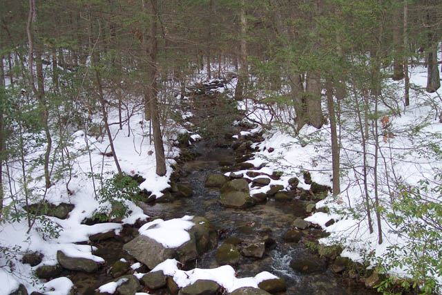
In about 0.23 miles, come to the
junction with blue-blazed Tumbling Run Trail. There are 2 shelters,
a privy and picnic table by the stream. Stay on the AT and begin a
steep ascent for the next 1.27 miles.
Turn right onto a blue blazed spur
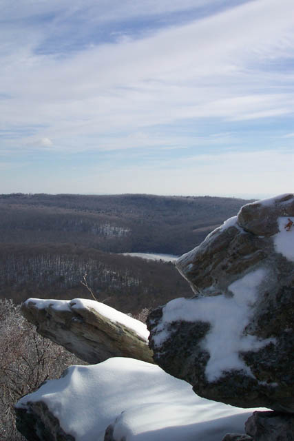
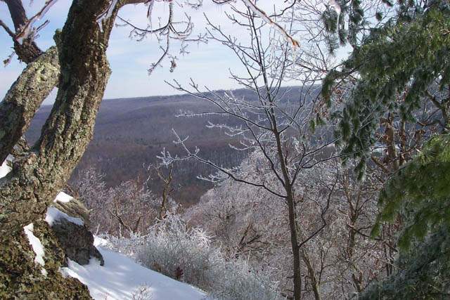
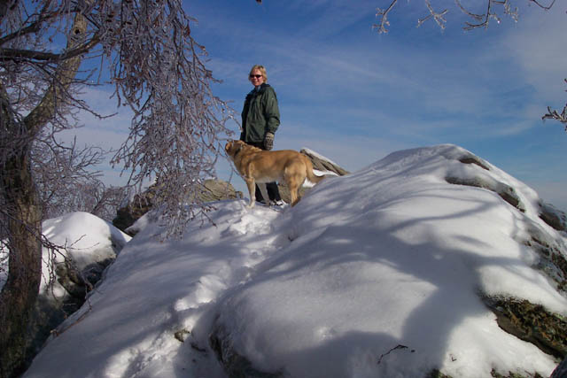
trail to Chimney Rocks (AKA
Return to the AT. If you wish to do the
shortest version cross the AT onto unsigned but blue blazed Tumbling
Run trail and follow it down to it�s junction with Chimney Rocks Rd.
Pickup the directions later.
To complete a longer version of the
hike turn right on the AT and continue north until you reach a gas
pipeline swath in 1 mile. TO complete a 6.2 mile version turn left
onto the swath for a short distance and then left again onto
un-signed Chimney
To do a longer version cross the
pipeline and continue on the AT. In 0.66 miles turn left onto an
unmarked but obvious path. Soon arrive at the north section of
Chimney
Soon come to a fork in the road. To
complete the 7.4 mile version continue straight (left) on Chimney
To do the longest version of this loop (8.0 miles) turn right at this fork and follow it out to the pipeline. |
|
Turn left onto the
pipeline swath and walk uphill for 0.45 miles to unsigned Chimney
In about 0.7 miles the trail will leave the road at a right turn onto a footpath. Follow the Tumbling Run trail for another 0.7 miles to its junction with the AT. Retrace your steps for the remaining 0.83 miles back to the cars. ______________________________________
______________________________________
Name: Terri V
Hike: Chimney Rocks (Michaux State Forest) Loop Critique: There haven't been any recent reviews of this hike, so I wanted to put in my two cents. I went on this hike today, and I really enjoyed it. The climb up to Chimney Rocks was quite a workout, but the view was really nice. I ended up going another couple of miles past Chimney Rocks on the AT -- relatively level ground -- and then turned around and came back via the AT instead of doing the loop hike. I was hiking by myself and wasn't 100% confident of the trail that I was supposed to take to get over to the return route and I didn't want to walk through the (very long) grass at the pipeline throughway. But it was a really nice out and back hike. But the most important thing I wanted to share is that THERE IS NO BASEBALL FIELD at the Old Forge picnic area anymore!! I was very confused about where to find the trailhead, but fortunately there were a couple of AT through hikers who came into the picnic area as I was looking around and they directed me to the trailhead. For reference, if you are looking at the big open grassy area from where you park your car, the trailhead is to the far right hand side right near a small building that stores fresh drinking water. Aside from that initial hiccup, it was a very enjoyable hike. ______________________________________
Name: Aisfor
Hike: Chimney Rocks (Michaux State Forest) Loop ______________________________________
Name: Pascale & Loic
Hike: Chimney Rocks (Michaux State Forest) Loop ______________________________________
Name: Harry
Hike: Chimney Rock ______________________________________
Name: Lou
Hike: Chimney Rocks 4.5 Miles ______________________________________
Name: michelle
Hike: Chimney Rock ______________________________________
Name: somewhere
Hike: Chimney Rocks ______________________________________ |
|
|