|
C&O Canal and Long Pond Shuttle |
|
|
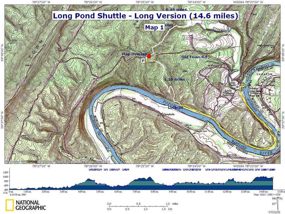
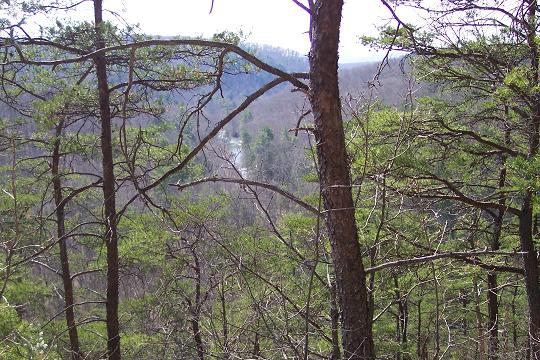
Description: This is a STRENUOUS shuttle hike with a maximum distance of 14.7 miles with the emphasis on strenuous. This is probably the hardest hike that I've undertaken. Although the maximum elevation gain is about 500 feet you get to do this about 4 times.To add to the elevation gains, there are several times when you have to quickly climb 100-300 feet without the aid of switchbacks in order to get above the cliffs and flood plains that surround Fifteen Mile Creek. Descents are also steep and slippery in places, requiring crab walking at times.
With all of the
difficulties involved with this trek I highly recommend it. Along
with being one of the most arduous day hikes in MD it is, perhaps,
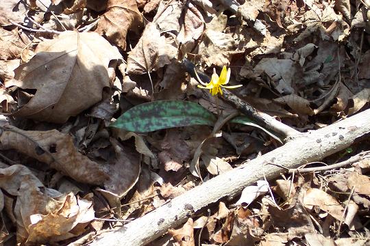
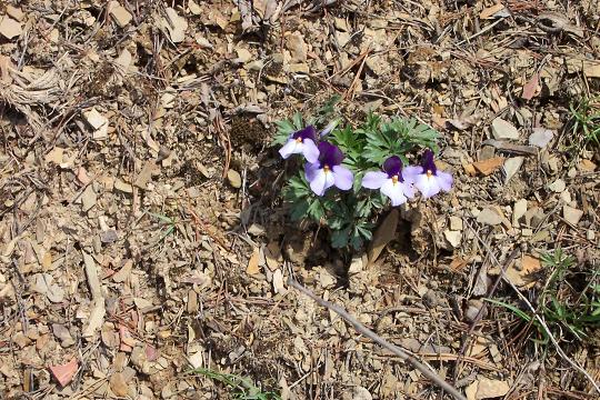
also the most beautiful. In spring the canal towpath is lined with
Dutchman's Britches, Virginia Blue Bells, Spring Beauties and Wild
Geraniums. Historically there is the old abandoned Western Maryland
RR bridge over the
|
|
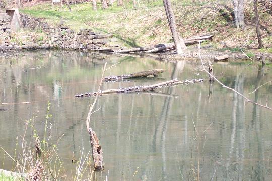
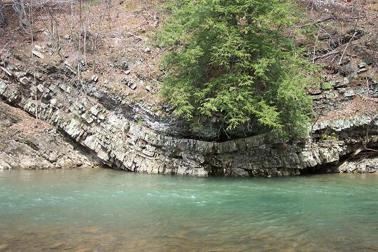
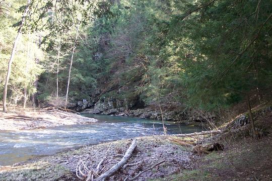
The visits to Long Pond and other parts of Fifteen Mile Creek are nothing short of inspirational. Also of note is a fairly large forest of healthy Hemlock trees not yet infected with the Woolly Adelgid parasite that has devastated similar forest in VA and PA.
NOTE: The length and difficulty of this hike can be varied by using alternate car drop-off points along Custom Google Directions (short hike) Custom Google Directions (long hike) _______________________________________ |
||
Note: The following GPS data is for the 9.3 mile version w/o the C&O Canal segment. It also includes the side adventure/bushwhack below Long Pond.
Zipped National Geographic. TOPO! GPS and Universal GPX Files |
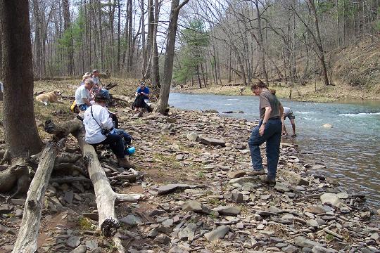
Trail Notes: From the Fifteen Mile Creek Campground and launch ramp area walk south on the
Walk across the bridge. The Long Pond Trail officially goes to the right of the kiosk, following white blazes, and quickly turns left, climbing over a hill and back down to a stream. There are enough hills to climb on this outing so I prefer to turn left from the kiosk, walking along the base of the hill (You're actually in the C&O Canal at this point.) until the stream is reached (about 150 yards). Turn right and soon cross the stream, following the white blazes.
In about � mile you'll walk through the stream at a narrow point in the valley with a large rock face to your left. Immediately past this rock make a hairpin left turn and switchback up the hill. This is your first 400 foot climb.
At about 1 mile after leaving the canal reach
gravel
Reach a stream and follow it down almost to its
junction with Fifteen Mile Creek. You'll cross the stream several
times. As the valley broadens and after the last crossing, the trail
becomes a forest road. Soon arrive at a T intersection with another
grassy forest road (about 1.7 miles from
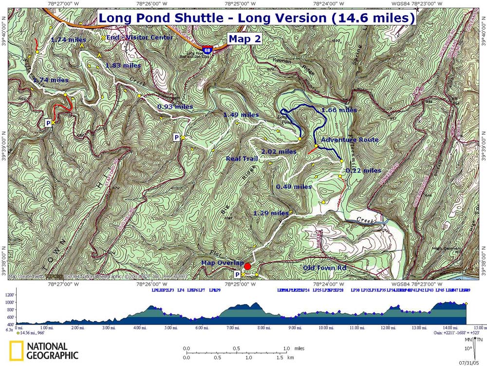
The forest road will slowly climb up and around a hill. This is the beginning of the second 500 foot elevation gain. There was a recent reroute off of an old grassy forest road on a footpath to the right. Follow it and arrive at a recently graded lumber road. This is part of the original trail but was re-opened for a lumbering project. Turn left and follow the road up hill. Keep an eye out for white blazes and another footpath to your left as the trail leaves the forest road and climbs more steeply to the top of a ridge. (If you feel adventurous and don�t mind a little bushwhacking and some stream crossings see the modification of the outing at the end of these notes.) Ignore the blue blazes near the top on your right. They lead to a campsite. When you reach the next ridge the trail will make a sharp right and descend along its spine to an area just above Long Pond. This is a great camping/lunch spot. The water is always cool and refreshing. To visit the real Long Pond, ford the creek where the trail first comes off of the ridge. |
|
You can hike the entire
length of Long Pond by a mixture of following an old, barely
discernable woods road, the shore and some open woods bushwhacking
downstream. Most people miss this part. The total distance between
Initially this section of trail will be flat
and narrow with a steep hill falling off to your right. In about 0.4
miles after leaving
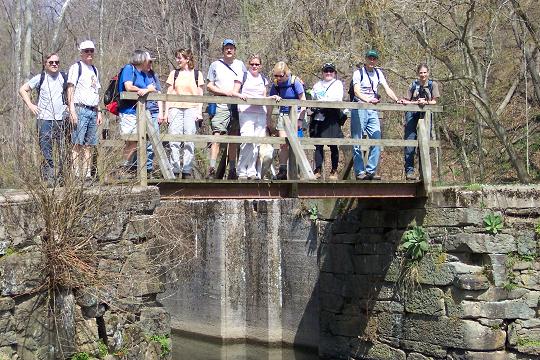
Cross the stream and climb another smaller hill before descending to the junction with Deep Run and the trail of the same name and Pine Lick Trail. Long Pond Trail ends here and the Pine Lick Trail takes you back to your car. Deep run may be a challenge to cross during high water periods. Follow Pine Lick Trail up Fifteen Mile Creek along the floodplain for a bit before the trail again climbs steeply to avoid steep banks and flooded areas. Descend again and in about 0.5 miles from the last trail junction come to a footbridge over the creek.
Cross the creek and begin a steep � mile climb. You'll gain 300 feet in that short distance. The trail forks near the crest of the hill. Take the right fork, eventually walking alongside of I-68 for a bit, and in 0.75 miles from the fork reach the ranger station and your vehicles.
Modification: Instead of turning left off of the
lumber road at the blaze continue up the road. The road will make a hard
left turn up a steep hill. Don�t turn but continue straight on an
old grassy woods road. This is the continuation of
_______________________________________
_______________________________________
Name: Jeeremy Krones Hike: C&O Canal/Long Pond Shuttle Date: 11/24/13 Rating: 3.2
Criitique: While this was a great hike on a beautiful day, it was nothing like what we expected. The group members (13 UMD students) each rated the hike, and our average is 3.2 (the highest was a 4, the lowest was 2.5). We started the hike at 10:30am and finished at 4:10pm on a cold, windy day (~20�F). This trail is not in any way strenuous. Moderate, certainly, and even on the tough side of moderate *at times*, but by and large this was not nearly as difficult as any other 'strenuous' hikes we've done nor was it any more difficult than many of the moderate hikes. If anything, the distance of the trail (NOT 15 miles � very possibly closer to 12) (if you did the entire hike, from the canal to Headquarters I can guarantee you it was 14.7 miles. If you did the short version, not hiking the canal part, it was 12 miles. I think your group is just in excellent physical condition.) made it more difficult than most other trails in MD. Additionally, while the trail is very clearly blazed (no real trail notes needed: follow the Red blazes until the first marked junction and then follow the clearly marked signs to the Headquarters, on Blue blazes), it is NOT very well maintained. Slope cuts were highly eroded; our downhills were steep, slippery, and dangerous at times; and the "boardwalk" bridge in the last few miles was treacherous to cross (pictures to come). The bridge is warped in the middle and very unstable to cross. The final critique is that there were no great views � we did it in the wintertime, which means that in the summer whatever views we saw would be even less due to more leaves. However, it was a nice trail, and an interesting one. The landscape and geological formations were great to look at, and the various bodies of water were fun. The cabin added to the experience, too. NOTE: from the first kiosk at the turn-off from the C&O Canal, just follow the base of the slope (as mentioned in the notes) instead of following the red blazes right off the bat; the "trail" is nonexistent on the slope, and more use can only increase the erosion and potential danger until a real tread is constructed.
_______________________________________
Name:Moonshine
Hike: Long Pond Trail _______________________________________ Name: Matt Zimmerman
Hike: Long Pond Name: Peter Fleszar
Hike: C&O Canal-Long Pond Shuttle _______________________________________ Name: Donald Holland Hike Name: C&O Canal/Long Pond Shuttle Hike date: 04-26-2003 Ranking: 5 comment: Though a gray day, a challenging and varied hike with lots of climbing and many streams. Perhaps one of the best in MD, even though hikers would feel worn out at the end. We did the full hike, ending on a long rocky uphill, but another hike cut that part out. We also got waylaid, but that's the fun of a scouting trip, many of which are actually better than the "official" hike because of experimentation. _______________________________________ Lynn (Done as Backpack) Hike Name: C&O Canal/Long Pond Shuttle Hike date:04-09 to 10-05 Ranking: 5
_______________________________________ Name: Mary Anderson Hike Name: C&O Canal/Long Pond Shuttle Hike Date: 7-22-05 Ranking: 5
M. R. Hyker Note: Not sure which version of the hike Mary did but it's all nice. We just hiked past Long Pond on 07/30/05. We found one outstanding Cardinal flower on the trail but up stream from Long Pond. I think we were a bit early. Mary, if you did a different hike e-mail me and clarify. |
|
|