|
High Meadows/Oak Ridge Loop |
|
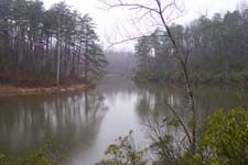
Description:
This is a relatively easy hike considering the 9 miles traversed
through its course. The hills are gentle and short and the tread,
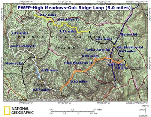
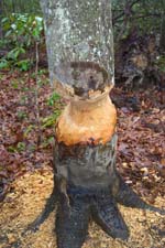
for the most part, smooth. Besides the usual features found in this
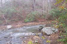
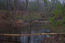
venue (pretty streams and creeks and lots of beaver activity) this
hike also includes a pleasant walk around a lake and the passage
through the headwaters of the south branch of Quantico Creek were
the terrain is quite boggy. In places, boardwalks help the hiker
through the boggiest of areas. This wet, grassy area suggests that
at one time beavers may have occupied this little valley creating
vast ponds which, when abandoned, created silty areas that
encourages the growth of thick grass.
After you enter the park turn left onto the Scenic Drive and
follow the signs to the
|
|
______________________________________ |
Zipped National Geographic. TOPO! GPS and Universal GPX Files |
Trail Notes:
From the parking lot
turn left onto
In another 0.34 miles
arrive at blue blazed
Continue on High Meadows Trail, passing a cemetery on the left, and in 0.86 miles cross Scenic Drive.
In another 0.82 miles descend to white blazed South Valley Trail.
Turn right onto South Valley Tr. In 0.57 miles arrive at an old bridge that crosses the creek to a trail that leads to a Cabin Camping Area. Do not cross but continue straight on the South Valley Tr.
As you pass the dam for the lake the blazes take on a pink shade. This is from painting over some old red blazes with white paint. Continue around the lake and cross Mawavi Rd at 0.73 miles from the old bridge.
In about 0.75 miles the creek will fork and the trail will follow the right fork as it passes through an open, boggy area. In about 2.19 miles from the Mawavi Rd Crossing arrive at the junction of yellow blazed Oak Ridge Tr.
|
|
Turn right onto Oak Ridge Trail. In about 0.57 miles cross the Scenic Drive. Gradually descend into a small hollow and the site of much beaver activity. (As of this writing the pond was lapping at the edge of the trail.)
In 1.13 miles from crossing the Scenic Dr. arrive at the Old Black Top Rd. Turn right onto the road.
In another 0.87 cross through the junction with Taylor Farm Rd (right) and the Burma Rd (left), staying on Black Top Rd.
In another 0.43 miles arrive back at the T.R.E.C. and your cars.
Printable/Downloadable Directions and Trail Notes _______________________________________
_______________________________________ |
|
|