|
G. Richard Thompson WMA Loop |
|
|
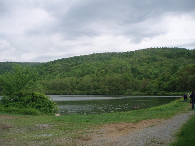
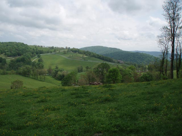
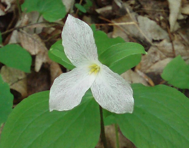
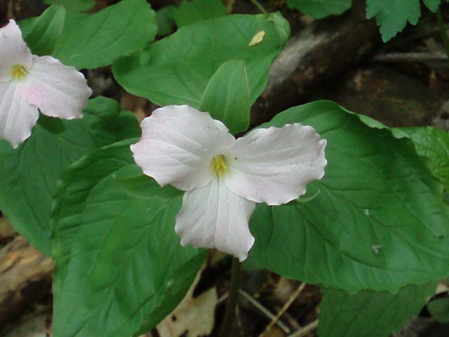
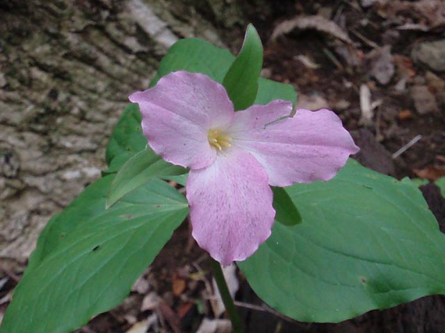
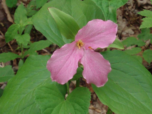
This venue has become a "Fee" area. See their website for details. Description: George Richard Thompson was an avid hunter. Upon his death he saw to it that this 4,000 acre tract of land was donated to the state of Virginia as a Wildlife Management Area so that his hunting friends could continue to enjoy its bounty. Besides hunting for deer. turkey and small game the area offers fishing at Thompson Lake and excellent hiking using a maze of woods roads, footpaths and the Appalachian trail which traverses the entire upper reaches of the WMA. Learn more about the G. Richard Thompson WMA here. The 9.2 mile moderate circuit hike with an overall elevation gain of about 1900 feet described here stands on it own merit. Do it anytime from mid-April to mid-May and you�ll enjoy the added bonus of a seemingly never-ending abundance of wildflowers. The flower season starts with the whites of the Dogwoods and the deep pink blossoms of the Red Buds as one of the first harbingers of spring, Blood Root, begins to line the trail. Then the real show starts. A local resident claims that this is the largest continuous stand of White Trillium (Trillium grandiflorum) in the Old Dominion and we have no reason to doubt her. |
|
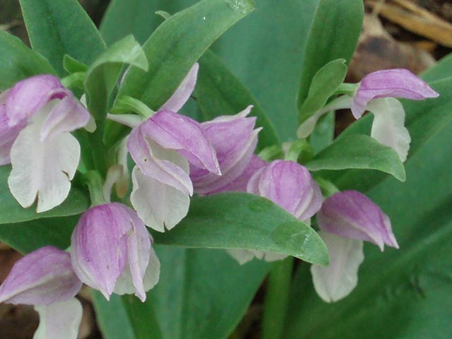
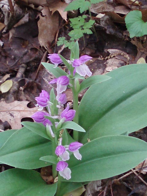
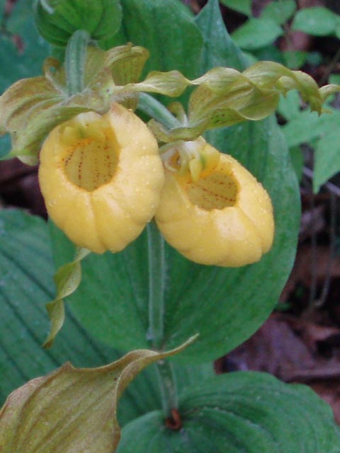
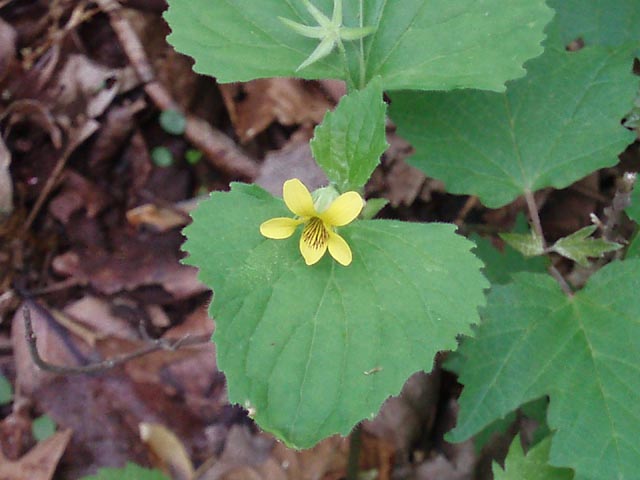
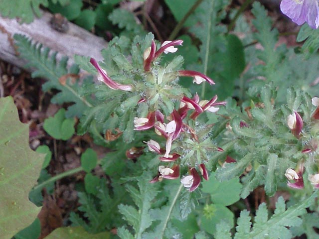
There are literally millions of Trillium (Janet described them as fields of trillium in the forest and that's a pretty apt description.), thousands of Showy Orchis (Galearis spectabilis or Orchis spectabilis) and, if you know where to look, some very impressive Yellow Lady Slippers (Cypripedium parviflorum). You might even see a rare double flower on one plant. They are found only in one small area on the ridge. These were the most exotic plants. The Trillium turn to a deep fuchsia color as they age. There is also Rue Anemone, May Apple and Wild Geranium - too many to count, several varieties of violets, a lot of Sweet Cicely, Star Chickweed, Fleabane, a couple varieties of mustard, Golden Ragwort, Wood Betony or Lousewort, Golden Alexander and way to much of that invasive Garlic Mustard. We don't know what blooms there in the summer but I thought I saw some Wild (Smooth) Hydrangea leaves and we found a lot of False Solomon's Seal that should be blooming in late spring to early summer. Google Custom Driving Directions Note: From I-66 turn left at the second brown and white G. R. Thompson WMA sign. ________________________________________ |
|
Zipped National Geographic. TOPO! GPS and Universal GPX Files GPS Text File for Non-TOPO! Users
|
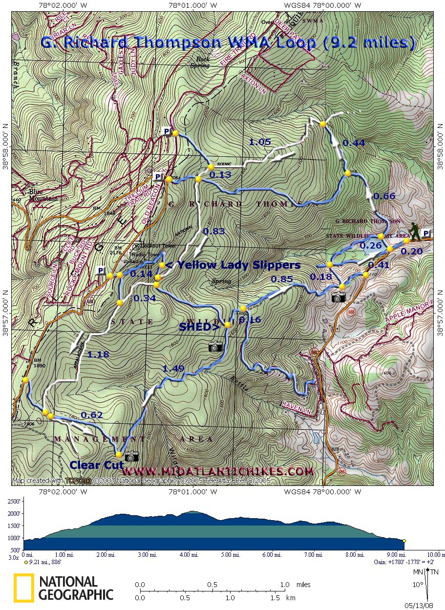
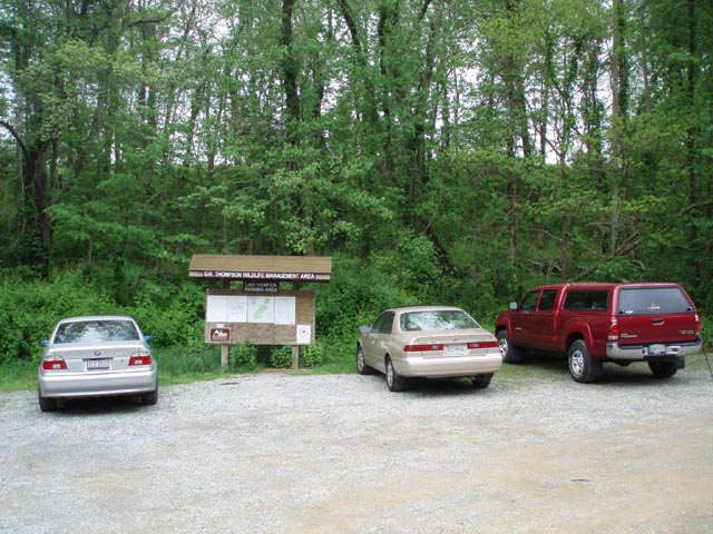
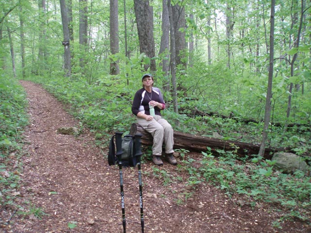
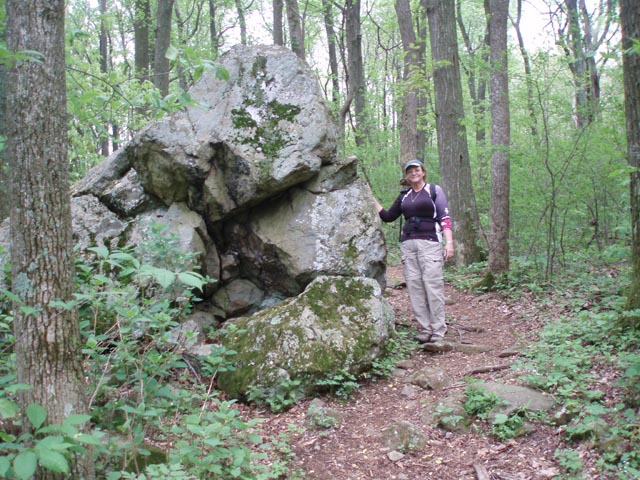
Trail Notes: First, the only trail that is blazed and signed is the AT. Take a good map with you. An additional map can be found here. Note that the AT connector trail (Stonewall Trail) used in this hike is not shown on the official map. Second, if doing this hike in the winter wear some blaze orange. This area is very popular with the hunters. From the kiosk follow the gravel road to Lake Thompson. Turn right and cross the earthen dam. Immediately after crossing the dam bear right onto an unmarked path/woods road. Some references call this the Lake Trail. Begin a gradual climb. At 0.66 miles from crossing the dam the Lake Trail will make a sharp bend to the left. Leave it here and follow a well worn footpath (Stonewall Trail) straight ahead. You�ll know you�re on the right trail because there will be several blowdowns you have to cross over or walk around. The grade gets steeper here. If you are doing the hike in spring you will start to see the Trillium and Showy Orchis along this trail. In another 0.44 miles arrive at the junction with the AT (Straight ahead and to the right). Continue straight, climbing to the top of the ridge via a series of switchbacks. Here is where the main flower show takes place. For the next 2 miles the terrain is either flat or slightly rolling. At 1.05 miles from the last trail junction pass a trail on the right then in another 0.13 miles cross the four way intersection with the Lake Tr/Road. In another 0.83 miles come to yet another woods road. To see the Yellow Lady Slippers turn right and walk about 0.14 miles. Look for short paths that climb the bank of the road on the left. There you will find these beauties. There are still more Lady Slippers further up around a sharp bed in the road. After your visit return to the last junction and continue down the road for just a couple of steps. Turn right onto the AT and climb steeply for a while. After the trail flattens out another footpath will come in sharply from the right in 0.34 miles from the last woods road. Continue on for 1.16 miles to the junction with the Vernon Smith Trail, a wide dirt/gravel road. Turn left here. |
|
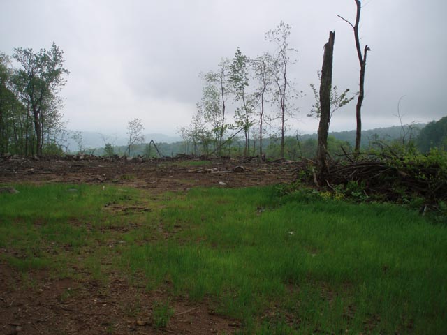
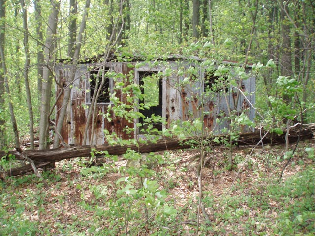
The AT will share the tread for a few more yards before turning off to the right on another footpath. Stay straight on the VMT and in 0.62 more miles arrive at a recent clear cut area (circa 2007). Follow the left edge of the clear cut and turn left onto a well defined footpath. As of this posting (05/08) there was a large log laying across it so you�ll have to look for it. Follow the VST for another 1.49 miles to an old metal shed on the left, a partial view to the right and the junction with another dirt road in a few more steps. (This is the same road that you used to visit the Yellow Lady Slippers.) Turn right onto the dirt road and in 0.16 miles come to a fork. Bear to the left. As you descend you will pass a fence with homes and outbuildings on the right (0.85 miles from the fork). This offers a nice pastoral view. Shortly after this clearing turn left onto another footpath and descend steeply in 0.18 miles to another 4X trail junction. Turn right and in 0.41 miles arrive back at the lake. Retrace your original steps back to your vehicle. ________________________________________
________________________________________
Name: Keith Robertson
Outing Critique: Due to getting a
late start, I opted to hike just the ridgeline portion along the
AT. I tried to find the northern most parking lot as marked on
the map but did not see it, so I parked at the middle one where
rt. 638 makes a sharp turn right (coming from the west.)
________________________________________ |
|
|