| French Creek SP-East/Hopewell Furnace |
|
|
Description:
French Creek State Park is
comprised of nearly 8000 acres of mostly forested rolling
terrain. Almost 40 miles of trails, including 8 miles of the
long distance Horse-Shoe Trail, provide easy access to nature in
an area so close to the metropolis of
Philadelphia (less than an hour�s drive). Most of
the trails on the west side of the park form overlapping loops,
allowing the hiker to tailor a hike to his/her liking. Short
sections of the trails can be pretty rocky but contrary to
popular belief they are short lived and in just certain areas.
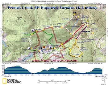
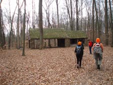
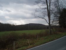
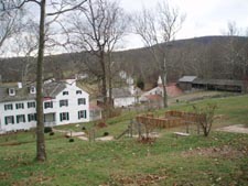
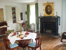
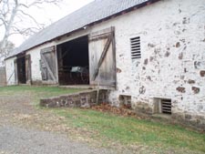
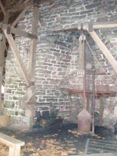
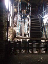
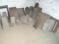
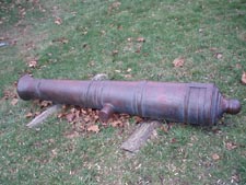
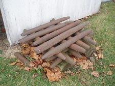
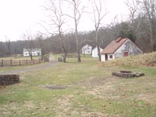
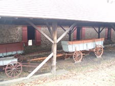
Good hiking boots should take care of those problems. Described here is a moderate 8.6 mile circumnavigation of the east side of the park including a visit to the Hopewell Furnace Historical Area, a restored iron refining village that operated in the 17 and 18 hundreds. Google Maps Custom Driving Directions The hike starts at the parking area on Shed Road close to its intersection with PA Rt 345. |
|
________________________________________ |
Zipped National Geographic TOPO! GPS and Universal GPX Files |
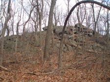
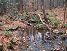
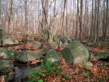
Trail Notes: Cross the road and walk around the park gate. In 0.36 miles the green Lenape Trail bears to the right. Continue straight on the Mill Run trail (white blaze with red stripe). In 0.39 more miles cross a power line swath. In another 0.34 miles the trail splits. Bear left and descend for 0.76 miles to Millers Point, a rocky knob with a partial view of the valley to the north. From here the trail switchbacks for 0.34 miles to a junction with a blue/red spur trail. Turn left to stay on Mill Run Trail. In 0.66 miles cross Mill Run with the junction of the red blazed Raccoon Trail on the right. In another 0.18 miles the trail will turn hard right onto an old woods road. In 0.17 an un-marked shortcut trail (shown as purple on the map) takes off to the right. Stay straight and in 0.35 miles turn right off of the road. In 0.78 miles from the turn arrive with the junction of the Buzzard Trail yellow with red stripe) on the left and the previously mentioned shortcut trail on the right. Turn left. In 0.16 miles the trail splits. Bear 0.52 miles reach the top of a hill. An unmarked trail continues straight ahead but you want to turn right to stay on the Buzzard trail. Descend and in 0.74 miles the trail once again splits. Bear left and soon enter the Hopewell Historic Area. In 0.55 miles from the last split arrive at an un-marked trail junction. This is the continuation of the Raccoon trail. Turn left. In 0.34 miles you have two options. You can continue straight or turn left, crossing a bridge, and then left again. Both ways lead you to Hopewell Road. Turn right onto the paved road. In 0.16 miles cross PA Rt354. a gravel road will bear off to the left and parallel the drive until you reach Hopewell village. After visiting the furnace and surrounding buildings continue on either of two gravel roads. They soon come together. Continue west for just a few steps on an un-named green trail before bearing right onto the Collier trail (white circles). In 0.18 miles cross Park Road and climb for 0.68 miles to the green Lenape trail. Turn right onto it and hike 0.2 miles back to your vehicle.
|
|
________________________________________
________________________________________ |
|
|