|
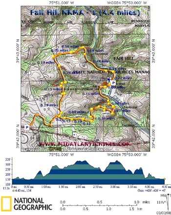
Fair Hill NRMA - 1 |
|
Description:
The Fair Hill Natural Resources Management Area (NRMA) is
located in the northeast corner of Cecil County, a mere stone�s
throw away from PA and DE. It consists of 5,613 acres (3000
acres of mature woods and the rest open pastures) and over 75
miles of multi-purpose (hiking, biking and equestrian) roads and
trails to explore. It was previously owned by William DuPont,
Jr. To learn more about the NRMA go to
their site. There are five blazed loops ranging from three to almost six miles in length (depending on where you start/end) but many of these can be spliced together, either directly or by using un-blazed trails and roads, to form loops of up to 12 miles in length. A shortened version of the �Orange Loop� is described here. Folks at the NRMA rate this loop as strenuous but we found it to be easy with only a couple of very short, steep climbs. The terrain is considered to be rolling. The hike starts at Parking Lot 2 and kiosk prior to crossing the Fox Catcher Covered Bridge. There is a $3.00 in-state parking fee paid on the honor system. The close-by Nature Center is open Monday through Saturday. |
|
________________________________________ |
|
Zipped National Geographic GPS and Universal GPX Files GPS Text Files for Non-TOPO! Users
|
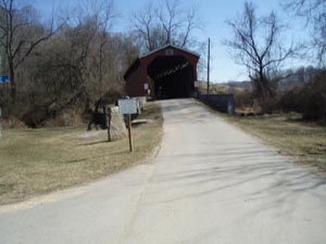
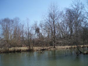
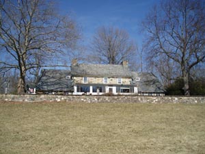
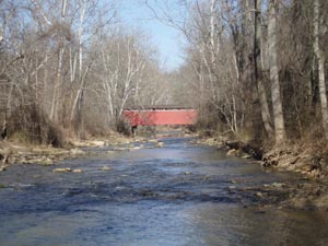
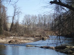
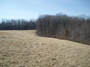
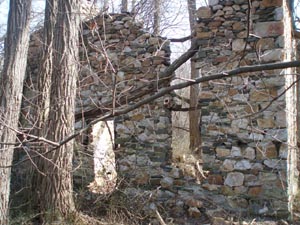
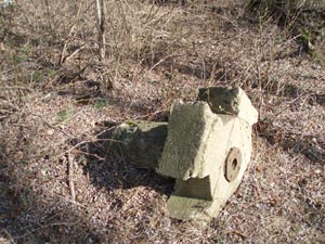
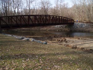
Trail Notes: The main trail is blazed orange. There are several un-blazed trails that join or intersect the main route. Some take you out to the pastures, some are nature trails and others serve as shortcuts or extensions of the existing route. We marked some of them but there are way too many for us to explore so they might not show up on this map. Unless you possess an official map , it is recommended that you stay on the blazed trail. From the parking lot cross Tawes Drive and pick up the trail in a grassy area. The orange blaze will be on a metal stake. Pass a small pond on the left (0.09 miles from the parking lot). Walk behind the Nature Center, home and barn on the right. The trail will turn left into the woods, cross a stream and follow it down to Big Elk Creek (0.41 miles from the pond). From there you can see the Fox Catcher Covered Bridge upstream (to the left) and the abutments and piers of another bridge destroyed over 20 years ago downstream (to the right). The trail then turns to the right and climbs steeply to a pasture passing two junctions of a nature trail. (You can use either to shorten the hike a bit.) For the next mile there are trails coming in from either side every 0.1 miles or so. While shown, for the most part, on the map they are too numerous to discuss here. Just keep following the orange blazes. At the pasture turn right and follow its edge to a double blaze and turn right back into the woods. Descend a bit and soon pass the same nature trails at their upper ends. Here the trail follows a small stream on the right for a while before bearing to the left and climbing away from it. You�ll pass several unmarked trails on either side along this next stretch. Stay with the orange blazes. The trail will make a hard right turn and follow a near straight line to a split in the trail. The trail to the left leads to Parking Area 1 in 0.8 miles. You want to take the right fork. Just before reaching another pasture there will be an odd shaped piece of concrete along the trail. This is an old footer for a corner fence post. In the woods, behind a wall of thorns are the ruins of an old stone tenant�s house � date unknown. |
|
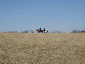
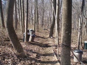
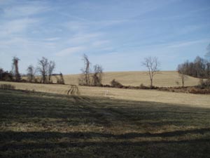
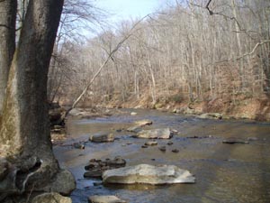
Once at the edge of the pasture you have 2 options: either follow the edge of the pasture to your left down to Tawes Drive or follow the orange blazes into the woods just behind it (recommended). This trail parallels the pasture. You will see several large green-roofed barns to the left before you enter the woods. Arrive at Tawes Drive in 0.29 miles from the ruins. If you want to truncate the hike here turn right and follow the road to your car. To complete the loop turn left on the road and in a few yards turn right onto an old woods road with orange blazes. When we first hiked this section we wondered how the NRMA could let folks throw their trash cans here in these beautiful woods. Then it dawned on us that there are tubes running from the trees to the plastic cans for the collection of sap used in the production of syrup. The trail splits in the middle of these cans (0.15 miles from the road). Turn right and follow the trail down to a dirt road. Turn right again and follow the dirt road towards a pony corral. Before reaching it turn left at a double blaze onto another dirt road. Climb gradually to the top of the hill passing a road on the right that leads to an old green barn (0.24 miles from the last turn). At the crest of the hill (0.19 miles from the barn road) turn right off of the road and gradually descend, passing through another pasture at 0.29 miles from leaving the last woods road. On the opposite side the trail becomes more of an old woods road. You�ll pass more side trails on the right. This road will eventually lead to Big Elk Creek. However, you don�t want to go that far. Turn right onto a footpath at 0.18 miles from crossing the last pasture and climb steeply a short distance to another wide dirt road/path. This section affords views of the creek from higher elevations and remains nearly flat until it approaches Black Bridge Road. It then descends and turns right onto Black Bridge Road at about 0.7 miles from the last turn. Turn right onto the road (Not the restricted Area road) and follow it back to your car. Take time to check out the creek on the left. Printable/Downloadable Trail Notes ________________________________________ Fox Catcher's Covered Bridge, Pond and Nature Center
Fox Catcher's Covered Bridge, Old Bridge Piers and Open Pastures
Ruins of Tenant's House and Corner Fence Footer
Equestrians, Syrup Collecting Cans and Yet Another Pasture
Black Bridge and Big Elk Creek
________________________________________ Outing Critiques
Name: Vincent
Hike: Fair Hill SP-1 ________________________________________ |
|
|